


Related Feature

Getting here
Related Feature
Getting here
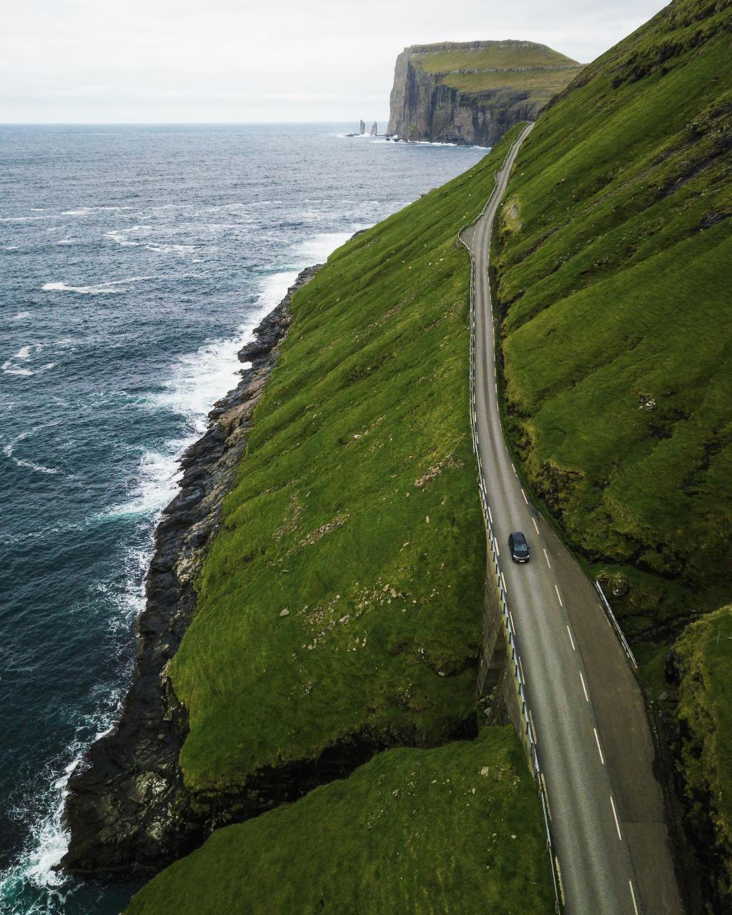
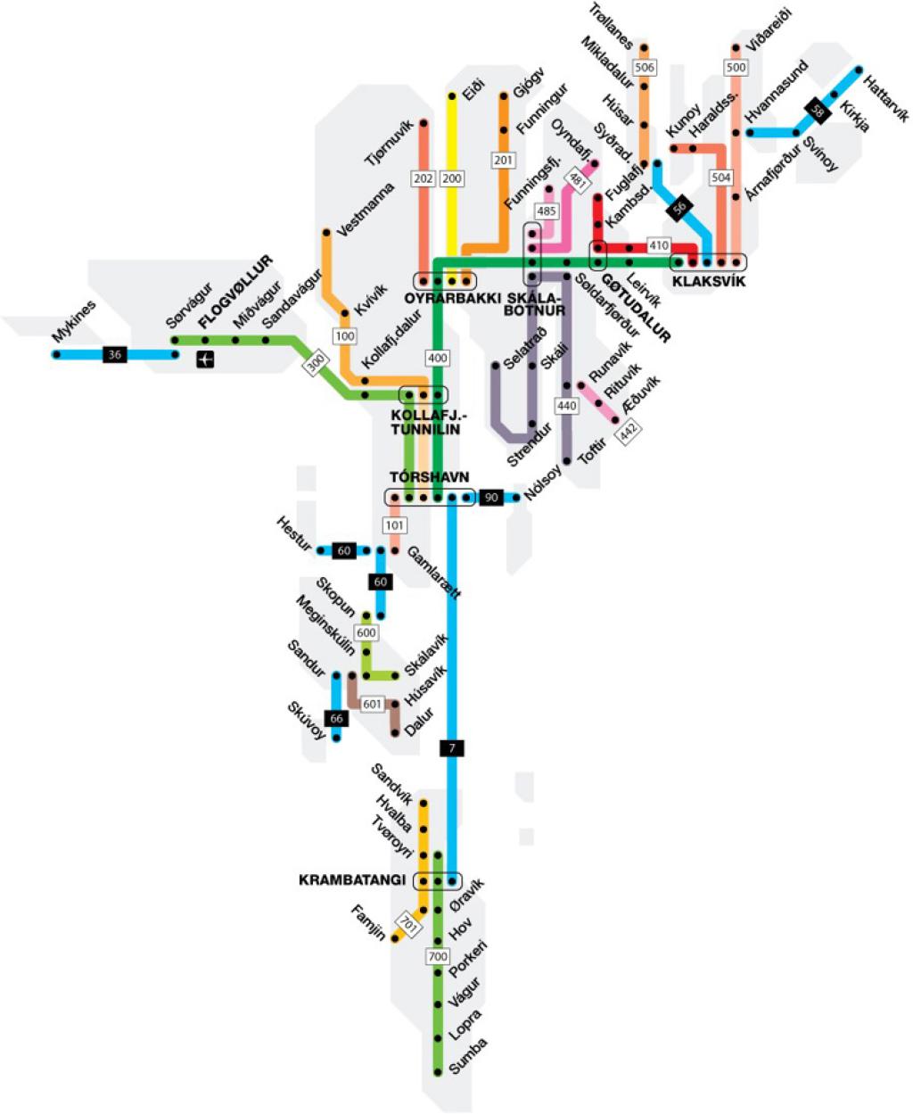
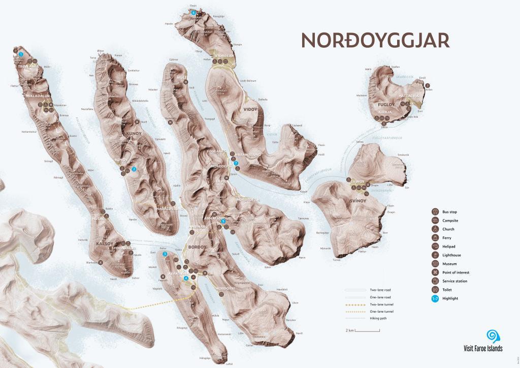
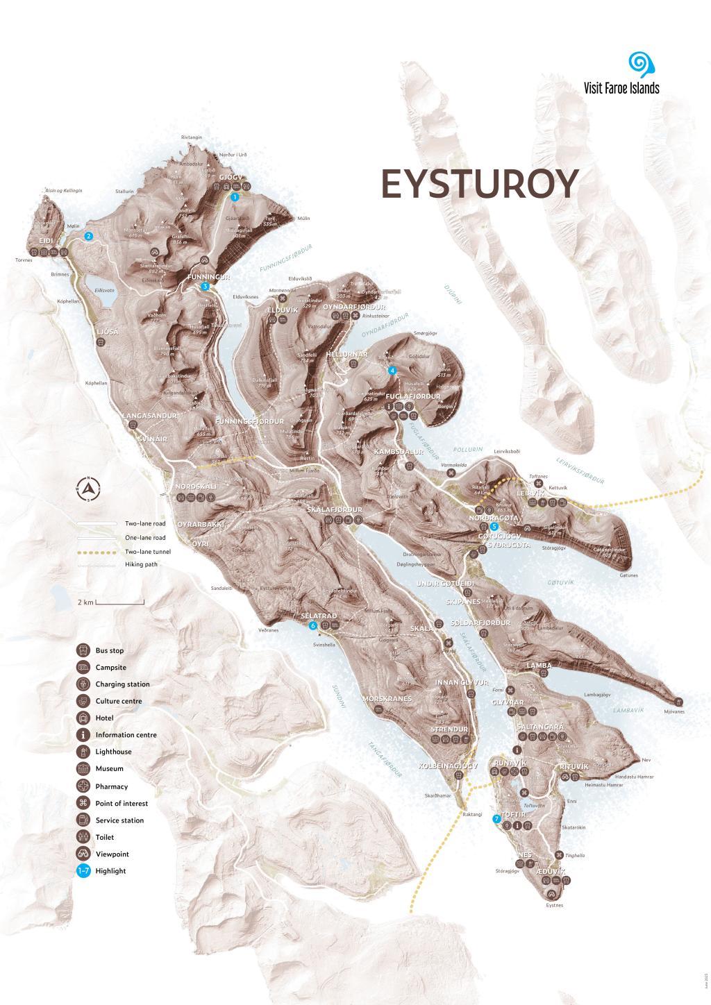
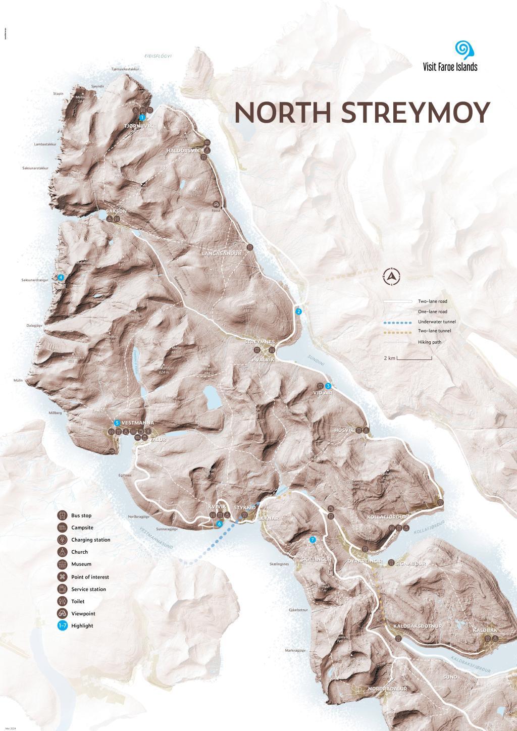
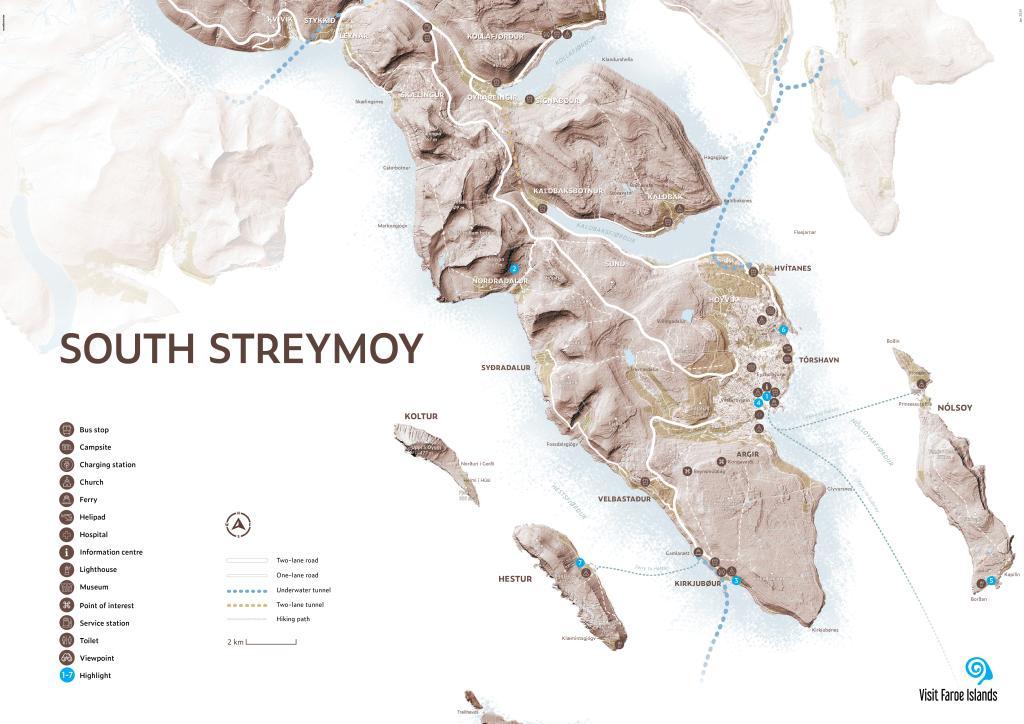
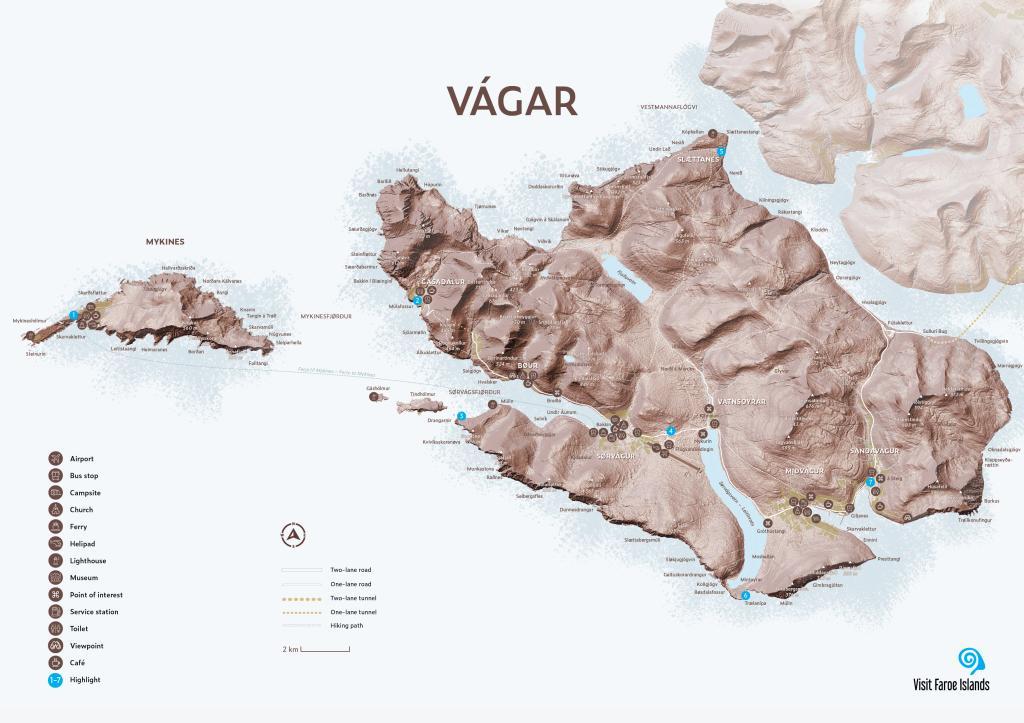
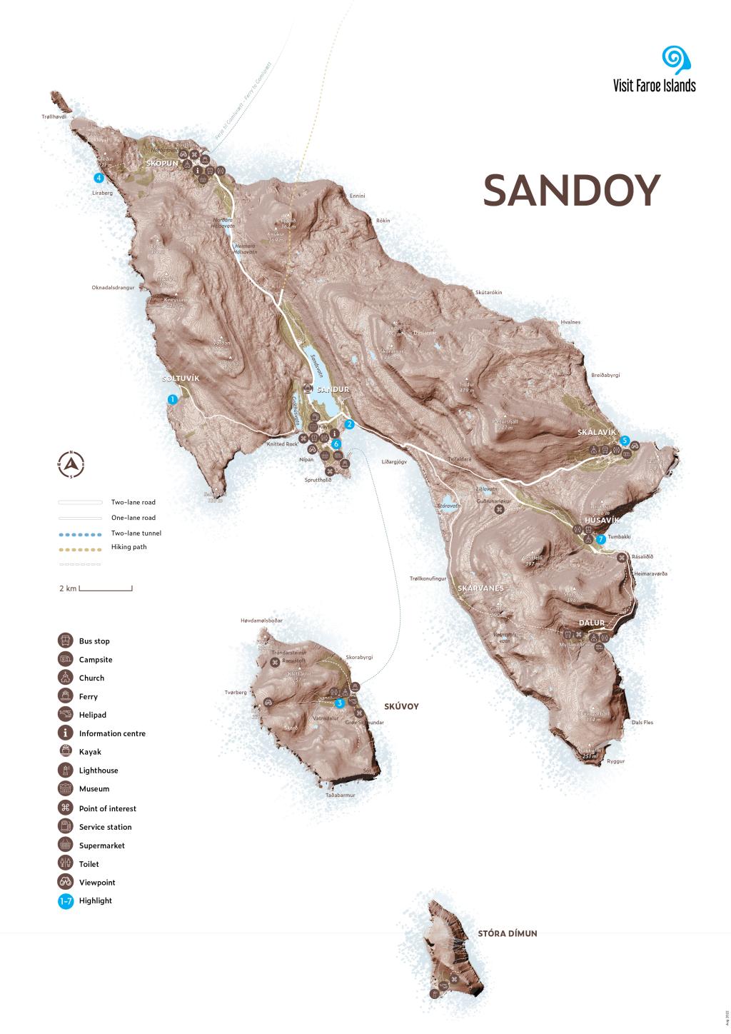
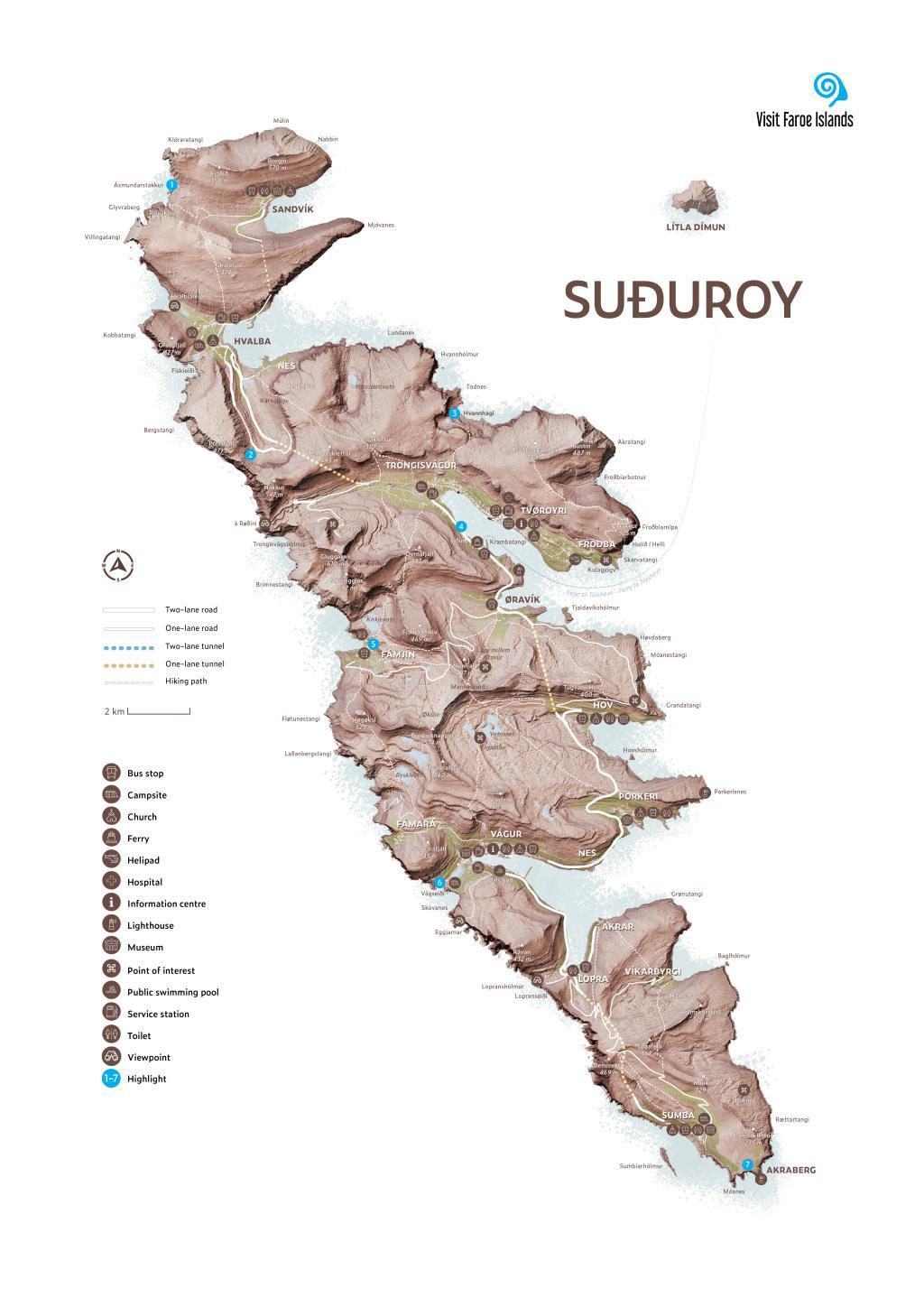
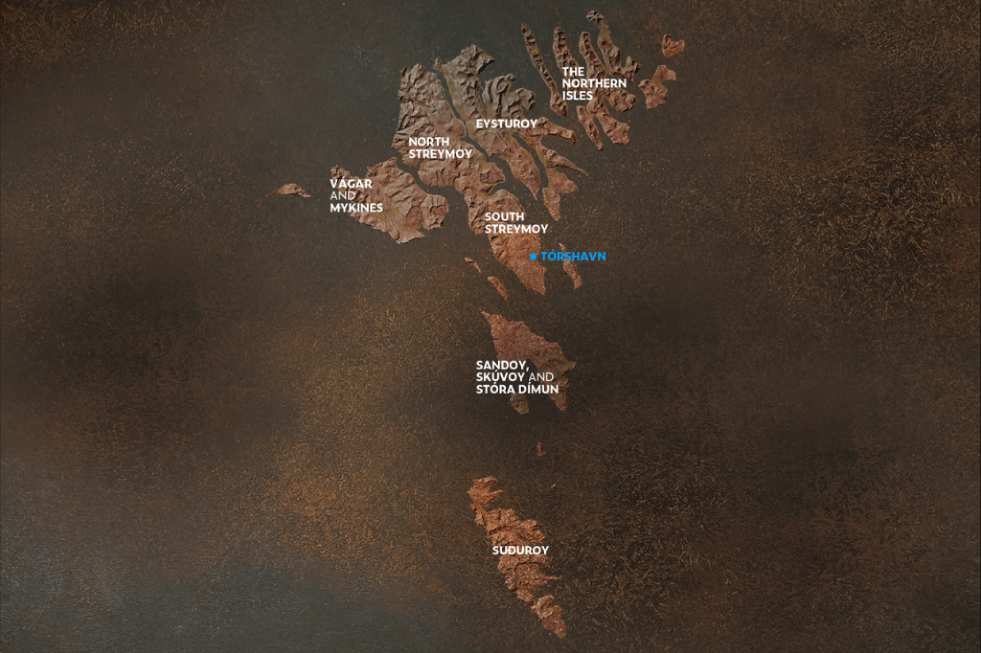
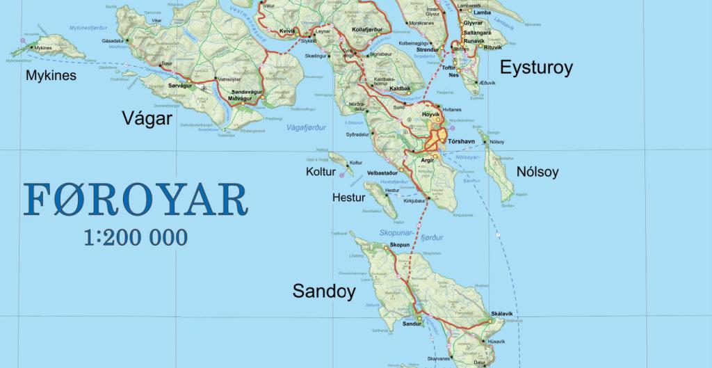
Narrow sounds and rapid currents separate the islands, yet are well-connected through an extensive network of roads, bridges, subsea tunnels, and ferries. Seven of the eighteen islands are interconnected, while the remaining eleven can be reached via ferries or public helicopters.
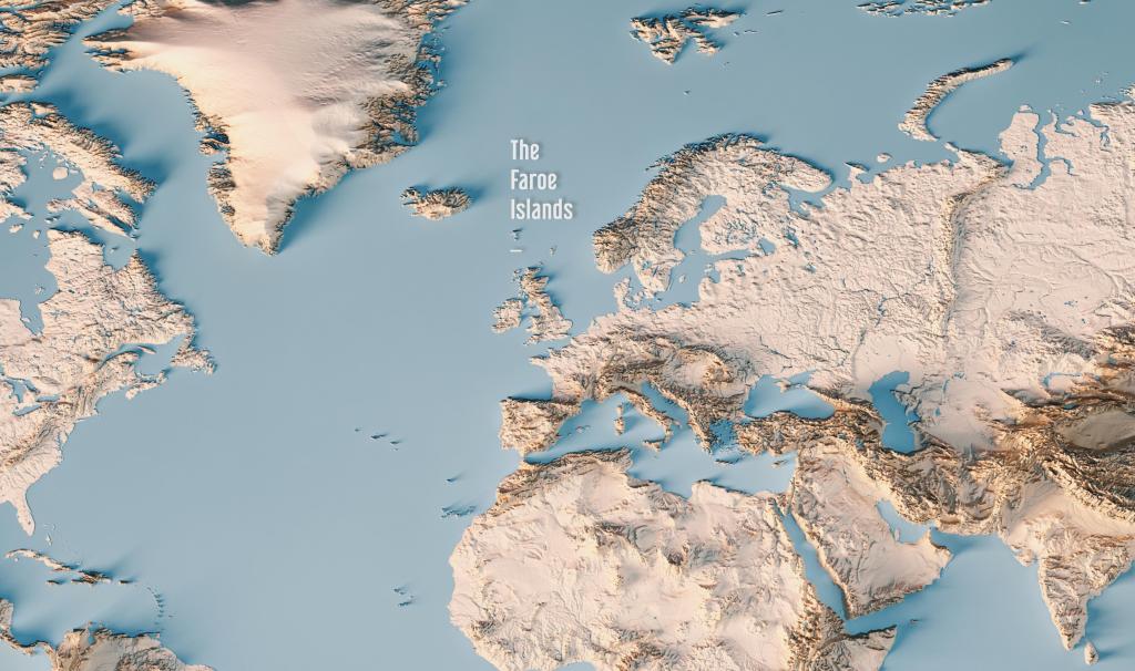
The Faroe Islands cover a land area of 1,400 square kilometres (540 square miles), with a maritime exclusive economic zone (EEZ) covering 274,000 square kilometres.
In other words, 99% of the Faroe Islands' total area is ocean.