You haven’t got any favourites yet
This is where you can collect inspiration, articles, events and places that interest you.
Click the icon on pages and they’ll appear here.
Your favourites
Inspiration & Articles
Events & Tours
Places
Hiking
INSPIRATION & ARTICLES
EVENTS & HIKES
Places
Fuglafjørður - Hellurnar - via Altarið


Link Copied!

-
-
-
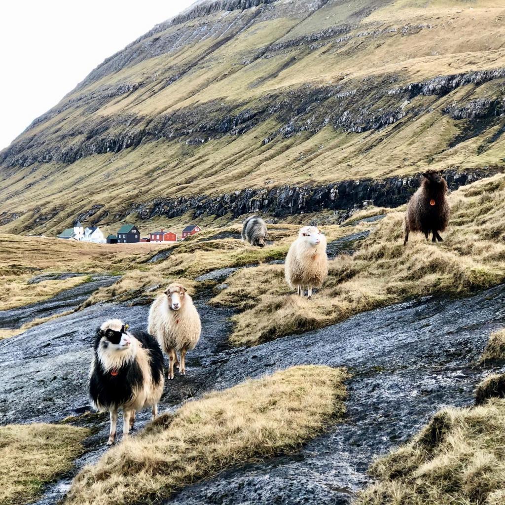
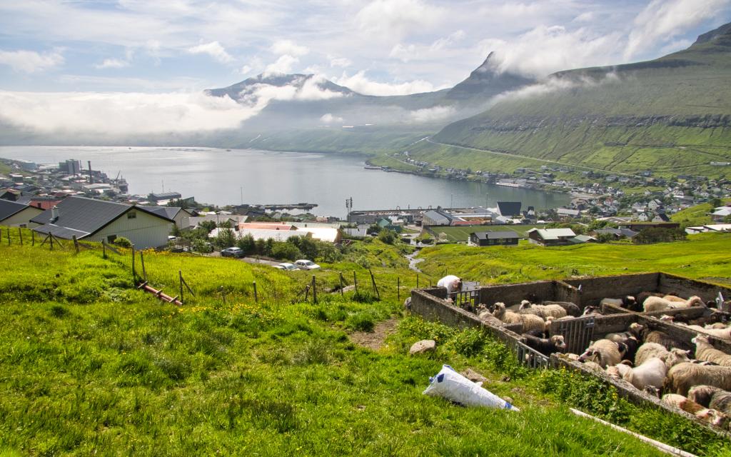
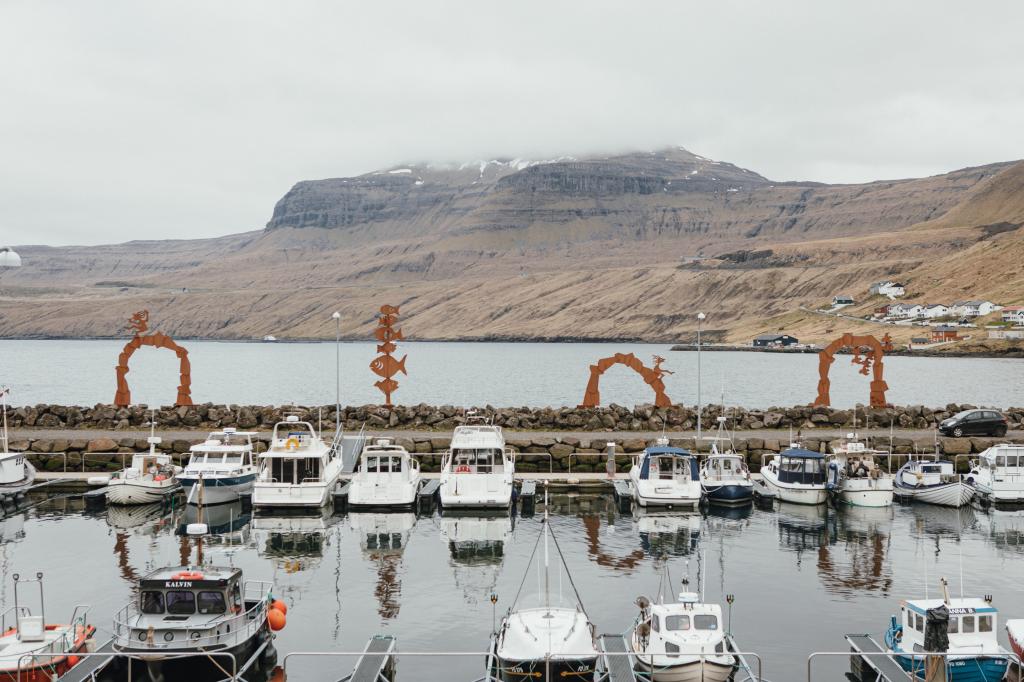 Harbour in Fuglafjørður. Photo: @kirstinvang
 -
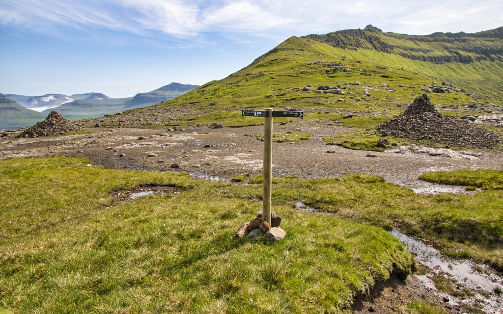
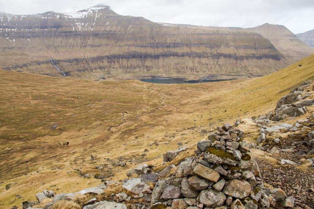
 Cairn at the place of Botnur, above Fuglafjørður, approximately 250m from the pass. Photo: Óli Gardshodn
 -
-
-
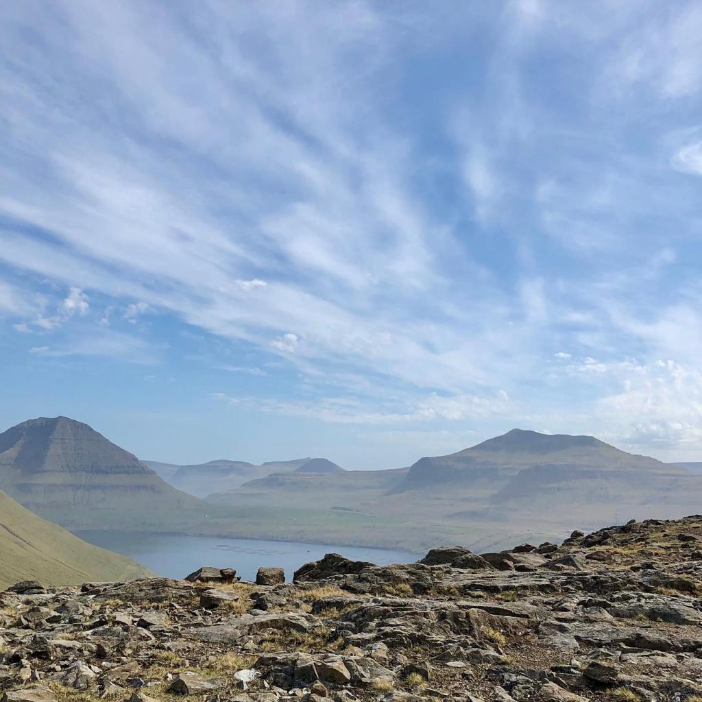
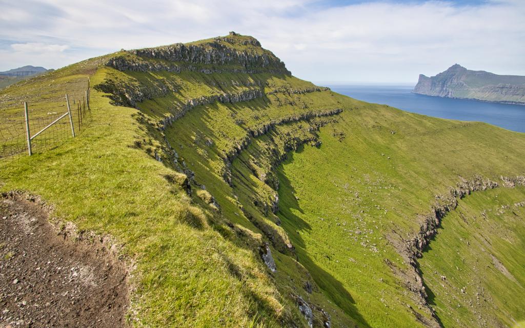
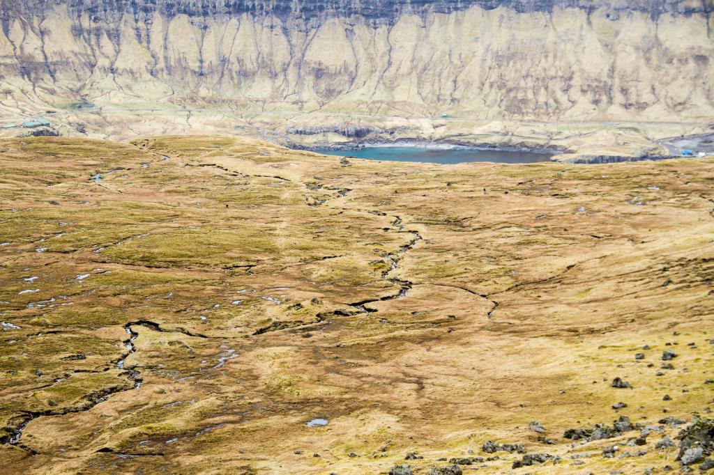
 View down over the valley over Hellurnar. On the way down from the pass Fuglfjarðarskarð to Hellurnar, you come to this cairn at Vørðhamar which marks the path up/down through the crag. Photo: Óli Gardshodn
 -
 View down through the valley over the village of Hellurnar. The path runs along the old peat sheds. Photo: Óli Gardshodn
 -
 The characteristic signpost over Hellurnar, which show where to go up / down through the steep slope called Spreingisbrekka. The stones marking the path have yellow marks painted on them. Photo: Óli Gardshodn
-
-
-
Harbour in Fuglafjørður. Photo: @kirstinvang
-
Cairn at the place of Botnur, above Fuglafjørður, approximately 250m from the pass. Photo: Óli Gardshodn
-
-
-
View down over the valley over Hellurnar. On the way down from the pass Fuglfjarðarskarð to Hellurnar, you come to this cairn at Vørðhamar which marks the path up/down through the crag. Photo: Óli Gardshodn
-
View down through the valley over the village of Hellurnar. The path runs along the old peat sheds. Photo: Óli Gardshodn
-
The characteristic signpost over Hellurnar, which show where to go up / down through the steep slope called Spreingisbrekka. The stones marking the path have yellow marks painted on them. Photo: Óli Gardshodn
Discover the scenic Fuglafjørður - Hellurnar hike via Altarið, a 6 km mountain walk with stunning views and rich local legends.
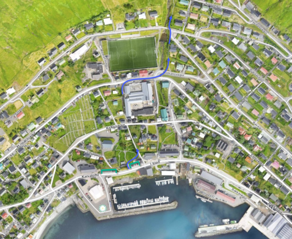
The route begins at the library above the boat basin. From here, walk through the park and follow Traðargøtu street above the school and eyst of the football pitch. Now go eystward of the river and through a sheepfold. Wayfinding posts mark the way along the Skarðsá river.
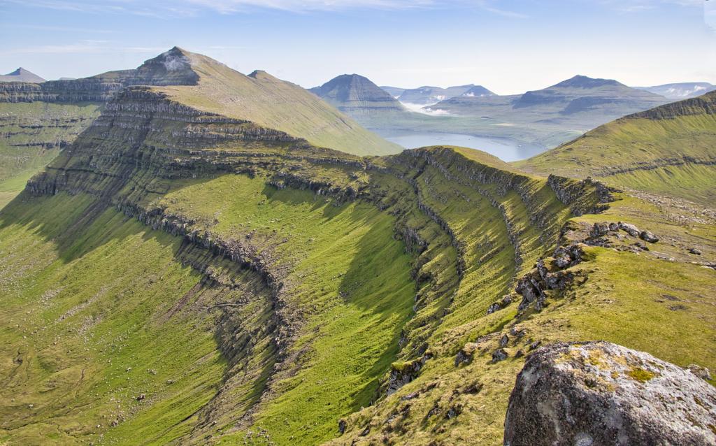
Facing west, you have views over Fuglafjørður to Mt. Blábjørg, the pass Jøklaskarð, Mt. Gjógvaráfjall and Niðan á Hús, where people from Fuglafjørður hid from pirates in the past. Further up, you will find the ledge Nón (which the sun hits at the hour of “nón,” that is 3 p.m.), the pass Breiðaskarð, Mt. Kambur, the pass Trælavatnaskarð, and Mt. Tyril.
Top Fuglafjørður, an organised hike to the 10 peaks around Fuglafjørður, is sometimes held in September. With its 18-20 kilometres, the hike is demanding but also exceptionally beautiful. For further information, contact the local tourist information office.
The path from Fuglafjørður to Hellurnar is called Sjúrðargøta. Legend has it that a giant from Suðuroy came to the village of Oyndarfjørður to test his strength. No one dared to fight him. The people of Oyndarfjørður urged Sjúrður, the farmer, to challenge the giant. He wanted his youngest son, also named Sjúrður, to try. They wrestled and Sjúrður the younger beat the giant. His father paid him well for this feat.
At the top of the pass Skarðið, you will find two large cairns. According to old custom, each time one crosses the pass, three small stones are to be thrown at the cairns while saying: “In the Name of the Father, and of the Son and of the Holy Spirit.” This is meant to both protect you from getting lost and bless your trip. To the north of Skarðið, you can see the village of Oyndarfjørður and the mountains Tindur, Knúkur and Sandfelli. On the first Sunday of August, an open-air public meeting with speeches and songs is held at Skarðið.
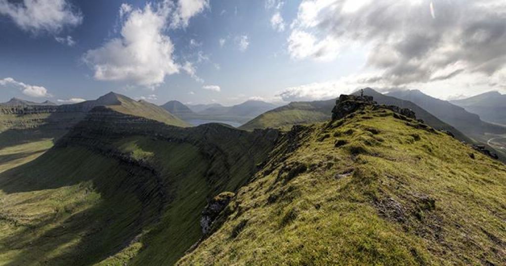
From here it is possible to take a detour to Altarið (483 m) a mountain to the north with exceptional views. The hike is one kilometre each way.
The hills Hulduheyggjar are to the west as you descend from the pass. Here, the story goes, the midwife of Dalbøur in Fuglafjørður aided a Huldre woman (a type of rock troll) in childbirth, a service for which she was richly rewarded.
Another story says that the farmer in Oyndafjørður and a farmer in Fuglafjørður named Gullbrandur fought over land. Gullbrandur was killed and hid in the cave Gullbrandshellið and later buried in Gullbrandsleiði, both of which you will find along this path.
Approaching Hellurnar, the path takes you down through the crag Kliv. From here, continue down the hill Spreingisbrekka. It is a little steep until you reach the outfield gate.


Fuglafjørður - Hellurnar
Public transport
Both Fuglafjørður and Hellurnar can be reached with public transportation.
Route 410 drives to and from Fuglafjørður (Fuglafjørður - Gøtudalur – Klaksvík)
Arriving by car
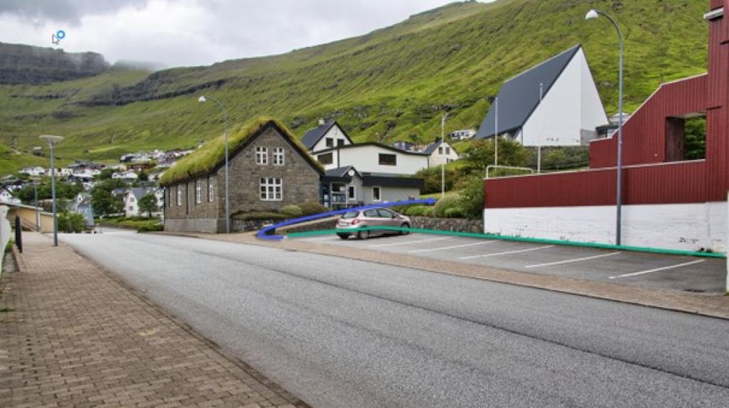
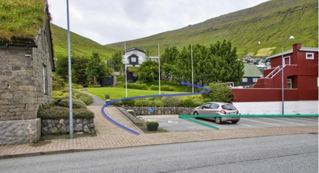
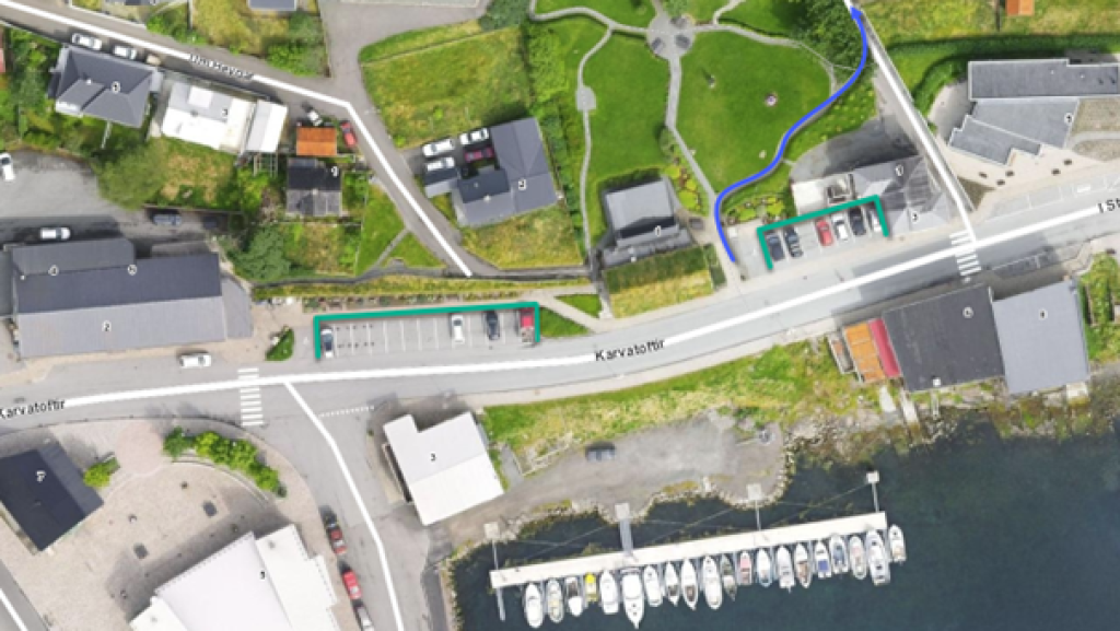
Parking, Fuglafjørður
You can park by the library in the center of Fuglafjørð—see the green lines. From here, follow the blue line to reach the village path.
Hellurnar - Fuglafjørður
Public transport
Both Fuglafjørður and Hellurnar can be reached with public transportation Route 481 drives to Oyndarfjørður (Skálabotnur – Oyndarfjørður).
Arriving by car
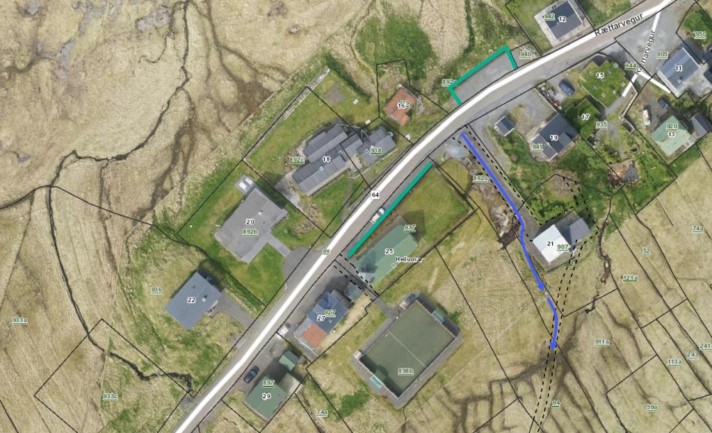
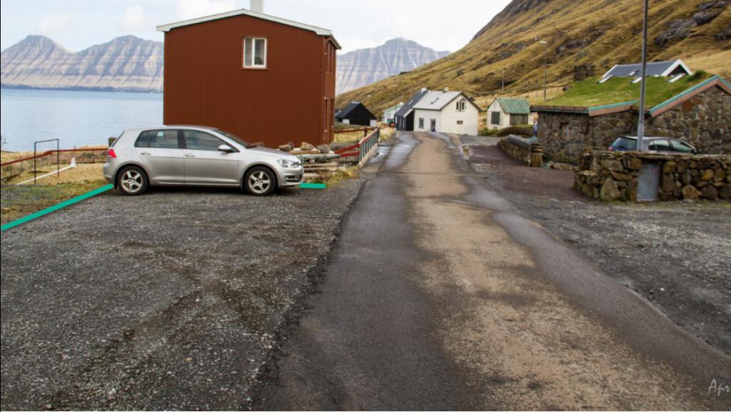
Parking, Hellurnar
It is reasonably easy to find parking places in Hellurnar. Down in the village, just next to where the path starts, there is a parking lot above the road that takes a few cars. Elsewhere, there is good parking by the end of the main road, down by the quay, about 160 metres from where the path starts. You can also park by the church when there are no church services. See the green lines.
-
 See the green lines for parking and blue lines for starting point
 -
 See green lines for parking and blue lines for starting point
 -
 See green line for parking
 -
 See green lines for parking and blue lines for starting point
Fuglafjørður - Hellurnar
Hellurnar - Fuglafjørður
Facts

Duration

distance

Peak

Elevation
 Suitable with children from the age of 6. Somewhat steep up from Hellurnar through the hill Spreingisbrekka
 Medium
- The first stretch up through the hill Spreingisbrekka at Hellurnar is a little strenuous
Medium
- The first stretch up through the hill Spreingisbrekka at Hellurnar is a little strenuous
 Grass-covered and good for walking throughout. Somewhat steep up from Hellurnar through the hill Spreingisbrekka