


You haven’t got any favourites yet
This is where you can collect inspiration, articles, events and places that interest you.
Click the icon on pages and they’ll appear here.
Your favourites
Inspiration & Articles
Events & Tours
Places
Hiking
INSPIRATION & ARTICLES
EVENTS & HIKES
Places
Múli - Lambagjógv


Link Copied!

-
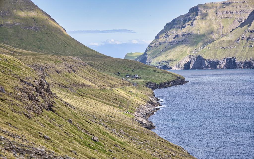 It is very beautiful to drive to the village of Múla. Here we stand below the valley of Ærgisdalur, where we look north towards the settlement of Múli that was abandoned in 1992. Closest towards us we see the boathouses, called Inni á Støð. To the left up on the mountainside below the mountain Tindur, Tobbabúð from the Black Death can be seen. To the right on the mountainside outside Viðareiði you can see the gorge Úti í Gjógv - and in the background you can see the green slope in the Ormadalur valley. Photo: Óli Gardshodn
 -
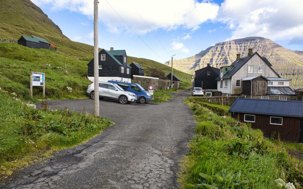 The village of Múli. Photo: Óli Gardshodn
 -
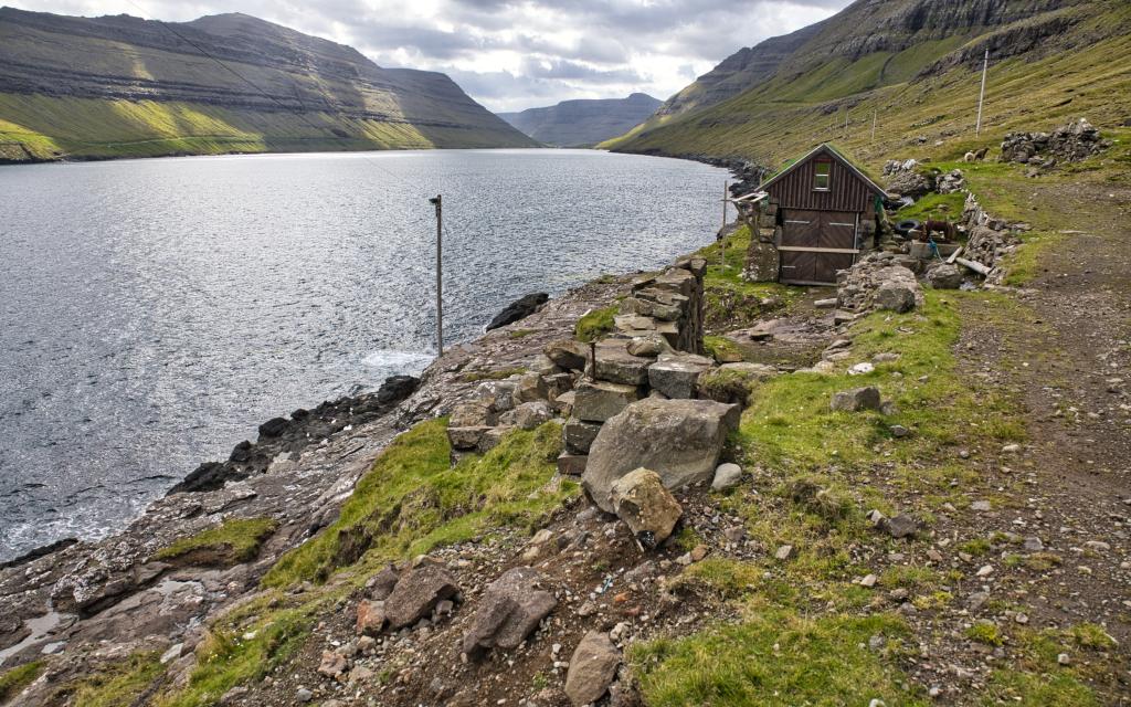 The boathouses of the residents of the village of Múli, located at Inni á Støð, 1 km. south of the settlement. Up to the right of the brown boat house, you can see the game that in recent times was used to pull the boats up the logs, which can be seen on the left down towards the lake. These were harsh conditions because outside to the north it was open to the North Sea... Photo: Óli Gardshodn
 -
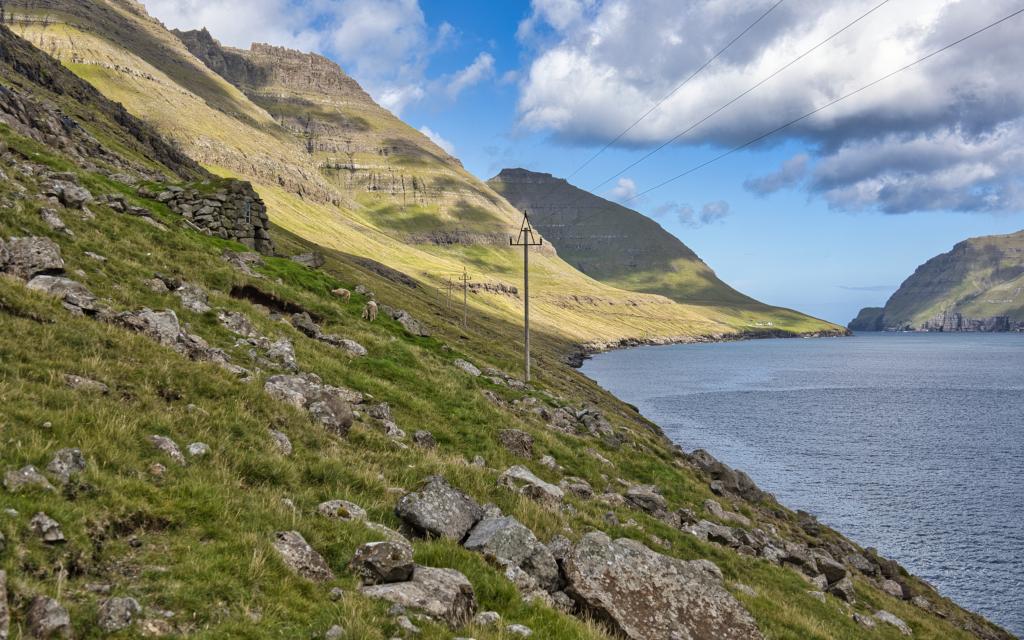
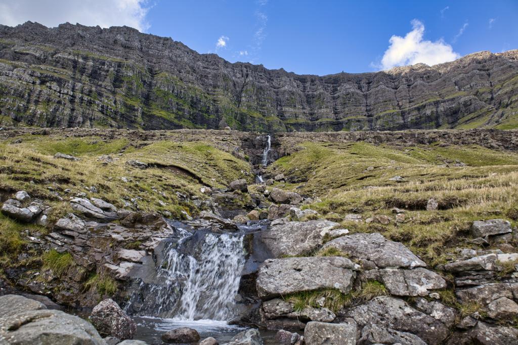 By the river Ærgdalsá below the Ærgisdalur valley. We don't see the valley itself – only the high and steep mountain rock walls above. Photo: Óli Gardshodn
 -
 The beautiful sheep house between the rain canyons Túvugil and Miðgil. In the background the village of Múli. At the top, on the left, where the sun is shining, the mountain Knúkur - one of the most difficult mountains to climb. Photo: Óli Gardshodn
-
It is very beautiful to drive to the village of Múla. Here we stand below the valley of Ærgisdalur, where we look north towards the settlement of Múli that was abandoned in 1992. Closest towards us we see the boathouses, called Inni á Støð. To the left up on the mountainside below the mountain Tindur, Tobbabúð from the Black Death can be seen. To the right on the mountainside outside Viðareiði you can see the gorge Úti í Gjógv - and in the background you can see the green slope in the Ormadalur valley. Photo: Óli Gardshodn
-
The village of Múli. Photo: Óli Gardshodn
-
The boathouses of the residents of the village of Múli, located at Inni á Støð, 1 km. south of the settlement. Up to the right of the brown boat house, you can see the game that in recent times was used to pull the boats up the logs, which can be seen on the left down towards the lake. These were harsh conditions because outside to the north it was open to the North Sea... Photo: Óli Gardshodn
-
By the river Ærgdalsá below the Ærgisdalur valley. We don't see the valley itself – only the high and steep mountain rock walls above. Photo: Óli Gardshodn
-
The beautiful sheep house between the rain canyons Túvugil and Miðgil. In the background the village of Múli. At the top, on the left, where the sun is shining, the mountain Knúkur - one of the most difficult mountains to climb. Photo: Óli Gardshodn
Discover the scenic Múli - Lambagjógv hike through historic villages, stunning valleys, and legendary tales in the Faroe Islands.
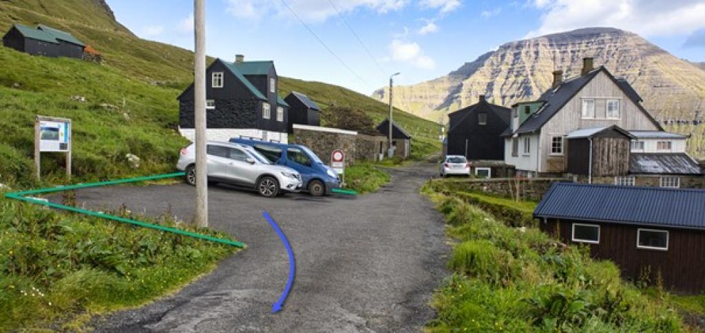
The hike starts in the ancient village of Múli at the north-eastern tip of the isle of Borðoy. The village is located in a unique place, both beautiful and tranquil. No permanent residents are left in the village’s four houses, the last left in 1992. But it is still quite busy—in addition to those who tend to their sheep, tourists visit the village and the houses have become vacation homes.
Múli is one of the oldest villages in the Faroe Islands. It is mentioned in Hundabrævið (the Dog Letter, a legal document from the 14th century). When the Black Death ravaged the village around 1347, the sick were quarantined in the valley above the village. A building, called Tobbabúð, was built to house them. It was placed high up in the valley’s northern end just under the hill Enni, where the slope turns steep above the depression Longukrógv. A hundred metres to the south, you find the boulder Húsbøsteinur. Food for the sick was placed here. The boulder is said to be inhabited by a rock troll.
Guttormur of Múli (1657-1739), who was said to know magic, lived here. Many legends are told about his special gifts. Is that why the village seems enchanted? Perhaps…
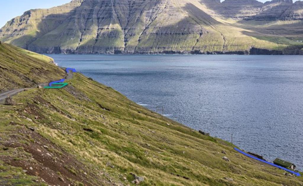
The village landing, Inni á Støði, lies a little over a kilometre south of the village. Up to three boats were kept in its boathouses. Some of the boathouses as well as rollers and a windlass used to draw the boats up from the sea are still there. The village path commences at the end of the road above the boathouses.
When you have parked your car in the big parking space by the river Klivsdalsá, walk 350 metres north to where the lower road goes down to the landing Inni á Støð. From there, take the 400 metres down to the end of the road, where you will find the village path.
The village path was crucial to Múli. Heavy surfs are common here. When northernly winds persisted, it was impossible to reach the village by boat, making the path the only way in and out of the village.
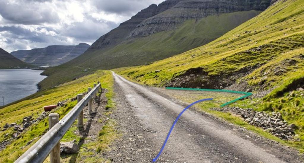
Continuing south and drawing close to the gorge Ærgdalsgjógv, you will find a large square cairn. Four cairns, about a mile apart, guided the traveller to the village of Norðdepil. Only two remain, this one and the one by the gorge Lambagjógv. The others were used as filler when the road to Múli was laid.
On the hike you will see high and steep rock ledges above the valleys of Klivsdalur and Ærgisdalur. On the other side of the sound Hvannasund, you will find the village of Viðareiði and the beautiful mountains towering above it.
Continuing southward, approaching the gorge Lambagjógv, go above it. Just south of the gorge, you reach the next cairn. From here, go up to the road. The remainder of the path to Norðdepil continues just below the road with the exception of the first 300 metres north of the river Fossá. The hike ends above the gorge Lambagjógv, beside which there is a large parking lot where you can set your car.
Note that a fascinating high and slender rock is found close the river Lítladalsá, a kilometre north of the river Fossá. From the road to Múli, you can walk straight down to the rock along the fence on the south bank of the river.


Múli - Lambagjógv
Parking is usually available in Klivsdalsá, 1 km south of Múli, or in the village.
Lambagjógv - Múli
Múli - Lambagjógv
Lambagjógv - Múli
Facts

Duration

distance

Peak

Elevation
 Suitable for children
 Medium
-
Medium
-
 The surface varies between loose rocks, bedrock and grassy path. It might be wet and slippery in places.
