


Tú hevur ongar yndis enn
Her kanst tú savna íblástur, greinar, tiltøk og støð, sum tú hevur áhuga fyri.
Trýst á ikonið á síðurnar, so koma tær fram her.
Tínir yndis
Íblástur & Greinir
Tiltøk & Túrar
Støð
Bygdagøtur
INSPIRATIÓNIR & ARTIKLAR
TILTØK & GONGUTÚRAR
Støð
Kirkja - Hattarvík


Link Copied!

-
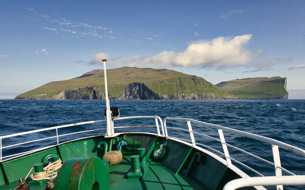 Always beautiful to sail out to the island of Fugloy. The village path between the two villages, Hattarvík and Kirkja, goes up over the mountain ridge above the steep slope, Sunnberg. Photo: Óli Gardshodn
 -
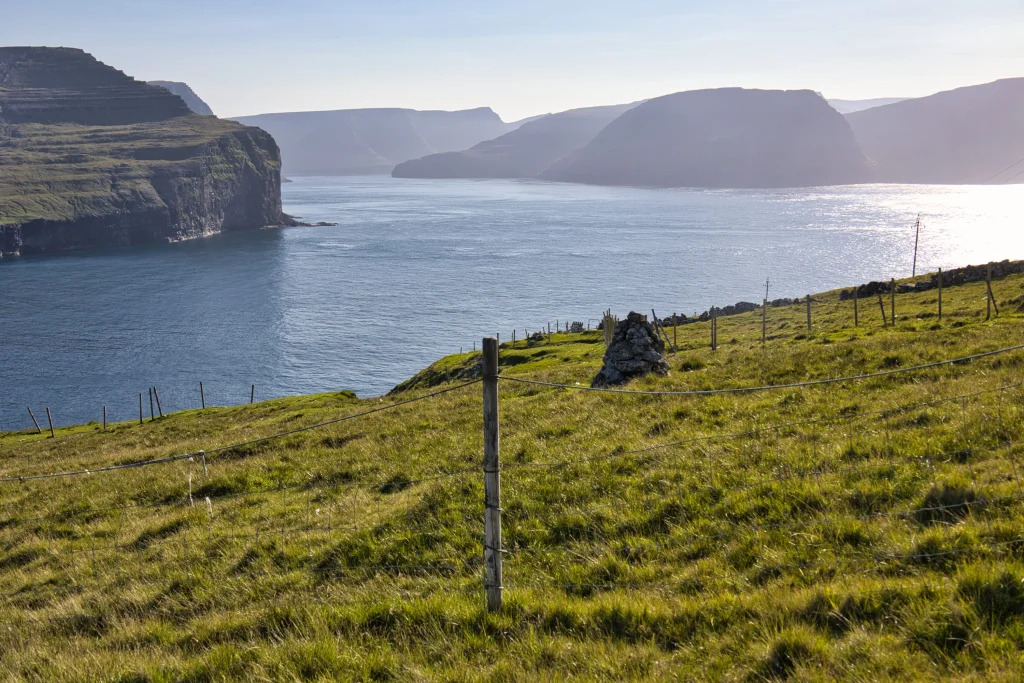 As we walk down towards the village of Kirkja, the view is good over to the neighbouring island Svínoy. Also, we see two of the other northern islands, Viðoy to the right and in the middle Borðoy. Here we are just outside the village fence in Kirkja. The village gate can just be seen in the middle of the picture. Photo: Óli Gardshodn
 -
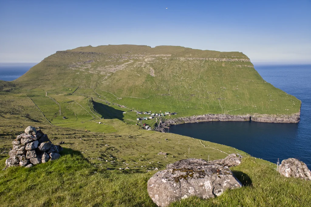 The view from the highest point down over the village Hattarvík. In the background we see the mountain Eystfelli, which is the easternmost mountain in the Faroe Islands. Photo: Óli Gardshodn
 -
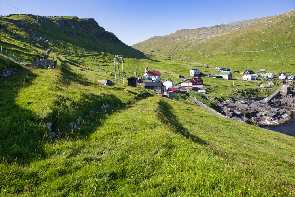 The beginning of the village path in the village Hattarvík. Photo: Óli Gardshodn
 -
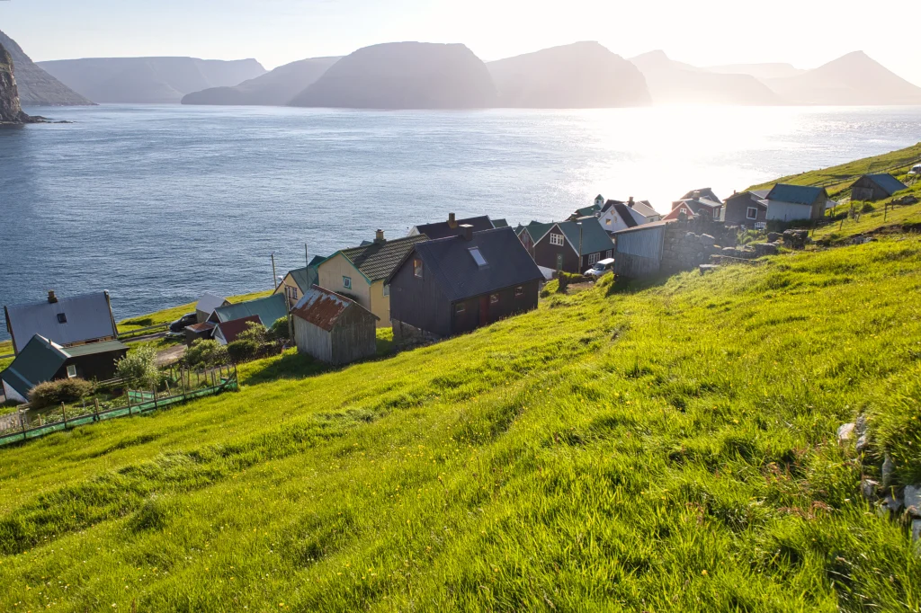 View down the village of Kirkja. Photo: Óli Gardshodn


-
Always beautiful to sail out to the island of Fugloy. The village path between the two villages, Hattarvík and Kirkja, goes up over the mountain ridge above the steep slope, Sunnberg. Photo: Óli Gardshodn
-
As we walk down towards the village of Kirkja, the view is good over to the neighbouring island Svínoy. Also, we see two of the other northern islands, Viðoy to the right and in the middle Borðoy. Here we are just outside the village fence in Kirkja. The village gate can just be seen in the middle of the picture. Photo: Óli Gardshodn
-
The view from the highest point down over the village Hattarvík. In the background we see the mountain Eystfelli, which is the easternmost mountain in the Faroe Islands. Photo: Óli Gardshodn
-
The beginning of the village path in the village Hattarvík. Photo: Óli Gardshodn
-
View down the village of Kirkja. Photo: Óli Gardshodn
Ein øðrvísi túrur, har til ber at vitja tvær fjarskotnar bygdir og sigla til aðra og heim aftur úr hinari.
At ganga bygdagøtuna millum Hattarvík og Kirkju er eitt sindur øðrvísi, tí her ber til at sigla til aðra bygdina og heim aftur úr hini bygdini í oynni. Hetta er tó bert, um veðrið loyvir tí, og mælt verður til at kanna, hvussu siglt verður, áðrenn farið verður avstað. Til ber at ringja til umsjónarmannin hjá SSL (Strandfaraskipum Landsins) íFugloynni á tlf. 293058 og spyrja nærri, hvussu siglt verður ávísan dag.
Frá Hattarvík er bygdagøtan løtt at finna. Gingið verður suður eftir vegnum gjøgnum eitt portur. Haðani verður gingið niðan til bøgarðsportrið, fram við Dirhamari, Gullheyggi og Kyrjarheyggi og beina leið niðan á Kross – tað er har, sum vegurin fer tvørtur um røðina. Gøtan verður ikki nógv gingin, so hon sæst ikki. Men varðar eru allan vegin, so tað er lætt at finna røttu leiðina.
Komin niðan á røðina við Kross verður gingið tætt niðan fyri el-steyrarnar oman til Kirkju.
Í báðum bygdunum er áhugavert at spáka sær ein túr runt í bygdini. Á Kirkju ber til at ganga oman til kirkjuna og haðani oman til gomlu lendingina Niðri á Gjógv.


Kirkja - Hattarvík
Oyggjaleiðir: 58 Hvannasund – Svínoy/Fugloy.
Times out of Svínoy, Kirkju and out of Hattarvík are changing according to suitability.
https://www.ssl.fo/fo/ferdaaetlan/oyggjaleidir/58-hvannasund-hattarvik/
The ferry Ritan, always sails to Kirkja and when needed to Hattarvík. However, these details must be checked and confirmed by calling the SSL overseer in Fugloy (number +298 293058). If possible, we recommend sailing with Ritan to Hattarvík and then walking to Kirkja, as Kirkja has a shop and cafe. Please bear in mind that the shop and cafe opening times are limited.
Plenty of parking where Ritan docks in Hvannasund.


Hattarvík - Kirkja
Oyggjaleiðir: 58 Hvannasund – Svínoy/Fugloy.
Times out of Svínoy, Kirkju and out of Hattarvík are changing according to suitability.
https://www.ssl.fo/fo/ferdaaetlan/oyggjaleidir/58-hvannasund-hattarvik/
The ferry Ritan, always sails to Kirkja and when needed to Hattarvík. However, these details must be checked and confirmed by calling the SSL overseer in Fugloy (number +298 293058). If possible, we recommend sailing with Ritan to Hattarvík and then walking to Kirkja, as Kirkja has a shop and cafe. Please bear in mind that the shop and cafe opening times are limited.
Decent parking where Ritan docks in Hvannasund.


Kirkja - Hattarvík
Hattarvík - Kirkja
Fakta

Tíð

longd

Hægsta stað

Hæddarmetrar
 When walking across Kross, the path's highest point, we recommend that an adult holds the child's hand, as the path is close to the edge above Sunnberg.
 Medium
- Slightly steep up the mountain crag in Hattarvík—east of Kross.
You must climb above three fences: 1) by Kyrjarheyggj in Hattarvík, 2) up on Krossinum, and 3) right outside the stone fence in Kirkju.
Medium
- Slightly steep up the mountain crag in Hattarvík—east of Kross.
You must climb above three fences: 1) by Kyrjarheyggj in Hattarvík, 2) up on Krossinum, and 3) right outside the stone fence in Kirkju.
 Grassy and decent terrain all the way.
Slightly steep on the way up through the highest mountain crag in Hattarvík.
Grassy and decent terrain all the way.
Slightly steep on the way up through the highest mountain crag in Hattarvík.

Øki / Torleikastig

 Avbjóðandi
 5 km /
1t
45m
5 km /
1t
45m


 8 km /
2t
20m
8 km /
2t
20m


