


Tú hevur ongar yndis enn
Her kanst tú savna íblástur, greinar, tiltøk og støð, sum tú hevur áhuga fyri.
Trýst á ikonið á síðurnar, so koma tær fram her.
Tínir yndis
Íblástur & Greinir
Tiltøk & Túrar
Støð
Bygdagøtur
INSPIRATIÓNIR & ARTIKLAR
TILTØK & GONGUTÚRAR
Støð
Mikladal - Húsar


Link Copied!

-
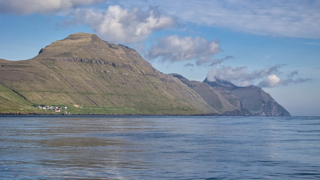 The view from the ferry while we sail from Klaksvík to Syðradalur on the island of Kalsoy. Here we look up along the east side of the island. The village on the left is Húsar. The village path from the village Mikladalur begins in the large valley furthest away, where we can just glimpse a few houses. Photo: Óli Gardshodn
 -
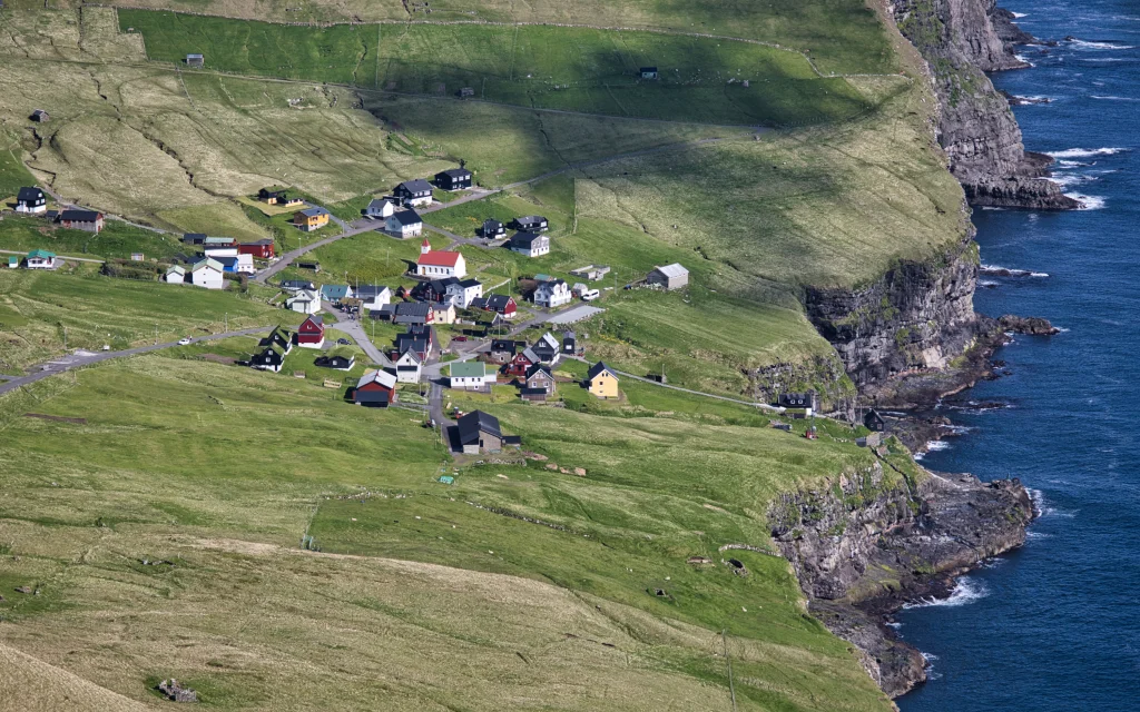 The beautiful view on the eastern side up in the valley Lítlidalur, down on the village Mikladalur with its steep cliffs down to the sea. Down at the end of the stairs down to the sea, we can just glimpse Kópakonan - the statue of the seal woman. Photo: Óli Gardshodn
 -
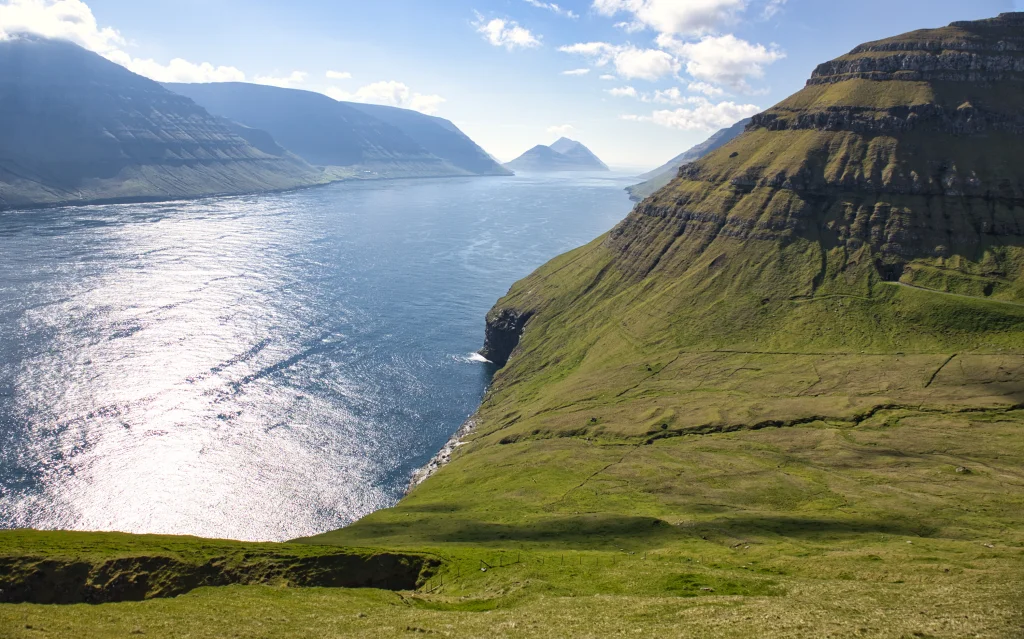 View of the valley Ritudal. Below us is part of the large gorge Ritudalsgjógv. On the other side of the strait the island of Kunoy. In the distant background is Klakkur - the mountain above the town of Klaksvík. Photo: Óli Gardshodn
 -
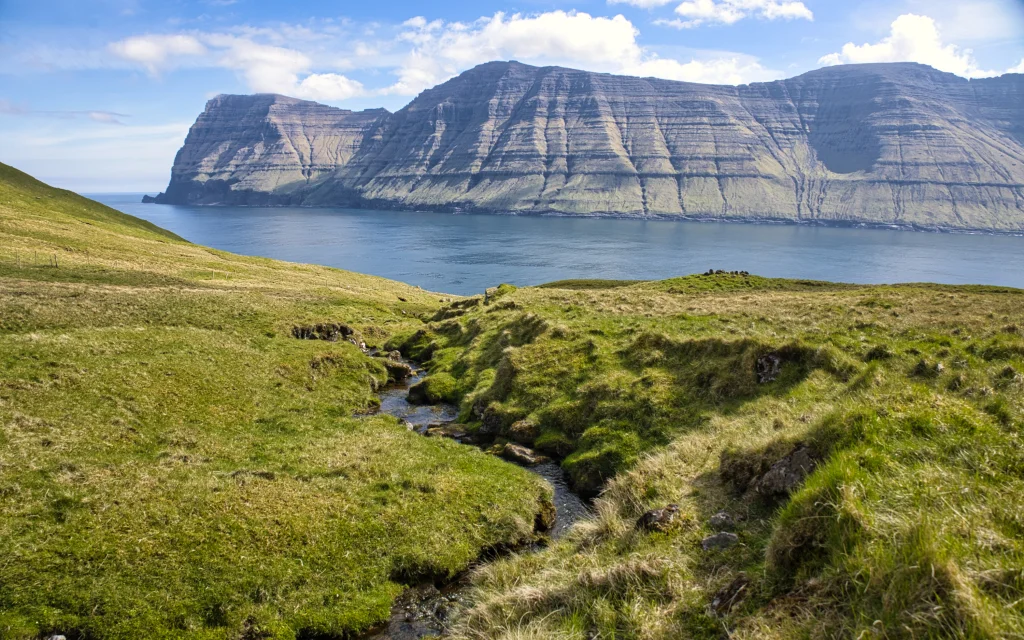 It is cozy down by the river in the valley Ritudali, close to the place Svínastall and the knoll Ritudalsheyggj. On the other side of the strait, the northern end of the island of Kunoy - the high island with the steep mountains. Photo: Óli Gardshodn
 -
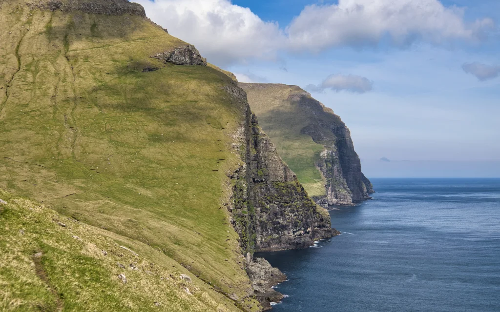 View from Bustin, south of the valley Ritudalur. The cliffs south and north of the village Mikladalur. Photo: Óli Gardshodn
 -
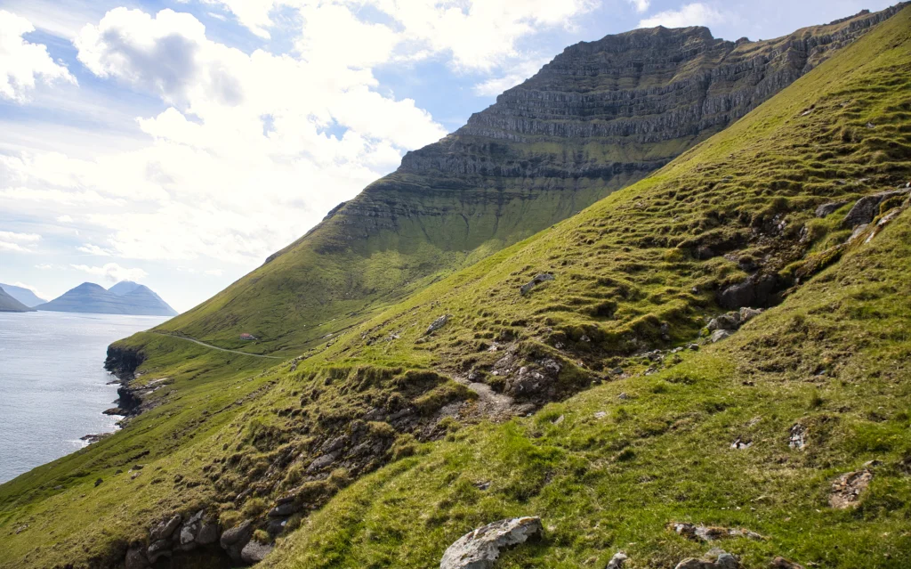 On the path between the gorge Lunnarsgjógv and the valley Hattardalur. At the top we see the mountain Hattardalstindur with its impressive steep cliffs. Photo: Óli Gardshodn


-
The view from the ferry while we sail from Klaksvík to Syðradalur on the island of Kalsoy. Here we look up along the east side of the island. The village on the left is Húsar. The village path from the village Mikladalur begins in the large valley furthest away, where we can just glimpse a few houses. Photo: Óli Gardshodn
-
The beautiful view on the eastern side up in the valley Lítlidalur, down on the village Mikladalur with its steep cliffs down to the sea. Down at the end of the stairs down to the sea, we can just glimpse Kópakonan - the statue of the seal woman. Photo: Óli Gardshodn
-
View of the valley Ritudal. Below us is part of the large gorge Ritudalsgjógv. On the other side of the strait the island of Kunoy. In the distant background is Klakkur - the mountain above the town of Klaksvík. Photo: Óli Gardshodn
-
It is cozy down by the river in the valley Ritudali, close to the place Svínastall and the knoll Ritudalsheyggj. On the other side of the strait, the northern end of the island of Kunoy - the high island with the steep mountains. Photo: Óli Gardshodn
-
View from Bustin, south of the valley Ritudalur. The cliffs south and north of the village Mikladalur. Photo: Óli Gardshodn
-
On the path between the gorge Lunnarsgjógv and the valley Hattardalur. At the top we see the mountain Hattardalstindur with its impressive steep cliffs. Photo: Óli Gardshodn
Ein friðarligur túrur tvørtur um fimm dalar, við vøkrum og stórbærum fjøllum og rókum omanfyri.
Byrjað verður í Mikladali, við stóra svingið í Sevgrøv beint sunnan fyri bygdina, har sniðgøtan sæst ganga niðan í Lítladal. Gøtan er partur av 14,5 km longu farleiðini millum Syðradal og Trøllanes, sum vanliga tók 4,5 tímar at ganga. Gøtan bleiv nógv brúkt, tí bæði Trøllanes og Mikladalur eru brimpláss, har tað ofta ikki var atkomuligt við báti í longri tíðarbil.
Gøtan er góð at ganga allan vegin og sæst næstan allan vegin. Tað er at kalla bert tvørtur um Ritudal og Villingadal, at hon ikki sæst.
Sera vakurt er at ganga niðan úr Mikladali, við góða útsýninum oman yvir bygdina, 788 m høgu Nestindum omanfyri og bjørgunum eystantil. Hinumegin fjørðin hava vit Kunoynna, sum m.a. er kend fyri síni nógvu høgu og brøttu fjøll. Niðri á helluni niðan fyri bygdina hómast standmyndin av kópakonuni.
Tað sýnist skjótt og lætt at ganga suðurum til Ritudal. Komin suður í Ritudal verður gingið beint oman í dalin eftir krókutu sniðgøtuni. Tað er skilligt, eftir hvussu væl gøtan sæst í brekkuni, at hon hevur verið nógv brúkt.
Niðri í dalinum, við ein stóran heygg, er ein elligomul pengahola, sum hevði eitt skelti við innskriftini “Til gott endamál”. Tað var siður í síni tíð, at tann, sum gekk framvið, kundi leggja nakrar smápengar í hesa holu. Júst hvussu býtislykilin var, hvør legði í, og hvør tók úr holuni, er ógreitt.
Úr Ritudali verður gingið suður gjøgnum Bustina til Villingadal og haðani suður um dalin, suður í Lundurðarnar. Her síggjast tvær gøtur í Lundurðunum. Ansa eftir, at tú tekur ta ovaru, so at tú kemur niðan um Lunnarsgjógv, sum er mark millum Mikladal og Húsar.
Við vakra útsýninum niðan á tignarliga Hattardalstind, 644 m, ganga vit seinasta strekkið frá Lunnarsgjógv suður í Hattardal, har bygdagøtan kemur inn á landsvegin.


Mikladal - Húsar
https://www.ssl.fo/fo/ferdaaetlan/oyggjaleidir/56-klaksvik-sydradalur/
Bus drives to and from the ferry dock:
https://www.ssl.fo/fo/ferdaaetlan/bygdaleidir/506-trollanes-sydradalur/
There are several significant parking areas in Mikladalur, including the one by the notice sign above the village (the green line). You must walk over to the path from there—refer to the blue arrows. Two fences are above the road, those you will have to climb over.

Húsar - Mikladal

Mikladal - Húsar
Húsar - Mikladal
Fakta

Tíð

longd

Hægsta stað

Hæddarmetrar
 Yes, 8+
 Medium
-
Medium
-
 Some areas are missing a path, for example, to the north of Lundurðarnar, which is pretty steep.
In Bergkøtlum, north of Lundurðarnar, and by Lunnarsgjógv, you will end up walking close to the edge, with the sea below. However, the distance from the edge is large enough not to frighten anyone.
Some fences without gates or ladders will require you to climb over.
Some areas are missing a path, for example, to the north of Lundurðarnar, which is pretty steep.
In Bergkøtlum, north of Lundurðarnar, and by Lunnarsgjógv, you will end up walking close to the edge, with the sea below. However, the distance from the edge is large enough not to frighten anyone.
Some fences without gates or ladders will require you to climb over.

Øki / Torleikastig

 Miðal
Miðal
 3 km /
1t
3 km /
1t


 8 km /
2t
20m
8 km /
2t
20m

