


Tú hevur ongar yndis enn
Her kanst tú savna íblástur, greinar, tiltøk og støð, sum tú hevur áhuga fyri.
Trýst á ikonið á síðurnar, so koma tær fram her.
Tínir yndis
Íblástur & Greinir
Tiltøk & Túrar
Støð
Bygdagøtur
INSPIRATIÓNIR & ARTIKLAR
TILTØK & GONGUTÚRAR
Støð
Múli - Skálatoftir - Strond


Link Copied!

-
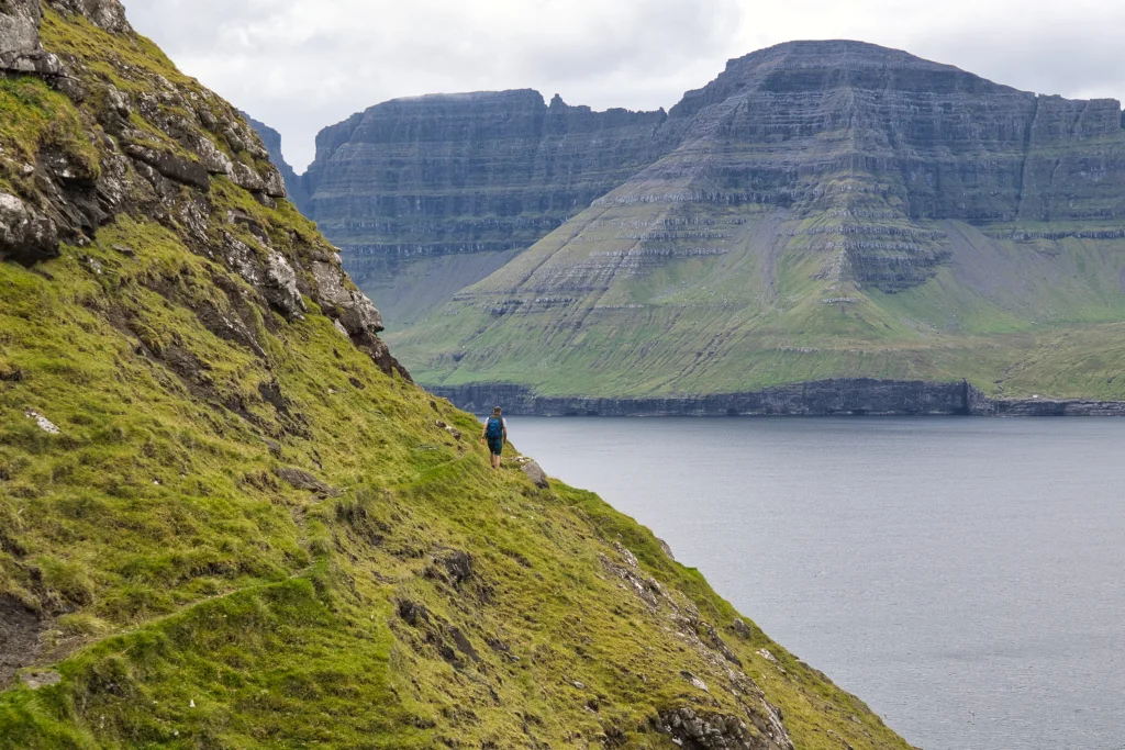 The steep slope at a height of 115 m above the site Fugltúvan, just west of the northern end of the island of Borðoy. Photo: Óli Gardshodn
 -
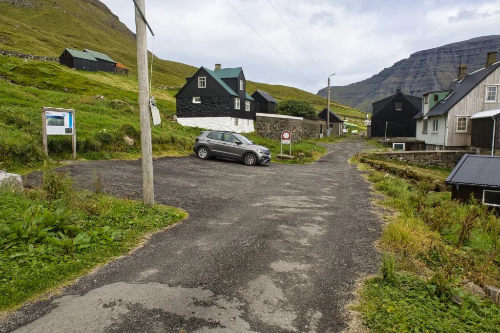 The village of Múli. Photo: Óli Gardshodn
 -
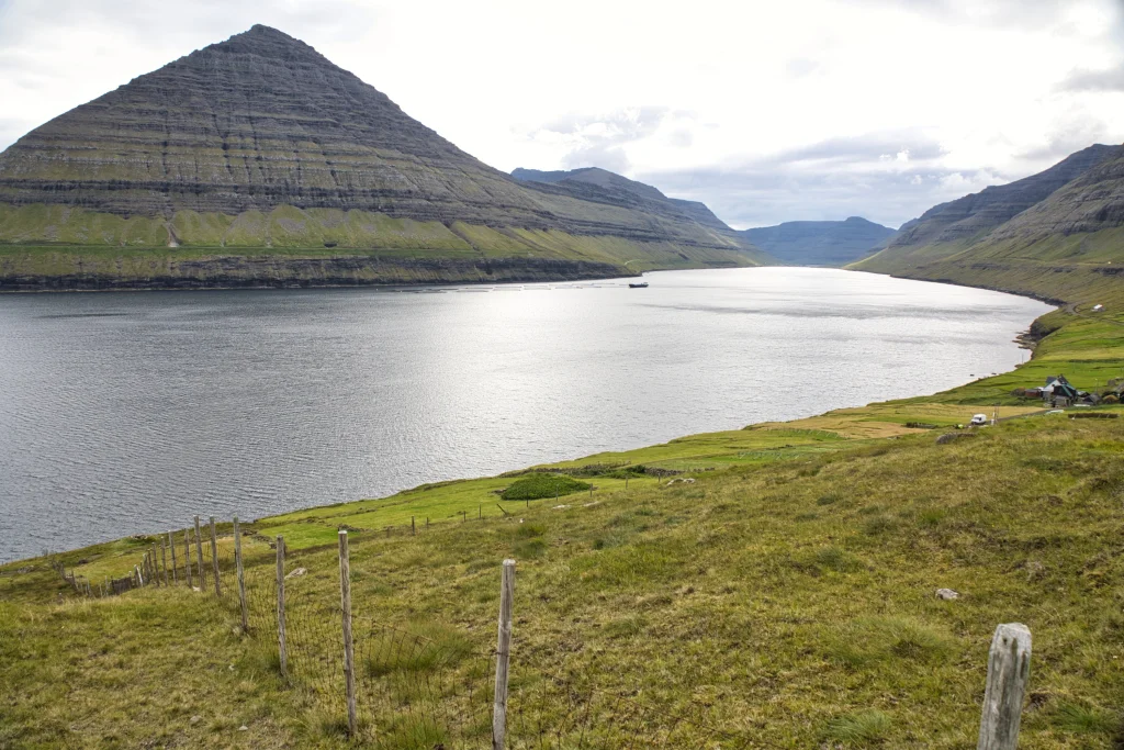 The view from the village gate north of the settlement Múla, south over the settlement Múli and the strait Hvannasund. Photo: Óli Gardshodn
 -
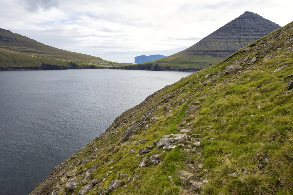 View from the place Oksaskriðan, north of the village Múli, over to the village Viðareiði, with the island Fugloy in the background. Photo: Óli Gardshodn
 -
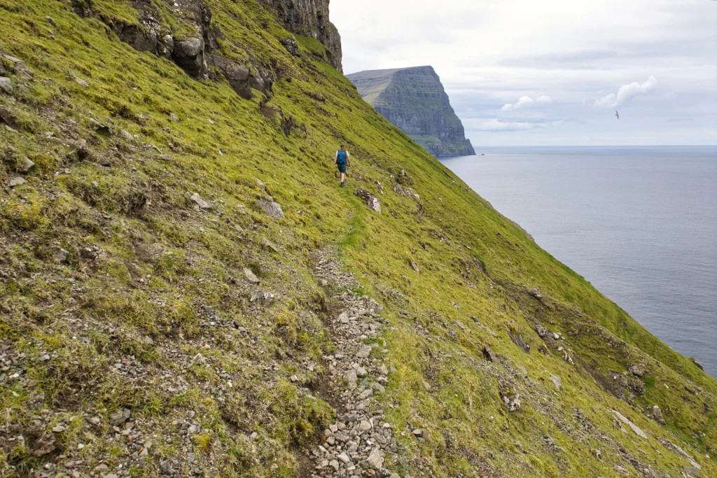 The mountain slope north of the village Múli is steep, but the village path is good to walk on, especially on a dry summer day. Here we are at the place called Gjáirnar. In the background we see the northern end of the island of Kunoy. Photo: Óli Gardshodn
 -
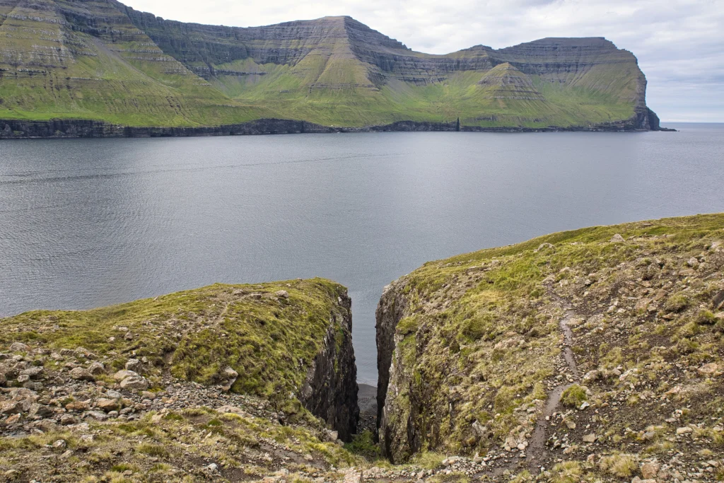 The gorge Ásugjógv, a little north of Skálatoftir on the island of Borðoy. If storms suddenly came and they did not see the opportunity to row home, they sought into this gorge. where they could haul the boat up on the sandy beach inside it. Photo: Óli Gardshodn
 -
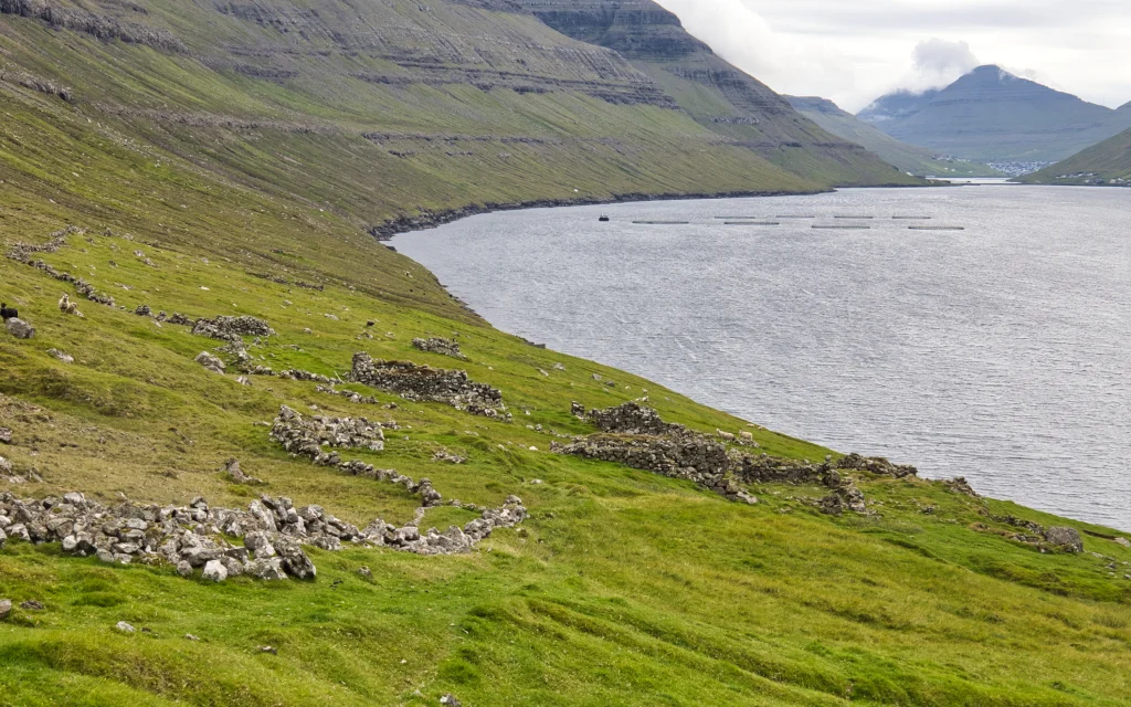 The ruins of the abandoned houses in the village Skálatoftir. Photo: Óli Gardshodn
 -
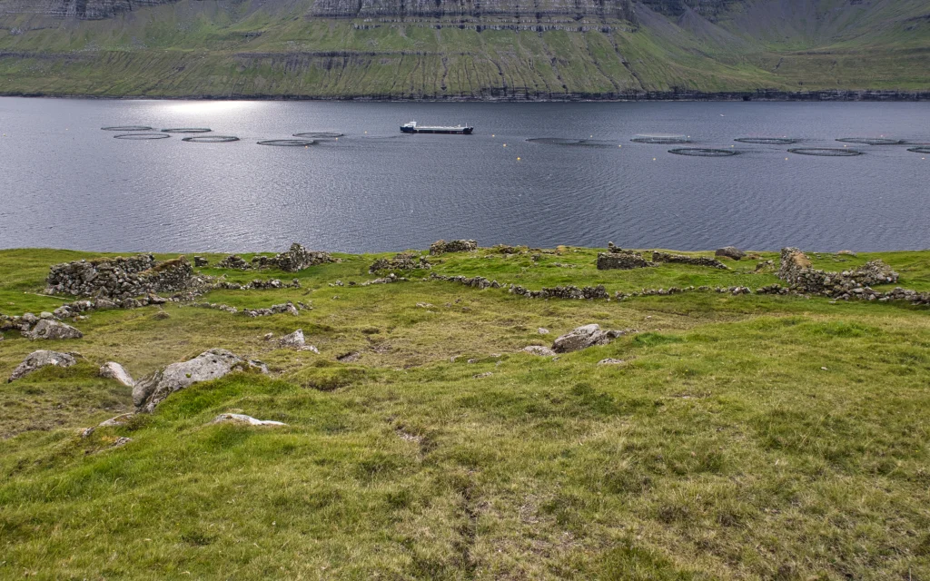 The ruins of the abandoned houses in the village Skálatoftir. Photo: Óli Gardshodn
 -
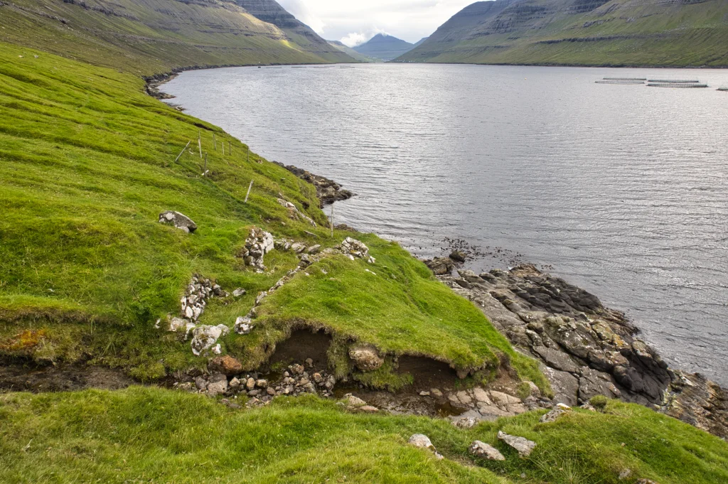
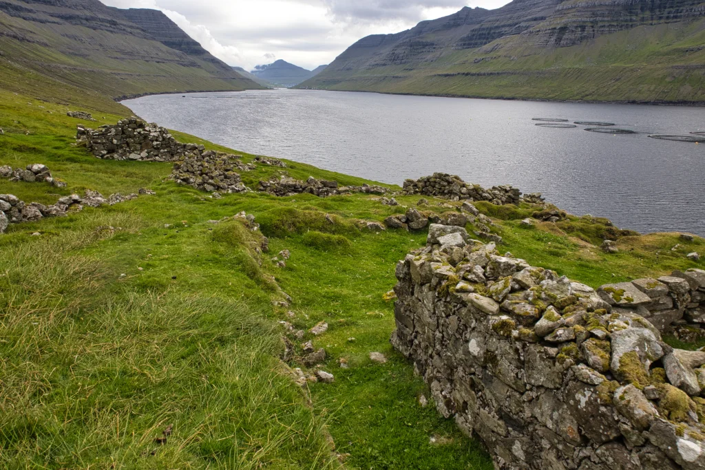 The ruins of the abandoned houses in the village Skálatoftir. Photo: Óli Gardshodn
 -
 The boat bus at the place Kleivin, below the village Skálatoftir. Photo: Óli Gardshodn
 -
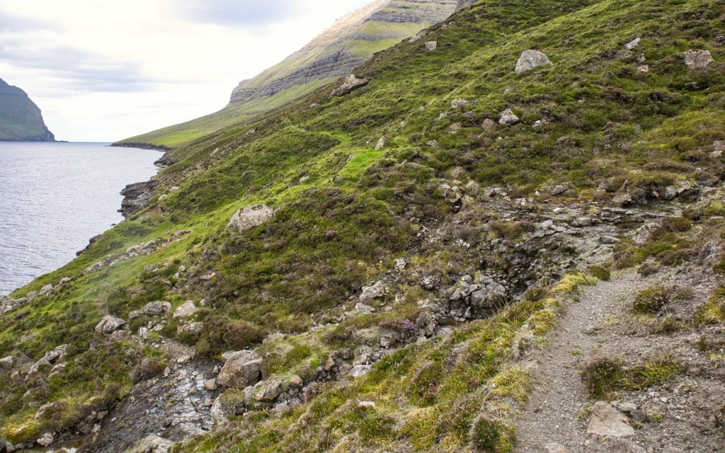 On the village path between Strond and Skálatoftir - here at the place Skarpiryggur. The green slope in the background is Skálatoftir. Photo: Óli Gardshodn
 -
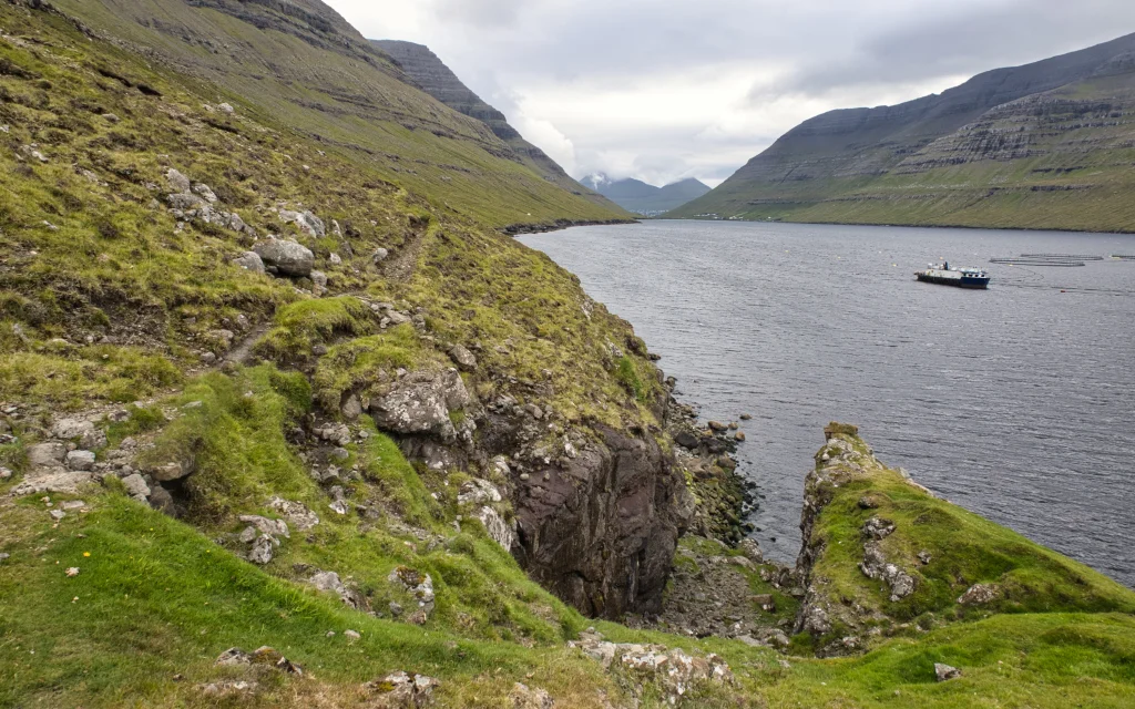 The gorge Krákugjógv. In the background on the other side of the strait is Photo: Óli Gardshodnthe settlement Haraldssund. In the distant background is the city of Klaksvík.


-
The steep slope at a height of 115 m above the site Fugltúvan, just west of the northern end of the island of Borðoy. Photo: Óli Gardshodn
-
The village of Múli. Photo: Óli Gardshodn
-
The view from the village gate north of the settlement Múla, south over the settlement Múli and the strait Hvannasund. Photo: Óli Gardshodn
-
View from the place Oksaskriðan, north of the village Múli, over to the village Viðareiði, with the island Fugloy in the background. Photo: Óli Gardshodn
-
The mountain slope north of the village Múli is steep, but the village path is good to walk on, especially on a dry summer day. Here we are at the place called Gjáirnar. In the background we see the northern end of the island of Kunoy. Photo: Óli Gardshodn
-
The gorge Ásugjógv, a little north of Skálatoftir on the island of Borðoy. If storms suddenly came and they did not see the opportunity to row home, they sought into this gorge. where they could haul the boat up on the sandy beach inside it. Photo: Óli Gardshodn
-
The ruins of the abandoned houses in the village Skálatoftir. Photo: Óli Gardshodn
-
The ruins of the abandoned houses in the village Skálatoftir. Photo: Óli Gardshodn
-
The ruins of the abandoned houses in the village Skálatoftir. Photo: Óli Gardshodn
-
The boat bus at the place Kleivin, below the village Skálatoftir. Photo: Óli Gardshodn
-
On the village path between Strond and Skálatoftir - here at the place Skarpiryggur. The green slope in the background is Skálatoftir. Photo: Óli Gardshodn
-
The gorge Krákugjógv. In the background on the other side of the strait is Photo: Óli Gardshodnthe settlement Haraldssund. In the distant background is the city of Klaksvík.
Millum hábærslig fjøll, eftir sera brøttu og vøkru bygdagøtuni úr gandakendu bygdini Múla, norður um Múlan, til avtoftaðu bygdina Skálatoftir. Túrurin er bert fyri fólk, sum ikki hava hæddarræðslu, og má bert gangast í turrveðri á hásumri.
Túrurin byrjar í fyrndargomlu bygdini Múla, sum liggur norðast á eystursíðuni á Borðoynni. Tað er vakurt og friðarligt at koma til Múla – eitt sindur sjáldsamt. Guttormur í Múla, sum skuldi duga meira enn at mata seg, búði einaferð her. Kanska er tað tí, at tað tykist eitt sindur gandakent. Ongin býr fast har í dag.
Gingið verður gjøgnum bygdina norður á endan á vallaða vegnum, har sum nakrir runnar standa framvið. Umleið 100 m longur norður, til eitt hegn, sum førir niðan til bøgarðsportrið. Vit ganga niðan norðan fyri hegnið, gjøgnum bøgarðsportrið og haðani 30 m longur niðan, til hornið á hegninum, sum stendur uppi á sløttum á Hagabrúgv. Haðani ganga vit norður eftir slættanum móti einum seyðabóli 200 m norðanfyri. Gøtan sæst ikki í fyrstuni, men tá ið vit ganga fram við seyðabólinum og eini kornkrógv beint aftaná, sæst gøtan væl. Skjótt koma vit í brattlendið á norðaru síðu. Legg til merkis, at gøtan býtir seg sundur tvær ferðir, og í báðum førum skalt tú velja ta ovaru leiðina.
Meðan vit ganga vestureftir, fer Kunoyggin at koma undan. Í umleið 100 m hædd fylgja vit gøtuni allan vegin rundan um Múlan. Eftir at vit hava runda Múlan fara vit at ganga suðureftir. Her, oman fyri Fugltúvuna, koma vit til tað brattasta strekkið á túrinum. Ein góðan summardag er hetta gott at ganga hjá fólki, sum ikki hevur hæddarræðslu, men um veturin hevur tað neyvan altíð verið stuttligt. Sjógvur er beint undir, so hjá onkrum er hetta møguliga ov nógv.
Á leiðini suður til Ørmansdal ganga vit gjøgnum Múlagjógv og fleiri onnur djúp gil, har útsýnið niðan í røkurnar er sera gott. Frá Ørmansdali og suðureftir er ikki bratt.
Ein góðan kilometur sunnan fyri Ørmansdal er Ásugjógv. Her kundu bátar seta upp, um teir á leiðini komu í neyð av t.d. óveðri. Bátur kundi dragast niðan á sandin í gjónni, men ikki slapst upp úr gjónni, so her svóvu teir onkuntíð. Seinni bleiv tað tó gjørligt, við hjálp frá Heina-Jógvani, ið eisini gjørdi arbeiðið við gøtuna til Árnafjarðar. Í dag stendur bert ein illa farin rustaður kongur eftir, so her er ikki longur ráðiligt at ganga.
Komin um sýnina stutt sunnan fyri Ásugjógv koma Skálatoftir umsíðir undan. Grøni bøurin við øllum teimum veltu teigunum og húsatoftunum. Sum vit nærkast, kann ein ímynda sær, hvussu hetta samfelagið hevur búleikast. Her vóru samanlagt eini seks hús, harav eitt heilt har suðuri við bøgarðsendan. Í 1880 búðu 23 fólk á Skálatoftum í fýra húsum, og at tað mundi vera tað mesta, sum hevur verið.
Trý av hesum húsum vóru bygd tætt saman sum ein samanhangandi long lon. Hetta vóru Kongsstovan og Innistovan í hvør sínum enda við Roykstovuni ímillum.
Oman frá norðastu húsunum ganga vit trappurnar oman til lendingina, Kleivina, har ein neystagrund stendur. Tað er áhugavert, at hesi trapputrin oman gjøgnum bøin framvegis eru góð at ganga eftir hóast heilt tilvaksin av grasi.
Vit ganga niðan aftur til húsini og haðani heim eftir vallaðu gøtuni. Tá ið vit koma heim um bøgarðin, ganga vit víðari eftir bygdagøtuni, sum fyrsta strekkið í støðum er steinsett.
Nógv er at hyggja at hinumegin fjørðin, har fleiri av hægstu fjøllunum í Føroyum eru umframt eisini størsta gjógv í Føroyum, Skarðsgjógv. So áðrenn vit vita av, eru vit komin suður til Strond, við byrgingina um Haraldssund.


Múli - Skálatoftir - Strond
There is a parking area in Múli—cite the green line. From the parking area, you walk a good 200-meters north through the small village until you reach a grassy road with bushes close by. From that road, you walk 100-meters further north to a fence which leads you to the stone gate 80-meters above. You then walk north of the fence upwards and out through the stone gate. From the stone gate, you walk 30-meters further north to the corner of the gate, which stands on flat terrain in Hagabrúgv. You walk north around the mountain along the village path—cite blue arrows.


Strond - Skálatoftir - Múli
SSL Bygdaleiðir, route 500/504 Klaksvík – Kunoy
https://www.ssl.fo/fo/ferdaaetlan/bygdaleidir/500-504-klaksvik-kunoy/
Parking in Strond, north of the embankment around Haraldssund:
By the enclosed area embarkment around Haraldssund, you will continue north towards the sea, north of Bakkafrost’s building, where you arrive at a road's end by a sheep’s house on the north side. You can park your car near the side of the road so that other cars can pass—cite the green line. From there, you will walk through a large gate facing north of the sheep house and then further through the gate north past the sheep house–cite blue arrows.


Múli - Skálatoftir - Strond
Strond - Skálatoftir - Múli
Fakta

Tíð

longd

Hægsta stað

Hæddarmetrar
 No.
No.
 Difficult
- The path is quite steep and narrow in some areas, so it is essential to have quality and used hiking boots. Remember to tie the laces close to the shoe, so they don't loosen or get stuck to the other shoe. It is steepest where the ocean is below may be challenging for people with a fear of heights. You are strictly warned against making this trip during slippery, snowy, or wet weather or shortly after rainy weather. According to the safety authorities, you are advised not to go off route.
Difficult
- The path is quite steep and narrow in some areas, so it is essential to have quality and used hiking boots. Remember to tie the laces close to the shoe, so they don't loosen or get stuck to the other shoe. It is steepest where the ocean is below may be challenging for people with a fear of heights. You are strictly warned against making this trip during slippery, snowy, or wet weather or shortly after rainy weather. According to the safety authorities, you are advised not to go off route.
 For the most part, grassy.
Although the path is decent, there are areas where gravel is loose and wet, meaning it can be slippery. One of the route's steepest points, Fuglatúvuna, consists of wet terrain.
As the river runs through the bedrock, it can be wet and slippy.
At the steepest point on the northern side, where walking around Múli, the ocean is directly beneath you, which may frighten people.
For the most part, grassy.
Although the path is decent, there are areas where gravel is loose and wet, meaning it can be slippery. One of the route's steepest points, Fuglatúvuna, consists of wet terrain.
As the river runs through the bedrock, it can be wet and slippy.
At the steepest point on the northern side, where walking around Múli, the ocean is directly beneath you, which may frighten people.

Øki / Torleikastig

 Miðal
Miðal
 3 km /
1t
3 km /
1t


 8 km /
2t
20m
8 km /
2t
20m


