


Tú hevur ongar yndis enn
Her kanst tú savna íblástur, greinar, tiltøk og støð, sum tú hevur áhuga fyri.
Trýst á ikonið á síðurnar, so koma tær fram her.
Tínir yndis
Íblástur & Greinir
Tiltøk & Túrar
Støð
Bygdagøtur
INSPIRATIÓNIR & ARTIKLAR
TILTØK & GONGUTÚRAR
Støð
Mikladalur - Trøllanes


Link Copied!

-
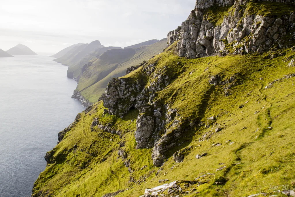 The steep terrain between Vørðan and the valley Djúpadalur. Photo: Óli Gardshodn
 -
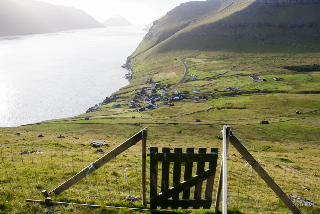 View above Mikladalur. Photo: Óli Gardshodn
 -
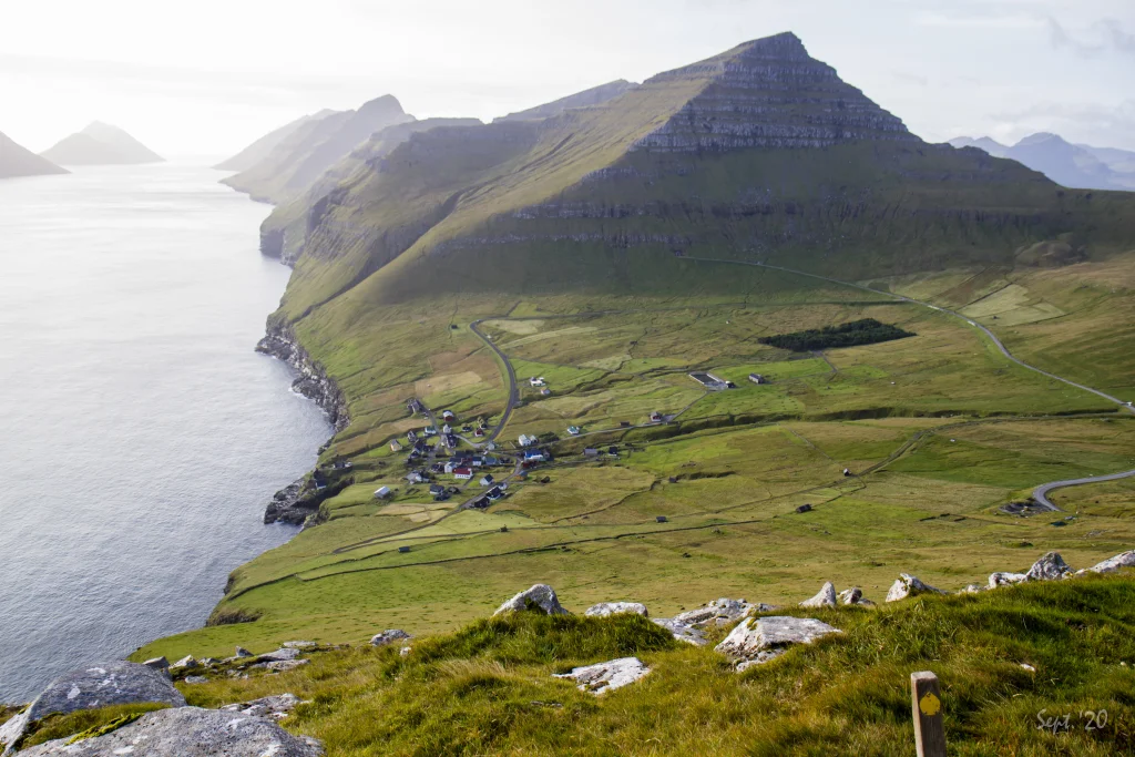 View up from Vørðan south over the island Kalsoy and the village Mikladalur. Signposts like the one seen in the picture are all the way except in the Djúpadalur valley, where the path is clearly visible. Photo: Óli Gardshodn
 -
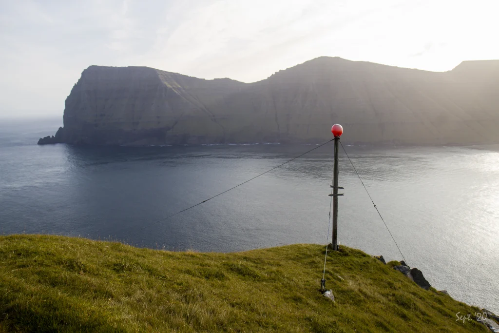 The characteristic signpost with the red buoy up on Vørðan where you enter the steep terrain towards the beautiful valley Djúpadalur. Photo: Óli Gardshodn
 -
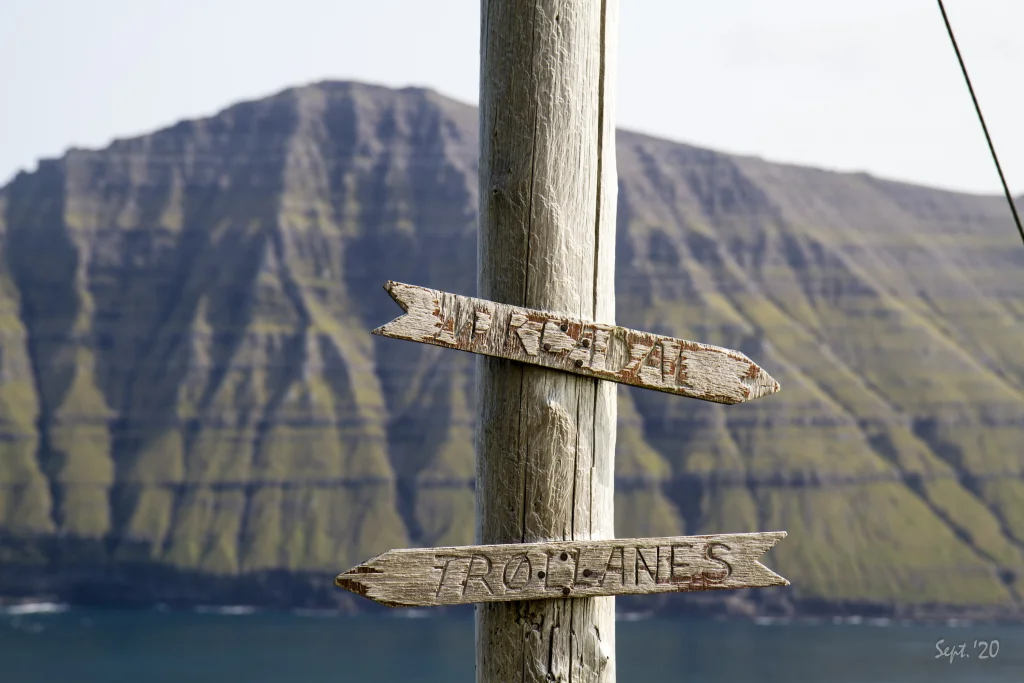 The signs on the signpost up at the place Vørðan over Mikladalur. Photo: Óli Gardshodn
 -
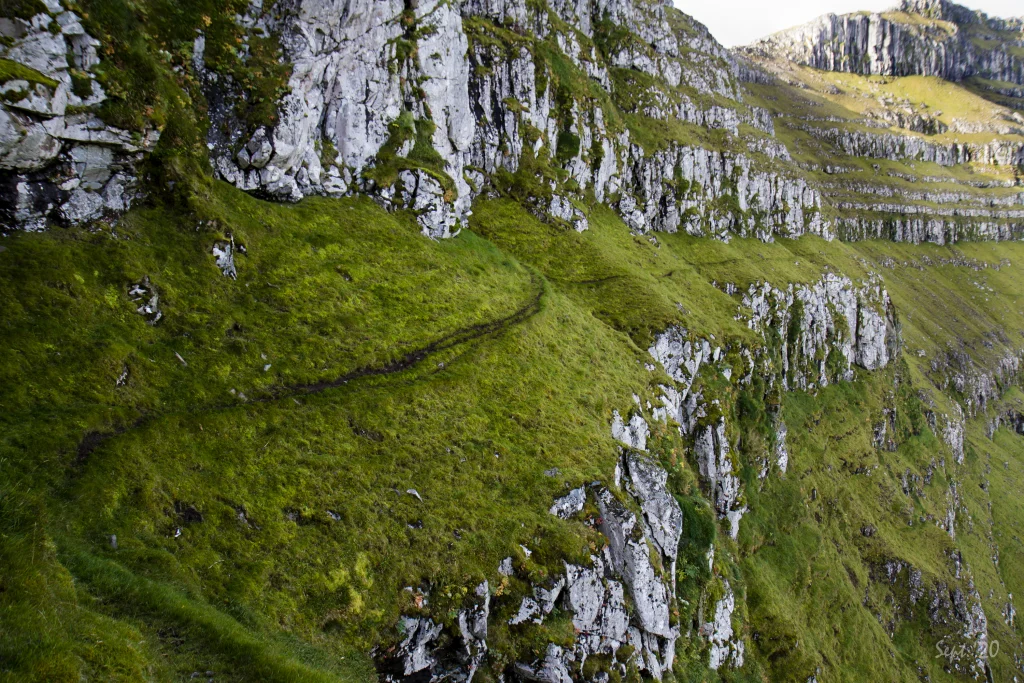 The very steep terrain, up in 350m. height on the southern side of the Djúpadalur valley where the path passes through. This very steep stretch is some 400m. long. Photo: Óli Gardshodn
 -
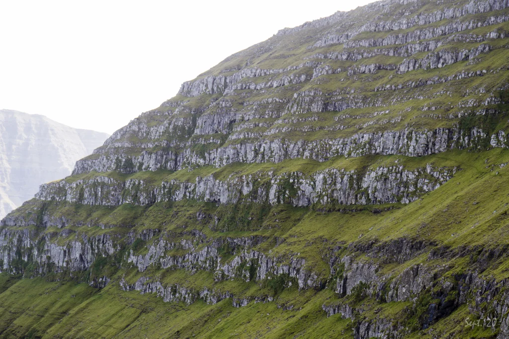 The very steep terrain at an altitude of 350 meters on the southern side of the Djúpadalur valley some 400m long. You can see the path in the middle of the picture. Photo: Óli Gardshodn
 -
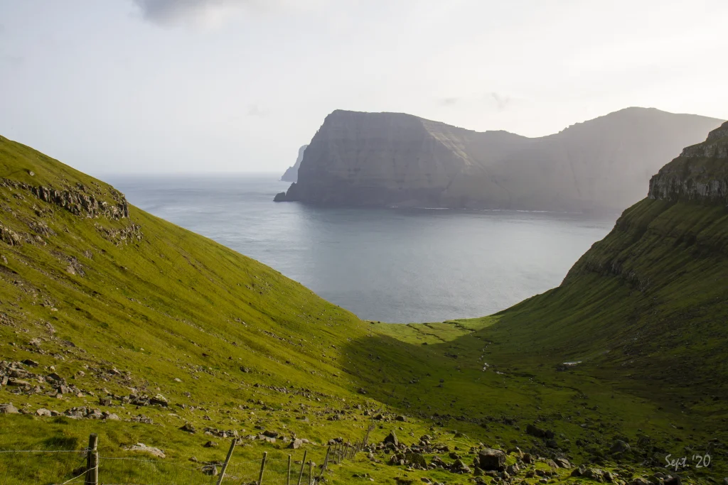 View over the Djúpadalur valley. In the background the northern end of the island of Kunoy. In the distant background the famous cliff Enniberg. Photo: Óli Gardshodn
 -
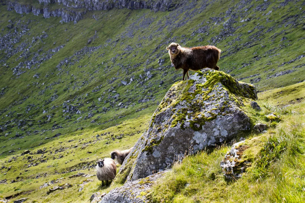 You see many sheep in the Djúpidalur valley in the summer. By the river Keldan Vívda, some of them were playing lively on the big rock. Photo: Óli Gardshodn
 -
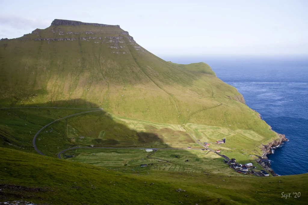 View of the village Trøllanes and the mountain Borgarin. In the very background to the right of the mountain, the famous lighthouse can be seen on the northern tip of Kallurin. Photo: Óli Gardshodn
 -
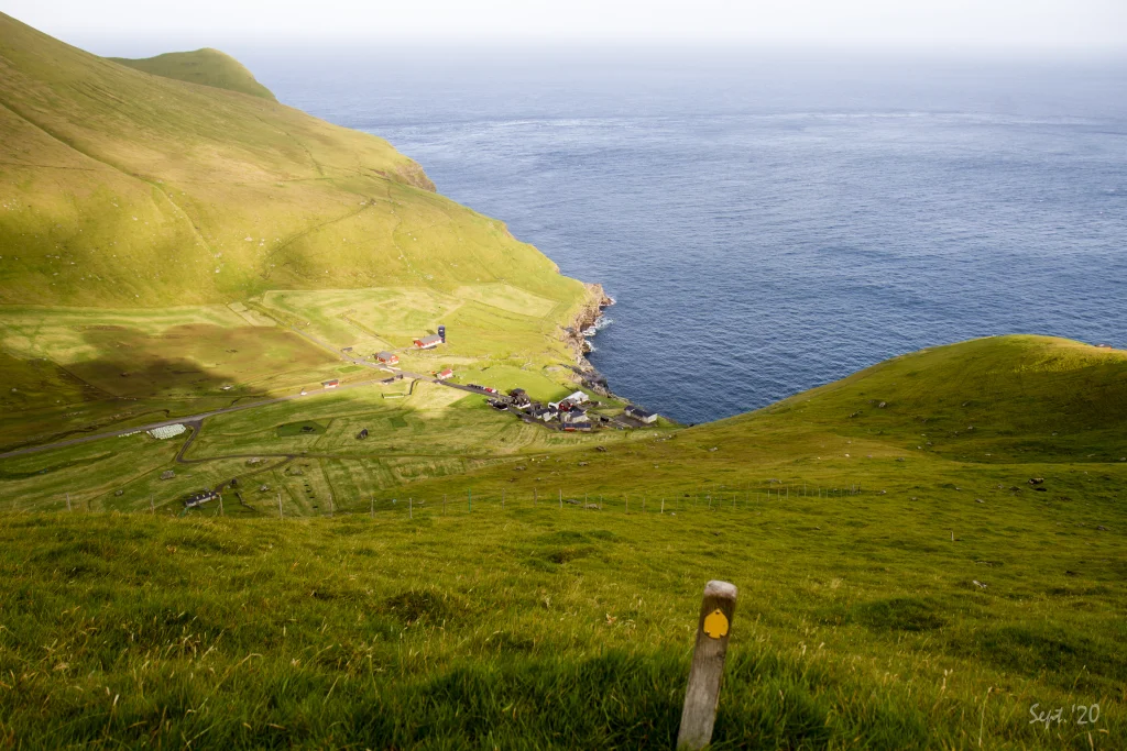 View above Trøllanes. Photo: Óli Gardshodn


-
The steep terrain between Vørðan and the valley Djúpadalur. Photo: Óli Gardshodn
-
View above Mikladalur. Photo: Óli Gardshodn
-
View up from Vørðan south over the island Kalsoy and the village Mikladalur. Signposts like the one seen in the picture are all the way except in the Djúpadalur valley, where the path is clearly visible. Photo: Óli Gardshodn
-
The characteristic signpost with the red buoy up on Vørðan where you enter the steep terrain towards the beautiful valley Djúpadalur. Photo: Óli Gardshodn
-
The signs on the signpost up at the place Vørðan over Mikladalur. Photo: Óli Gardshodn
-
The very steep terrain, up in 350m. height on the southern side of the Djúpadalur valley where the path passes through. This very steep stretch is some 400m. long. Photo: Óli Gardshodn
-
The very steep terrain at an altitude of 350 meters on the southern side of the Djúpadalur valley some 400m long. You can see the path in the middle of the picture. Photo: Óli Gardshodn
-
View over the Djúpadalur valley. In the background the northern end of the island of Kunoy. In the distant background the famous cliff Enniberg. Photo: Óli Gardshodn
-
You see many sheep in the Djúpidalur valley in the summer. By the river Keldan Vívda, some of them were playing lively on the big rock. Photo: Óli Gardshodn
-
View of the village Trøllanes and the mountain Borgarin. In the very background to the right of the mountain, the famous lighthouse can be seen on the northern tip of Kallurin. Photo: Óli Gardshodn
-
View above Trøllanes. Photo: Óli Gardshodn
Ein rættiliga avbjóðandi, men vakur túrur, ið vísir, hvussu nógv tey gomlu løgdu fyri til tess at búleikast á hesum fjarskotnu leiðum. Er bara egnaður at ganga í turrum veðri og bara fyri fólk, ið ikki ræðast hæddir
Mælt verður til at byrja túrin í Mikladali, har tað er eitt sindur lættari at ganga niðanfrá. Gingið verður beint niðaneftir frá samkomuhúsinum Malta, og portur eru allan vegin niðan, tó at eitt lágt stik er millum uppdyrkingarvegin og bøgarðin. Gingið verður fyrst niðan til Vørðuna, har ein sera sjónligur 3 m høgur peli við eini reyðari boyu vísir, hvar gøtan inn í røkurnar (brattlendið) gongur.
Prestar eru allan vegin niðan úr Mikladali, so tað er lætt at síggja, hvar gingið skal verða. Tað er gott at ganga norður móti Djúpadali. Men teir fyrstu 500 metrarnar inn í Djúpadal, gjøgnum røkurnar oman fyri Ovarurók, er tað torførasta. Her verður gingið gjøgnum eina hampiliga smala og bratta rók, og bratt er niðurfyri (sí myndir). Í turrveðri um summarið ber væl til at ganga her. Tað, at gingið verður so ytst á rókini, har tað er sera bratt niður, ger, at hetta als ikki er fyri tey, ið hava hæddarræðslu. Her ræður um at savna seg um at ganga rætt, hyggja væl og ganga spakuliga fót fyri fót og at vera klárur at taka fyri seg, um tað krevst. Ansa eisini eftir, at lissurnar á skónum eru bundnar væl og tætt, so at onki hongur leyst, sum ger, at skógvarnir kunnu gerast fastir, so tú snávar.
Grøni og vallaði Djúpidalur er sera vakur, við Djúpadalsgjónni niðast og Nestindum ovast og breiðum rókum har ímillum. Í dalinum er sera nógvur seyður, og í gomlum døgum høvdu tey eisini neyt gangandi her. Av Trøllanesi leiddu tey neytini eftir bygdagøtuni, men tey í Mikladali máttu leiða neytini tvørtur um fjallið og inn í dalin gjøgnum Neytagøtuna. Eftir at tunnil er komin til Djúpadals, er alt vorðið munandi lættari, og seyðurin verður tikin úr dalinum um veturin.
Gøtan úr Djúpadali til Trøllanes gongur oman fyri Djúpadalsgjónna, norður gjøgnum Norðaruskorð og haðan heim til Vørðu. Eisini her er ein sera sjónligur 2 m høgur peli við eini reyðari boyu, sum vísir, hvar gøtan inn í røkurnar byrjar. Gøtan millum vørðurnar báðar, gjøgnum Djúpadal, sæst sera væl allan vegin.
Leiðin oman á Trøllanes gongur nøkulunda beina leið frá boyuni og oman í bygdina. Prestar vísa á, hvar leiðin gongur. Tá ið komið verður inn um bøgarðsportrið, verður fyrstu 30 metrarnar gingið skrátt vestureftir oman til pelan. Síðani vendir tú 90 stig til høgru og so oman við prestunum til vegendan eystast í bygdini.
Tað verður strangliga mælt frá at ganga hendan túrin í hálku og kava, og tá ið vátligt er, ella tá ið tað hevur regnað dagarnar frammanundan. Sum skelti á Trøllanesi vísa á, so er ikki loyvt at fara av gøtuni, og tað er eisini av trygdarávum.
Tað er møguligt at ganga túrin úr báðum endum. Men bratta brekkan niðan av Trøllanesi ger, at fólki á staðnum dámar betur, at gingið verður niðan úr Mikladali.


Mikladalur - Trøllanes
Public transport
There is a good ferry connection to the island of Kalsoy (route 56), where you can take the ferry Sam up to eight times a day.
Bus route 506 runs in connection with every ferry crossing.
Arriving by car
Parking, Mikladalur
Good parking is found in Mikladalur. You can park your car by the gospel hall Malta (Fornagøta 11) or in of the larger parking lots in the village (marked with green in the picture). The blue line guides you to the village path.
-
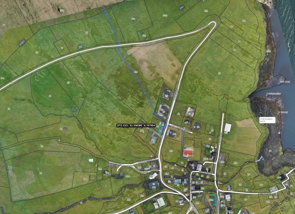 See blue line for parking and blue line for startingpoint
 -
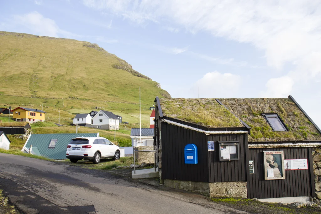 The local bus stop and information point. Photo: Óli Garðshorn
 -
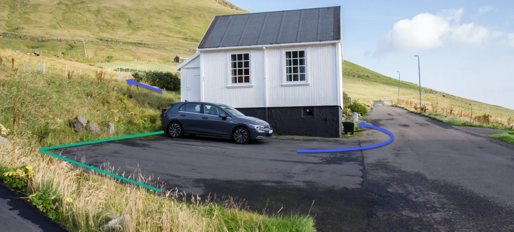 See blue line for parking and blue line for startingpoint


Trøllanes - Mikladalur
Public transport
There is a good ferry connection to the island of Kalsoy (route 56), where you can take the ferry Sam up to eight times a day.
Bus route 506 runs in connection with every ferry crossing.
Arriving by car
Parking, Trøllanes
A good parking lot is also found in Trøllanes (marked with green). However, it is often full due to visitors who want to take a walk out to the promontory Kallur.
-
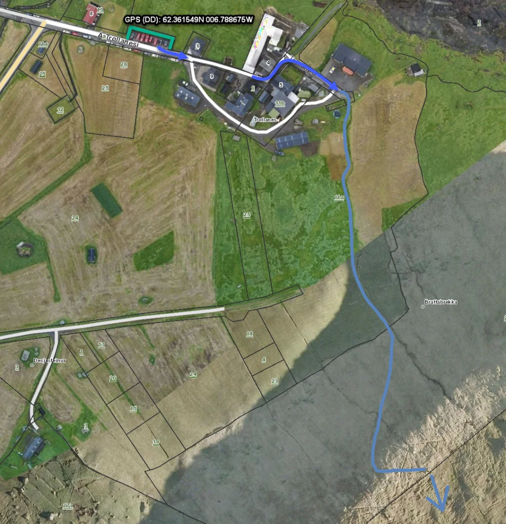 See blue line for parking and blue line for startingpoint
 -
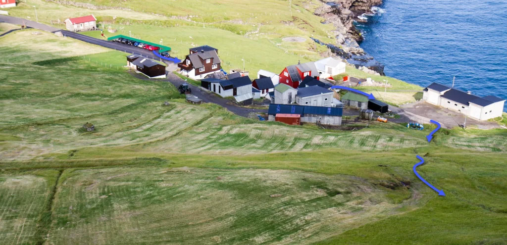 See blue line for parking and blue line for startingpoint


Mikladalur - Trøllanes
Trøllanes - Mikladalur
Fakta

Tíð

longd

Hægsta stað

Hæddarmetrar
 NOT suitable with children
 Difficult
- It is quite steep to walk through the ledges above Ovararók in the southern part of Djúpidalur, where you walk very close to an edge with a sheer drop. Otherwise, the hike is good for walking, although it is steep in places.
You should not take this hike when it is slippery, snowing, rainy, or has rained one of the previous days. As the sign in Trøllanes points out, you are not allowed to veer of the path. This is for your own safety.
Difficult
- It is quite steep to walk through the ledges above Ovararók in the southern part of Djúpidalur, where you walk very close to an edge with a sheer drop. Otherwise, the hike is good for walking, although it is steep in places.
You should not take this hike when it is slippery, snowing, rainy, or has rained one of the previous days. As the sign in Trøllanes points out, you are not allowed to veer of the path. This is for your own safety.
 Grass-covered for the most part. Through the ledge Ovararók, in the steep terrain in the southern part of the valley Djúpidalur, the path turns wet and muddy when it has rained.
The steep terrain up to the gate in the rock wall in Trøllanes is uneven, and the tall gras makes it difficult to see how you should walk. Most of the hike is steep. The path goes through rock ledges, with high crags below them.
Grass-covered for the most part. Through the ledge Ovararók, in the steep terrain in the southern part of the valley Djúpidalur, the path turns wet and muddy when it has rained.
The steep terrain up to the gate in the rock wall in Trøllanes is uneven, and the tall gras makes it difficult to see how you should walk. Most of the hike is steep. The path goes through rock ledges, with high crags below them.

Øki / Torleikastig

 Miðal
Miðal
 3 km /
1t
3 km /
1t


 8 km /
2t
20m
8 km /
2t
20m


