


You haven’t got any favourites yet
This is where you can collect inspiration, articles, events and places that interest you.
Click the icon on pages and they’ll appear here.
Your favourites
Inspiration & Articles
Events & Tours
Places
Hiking
INSPIRATION & ARTICLES
EVENTS & HIKES
Places
Æðuvík – Nes


Link Copied!

-
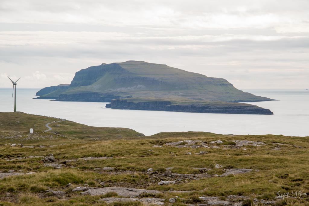 View from the mountain Vørðan south on the island Nólsoy. Photo: Óli Gardshodn
 -
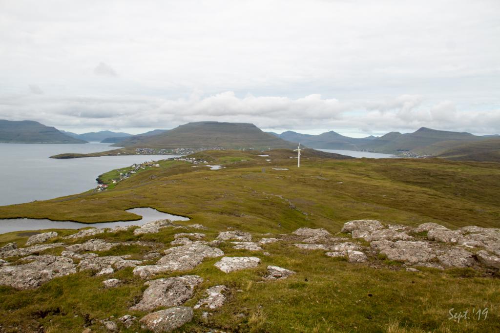 View from the mountain Vørðan north over the outfield above the villages Nes and Toftir. Photo: Óli Gardshodn
 -
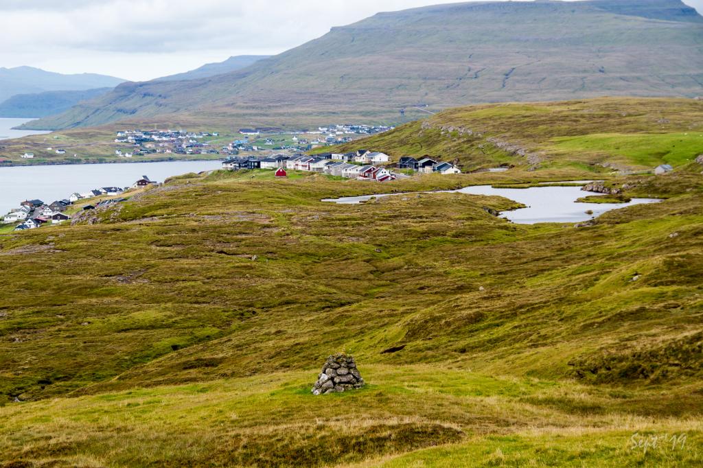 View of Lake Starvatn and the southern part of the village Toftir. In the background is the southern part of the village Strendur. Photo: Óli Gardshodn
 -
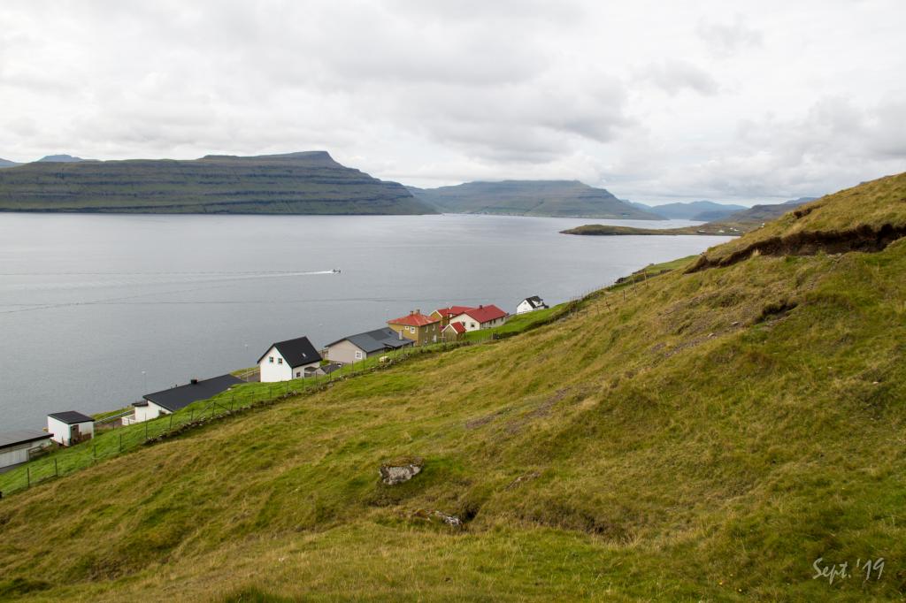 The village path where it comes up from the village Nes. Photo: Óli Gardshodn
 -
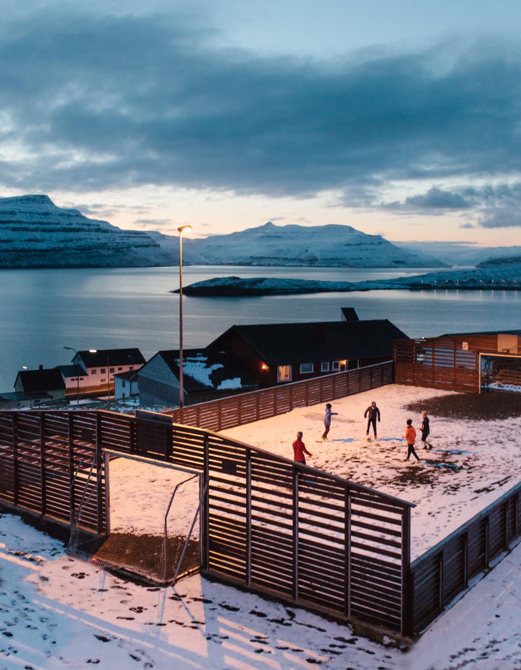 Children playing in Nes. Photo: @kevin Faingnaert
-
View from the mountain Vørðan south on the island Nólsoy. Photo: Óli Gardshodn
-
View from the mountain Vørðan north over the outfield above the villages Nes and Toftir. Photo: Óli Gardshodn
-
View of Lake Starvatn and the southern part of the village Toftir. In the background is the southern part of the village Strendur. Photo: Óli Gardshodn
-
The village path where it comes up from the village Nes. Photo: Óli Gardshodn
-
Children playing in Nes. Photo: @kevin Faingnaert
Æðuvík – Nes offers an easy, family-friendly hike through scenic moors with stunning views of Skálafjørður and Nólsoy.
The cairn path between Æðuvík and Nes takes about an hour to walk. The terrain is grass-covered and easy to walk, well-suited for those who find walking difficult. The view to the south is toward the isle of Nólsoy and Tórshavn, and turning north you see Skálafjørður and Sundini, the strait between the isles of Streymoy and Eysturoy. The path is marked with cairns, but you must pay close attention to the path as there is quite a distance between the cairns at times. If one is unfamiliar with the path, a GPX-file might be of great help. A table and benches are located where the path crosses the road to Eystnes, a great place to take a break and enjoy your packed lunch. It is worthwhile to take the hike up to Vørðin (160 m) with its expansive views of the isles of Nólsoy, Sandoy and Streymoy, the fiords of Kaldbaksfjørður, Kollafjørður and Skálafjørður, and the strait between Eysturoy and Streymoy. The hike will add at least 10 to 15 minutes to your walk. The path can be taken in both directions and is well marked at both ends. Big signs show where the path starts and describe the walk in words and illustrations. The path is marked with cairns but pay careful attention as there is quite a distance between the cairns in places. If one is unfamiliar with the path, a GPX-file might be helpful.


Æðuvík – Nes
Public Transport
From Tórshavn or Klaksvík, take route 400 to Runavík, where you can switch to route 442, which can take you to either Æðuvík or Nes.
Arriving by car
Æðuvík and Nes are easy to reach by car.
Parking, Æðuvík
Parking is good in Æðuvík. If you travel with a single car, it can be parked in several places close to the beginning of the path, but it is best to park in the large parking lot just before the cattle grid on the way to the village. The parking lot is marked with green. From here, follow the blue line.
-
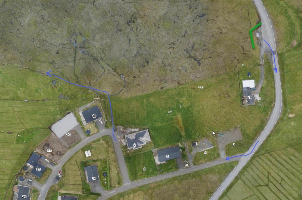 See green line for parking and blue line for starting point
 -
 See green line for parking and blue line for starting point
Nes - Æðuvík
Public Transport
From Tórshavn or Klaksvík, take route 400 to Runavík, where you can switch to route 442, which can take you to either Æðuvík or Nes.
Arriving by car
Æðuvík and Nes are easy to reach by car.
Parking, Nes
Good parking is found in Nes about 60 m just north of where the path start, note the green markers. From here, follow the blue line to the gate:
-
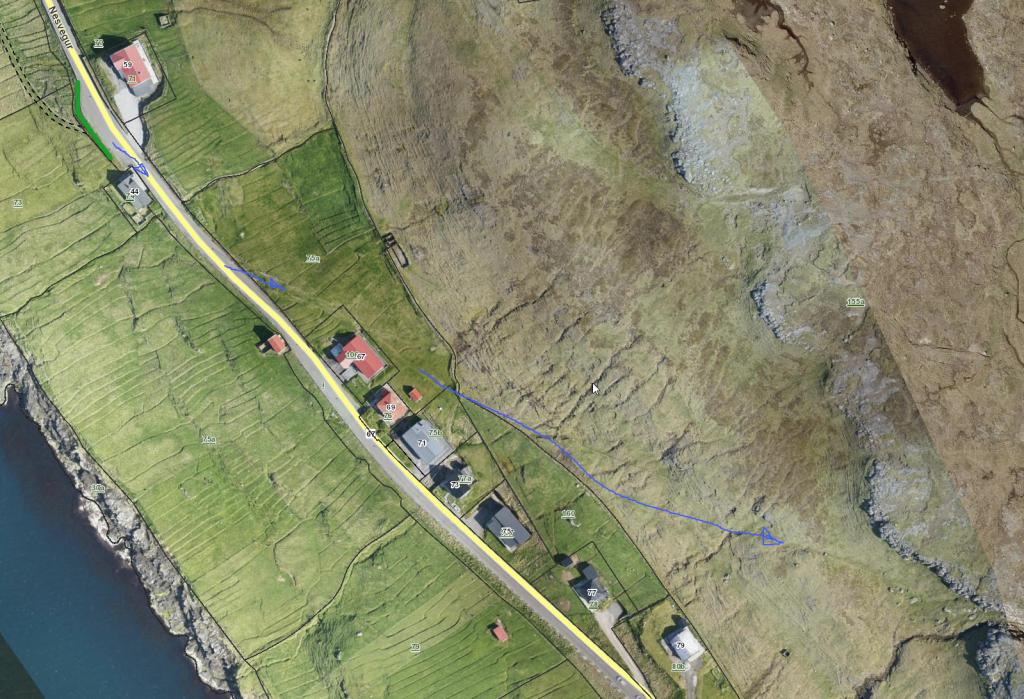 See green line for parking and blue line for starting point
 -
 See green line for parking and blue line for starting point
Æðuvík – Nes
Nes - Æðuvík
Facts

Duration

distance

Peak

Elevation
 Perfekt for children
 Medium
- The whole path is easy to walk. The path is marked with cairns, but one needs to be attentive as the distance between cairns can be significant in places
Medium
- The whole path is easy to walk. The path is marked with cairns, but one needs to be attentive as the distance between cairns can be significant in places
 Gras-covered and easy to walk, a little wet in places
