


You haven’t got any favourites yet
This is where you can collect inspiration, articles, events and places that interest you.
Click the icon on pages and they’ll appear here.
Your favourites
Inspiration & Articles
Events & Tours
Places
Hiking
INSPIRATION & ARTICLES
EVENTS & HIKES
Places
Árnafjørður - Norðtoftir


Link Copied!

-
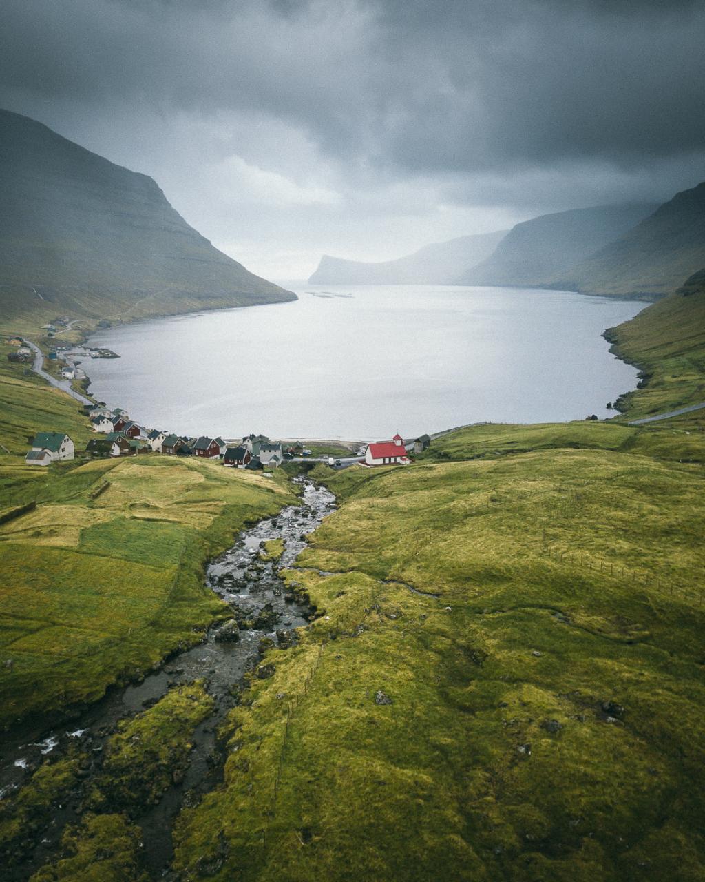 Village of Árnarfjørður Photo: @kristof.massoels
 -
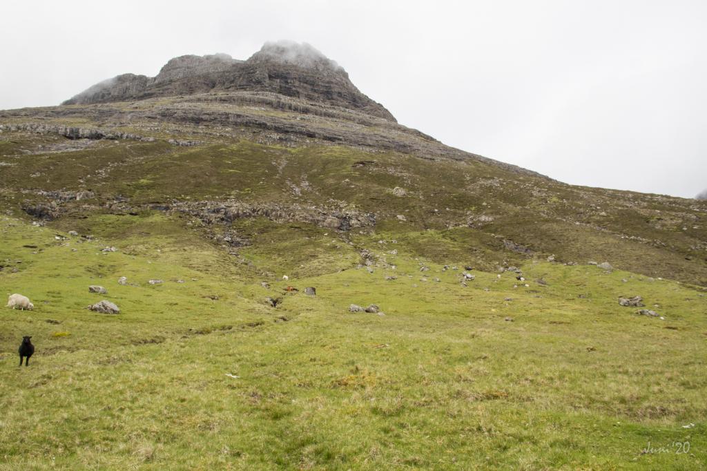 Tólvmarkaknúkur above the village of Árnafjørður. Photo: Óli Gardshodn
 -
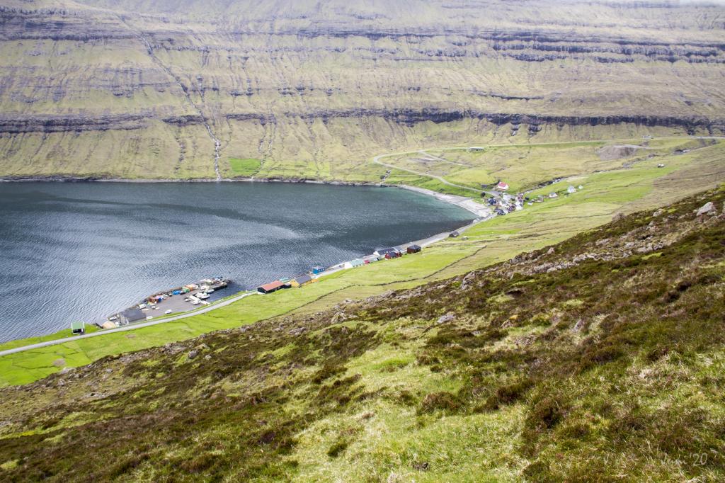 View from the place Sýnin down over the village of Árnafjørður. Photo: Óli Gardshodn
 -
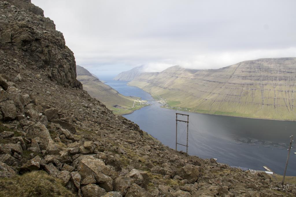
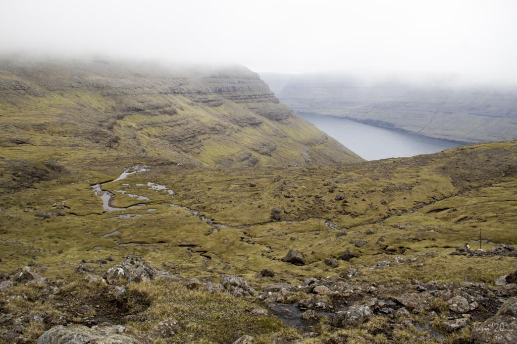 View from the pass Toftaskarð down over the valley Svartidalur east of Árnafjørður. Photo: Óli Gardshodn
 -
 As you walk down through the valley Toftadalur, which lies above the village of Norðtoftir, you have a stunning view north through Hvannasund. Photo: Óli Gardshodn
 -
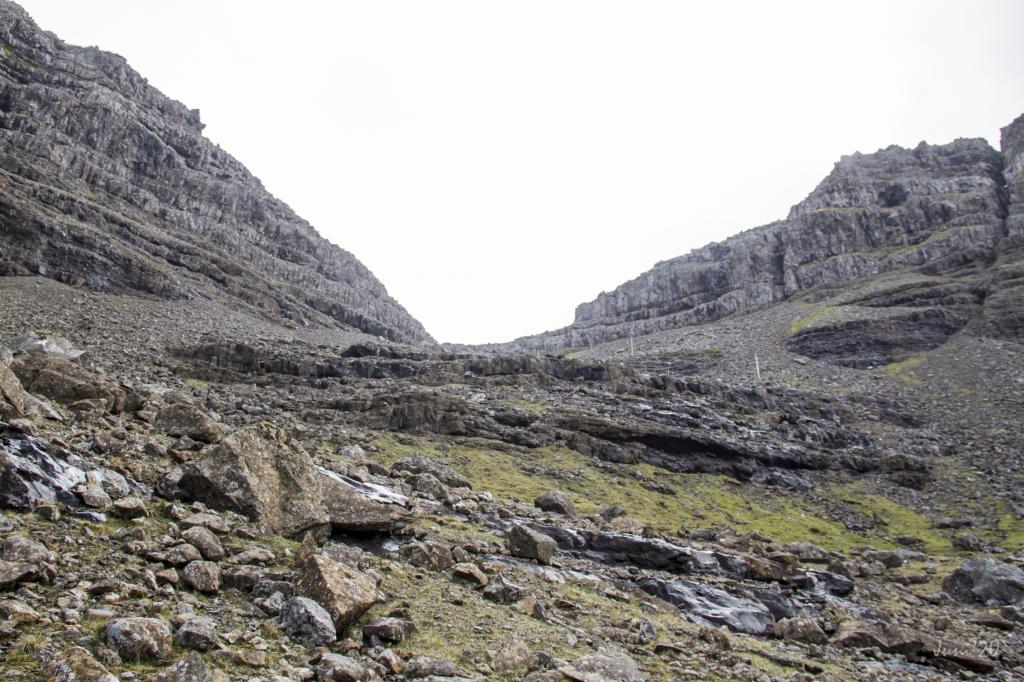 It is knotty and strenuous to walk down from the pass Toftaskarð through all the loose stones in the steep valley Toftadalur. In the front of the picture the crag Svarthamar (Black crag). Photo: Óli Gardshodn
 -
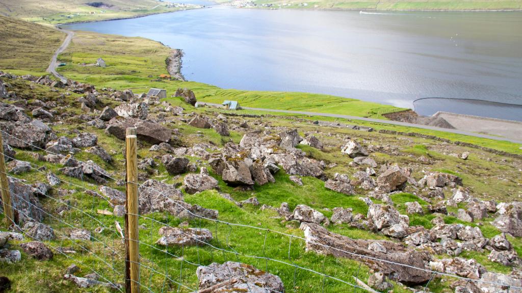 Across the fence, and then the last stretch down to the sheepfold in Norðtoftir. In the background the village of Hvannasund More about this source text. Photo: Óli Gardshodn
-
Village of Árnarfjørður Photo: @kristof.massoels
-
Tólvmarkaknúkur above the village of Árnafjørður. Photo: Óli Gardshodn
-
View from the place Sýnin down over the village of Árnafjørður. Photo: Óli Gardshodn
-
View from the pass Toftaskarð down over the valley Svartidalur east of Árnafjørður. Photo: Óli Gardshodn
-
As you walk down through the valley Toftadalur, which lies above the village of Norðtoftir, you have a stunning view north through Hvannasund. Photo: Óli Gardshodn
-
It is knotty and strenuous to walk down from the pass Toftaskarð through all the loose stones in the steep valley Toftadalur. In the front of the picture the crag Svarthamar (Black crag). Photo: Óli Gardshodn
-
Across the fence, and then the last stretch down to the sheepfold in Norðtoftir. In the background the village of Hvannasund More about this source text. Photo: Óli Gardshodn
Enjoy a peaceful, challenging hike from Árnafjørður to Norðtoftir with stunning mountain views and rugged Faroese landscapes.
The mountains in the Northern Isles are high, craggy and awe-inspiring. The crags are broad and steep, and hardly anything grows near the peaks. Part of this hike goes through this area, making for some rough walking, especially down through the pass Toftaskarð.
The path starts down in the village of Árnafjørður and goes up through a new lane, running just west of the house that stands at Viðurbyrgi 23. (see ‘starting point’ below)
For the first stretch, the path is easy to see, but further up in the valley Svartadalur it becomes more difficult to spot. But a few cairns lead the way up through the valley. It is easy and very peaceful to walk up Tólvmarkaknúkur, a large knoll, continuing through the lower, middle and upper paths of the crags, and finally reach Toftaskarð.
The pass is very rocky, making the hike down to Norðtoftir quite difficult and potentially dangerous. Keep to the east side of the pass throughout the rocky stretch until the terrain becomes grass covered. Then, go straight down east of Sjøt, continuing on the path in the í Kleiv area all the way to Norðtoftir.
There are no gates in the fences of the outfields, so you must find a good place to climb over them. Using a gpx-file is recommended in order to find the right path through the outfields.
The hike can be taken in either direction.
It is possible to walk a part of the trail, up to the pass Toftaskarð, where you can enjoy magnificent views. From there you can take the path down to Klaksvík via Katlarnar. Here you can take the path from the pass Áarskarð down to the portals of the tunnels.


Árnafjørður - Norðtoftir
Public transport
Bus route 500 (Klaksvík – Viðareiði) drives to both locations.
Arriving by car
Árnafjørður is also easily accessible by car 10 min drive from Klaksvík
Parking, Árnafjørður
Parking is available by the road where the village path starts – note the green lines. From there, follow the blue line up through the lane.
-
 Green line marks parking area
 -
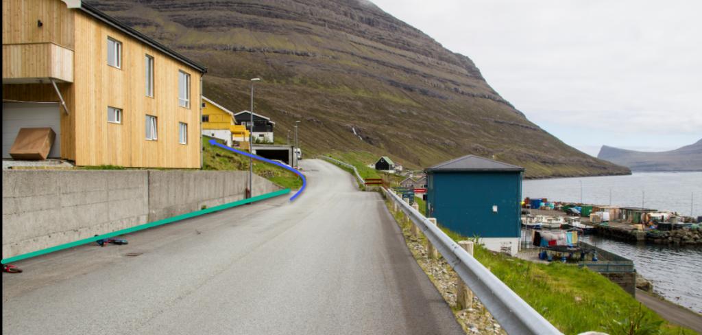 Green line marks parking area. The hike starts down in the village of Árnafjørður just by the house at Viðurbyrgi 23
Norðtoftir - Árnafjørður
Public transport
Bus route 500 (Klaksvík – Viðareiði) drives to both locations.
Norðtoftir is also easily accessible by car 15 min from Klaksvík
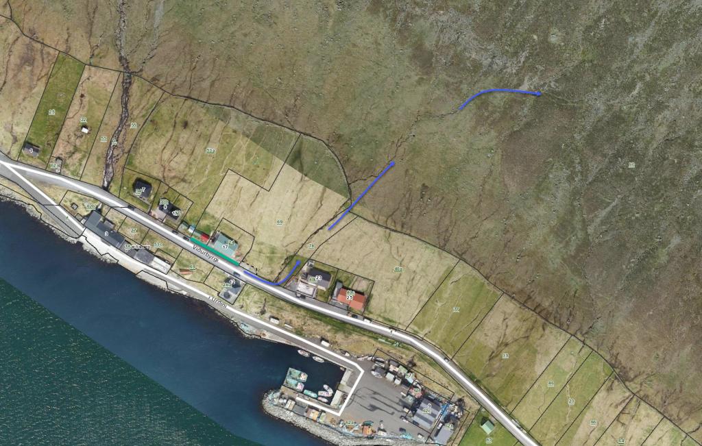
Parking, Norðtoftir
Parking is available about 210 metres west of Norðtoftavegur 10 – note the green lines. From there, follow the blue lines up to the sheep pen, and then continue straight up the hill for another 120 metres or so until you reach the path.
-
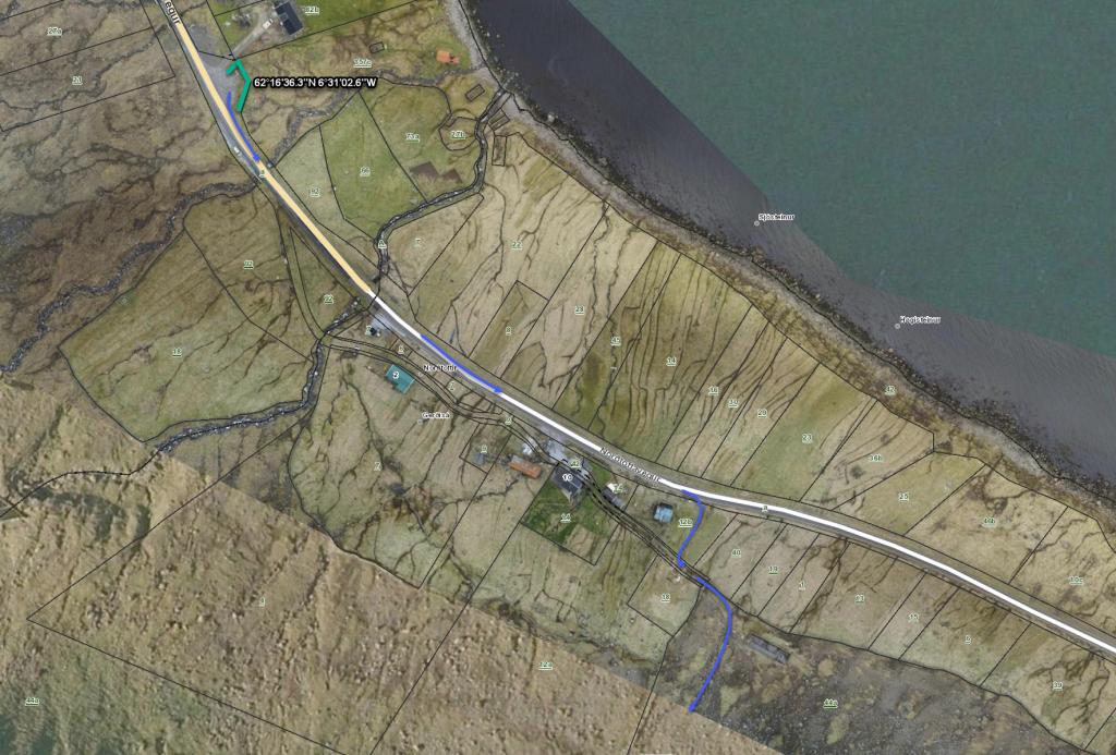 See green lines for parking and blue line for startingpoint. The hike starts besides a lawn on Norðtoftavegur 10
Árnafjørður - Norðtoftir
Norðtoftir - Árnafjørður
Facts

Duration

distance

Peak

Elevation
 Not suitable with children. It is best to be at least 14 years. Includes very rocky areas, where one can easily get scraped
 Difficult
- At the steepest parts of the pass, one must be very careful to keep rocks from rolling down the hill
Difficult
- At the steepest parts of the pass, one must be very careful to keep rocks from rolling down the hill
 The terrain in the village of Árnafjørður is grassy. When you reach the path at about 70 metres above sea level, there is heather and small rocks on the path. It is fairly good to walk all the way up to the pass Toftaskarð (466 m). However, walking down through Toftaskarð, the path is very rocky until you have descended a fair distance and leave the pass on its eastern side, at an elevation of about 320 metres. From there, the terrain is grass-covered and easy to walk all the way down to Norðtoftir
