You haven’t got any favourites yet
This is where you can collect inspiration, articles, events and places that interest you.
Click the icon on pages and they’ll appear here.
Your favourites
Inspiration & Articles
Events & Tours
Places
Hiking
INSPIRATION & ARTICLES
EVENTS & HIKES
Places
Funningur - Eiði


Link Copied!

-
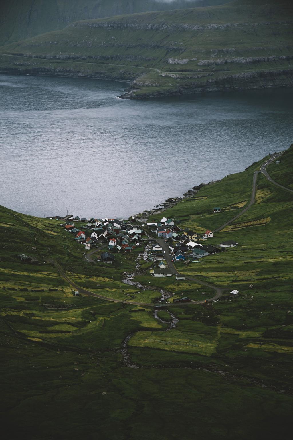
 Village of Funningur. Photo: @alexstelma
 -
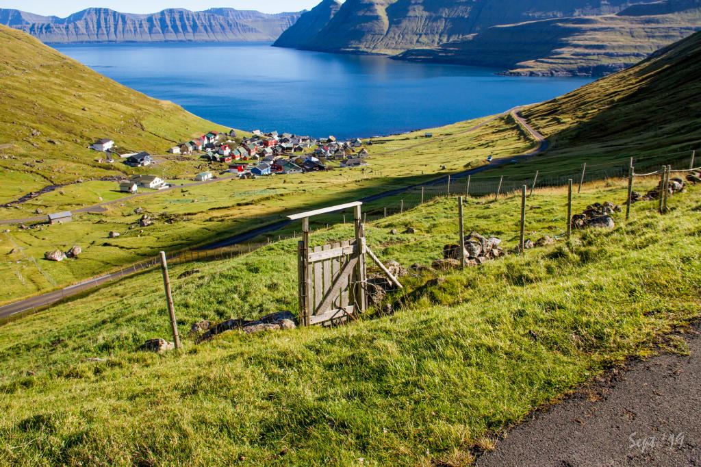 View from the gate in the village fence down to the village of Funningur. Photo: Óli Gardshodn
 -
 View from a peat shed up on Grønubrekku over the village of Funningur. Photo: Óli Gardshodn
 -
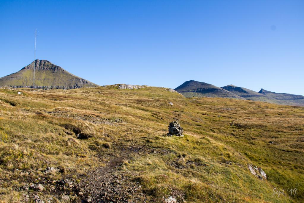
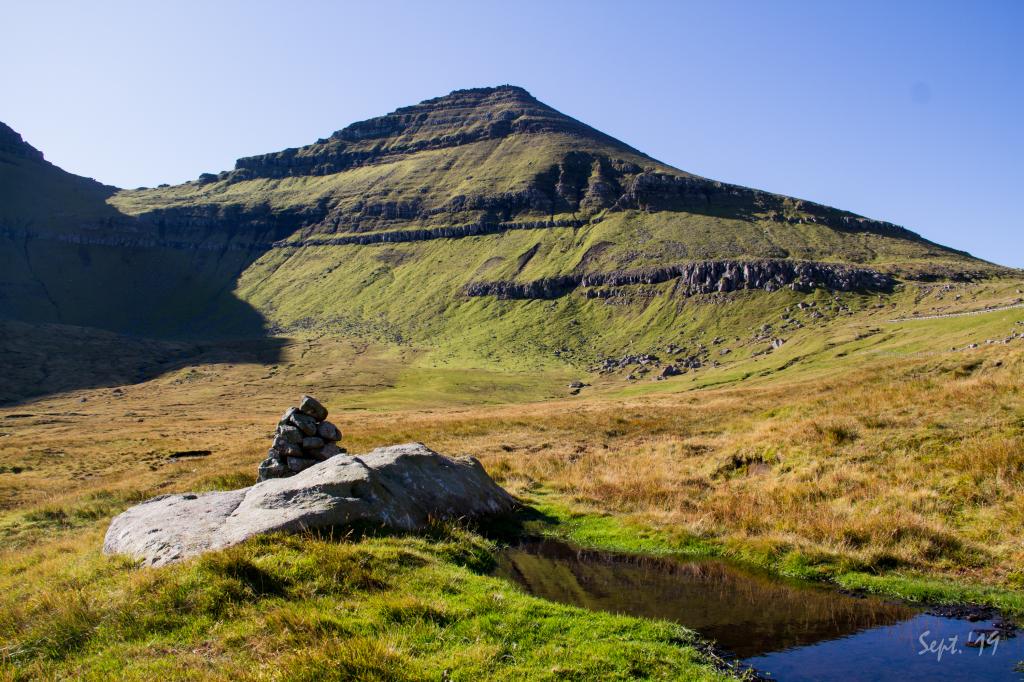 A cairn up on Grønubrekku showing the village path. In the background the mountain of Vaðhorn. Photo: Óli Gardshodn
 -
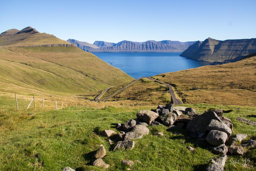
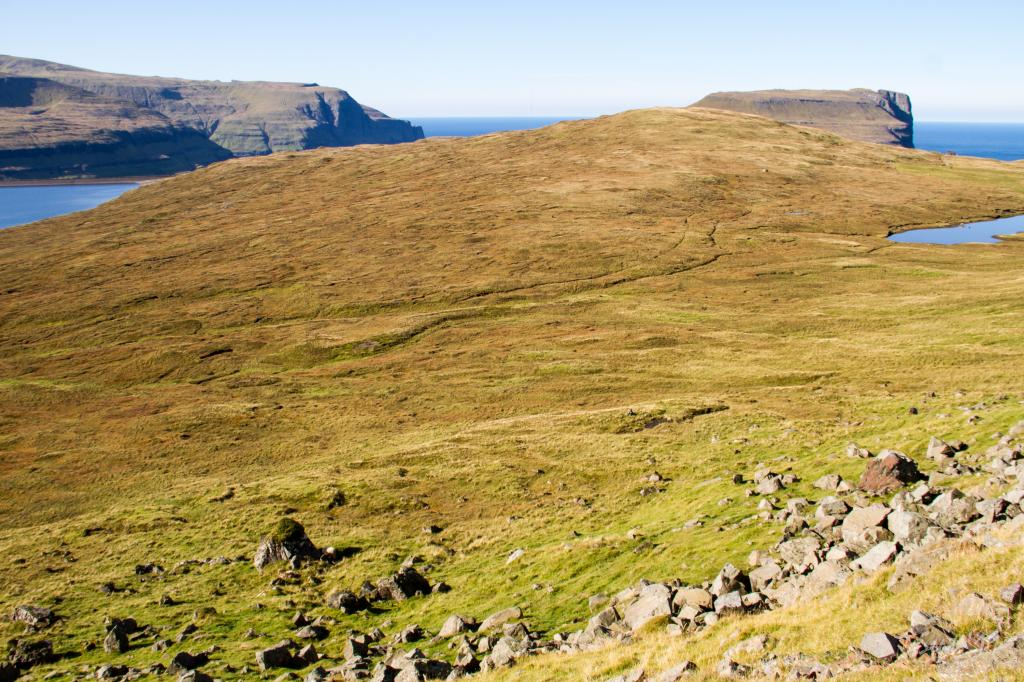
 View of Lake Eiðisvatn belonging to the hydropower plant below. In the background the island of Streymoy. Photo: Óli Gardshodn
 -
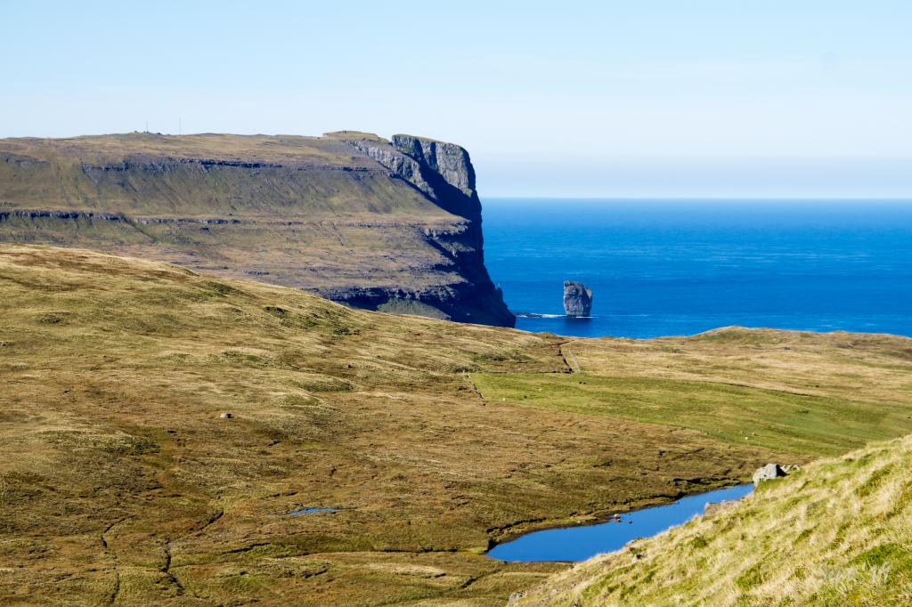 View of the Giant (and the witch). Photo: Óli Gardshodn
 -
 The path across the hill Vál is a smooth and pleasant walk. Photo: Óli Gardshodn
 -
 A cairn near the gate in the village fence in Eiði. Further up we see the cairn at Millum Klettar. In the background to the left we see Hálsur, 705m, which leads up to the mountain Slættaratindur, 882m, which is the highest mountain in the Faroe Islands. Photo: Óli Gardshodn
 -
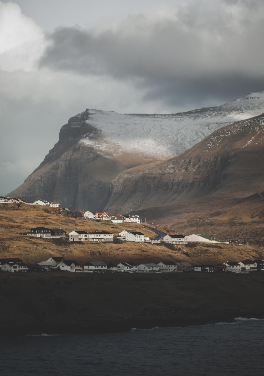
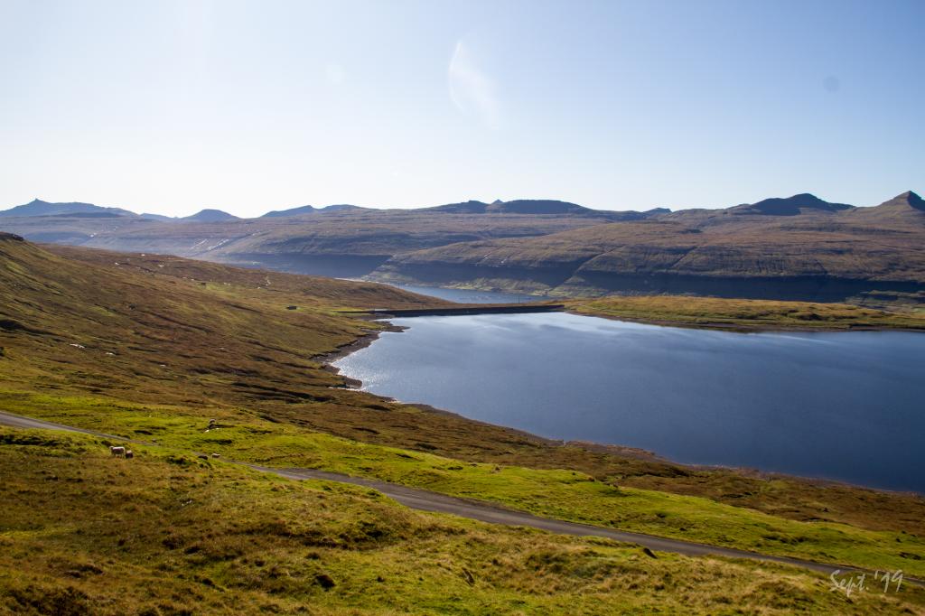
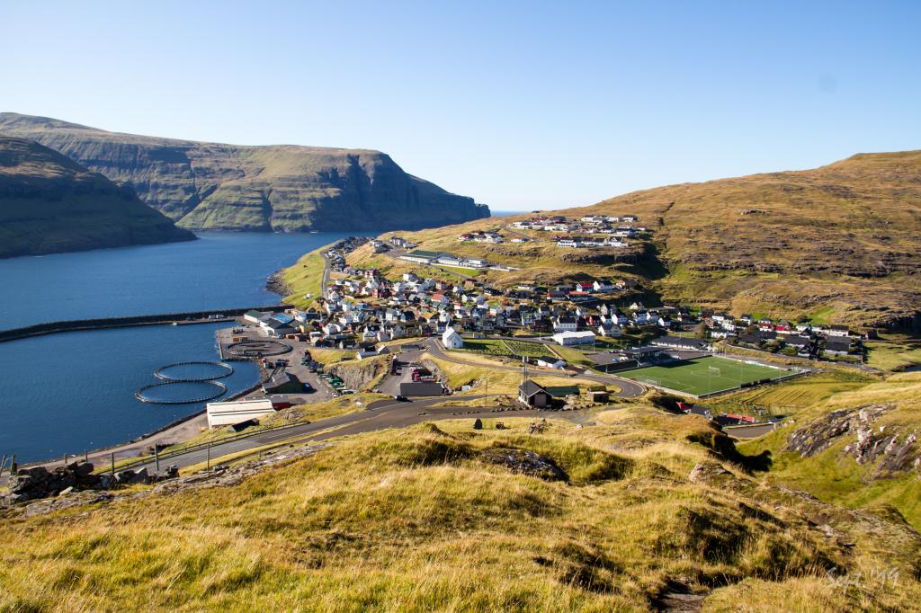 View of the village Eiði. Photo: Óli Gardshodn
 -
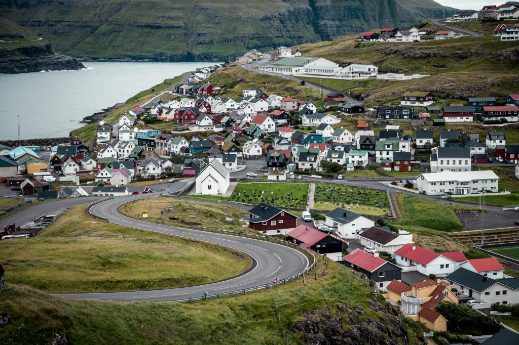 Village of Eiði. Photo: @formgestalter
-
Village of Funningur. Photo: @alexstelma
-
View from the gate in the village fence down to the village of Funningur. Photo: Óli Gardshodn
-
View from a peat shed up on Grønubrekku over the village of Funningur. Photo: Óli Gardshodn
-
A cairn up on Grønubrekku showing the village path. In the background the mountain of Vaðhorn. Photo: Óli Gardshodn
-
View of Lake Eiðisvatn belonging to the hydropower plant below. In the background the island of Streymoy. Photo: Óli Gardshodn
-
View of the Giant (and the witch). Photo: Óli Gardshodn
-
The path across the hill Vál is a smooth and pleasant walk. Photo: Óli Gardshodn
-
A cairn near the gate in the village fence in Eiði. Further up we see the cairn at Millum Klettar. In the background to the left we see Hálsur, 705m, which leads up to the mountain Slættaratindur, 882m, which is the highest mountain in the Faroe Islands. Photo: Óli Gardshodn
-
View of the village Eiði. Photo: Óli Gardshodn
-
Village of Eiði. Photo: @formgestalter
Experience the scenic Funningur - Eiði hike, a 7 km trail beneath the Faroe Islands’ highest peaks with stunning views.
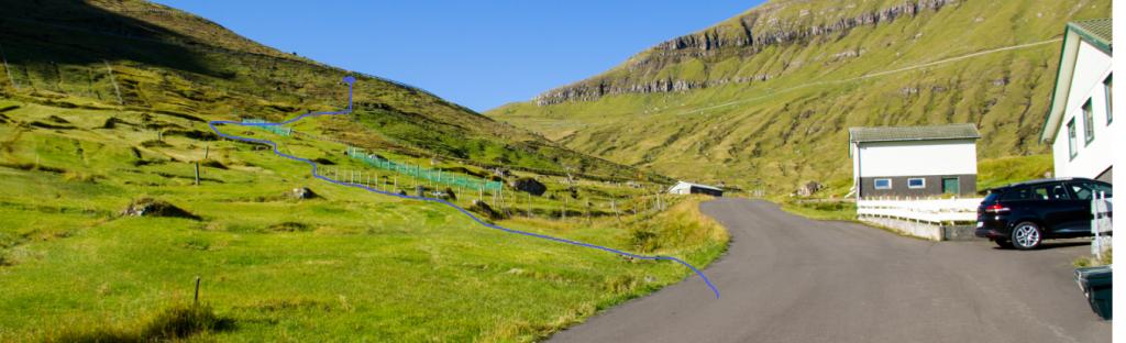
If starting in Funningur, take the path from the top of the village (Svørvisvegur 8) straight up to the main road above the village. The first cairns are not visible from the road; you will spot the first ones when you walked far up into the hill of Grønabrekka, at an elevation of about 250 m.
A narrow stretch of land is set aside for the village path when going up from Funningur; therefore, you need to walk along the riverbank. Reaching the road, go at an angle up to the gate in the stone fence, called Eiðisportrið.
Arnasteinur, the large boulder west of Funningur, found just before you come up to the road, is supposed to be named after one Arni, who was found frozen here. He and some others had found their way this far after having been ship-wrecked nearby. On the other side of the road is Hórissteinur, named after another one in the same company who had not reached as far as Arni had done.
It is easier to begin in Eiði, where the trail is also far easier to spot. It starts by the water reservoir and ascends along the ridge by the gully Króksgil. Nearby you will see the first of several cairns leading up to the pass Eiðsskarð, although there is a fair distance between some of the cairns.
The path can be walked in either direction. However, better parking is found in Eiði.


Funningur - Eiði
Public transport
SSL route 201 which runs between Oyrabakki and Gjógv stops in Funningur, and route 200 runs between Oyrabakki and Eiði. This means you can leave your car in Eiði or Funningur and return by bus.
Rute 450 is driving to and from Oyrarbakka.
Arriving by car
Parking, Funningur
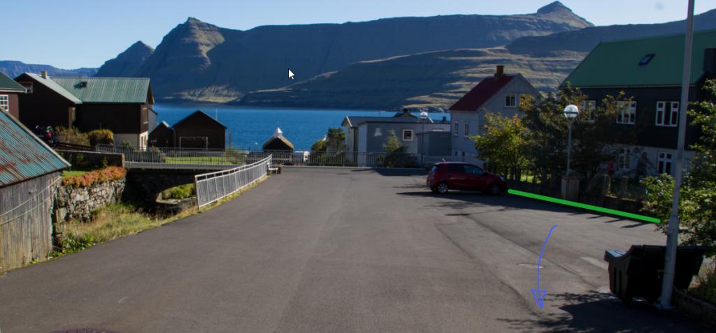
Good parking is found by the bridge in Funningur. See the photos, the green lines indicate the parking lot.
-
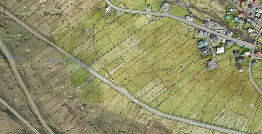 See green line for parking and blue line for starting the route
 -
 See green line for parking and blue line for starting the route
 -
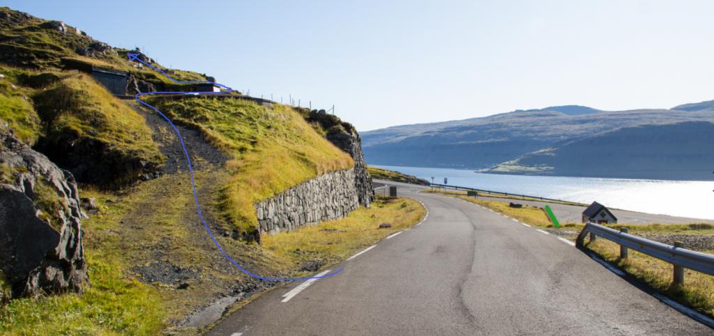
 Follow the blue line to get strated on your hike
 -
Gate above Funningur
Eiði - Funningur
Public transport
SSL route 201 which runs between Oyrabakki and Gjógv stops in Funningur, and route 200 runs between Oyrabakki and Eiði. This means you can leave your car in Eiði or Funningur and return by bus.
Rute 450 drives to Oyrarbakka.
Arriving by car
Parking, Eiði
Good parking is found next to where the path starts in Eiði, i.e. where the road to Funningur and Gjógv also commences. See the photos, the green line shows were the parking lot is.
-
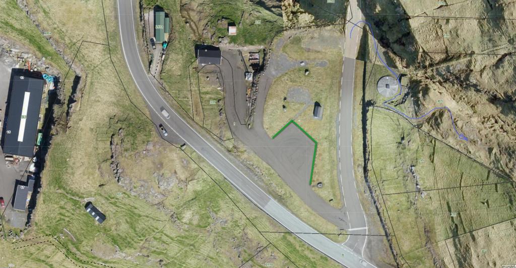 See green line for parking and blue line for starting point
 -
 See green line for parking and blue line for starting point
Funningur - Eiði
Eiði - Funningur
Facts

Duration

distance

Peak

Elevation
 Suitable for children over 8
 Medium
- The stretch above Funningur is steep and the path down to the lake Eiðisvatn is a little rough
Medium
- The stretch above Funningur is steep and the path down to the lake Eiðisvatn is a little rough
 Grass-covered throughout and easy to walk, quite steep when approaching Funningur