


You haven’t got any favourites yet
This is where you can collect inspiration, articles, events and places that interest you.
Click the icon on pages and they’ll appear here.
Your favourites
Inspiration & Articles
Events & Tours
Places
Hiking
INSPIRATION & ARTICLES
EVENTS & HIKES
Places
Funningur - Gjógv


Link Copied!

-
 At the stone Hórissteinur just above the village fence in the village Funningur. Photo: Óli Gardshodn
 -
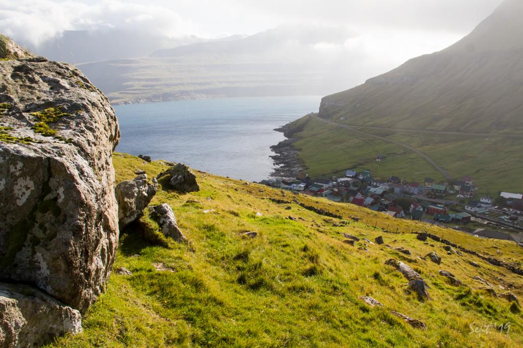
 Swift change of the weather, where clouds suddenly are getting in on us. View from up on the plain above the village Funningur just beneath the water spring Mortanskelda. In the background to the right the mountain Vaðhorn. Photo: Óli Gardshodn
 -
 The path runs partly along the main road to/from Gjógv. Photo: Óli Gardshodn
 -
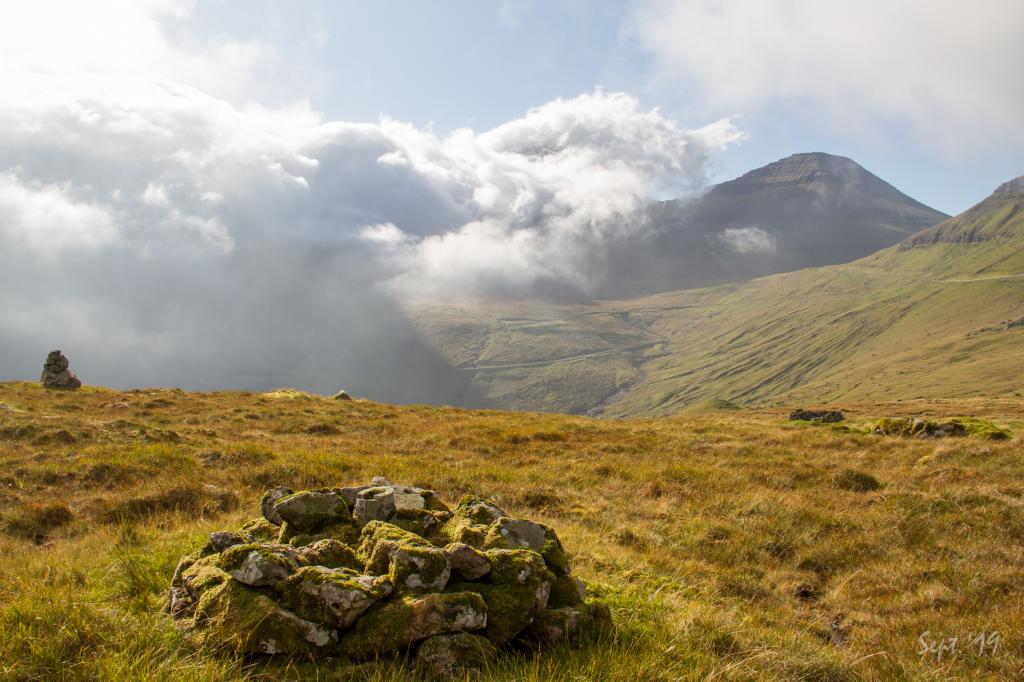
 Cairns as road signs north of the pass on the village path from Funningur to Gjógv. Photo: Óli Gardshodn
 -
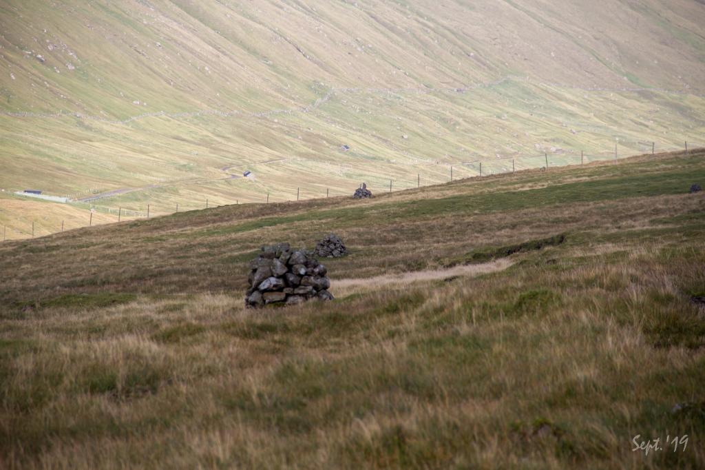
 The hike runs partly between the main road to/from Gjógv and next to a river. Photo: Óli Gardshodn
 -
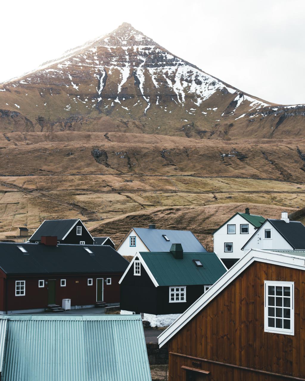 Village of Gjógv Photo: @bastifbr
-
At the stone Hórissteinur just above the village fence in the village Funningur. Photo: Óli Gardshodn
-
Swift change of the weather, where clouds suddenly are getting in on us. View from up on the plain above the village Funningur just beneath the water spring Mortanskelda. In the background to the right the mountain Vaðhorn. Photo: Óli Gardshodn
-
The path runs partly along the main road to/from Gjógv. Photo: Óli Gardshodn
-
Cairns as road signs north of the pass on the village path from Funningur to Gjógv. Photo: Óli Gardshodn
-
The hike runs partly between the main road to/from Gjógv and next to a river. Photo: Óli Gardshodn
-
Village of Gjógv Photo: @bastifbr
Experience the scenic Funningur - Gjógv hike, walking between charming villages with stunning views and rich local history.
In Funningur, the best way to reach the path is to go between the old dance hall, Uppi í Túni 18, and the house just above it, í Túni 16. From here, follow the left (western) bank of the river.
Originally, the path was paved with stones, but this is hard to see today. The path takes you to the gate of the village fence, called Gjáarportrið. From here, continue upward, east of the river Skarðsá.
When the villagers in Gjógv went to church in Funningur, not everyone walked all the way down to Funningur. The elderly, who found the steep hill down to the village too difficult to walk, stopped at Kirkjusteinur (Church Boulder), 215 metres above sea level. Líksteinur (Corpse Boulder) is in the pass Gjáarskarð. When a coffin was carried between Gjógv and Funningur, people paused here.
The path does not have any cairns before you reach the plains at 240 m. From here, cairns lead you to the fence by the pass Gjáarskarð. From there you must walk a fair distance down the valley before you see the next cairns, which are few in number.
At Gjógv, the path starts by the cattle grill down in the village. Follow the fence to its end and then walk straight up to the pass.
The hike can be taken in either direction. However, parking is better in Funningi.


Funningur - Gjógv
Public transport
SSL route 201 which runs between Oyrabakki and Gjógv stops in Funningur. This mean that you can take your car to either Funningur and Gjógv and return by bus.
Route 450 drives to Oyrarbakki
Arriving by car
Parking, Funningur
There is good parking in Funningur down by the bridge. The parking lot is indicated with green lines in the photos.
-
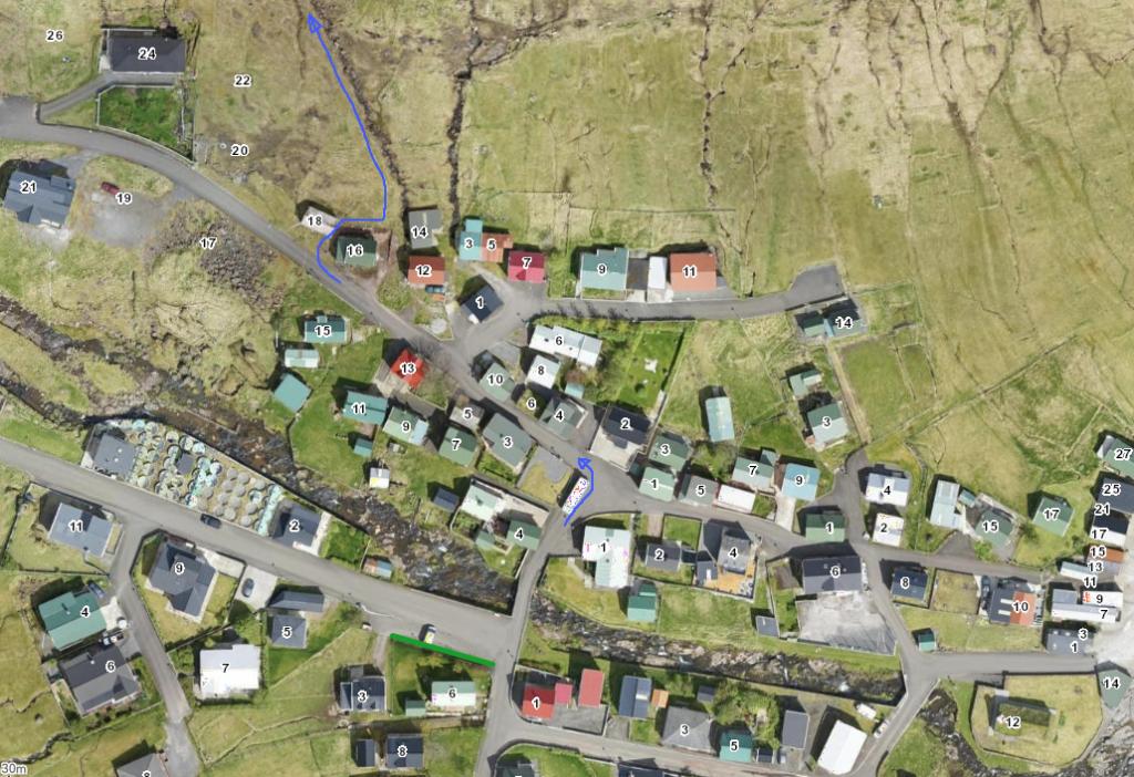 See green line for parking and blue line for startingpoint
Gjógv - Funningur
Public transport
SSL route 201 which runs between Oyrabakki and Gjógv stops in Funningur. This mean that you can take your car to either Funningur and Gjógv and return by bus.
Route 450 drives to Oyrarbakki
Arriving by car
Parking, Gjógv
You can park in the public parking spaces in Gjógv – see photo.
-
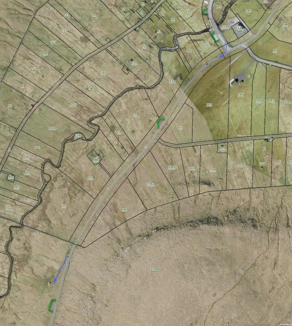 See green line for parking and blue for starting point
 -
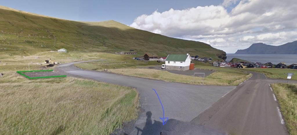 See green line for parking and blue for starting point
Funningur - Gjógv
Gjógv - Funningur
Facts

Duration

distance

Peak

Elevation
 Suitable with children over 8 years
 Medium
- It is steep above Funningur – apart from that the trail is grass grown and easy to walk
Medium
- It is steep above Funningur – apart from that the trail is grass grown and easy to walk
 Grass-covered and good for walking. Toward Funningur, the path is quite steep


