


You haven’t got any favourites yet
This is where you can collect inspiration, articles, events and places that interest you.
Click the icon on pages and they’ll appear here.
Your favourites
Inspiration & Articles
Events & Tours
Places
Hiking
INSPIRATION & ARTICLES
EVENTS & HIKES
Places
Guðrunarløkur - Húsavík - Dalur - Skarvanes - Guðrunarløkur


Link Copied!

-
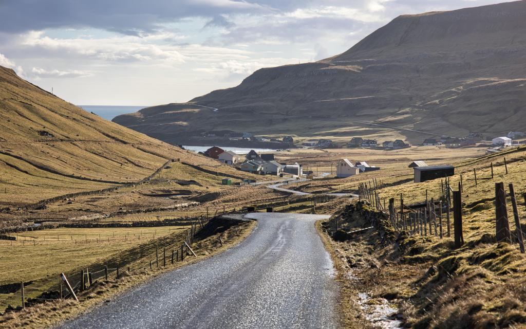 View down over the settlement of Húsavík as we walk from Guðrunarløki down the Húsisdal valley. In the background on the right side is the slope that you walk up on the way to the village of Dalur. Photo: Óli Gardshodn
 -
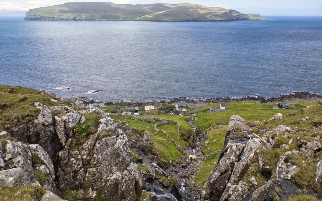
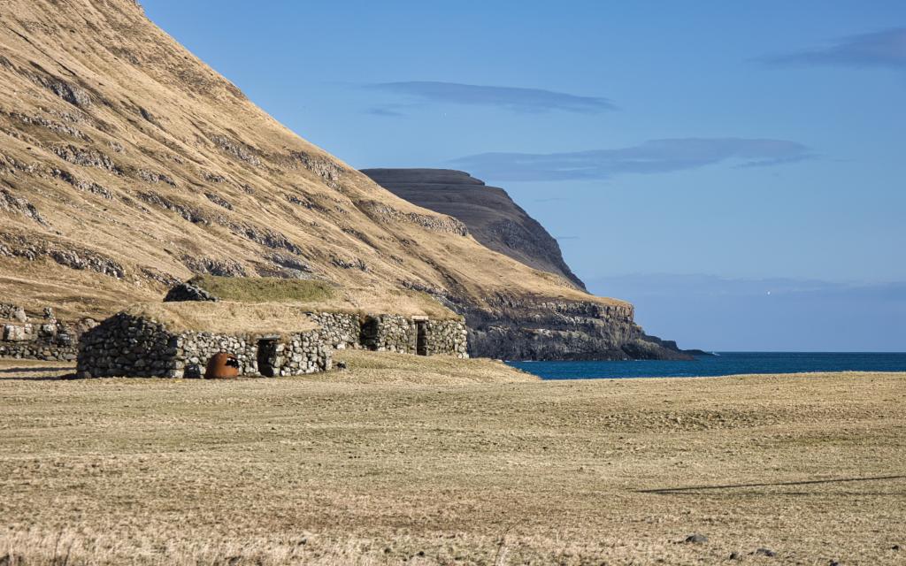 The old stone houses down by the beach in Húsavík (á Tumbakka). Photo: Óli Gardshodn
 -
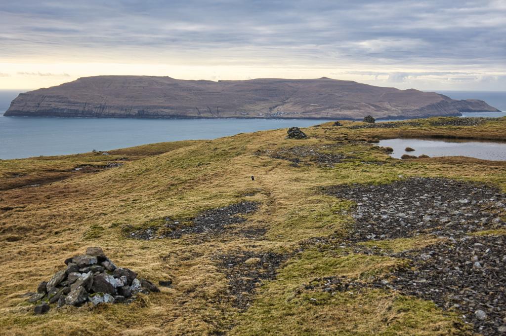
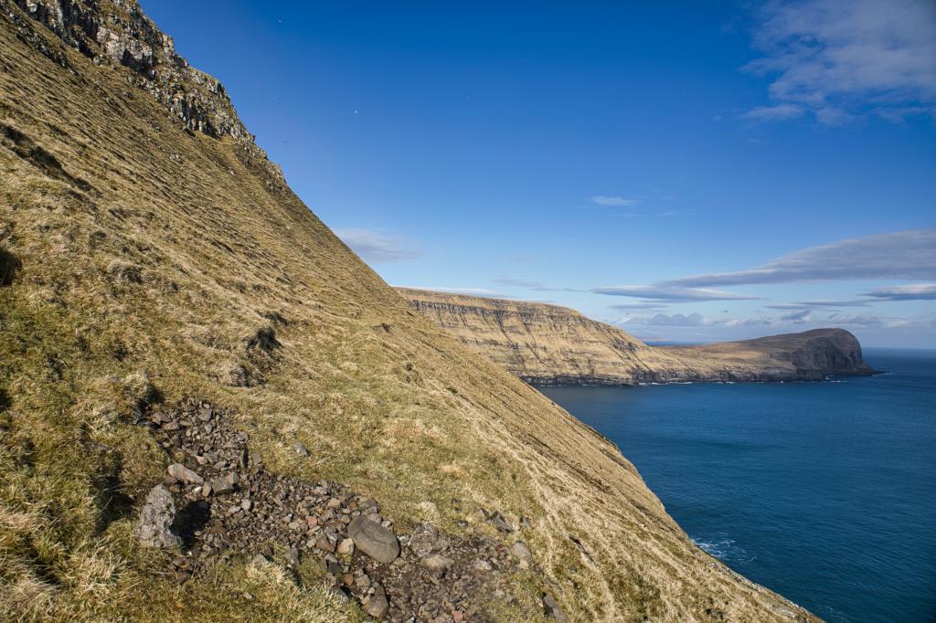 At Heimaruvørðu, at 140 m. altitude. In the background on the right, the 203 m high mountain Skálhøvdi. Although it seems steep, the path is good and easy to walk along. Photo: Óli Gardshodn
 -
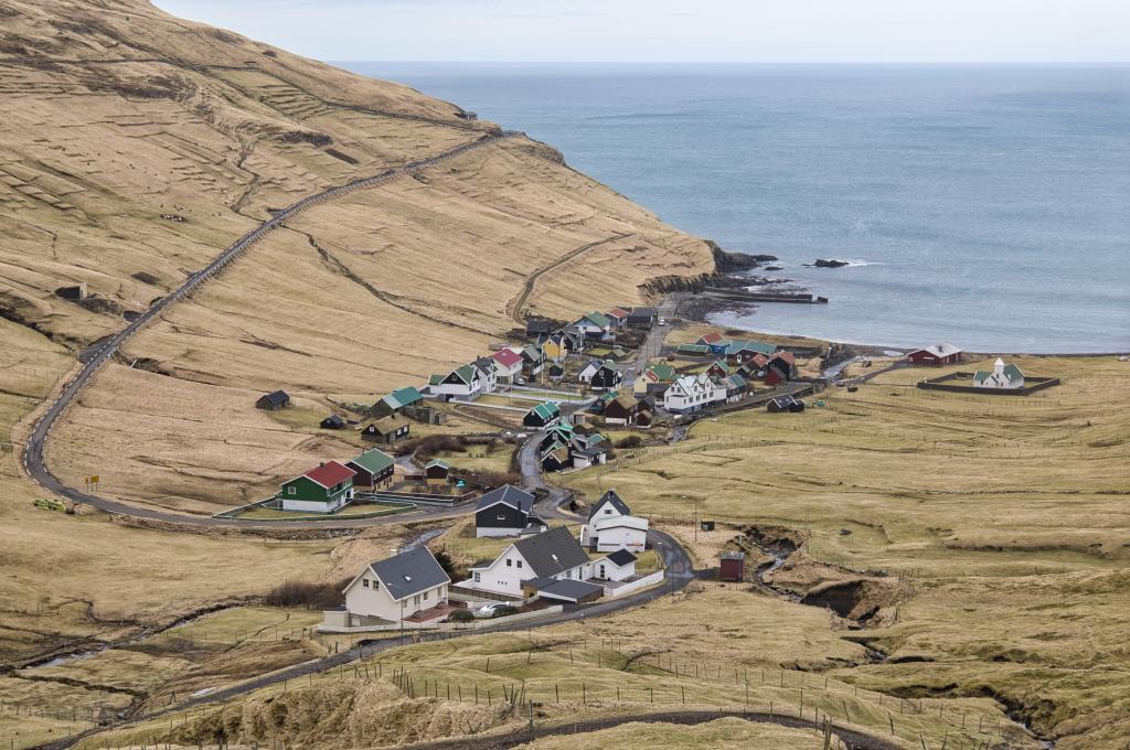 View down over the village Dalur. Photo: Óli Gardshodn
 -
 View down over the village Dalur. Photo: Óli Gardshodn
 -
 Up on the wide pass between the villages of Dalur and Skarvanes, it is very beautiful and pleasant to walk. There are many ponds here and the view is good - here with the island of Skúgvoy in the background. Photo: Óli Gardshodn
 -
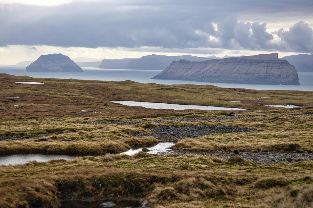 The good view to the south of the islands Stóru Dímun and Lítlu Dímun and in the background Suðuroyggin. If the weather is clear, you can see all the way south to the 470 m high Beinisvørð, 41 km. away, as we can see here a little to the right of Lítla Dímun, above the rock column Bárðadrangur. Photo: Óli Gardshodn
 -
 The village Skarvanes. Photo: Óli Gardshodn
 -
 View down over the village Skarvanes. Photo: Óli Gardshodn
 -
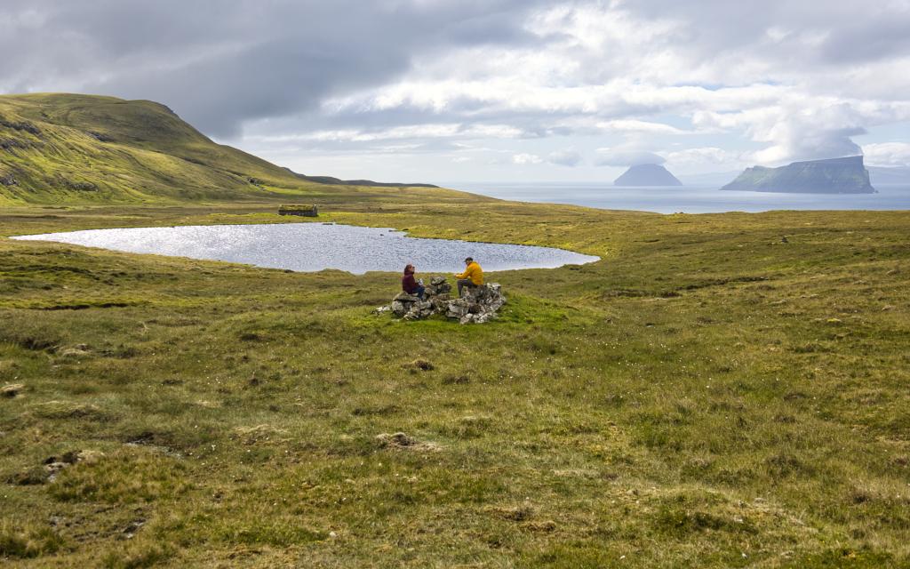 North of the pond Dúniavatn it is incredibly beautiful and cozy. The view is good south along the plain Undir Hjøllum with the islands Lítla Dímun and Stóra Dímun in the background. Enjoy the moment before we walk the last slightly steep stretch down to the village Skarvanes. Photo: Óli Gardshodn
-
View down over the settlement of Húsavík as we walk from Guðrunarløki down the Húsisdal valley. In the background on the right side is the slope that you walk up on the way to the village of Dalur. Photo: Óli Gardshodn
-
The old stone houses down by the beach in Húsavík (á Tumbakka). Photo: Óli Gardshodn
-
At Heimaruvørðu, at 140 m. altitude. In the background on the right, the 203 m high mountain Skálhøvdi. Although it seems steep, the path is good and easy to walk along. Photo: Óli Gardshodn
-
View down over the village Dalur. Photo: Óli Gardshodn
-
View down over the village Dalur. Photo: Óli Gardshodn
-
Up on the wide pass between the villages of Dalur and Skarvanes, it is very beautiful and pleasant to walk. There are many ponds here and the view is good - here with the island of Skúgvoy in the background. Photo: Óli Gardshodn
-
The good view to the south of the islands Stóru Dímun and Lítlu Dímun and in the background Suðuroyggin. If the weather is clear, you can see all the way south to the 470 m high Beinisvørð, 41 km. away, as we can see here a little to the right of Lítla Dímun, above the rock column Bárðadrangur. Photo: Óli Gardshodn
-
The village Skarvanes. Photo: Óli Gardshodn
-
View down over the village Skarvanes. Photo: Óli Gardshodn
-
North of the pond Dúniavatn it is incredibly beautiful and cozy. The view is good south along the plain Undir Hjøllum with the islands Lítla Dímun and Stóra Dímun in the background. Enjoy the moment before we walk the last slightly steep stretch down to the village Skarvanes. Photo: Óli Gardshodn
Guðrunarløkur - Húsavík - Dalur - Skarvanes - Guðrunarløkur: Challenging 15 km roundtrip hike with historic villages and stunning coastal views.
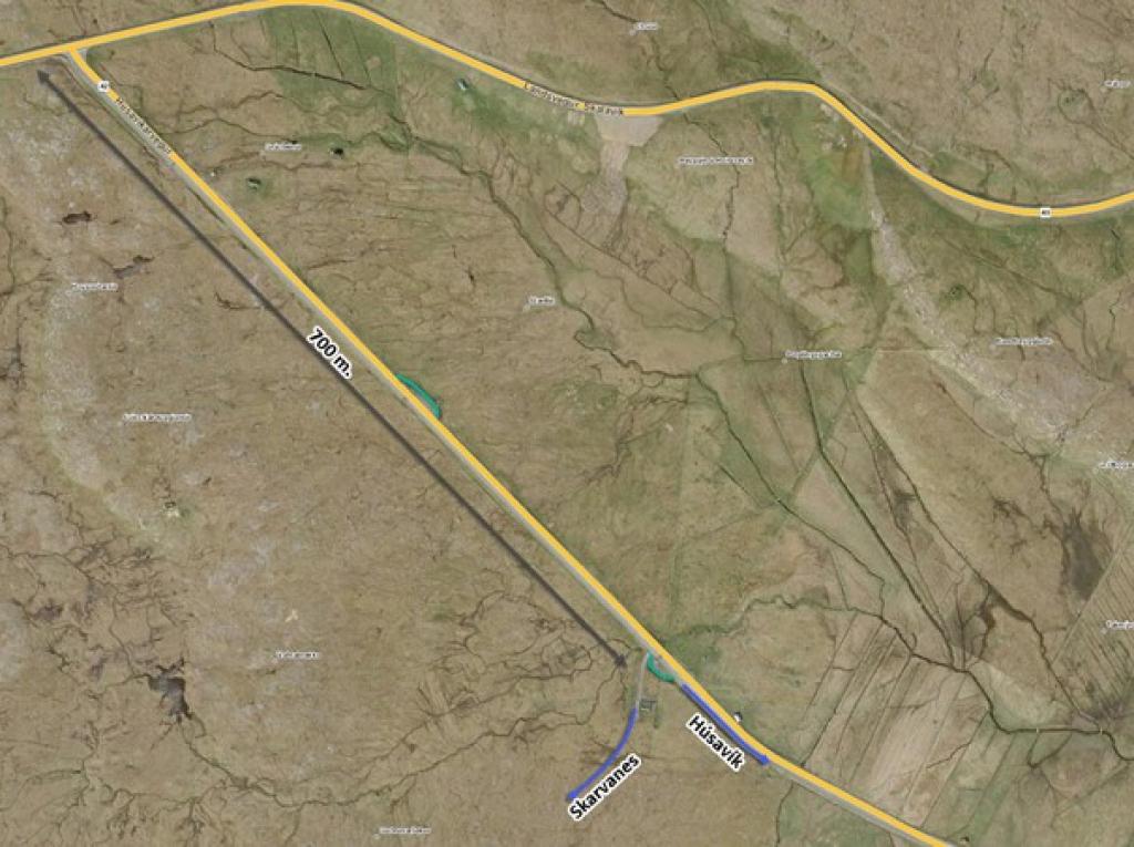
The hike starts by Guðrunarløkur, a brooklet located nearby the parking some 700 meters towards the road to Húsavík. Walk south along the main road to Húsavík.
According to legend the exceptionally rich Guðrun Sjúrðardóttir lived and owned land in Húsavík in the Middle Ages. You'll notice stonewalls and stone houses, some dating back to the times of Guðrun. It is estimated that 10 kilometres of stone wall is in Húsavík.
Continue towards the shore to the area known as Tumbakki. Here, you'll see several turf
sheds. No one knows the age or story surrounding the buildings, but it is likely that the houses have been used for food storage.
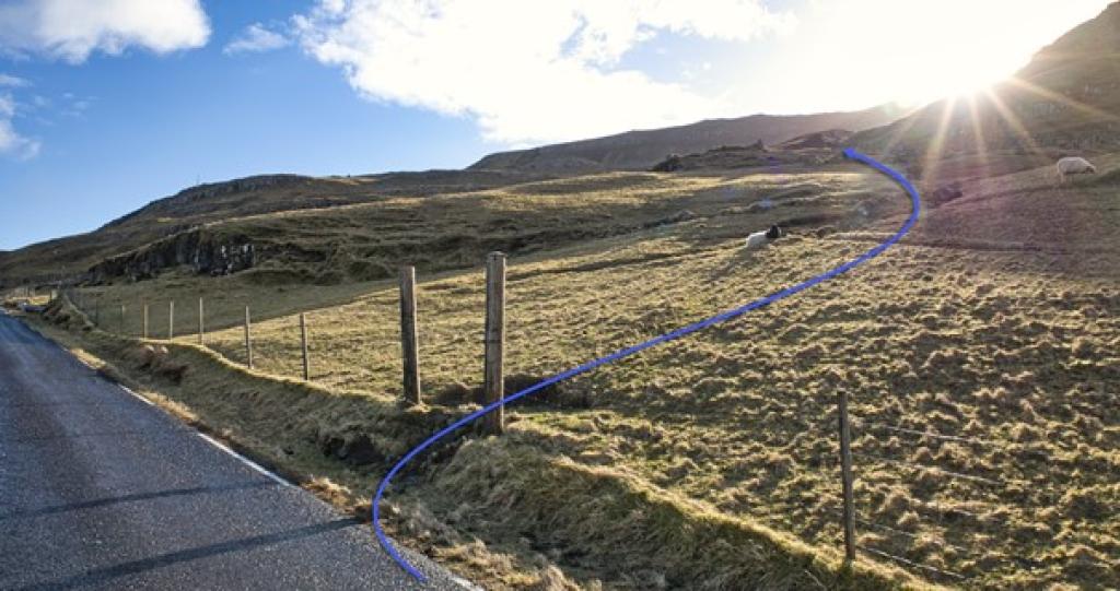
Continue along the main road and turn left towards Dalur. After 200 meters, walk through two large posts, indicating the start of the village path. Continue through the old stone ruins and out through the sheepfold.
Cairns lead the way, and despite the hill being quite steep, the path is wide and easy to walk. The path is well trodden, because it was used by villagers from Dalur every Sunday, before the completion of the Dalur Church in 1957. The road to Dalur opened in 1963. However, it road is narrow, and landslides are common, so work is being made to replace the old road with a tunnel between Húsavík and Dalur.
Follow the small poles until you'll see the deep valley, which the village is named after. Dalur is famous for its strong traditions in Faroese dance and for having produced many excellent ballad chanters.
Walk down towards the village, continue across the river, and turn right to the road leading uphill. This road is from the 1930s and was built to connect the village to nearby peat fields. Today no one cuts peat anymore and the road is mostly used by local sheep farmers.
Follow the road for 1,3 kilometres, and don't forget to enjoy the great view. You'll see the sign pointing towards the village path to Skarvanes. Follow the poles and cairns up towards the hill until it flattens. During clear days several islands will be visible.
The path starts leading downwards and becomes rather steep. Suddenly the tiny village of Skarvanes will be visible. Díðrikur á Skarvanesi (1802-1865), also known as Díðrikur of Kárastova, lived here. He is known as the first painter in the Faroes. Some of his unique bird illustrations have survived and can be viewed at the National Gallery of the Faroe Islands. Before arriving at the infield gate, a sign will point towards Guðrunarløkur. Turn to the righ and continue up the short hill. Cross the river and be careful if the path is slippery.
Follow the cairns and poles along the small lake, Dúniavatn. The last 2,5 km will take you through wet landscape. Try to stay on the eastern side where the path is much dryer, and a fence ladder will take you across the fence.
Along the path are two rocks called Klovnusteinar. They look like a single rock that has been split into two. People used to believe that if you walked through the rocks, you would die before the year is over. This is most likely a myth, but try to steer around the rocks… Just in case.
When you arrive at Guðrunarløkur, continue towards the road some 70 meters north of the sheepfold, to where the hike started.


Guðrunarløkur - Húsavík - Dalur - Skarvanes - Guðrunarløkur


Húsavík - Dalur - Skarvanes - Guðrunarløkur - Húsavík
Busroute 601 connects Húsavík. See schedule here: https://www.ssl.fo/en/timetable/bus/601-dalur-sandur-skopun/
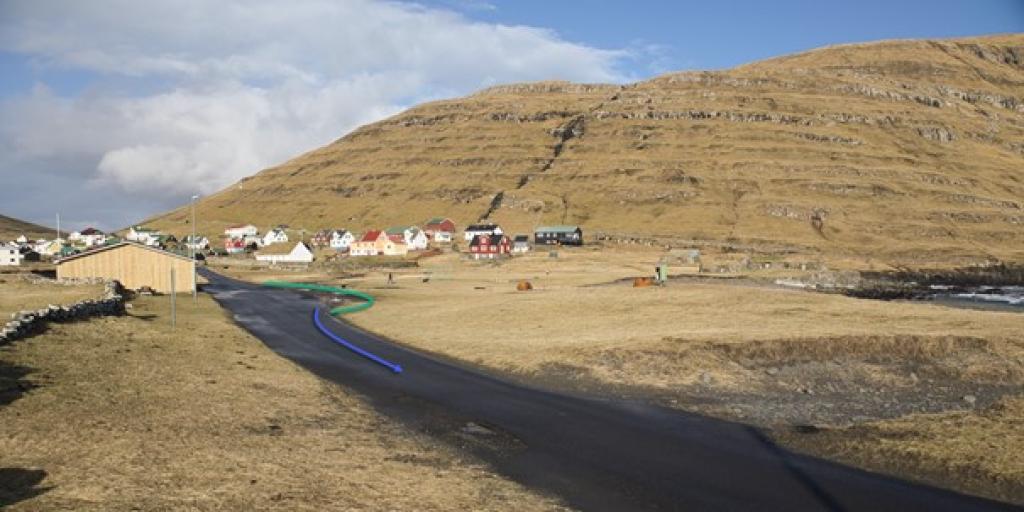
It is possible to park by the local village hall, Sólarís. Between the sand and the road is a parkway. Follow the blue arrows (see map).

Guðrunarløkur - Húsavík - Dalur - Skarvanes - Guðrunarløkur
Facts

Duration

distance

Peak

Elevation

 Difficult
-
Difficult
-

