


You haven’t got any favourites yet
This is where you can collect inspiration, articles, events and places that interest you.
Click the icon on pages and they’ll appear here.
Your favourites
Inspiration & Articles
Events & Tours
Places
Hiking
INSPIRATION & ARTICLES
EVENTS & HIKES
Places
Hov - Fámjin


Link Copied!

-
 View over the village Hov from the pass Mannaskarð. Photo: Óli Gardshodn
 -
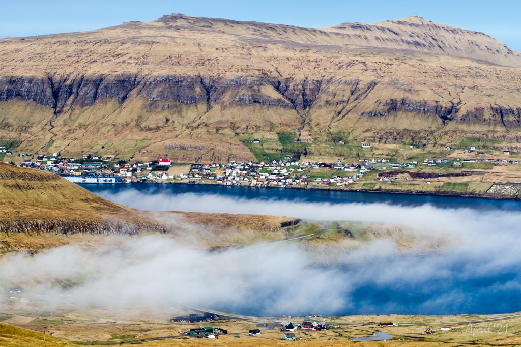
 View of the village Hov from the pass Mannaskarð. To the right you can just see the lake Vatnsnes come into view. Photo: Óli Gardshodn
 -
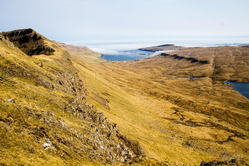
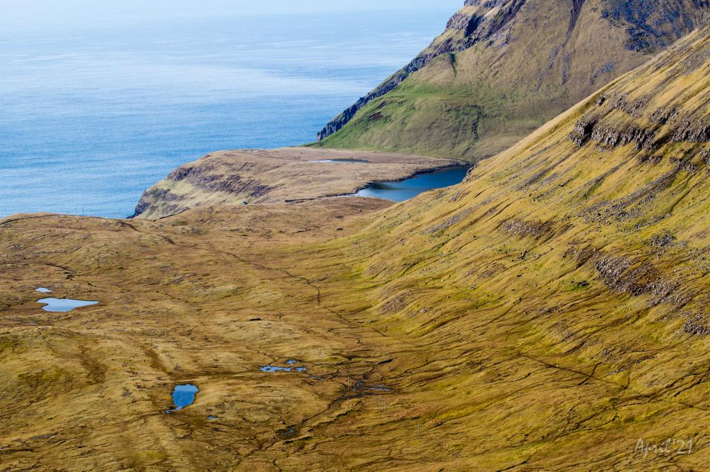
 View from the pass Mannaskarð over the valley of Hov and the large lakes Vatnsnes and Bessavatn. Photo: Óli Gardshodn
 -
 View from the pass Mannaskarð over the valley above Øravík. To the left Mt. Nónfjall, 427m. In the background the village Tvøroyri. Slightly to the right in the centre of the picture is Tingstovan, the ancient thingstead of Suðuroy, also called "Uppi millum Stovur". Photo: Óli Gardshodn
 -
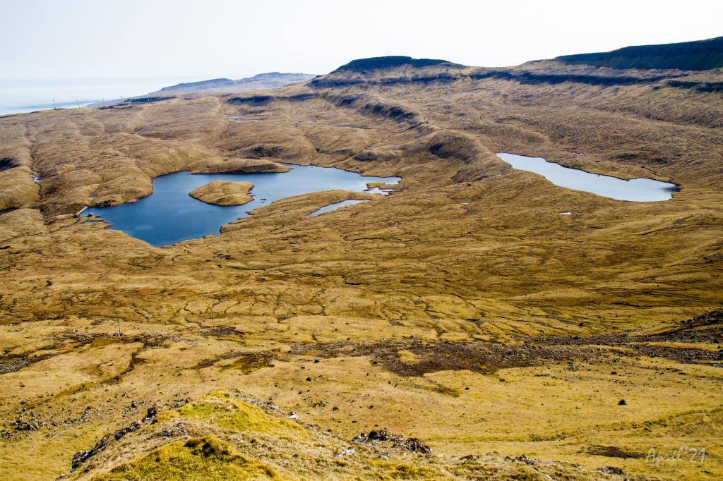
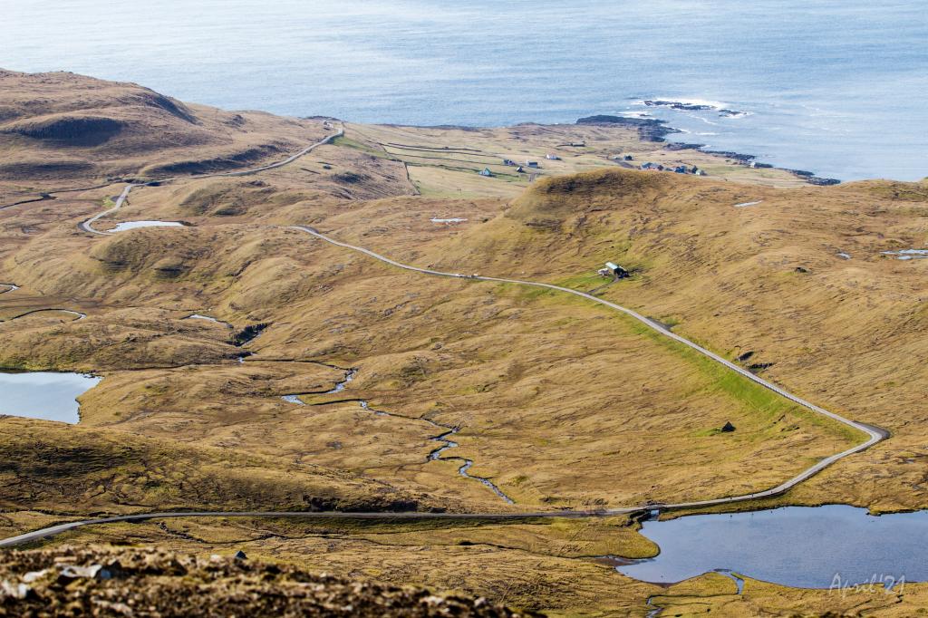
 View over the valley between the passes Fámjinsskarð and Mannaskarð. To the left is lake Nykavatn with Mt. Enni (424m.) in the background. Photo: Óli Gardshodn
 -
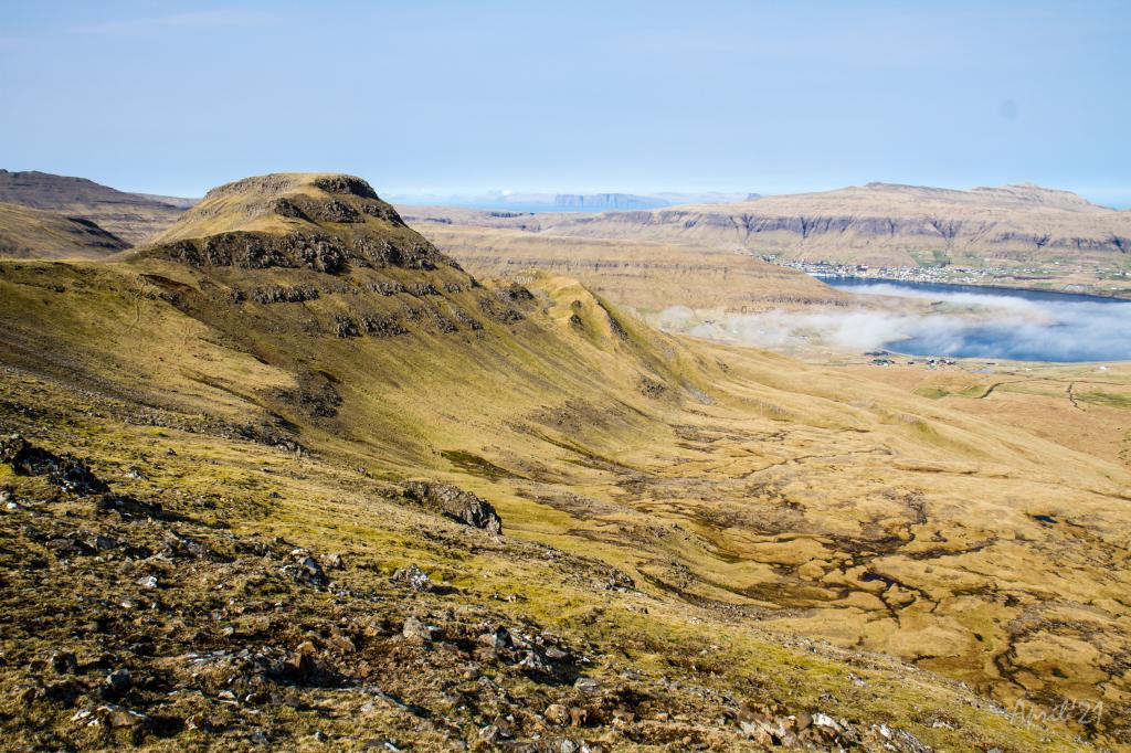
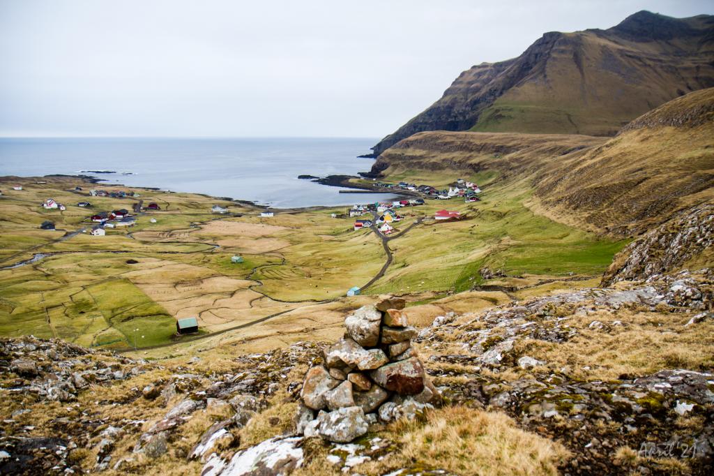
 View from Mannaskarð over the fjord Trongisvágsfjørður with the village Øravík in the foreground and Tvøroyri in the background. Photo: Óli Gardshodn
 -
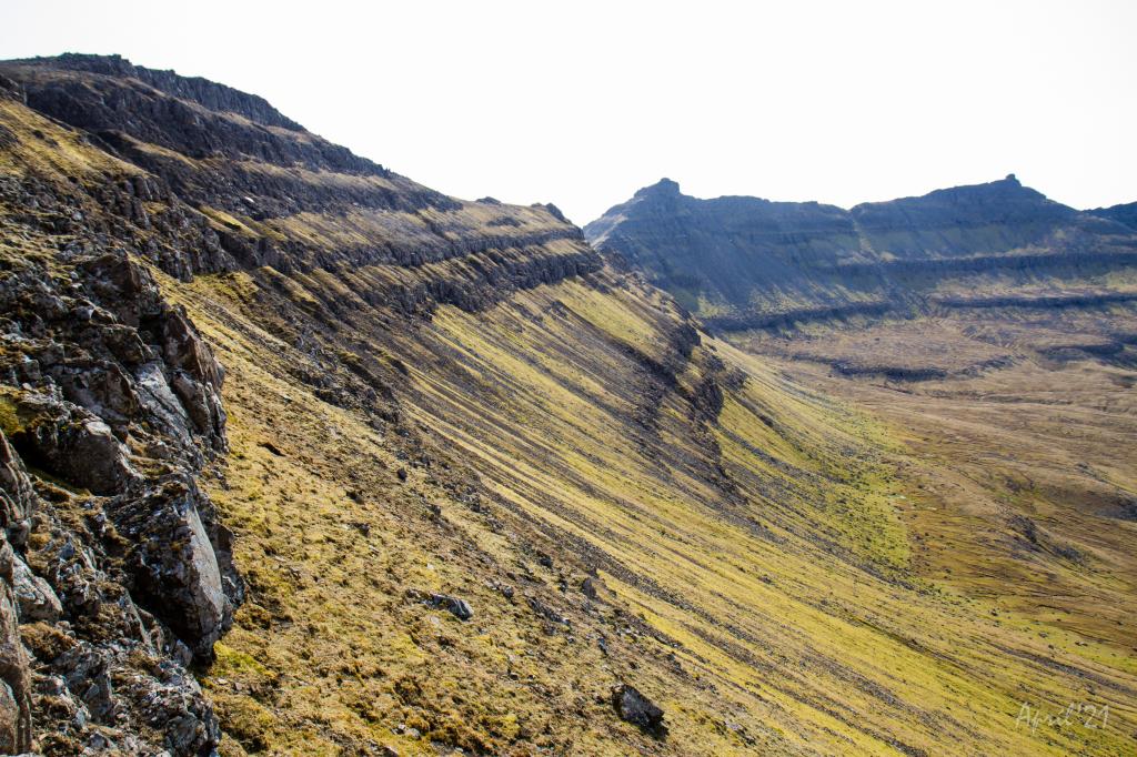
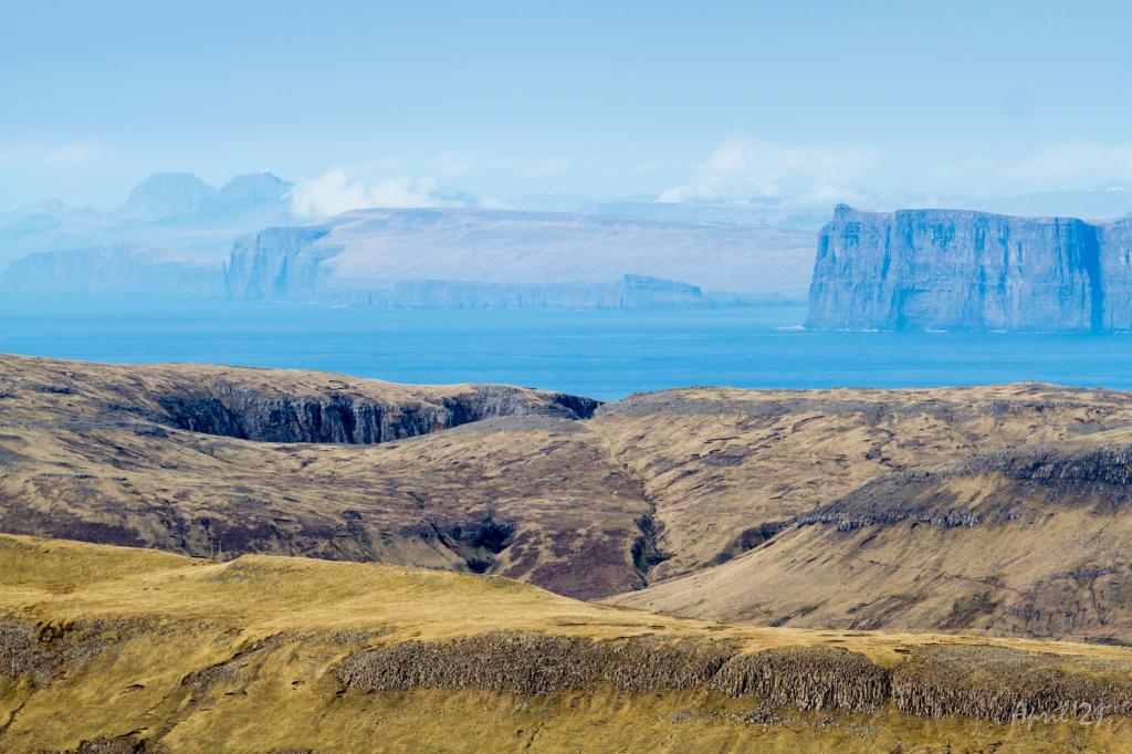 The view from the pass Mannaskarð across Trongisvágur and the deep and beautiful valley Hvannhagi. In the background the islands of Skúgoy and Sandoy. In the distant background, the radar on Mt. Sornfelli and Mt. Skælingur (767m.) is seen, 62 and 65km away respectively. Photo: Óli Gardshodn
 -
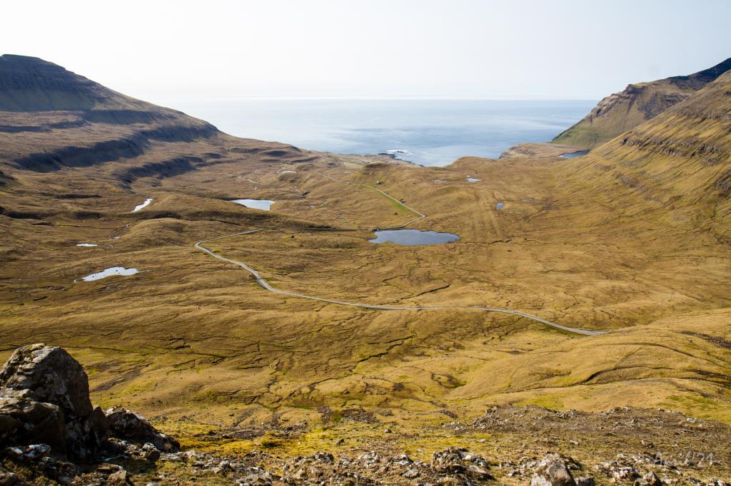 View over the Valley of Fámjin from the pass Fámjinsskarð. Photo: Óli Gardshodn
 -
 View over the Valley of Fámjin from the pass Fámjinsskarð. In the background Fámjin. Photo: Óli Gardshodn
 -
 View from the pass Fámjinsskarð south towards the mountains Borgarknappur (574m.) and Borgin (570m). Photo: Óli Gardshodn
 -
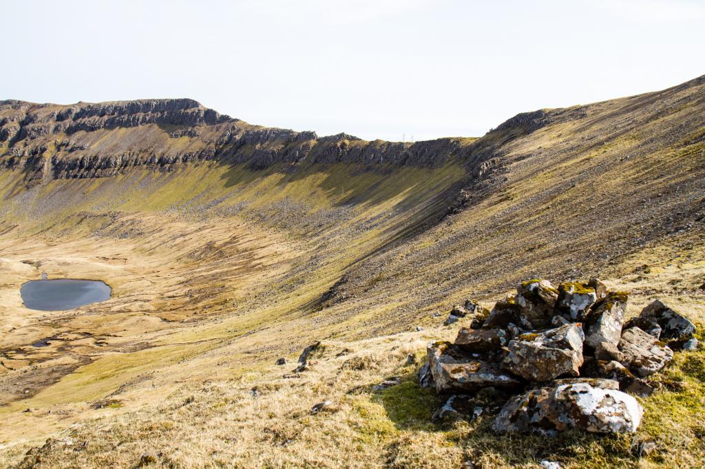
 The Lake Kirkjuvatn above Fámjin village. Photo: Óli Gardshodn
 -
 View of Fámjin from the first cairn on the village path to Hov. Photo: Óli Gardshodn
-
View over the village Hov from the pass Mannaskarð. Photo: Óli Gardshodn
-
View of the village Hov from the pass Mannaskarð. To the right you can just see the lake Vatnsnes come into view. Photo: Óli Gardshodn
-
View from the pass Mannaskarð over the valley of Hov and the large lakes Vatnsnes and Bessavatn. Photo: Óli Gardshodn
-
View from the pass Mannaskarð over the valley above Øravík. To the left Mt. Nónfjall, 427m. In the background the village Tvøroyri. Slightly to the right in the centre of the picture is Tingstovan, the ancient thingstead of Suðuroy, also called "Uppi millum Stovur". Photo: Óli Gardshodn
-
View over the valley between the passes Fámjinsskarð and Mannaskarð. To the left is lake Nykavatn with Mt. Enni (424m.) in the background. Photo: Óli Gardshodn
-
View from Mannaskarð over the fjord Trongisvágsfjørður with the village Øravík in the foreground and Tvøroyri in the background. Photo: Óli Gardshodn
-
The view from the pass Mannaskarð across Trongisvágur and the deep and beautiful valley Hvannhagi. In the background the islands of Skúgoy and Sandoy. In the distant background, the radar on Mt. Sornfelli and Mt. Skælingur (767m.) is seen, 62 and 65km away respectively. Photo: Óli Gardshodn
-
View over the Valley of Fámjin from the pass Fámjinsskarð. Photo: Óli Gardshodn
-
View over the Valley of Fámjin from the pass Fámjinsskarð. In the background Fámjin. Photo: Óli Gardshodn
-
View from the pass Fámjinsskarð south towards the mountains Borgarknappur (574m.) and Borgin (570m). Photo: Óli Gardshodn
-
The Lake Kirkjuvatn above Fámjin village. Photo: Óli Gardshodn
-
View of Fámjin from the first cairn on the village path to Hov. Photo: Óli Gardshodn
Hov - Fámjin hiking offers stunning views over three valleys with a scenic, grassy trail across Mannaskarð.
Hov - Fámjin
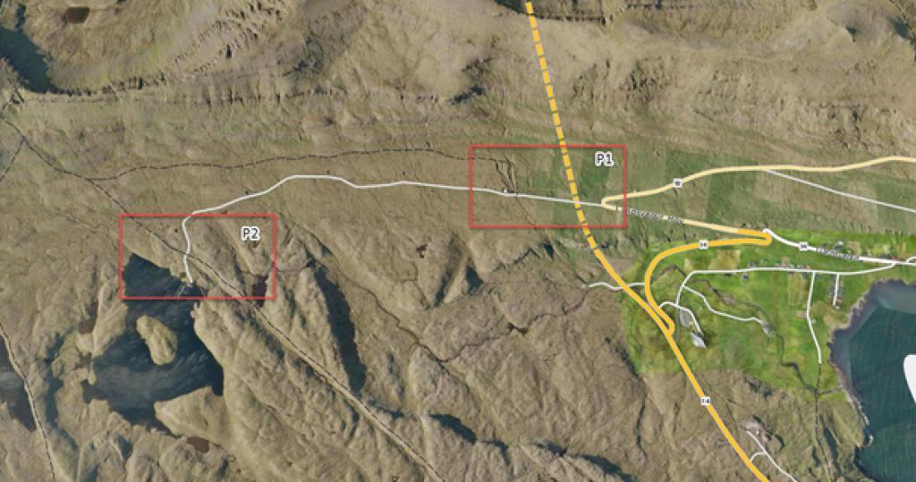
The route starts in Hov. If you want to walk the entire length of the path, start by the water tank and waterworks located outside the cattle grid by the road heading towards Hovdal’s dam (see P1 in the pictures). From there, walk up towards the first cairn, located 145 meters above the cattle grid. According to the locals, it is common to drive all the way up to the parking area (see P2 in the pictures) which lies 175 meters from the end of the road close to the dam. From that spot, walk towards the village path leading out of Porkeri until you reach the meeting point of the pathway between Hov and Fámjin.
The grassy path towards Mannaskarð is marked by cairns and is slightly steep. On top of Mannaskarð you are rewarded with a stunning view of Hovsdal; a large valley featuring water running between the rocky landscape below. The mountain ridges around the valley meet at the magnificent mountain “Borgarknappi”, the tallest mountain in the area (574 m.). From there, the mountain chain continues west on the southern side of Fámjinsdal.
In Ærgidali, south of the river between the lakes of Bessavatn and Vatnsnes, archaeologists have discovered ancient ruins that provide evidence that Vikings once lived there whilst caring for their cattle during the summer season.
When walking around Mannaskarð, you get a great view looking over Øravík, towards Froðba and Tvøroyri. If the weather is good, it is possible to see Skælingsfjall and Sornfelli, with their white radar domes.
Although the path towards Fámjinsskarð is not visible, it is a decent 400-meter walk on a straight, pebbly road.
In Fámjinsskarð it is possible to enjoy the view of Fámjin’s valley, a natural gem. From there you can see the southern aspects of Borgarknappur, Borgin and Glopprókin with their basalt columns. On the northern side, you can catch a glimpse of Kirkjuvatn.
The trail down towards Fámjin is a long descent marked by the stone cairns, which are located close to each other. They will guide you down by Mosavøl, through Traðarhamar and towards the gates of the sheepfold. Finally, there is a path that will lead you down towards the road from the sheepfold and into the village.


Hov - Fámjin
Public transport
There is a good bus connection to Hov, route 700
Parking
Parking depends on whether you want to start your walk along the village path from Hov. The path starts by the cattle grid, which is located 240 meters away from the 180-degree swing on the road heading towards Hovsegg (P1). It is most popular to walk from the parking lot up in the walley, which is 175 meters from the end of the road (P2), and from there follow the path from Porkeri heading up to the pass Mannaskarð.
Both parking areas, down by the cattle grid (P1) and by the path leaving Porkeri (P2), are good options.
See green markings on the photos for parking options.
-
 There are two parking places, P1 and P2, depending on which route you plan to take out on the Fámjin villagepath.
 -
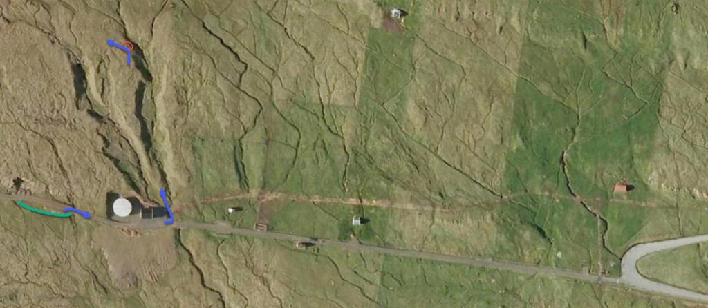 Parking spot 1 (P1), closer to Hov. See green line for parking and blue line for starting point
 -
 Parking spot 1 (P1), closer to Hov. See green line for parking and blue line for starting point
 -
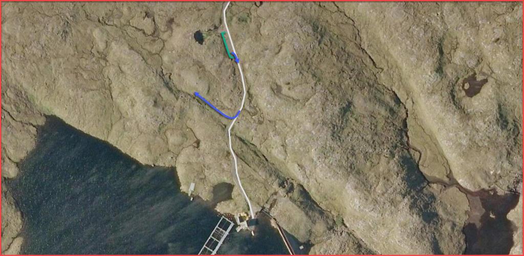 Parking spot 2 (P2), further up the valley, close to lake Vatnsnes. See green line for parking and blue line for starting point
 -
 Parking spot 2, further up the valley (P2). See green line for parking and blue line for starting point
Fámjin - Hov
Public transport
There is a decent bus connection from Fámjin on route 701. However, this trip requires you to pre-ordering( pre-ordering for most trips and sometimes pre-ordering preferably the day before)
Parking, Fámjin:
Park at the big parking space by the bay, just below where Traðavegur leads down towards Famjinsvegur, and walk from there.
By the church, there are some parking spaces available; however, it is unclear whether it is allowed to park there leaving no spaces available for those visiting the church graveyard.
-
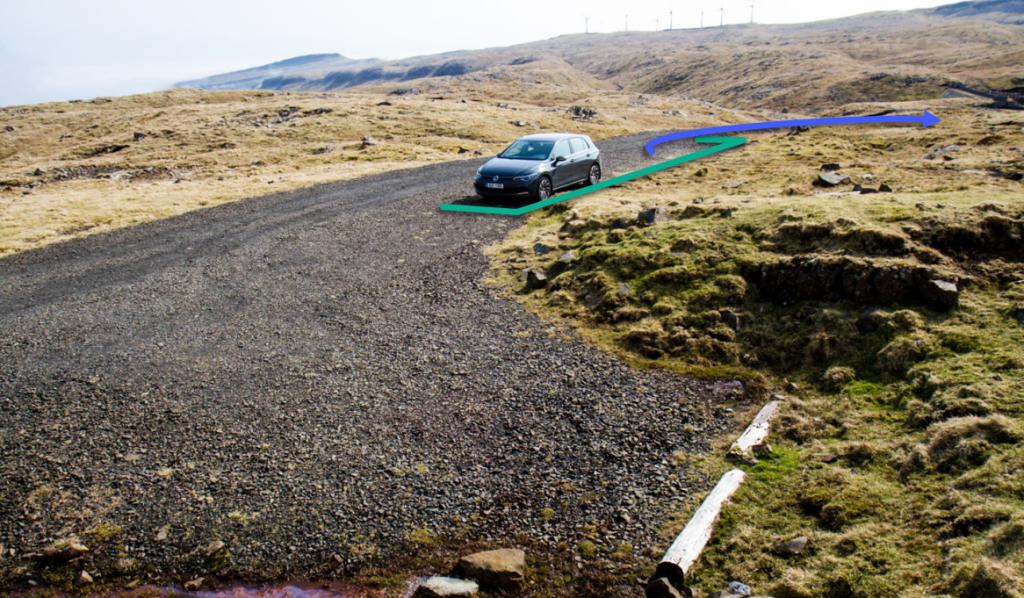
 See green line for parking and blue line for starting point
 -
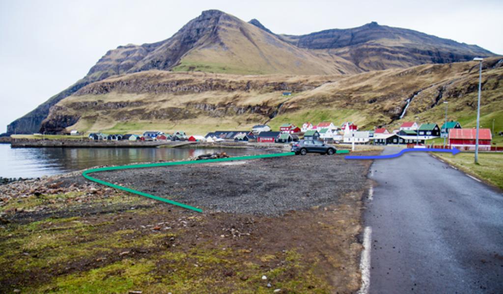 See green line for parking and blue line for the direction to the starting point
Hov - Fámjin
Fámjin - Hov
Facts

Duration

distance

Peak

Elevation
 Suitable for children above 8 years
 Medium
- It is a little steep on the southside of Mannaskarð, but the terrain is grassy and therefore suitable to walk on.
Medium
- It is a little steep on the southside of Mannaskarð, but the terrain is grassy and therefore suitable to walk on.
 Good terrain and grass-covered all the way. The terrain is wet in certain areas.
Quite steep downhill on the way down from Mannaskarð.
Good terrain and grass-covered all the way. The terrain is wet in certain areas.
Quite steep downhill on the way down from Mannaskarð.
