You haven’t got any favourites yet
This is where you can collect inspiration, articles, events and places that interest you.
Click the icon on pages and they’ll appear here.
Your favourites
Inspiration & Articles
Events & Tours
Places
Hiking
INSPIRATION & ARTICLES
EVENTS & HIKES
Places
Hvalvík - Vestmanna


Link Copied!

-
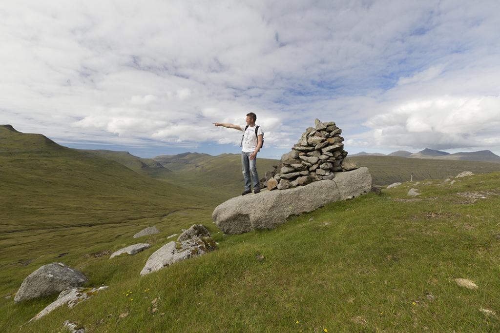
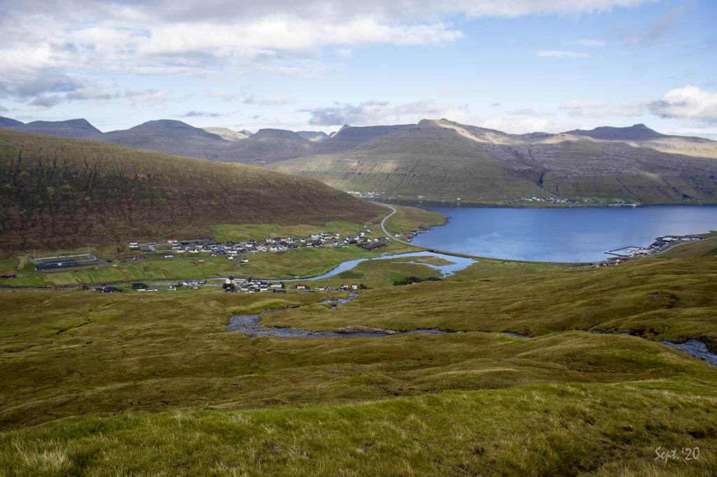
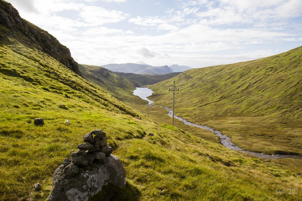
 Up by the first cairn in Hvalvík in 146m. height. Photo: Óli Gardshodn
 -
 It is very beautiful to walk up along Myllá. As you get higher up, you get a better and better overview of the many and high mountains on the neighbouring island of Eysturoy. Photo: Óli Gardshodn
 -
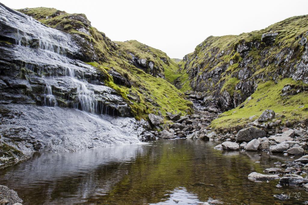 In Hvalvíksgjógv up above the village Hvalvík it is tranquil and beautiful. Photo: Óli Gardshodn
 -
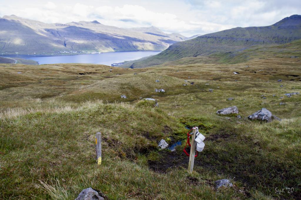 It is no wonder that exactly here two mugs have been hung on a wooden stick. The view is fantastic, it is peaceful and now that you have a spring close at hand... Photo: Óli Gardshodn
 -
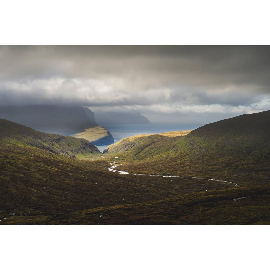
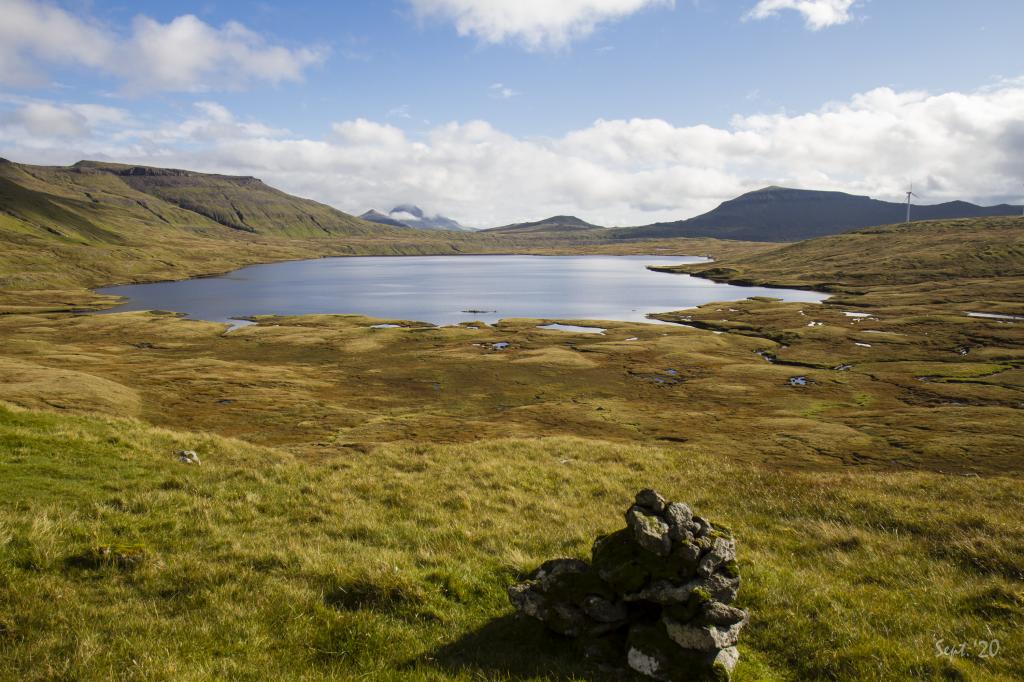
 Up at Kellingarsteinur in 380m. altitude we have a fantastic view of Saksunardalur, the longest valley in the Faroe Islands. Photo: Óli Gardshodn
 -
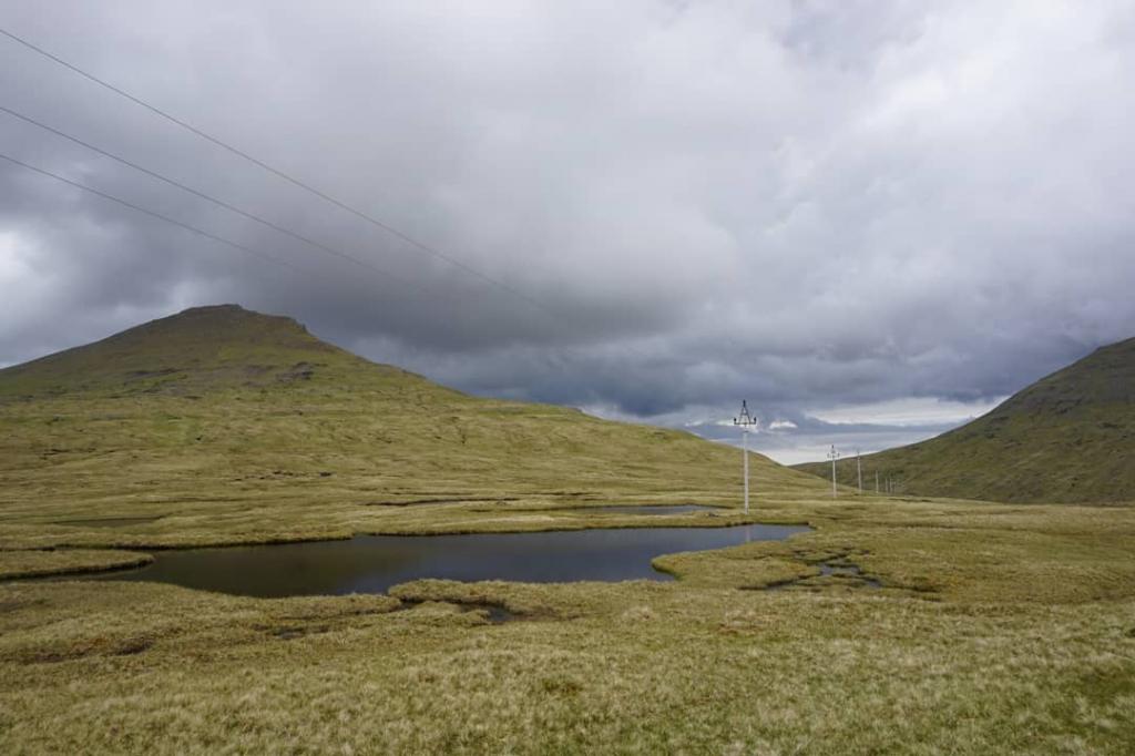
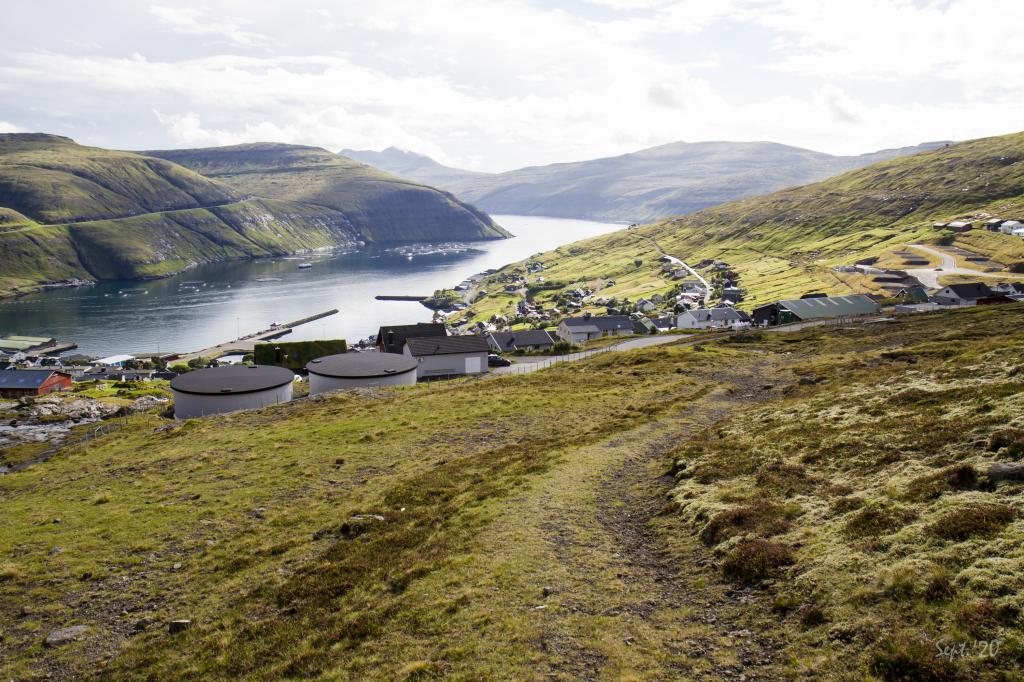
 Den øverste af de fire vanddemninger, som hører til vandkraftværket i Vestmanna. Photo: Óli Gardshodn
 -
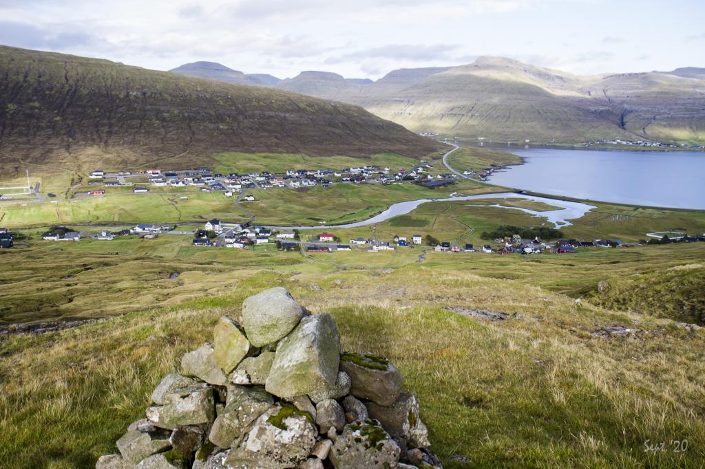
 Bjarnadalur - the bear valley, in Vestmanna. Photo: Óli Gardshodn
-
Up by the first cairn in Hvalvík in 146m. height. Photo: Óli Gardshodn
-
It is very beautiful to walk up along Myllá. As you get higher up, you get a better and better overview of the many and high mountains on the neighbouring island of Eysturoy. Photo: Óli Gardshodn
-
In Hvalvíksgjógv up above the village Hvalvík it is tranquil and beautiful. Photo: Óli Gardshodn
-
It is no wonder that exactly here two mugs have been hung on a wooden stick. The view is fantastic, it is peaceful and now that you have a spring close at hand... Photo: Óli Gardshodn
-
Up at Kellingarsteinur in 380m. altitude we have a fantastic view of Saksunardalur, the longest valley in the Faroe Islands. Photo: Óli Gardshodn
-
Den øverste af de fire vanddemninger, som hører til vandkraftværket i Vestmanna. Photo: Óli Gardshodn
-
Bjarnadalur - the bear valley, in Vestmanna. Photo: Óli Gardshodn
Experience the stunning Hvalvík - Vestmanna hike with breathtaking mountain views, lakes, and fascinating local history.
The tour begins by the Mission House in Hvalvík (Hvalvíksvegur 77). From here follow the new path, where you will find a gate.
Walk along the river Myllá, which runs north of the Mission House in Hvalvík. About 200 metres from Hvalvíksgjógv is the first cairn.
When you have passed Eggjarmúli, there is a fine view through Saksunardalur, the longest valley in the country. From here, follow the SEV electricity line all the way to Vestmanna. SEV is the national electric power company. The first mechanical digger purchased to the Faroe Islands came to Hvalvík. It was called the Hvalvíkskúgvin. On one occasion, the people from Vestmanna wanted to borrow it for some work and it was carried up over Hvalvíksskarð along this path.
Now, you arrive at a cairn, stacked on a large stone called Kellingarsteinur. At the next cairn, after Kellingarsteinur, the path divides. The path south goes to Kvívík and the path north goes to Vestmanna. Follow the latter.
On top of Hvalvíksskarð, you see over to Mýrarnar and one of the first dams built by SEV in the early 1960s. There is also a small private windmill park. To the south is the mountain range Egilsfjall, Goturshálsur, Sátan and Skælingsfjall and on Vágar, you can see Reynsatindur and Heldarstindur.
Loysingafjall is just in front of you. There is an account of a girl in Vestmanna who disappeared from the town and could not be found. The next day, a shepherd found her high up on Loysingafjall. She said that a man in white clothes had led her by the hand and fed her. No one knew this man. The cairns and SEV-line take you to the left side of Bjerndalsgjógv. Be careful when the path turns south, as it is steep downwards.
There are now two possible ways down to Vestmanna. The path divides by the dam at Fossá. You can follow the road and go down Á Fjørð or go over the first dam, follow the cairns to Vestmanna along Gjógvará and down along Miðalsbrekka.
Another story is about a young milkmaid who disappeared in the river at Gjógvará. She had tripped and fallen and was carried down the large waterfall. There was no thought of her coming out alive from the fall. When people at home heard the news, they immediately went out to search. But they found no body. The girl was not dead. Naked, in a bad state, she was lying in the cleft, clinging to a stone. She could hear people calling for her, but she did not dare to call out because she was afraid of Huldufólk (Hidden People) and trolls. Not until the day after, when the river had settled down, did she dare to approach the houses. It was a miracle that she survived the incident.
Before the Faroe Islands got its first subsea tunnel between Streymoy and Vágar in 2002, the ferry port of Vestmanna was the hub for traffic to and from the airport in Vágar.
The walk can be taken in either direction. However, it is significantly easier to walk from Vestmanna.


Hvalvík - Vestmanna
Public transport
Its recommended to take the bus for this hike.
Route 450 (Kollafjørður - Skálafjørður) stops in Hvalvík.
Route 100/300 drives between Vestmanna and Tórshavn.
Arriving by car
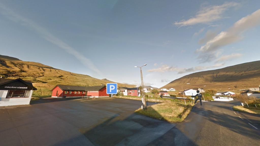
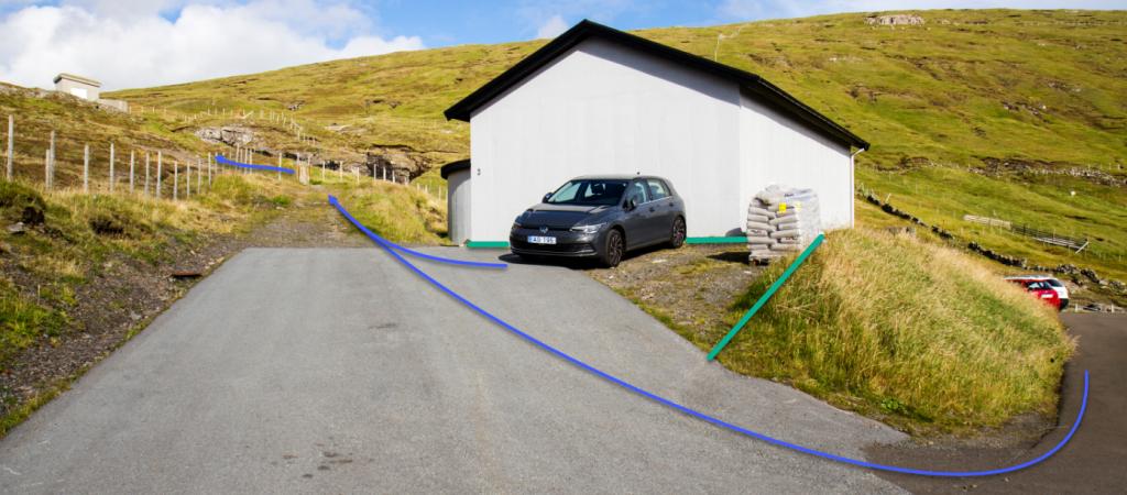
Parking, Hvalvík
Park by the Mission House or public library in Hvalvik – just by the beginning of the path.
-
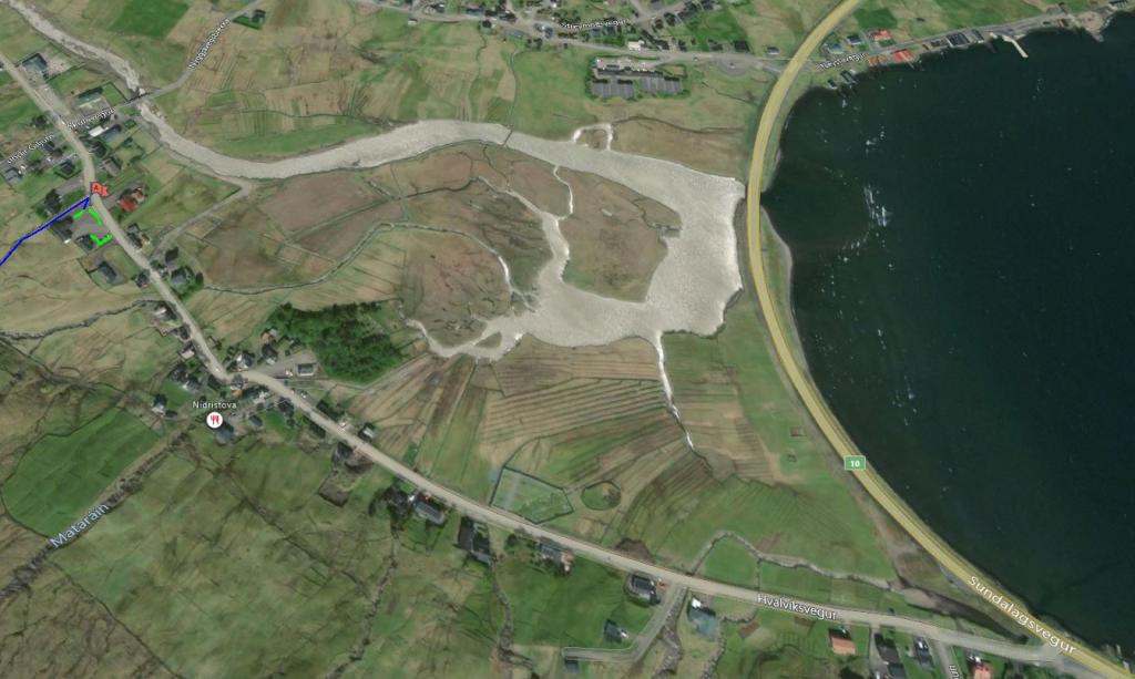 See green line for parking and blue line for starting point
 -
 Park by the Misson House in Hvalvik - just by the beginning of the path.
 -
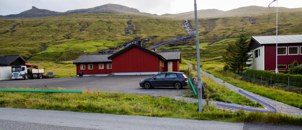 See green line for parking and blue line for starting point
 -
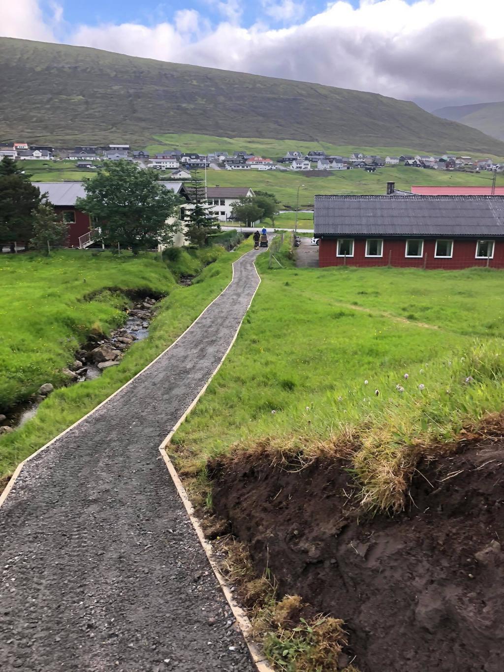 The beginning of the path in Hvalvík.
 -
 The beginning of the path in Hvalvík.
 -
 Bláa linjan vísir leiðina niðaná.
Vestmanna - Hvalvík
Public transport
Its recommended to take the bus for this hike.
Route 450 (Kollafjørður - Skálafjørður) stops in Hvalvík.
Route 100/300 drives between Vestmanna and Tórshavn.
Arriving by car
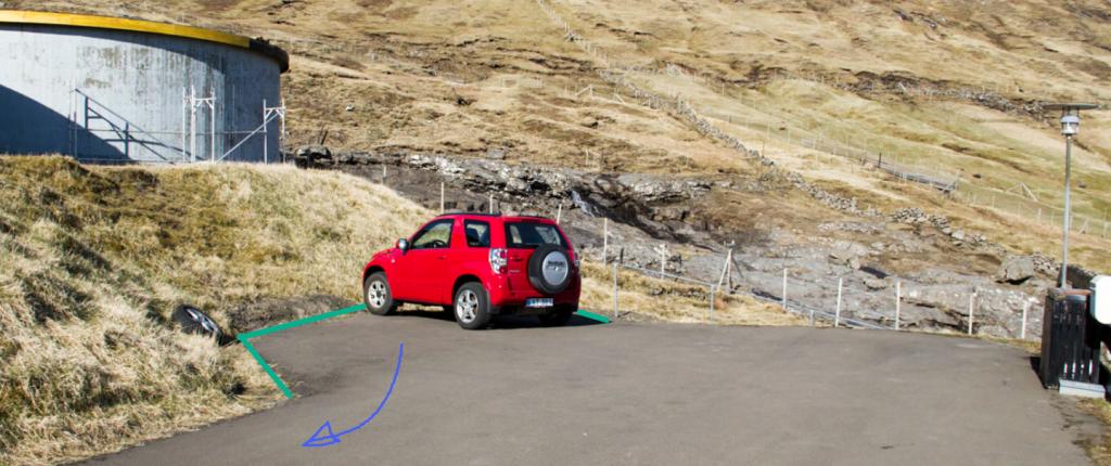
Parking, Vestmanna
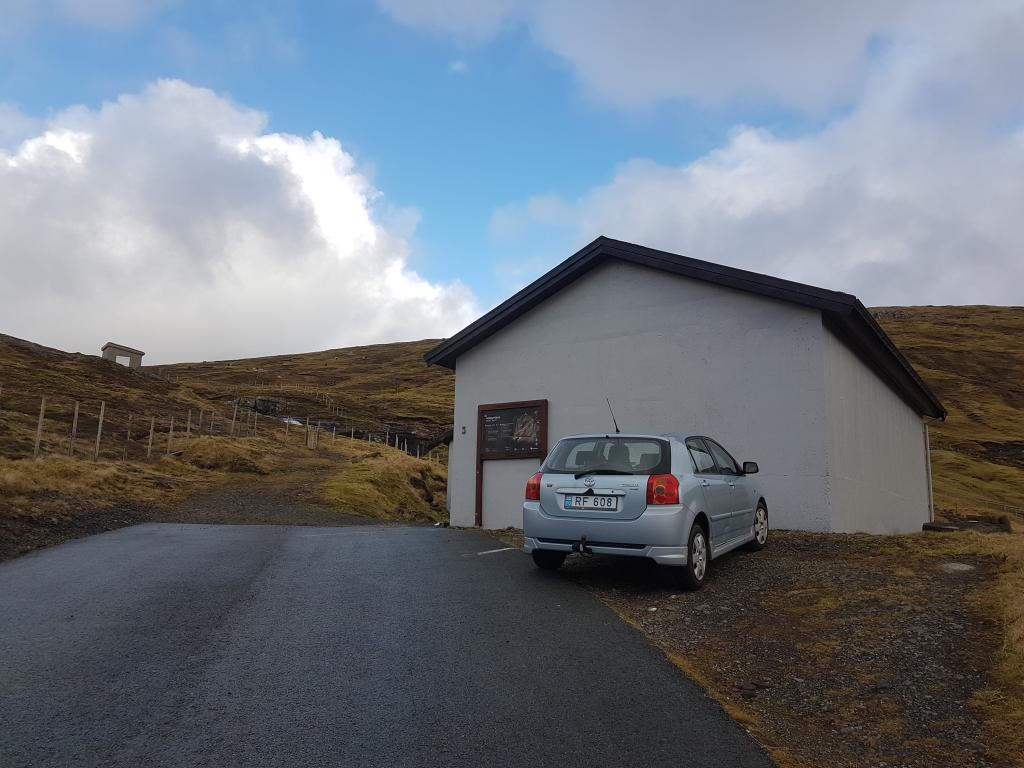
You can park by the water wells at the very top of Vestmanna - Skorðalíð 3.
-
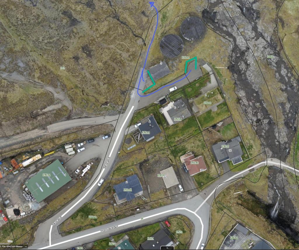 See green line for parking and blue line for starting point.
 -
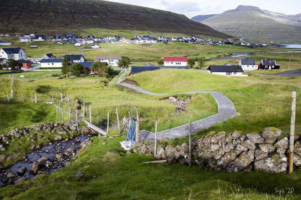
 Starting point on Meðalsbrekka in Vestmanna.
 -
 See green line for parking and blue line for starting point.
 -
 See green line for parking and blue line for starting point.
 -
 The beginning of the path in Vestmanna.
Hvalvík - Vestmanna
Vestmanna - Hvalvík
Facts

Duration

distance

Peak

Elevation
 Not suitable for children under the age of ten. Be careful with children at Bjerndalsgjógv
 Medium
- From Hvalvík it is a little difficult to walk up the mountain. Otherwise, the path is easy to walk along
Medium
- From Hvalvík it is a little difficult to walk up the mountain. Otherwise, the path is easy to walk along
 Grass cairn path. In some places, stones and rocks