


You haven’t got any favourites yet
This is where you can collect inspiration, articles, events and places that interest you.
Click the icon on pages and they’ll appear here.
Your favourites
Inspiration & Articles
Events & Tours
Places
Hiking
INSPIRATION & ARTICLES
EVENTS & HIKES
Places
Kambsdalur – Skálafjørður


Link Copied!

-

-
 View from the cairn at Gunnarsgil in the Kambsdalur valley over the mountain Ritafjall. Photo: Óli Gardshodn
 -
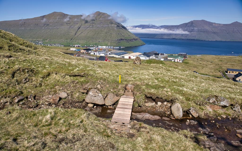 The bridge over the stream at Gunnarsgil in the Kambsdalur valley. In the background to the left is the settlement of Fuglafjørður and to the right the island of Kalsoy. Photo: Óli Gardshodn
 -
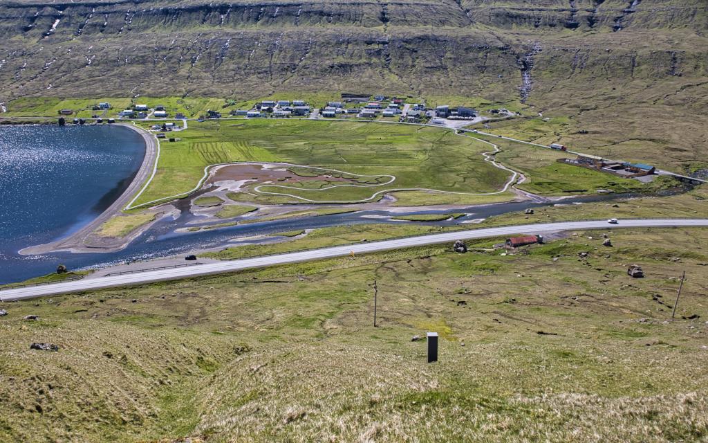
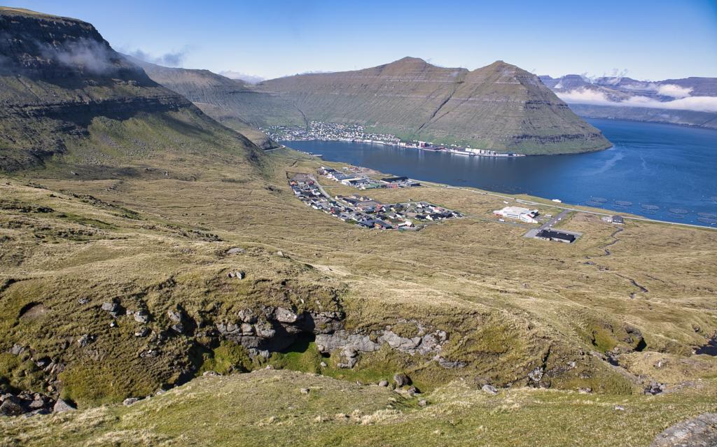 View down the valley Kambsdalur - also called Ytridalur. In the background the settlement of Fuglafjørður. Kambsdalur was one of the good peat areas at Fuglafjørður. The settlement in Kambsdalur began in 1986. Photo: Óli Gardshodn
 -
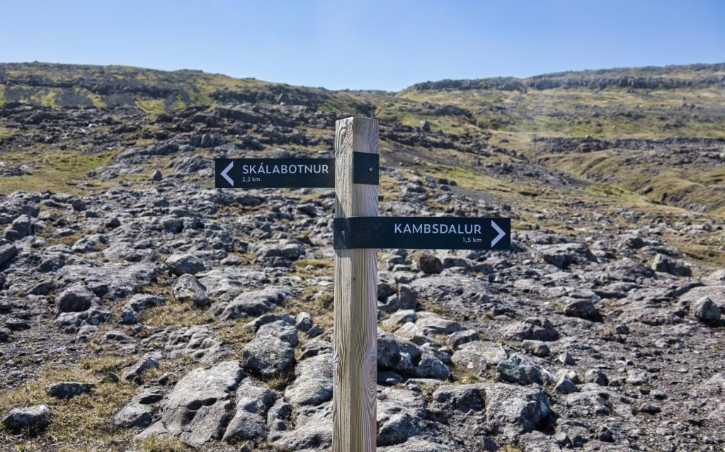 Guidepost up on Skarðsbrúgv by the Trælavatn water. Photo: Óli Gardshodn
 -
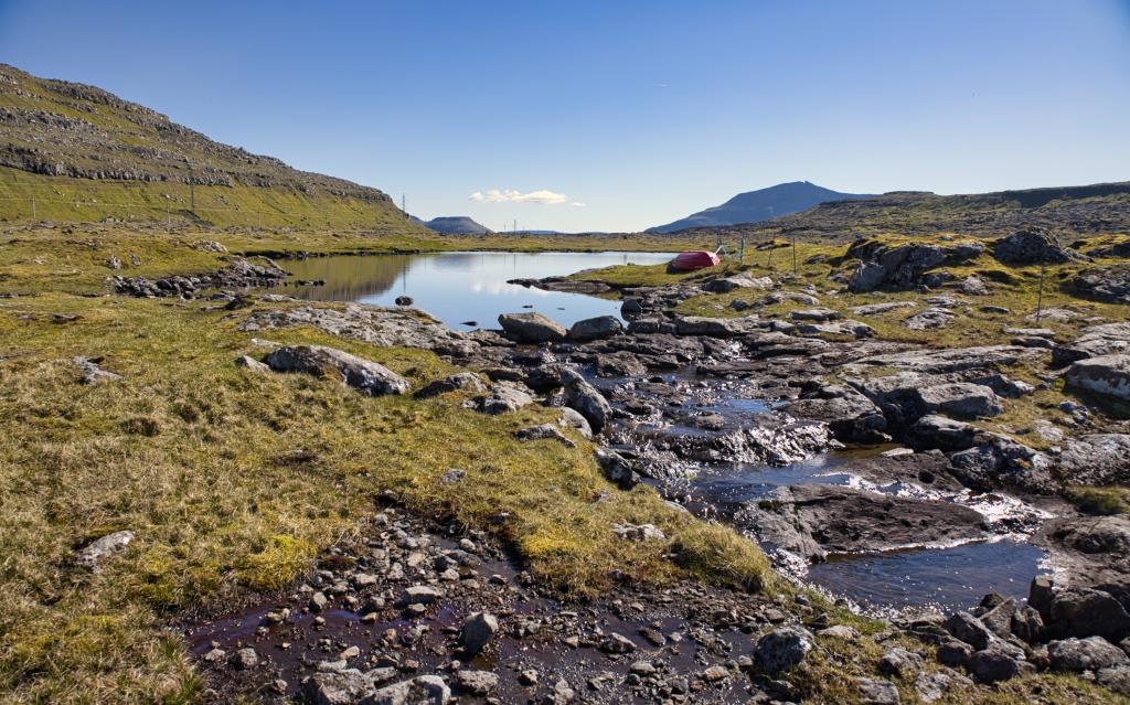 The water Trælavatn up on the pass Trælavatnaskarð at an altitude of 366 m. Photo: Óli Gardshodn
 -
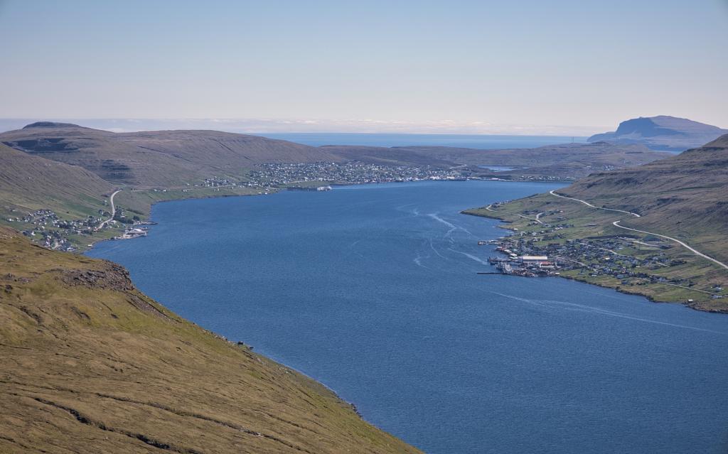 View up from the Trælavatnaskarð pass out along the Skálafjørður fjord. In the background on the right side is the water Toftavatn. Farthest to the right is the island of Nólsoy. Photo: Óli Gardshodn
 -
 View down over the village of Skálafjørður. Photo: Óli Gardshodn
-
-
View from the cairn at Gunnarsgil in the Kambsdalur valley over the mountain Ritafjall. Photo: Óli Gardshodn
-
The bridge over the stream at Gunnarsgil in the Kambsdalur valley. In the background to the left is the settlement of Fuglafjørður and to the right the island of Kalsoy. Photo: Óli Gardshodn
-
View down the valley Kambsdalur - also called Ytridalur. In the background the settlement of Fuglafjørður. Kambsdalur was one of the good peat areas at Fuglafjørður. The settlement in Kambsdalur began in 1986. Photo: Óli Gardshodn
-
Guidepost up on Skarðsbrúgv by the Trælavatn water. Photo: Óli Gardshodn
-
The water Trælavatn up on the pass Trælavatnaskarð at an altitude of 366 m. Photo: Óli Gardshodn
-
View up from the Trælavatnaskarð pass out along the Skálafjørður fjord. In the background on the right side is the water Toftavatn. Farthest to the right is the island of Nólsoy. Photo: Óli Gardshodn
-
View down over the village of Skálafjørður. Photo: Óli Gardshodn
Discover the scenic Kambsdalur – Skálafjørður hike with stunning views over Fuglafjørður, mountains, and Trælavatn lake.
From Kambsdalur the path begins on the road Børkugøta. A sign marks the beginning newly erected cairns lead the way.First, you walk by the old peat strip belonging to Fuglafjørður. On Skarðsbrúgv, you arrive at a gorge. Walk towards the edge of the gorge where there is a passage up to Skarðsbrúgv. There, you will see the first cairn. You will have an excellent view over Fuglafjørður and the surrounding mountains.
To the north, there is also a view towards Kalsoy with the spiky Nestindur, with its 788 metres, towering skywards, and Kunoy with its distinctive, huge notch in the otherwise solid wall of rock. To the east Ritafjall (also called Leirvíksfjall) and if you gaze down you see an old road. This is the first road to Leirvík.
You now come to Trælavatn where there is a large colony of Herring Gulls in the summer. There are also Oystercatchers, Geese and other birds. You must keep to the north side of the lake where you come in on the old path. The path is level, but the terrain is uneven and rocky. There are some cairns showing land boundaries in the outfield approximately 100 metres south of the trail. Be careful not to go the wrong way!
When you see the long fjord south towards Toftavatn with Nólsoy in the background, the village cairn path slowly turns to the right. On the other side of the fjord, you have the beautiful Reyðafelstindur in front of you. Be careful when you go down through Rossastígar, as it is steep in some places. It can be difficult to spot the cairns. The cairns are further down on the plain. Walk towards them.
The best place to walk along the river down to Tundradalur is on the south side (left side).
Legend has it that once upon a time there were four men from Hattarvík on Fugloy called Floksmenninir who wanted to conquer all the Faroe Islands. They were captured and sentenced to be thrown off the steepest area by Valaknúkar. Their sentence was carried out and they were buried at Tingsteinur under Valaknúkar. Walk down on the main road near the petrol station. If you want to go further, you can continue from Skálabotnur to Selatrað. It takes about three and a half hours more.


Kambsdalur – Skálafjørður
Public transport
Route 400 stops in Gøtudalur where you can transfer to Route 410 that stops in Kamsbdalur.
Arriving by car
There's plenty of parking where the path starts. See the green line
Skálafjørður - Kambsdalur
Public transport
Route 450 stops in Skálafjørður. If you take Route 450 to Skipaneskrossur there is a connection to Route 400 which drives to both Tórshavn and Klaksvík.
Arriving by car
Parking, Skálafjørður
1) By the gas station EFFO or 2) by the congregation Keldan further down the road in Skálafjørður.
Kambsdalur – Skálafjørður
Skálafjørður - Kambsdalur
Facts

Duration

distance

Peak

Elevation
 The route is reasonably suitable for children. However, be careful down from Trælavatnaskarð and down Rossastígar
 Medium
- Moderate. Somewhat difficult to come up from Kambsdalur, then the path follows flat terrain until it starts to go down towards Skálafjørður
Medium
- Moderate. Somewhat difficult to come up from Kambsdalur, then the path follows flat terrain until it starts to go down towards Skálafjørður
 Partly hard-to-see grass path up to the area before Trælavatn. From there, grass/ stone path with cairns. In some places, stones and rocks
