


You haven’t got any favourites yet
This is where you can collect inspiration, articles, events and places that interest you.
Click the icon on pages and they’ll appear here.
Your favourites
Inspiration & Articles
Events & Tours
Places
Hiking
INSPIRATION & ARTICLES
EVENTS & HIKES
Places
Klaksvík - Árnafjørður


Link Copied!

-
 The city of Klaksvík. Photo: @aronsche
 -
 View right over where the village path in Klaksvík starts. In the picture you can see the wooden sticks that you follow all the way to the village Árnafjørður. Photo: Óli Gardshodn
 -
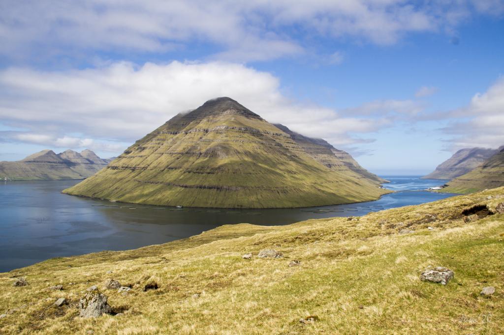 As we walk through the peatlands, we enjoy the stunning views of the islands of Kunoy and in the background Kalsoy. Photo: Óli Gardshodn
 -
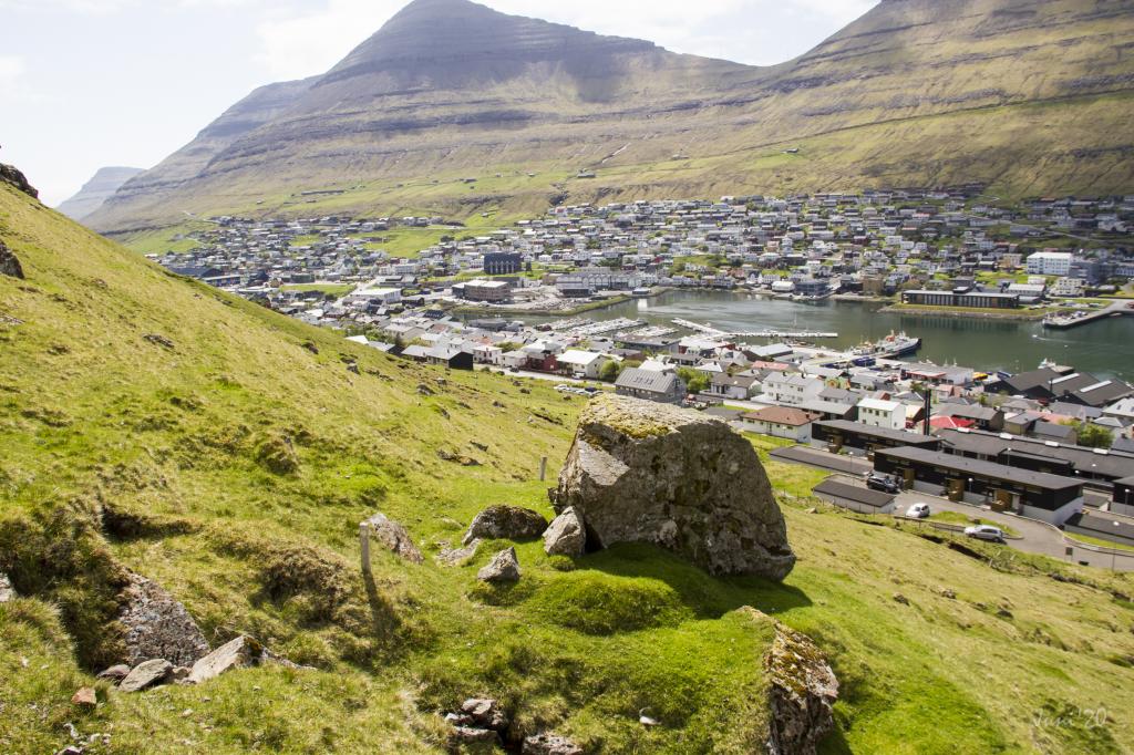
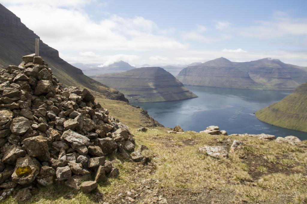
 Klaksvík, seen from the place Norðastustígar. Photo: Óli Gardshodn
 -
 In the beautiful surroundings, close to the gorge Ánagjógv, we pass the cottage of the farmer, Archibald Black. Photo: Óli Gardshodn
 -
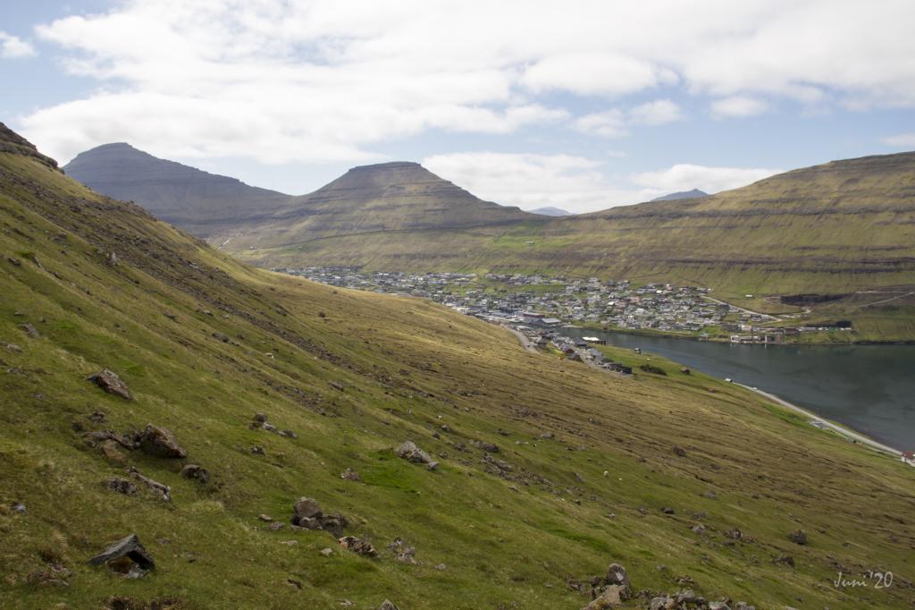
 View from the pass Áarskarð down towards Klaksvík, which we can just see appear on the left. In the background Mt. Gøtunestindur on the island of Eysturoy. Photo: Óli Gardshodn
 -
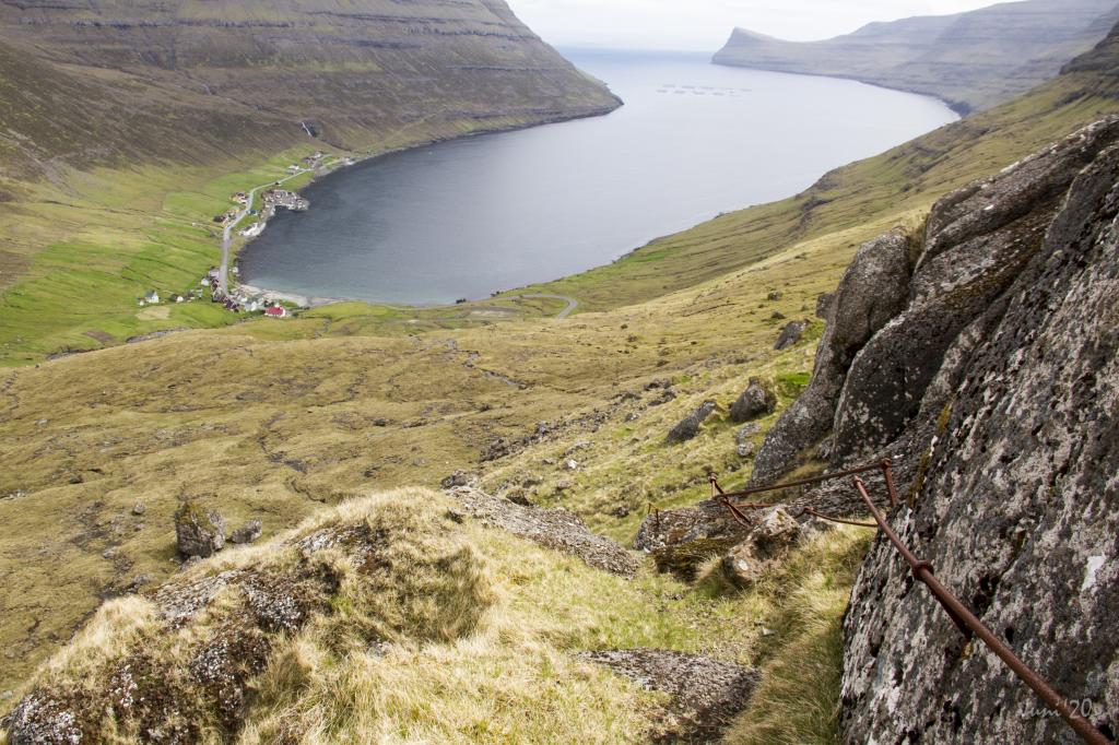 The path down to the village Árnafjørður can seem challenging when you walk down the iron railing through the gorge in Ovarustígar, where some of the steps are chiseled down into the rock. Photo: Óli Gardshodn
 -
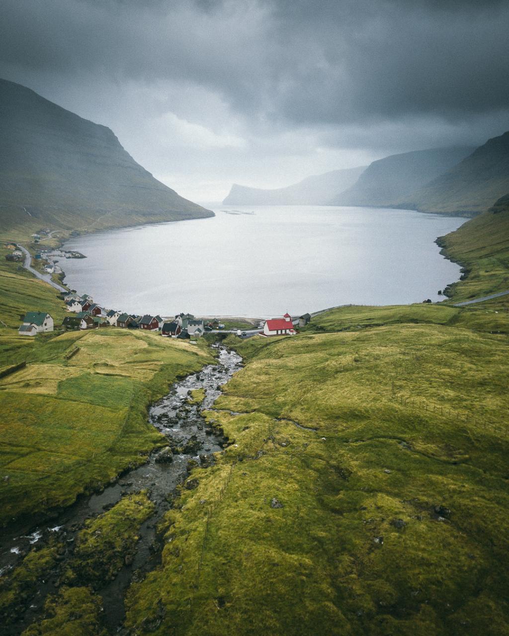 Árnafjørður. Photo: Kristof Massoels
-
The city of Klaksvík. Photo: @aronsche
-
View right over where the village path in Klaksvík starts. In the picture you can see the wooden sticks that you follow all the way to the village Árnafjørður. Photo: Óli Gardshodn
-
As we walk through the peatlands, we enjoy the stunning views of the islands of Kunoy and in the background Kalsoy. Photo: Óli Gardshodn
-
Klaksvík, seen from the place Norðastustígar. Photo: Óli Gardshodn
-
In the beautiful surroundings, close to the gorge Ánagjógv, we pass the cottage of the farmer, Archibald Black. Photo: Óli Gardshodn
-
View from the pass Áarskarð down towards Klaksvík, which we can just see appear on the left. In the background Mt. Gøtunestindur on the island of Eysturoy. Photo: Óli Gardshodn
-
The path down to the village Árnafjørður can seem challenging when you walk down the iron railing through the gorge in Ovarustígar, where some of the steps are chiseled down into the rock. Photo: Óli Gardshodn
-
Árnafjørður. Photo: Kristof Massoels
Experience the challenging Klaksvík - Árnafjørður hike with stunning views of mountains, historic sites, and rugged northern landscapes.
The hike starts by the infield’s gate, just above Undir Kráarbrekku 21 in Klaksvík, also known as Rynkeby. From there you follow the village path north through the pastures of Myrkjanoyrarhagi past a lone cottage.
This outfield belonged to the Faroese national hero Nólsoyar Páll (1766-1809) and has been in the family ever since. Nólsoyar Páll was a shipbuilder, captain, farmer and poet, among other things.
Nólsoyar Páll wrote the satirical ballad, Fuglakvæðið (Bird Ballad), where he made bird caricatures of specific people in the community. The poem prompted anger among the Danish officials in the Faroe Islands, but amusement among ordinary citizens. Nólsoyar Páll disappeared on a voyage in the winter of 1808-1809. The farm of Nólsoyar Páll is being reconstructed at Biskupstøð in the centre of Klaksvík. Be sure to visit there on your way back.
Walk through the old peat fields where residents in Klaksvík dug and dried peat for fuel. Some places you can see ruins from the ancient sod houses. There are many birds in the area, in particular Curlew, Oystercatcher, Golden Plover, Snipe and Herring Gull.
When you get to the area above Ánir and up to Áarskarð, the landscape becomes more rugged. Be careful because some places may be slippery when wet. Áarskarð is a real treat. The view over the nice, small village of Árnafjørður and the high mountains that encircle the village is magnificent. To the south you see Lisshøvdi, and north into the bottom of the valley lays the ancient Thing, Katlarnir, which was the local court for the northern islands in the old days. On both your sides, two high mountains protrude skywards - to the north, Snæfelli, and to the south Myrkjanoyrarfjall.
Take a detour to Katlarnar
Katlarnir was the local Thing for the northern islands for centuries, where sentences were passed in various disputes and crimes. Parliament was in session during the spring. We do not know when it started, but there are signs that it ended around 1670-80. In addition to the great Thing Stones, there are smaller stones scattered on the rocky plateau, which were probably used for issues related to the Thing. To reach Katlarnir you must go diagonally down into the valley. There are cairns, but some of them can be difficult to spot. You enter through the area called Niðari Snæhjalli. As you approach the first large stream in the valley, you come to a fence. Climb carefully over the fence and cross the creek. The old Tingsteinur (Thing Stone) is located here.
You can now choose to continue down to Árnafjørður or return to Klaksvík the same way you came.
Continue to Árnafjørður
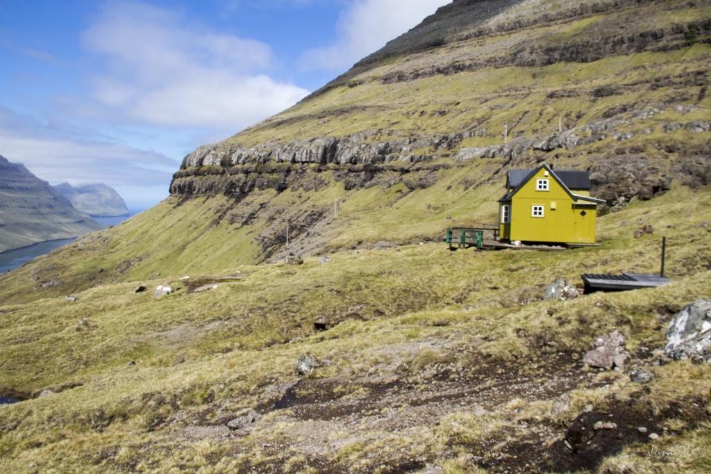
If you choose Árnafjørður, you must walk about 500 metres back towards Áarskarð. However, do not climb Áarskarð again, but maintain roughly the same altitude as Katlarnir until you come to Rossastígar. There is a passage between the rocks where you can head down. Head for the scout hut that is further down where you will find the path down to the road between the two tunnels. Follow the cairns, but be very careful as the terrain is steep in some places.
On your walk you will pass a boulder named Grindasteinur—Pilot Whale Boulder. According to Hanus Poulsen in Árnafjørður – Staðarnøvn, it was here that news of a pilot whale hunt would be shouted down to Árnafjørður, hence the name.
It is challenging to hike down through the path called Ovarustígar, also known as upp í Jørnunum, where the path descends along an iron fence, where some of the steps are chiseled into the rock. The path is marked well with cairns and posts with reflectors.
You come down onto the road between the two tunnels. The distance from here to the village of Árnafjørður is approximately one kilometre.
From the tunnels down to Árnafjørður there are no posts to guide you. Walk closely by the so-called Minhúsið and from there down the path called Válagøtan, which runs along the ridge, to the village just east of the river Stórá and the church. The villagers of Árnafjørður built Minhúsið as shelter from mines that drifted into the bay and blew up.
Árnafjørður is one of the oldest villages in the northern islands and the inhabitants mostly work in salmon farming. There are also good areas for lobster fishing in the fjord.
The hike can be taken in either direction. However, the first ascent is more strenuous if starting in Árnafjørður.


Klaksvík - Árnafjørður
Public Transport
There is public transport between Klaksvík and Tórshavn with Route 400
Arriving by car
Parking, Klaksvík
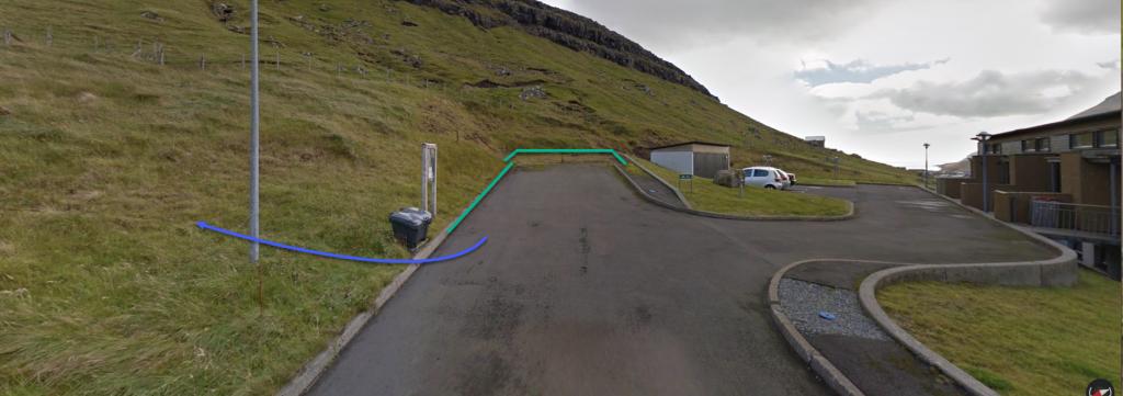
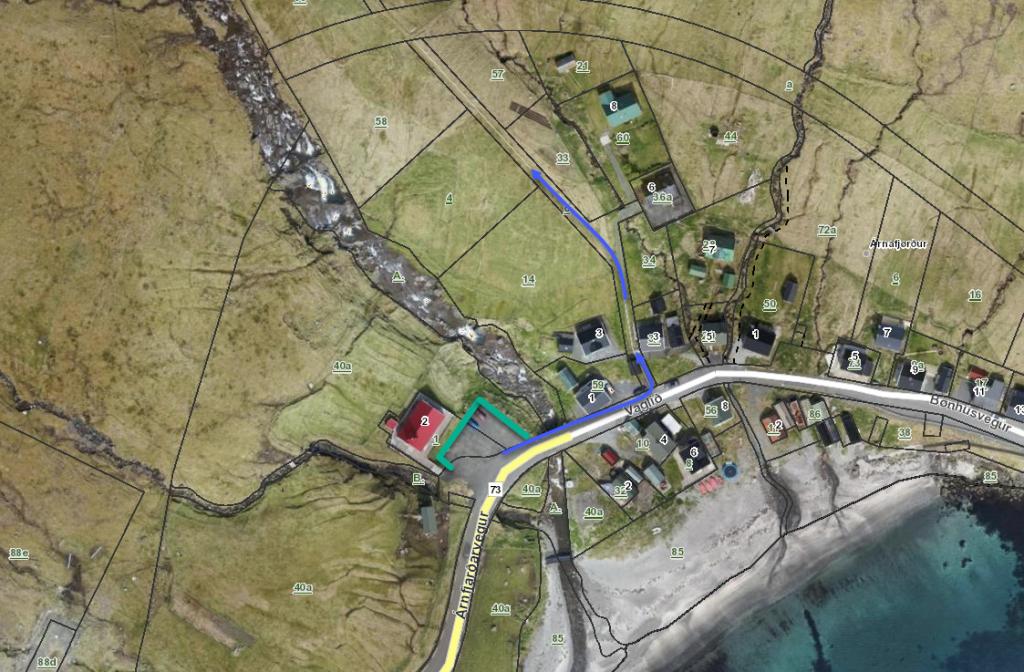
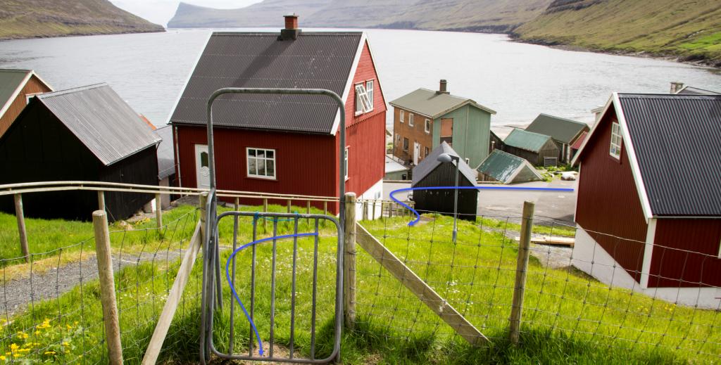
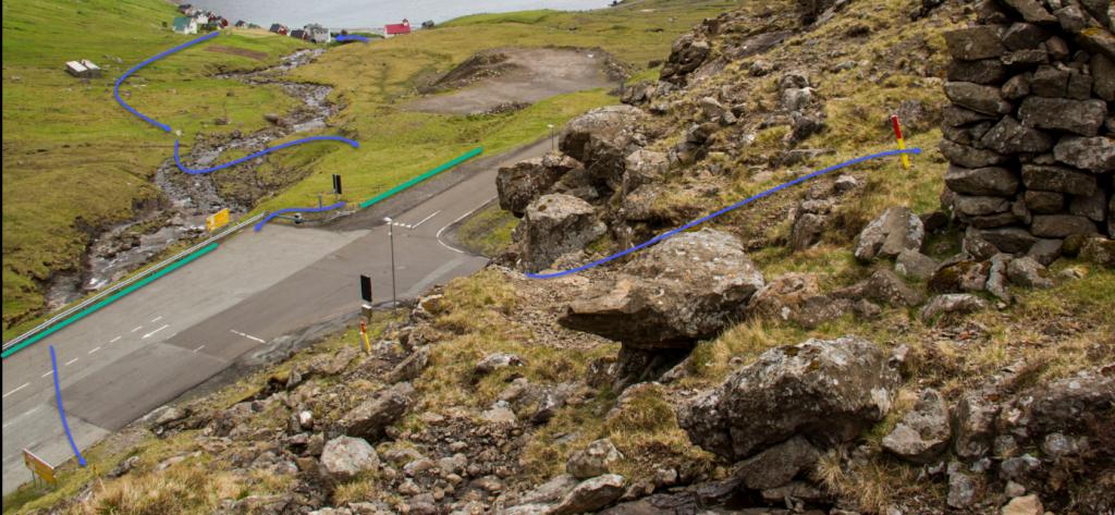
Parking is available in Kráarbrekka, at the end of the road, close to the infield gate. (note the green lines in the photo) From there, follow the blue line through the gate.
-
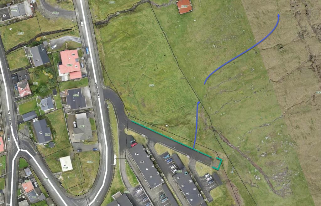 green line represents parking, blue line is the start of the route
 -
 green line represents parking, blue line is the start of the route
 -
 green line represents parking, blue line is the start of the route
Árnafjørður - Klaksvík
Public Transport
There is public transport between Klaksvík and Viðareiði See timetable: Route 500 Klaksvík – Viðareiði.
Arriving by car
Parking, Árnafjørður
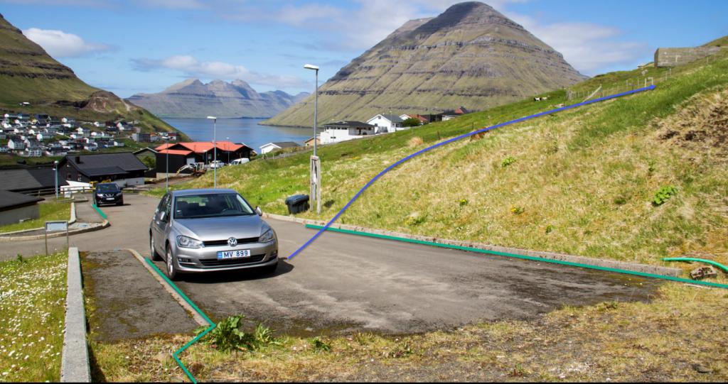
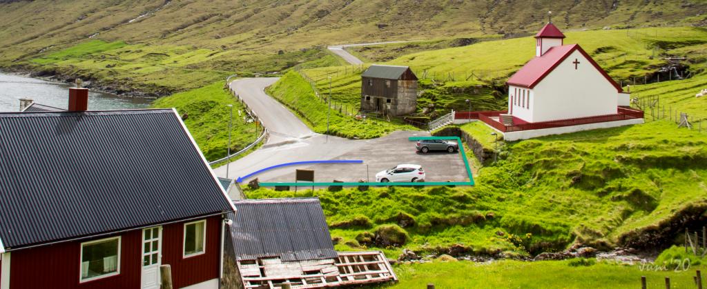
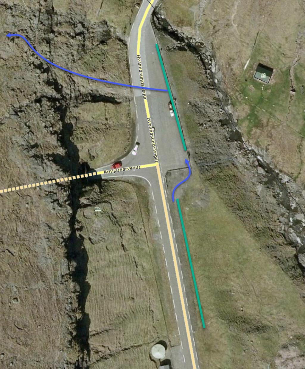
Parking is available by the churches. From there, follow the blue line up to the infield gate. Please do not park here during church services on Sundays, between 11 a.m. and noon. Parking is also available up by the tunnels – note the green lines in the photo.
-
 green line represents parking, blue line is the start of the route
 -
 green line represents parking, blue line is the start of the route
 -
 green line represents parking, blue line is the start of the route
 -
 green line represents parking, blue line is the start of the route
 -
 green line represents parking, blue line is the start of the route
Klaksvík - Árnafjørður
Árnafjørður - Klaksvík
Facts

Duration

distance

Peak

Elevation
 Partly child-friendly, but it is steep down to Árnjafjørður. Recommended only for kids above 8, accompanied by adults
 Difficult
- Steep and loose ground at times – especially above Árnafjørður
Difficult
- Steep and loose ground at times – especially above Árnafjørður
 The terrain shifts between good grass-cover to lose, pebbly ground. Descending to Árnafjørður loose rocks are between the pass Áarskarð and the paths that run through the crags, where iron poles are installed to assist the descent. The terrain is grass-covered between the crags.
On the last stretch, from the tunnels down to the village of Árnafjørður, one first crosses the river Stórá. The paths through the crags of Árnafjørður and Sjálsenni are quite steep
The terrain shifts between good grass-cover to lose, pebbly ground. Descending to Árnafjørður loose rocks are between the pass Áarskarð and the paths that run through the crags, where iron poles are installed to assist the descent. The terrain is grass-covered between the crags.
On the last stretch, from the tunnels down to the village of Árnafjørður, one first crosses the river Stórá. The paths through the crags of Árnafjørður and Sjálsenni are quite steep
