


You haven’t got any favourites yet
This is where you can collect inspiration, articles, events and places that interest you.
Click the icon on pages and they’ll appear here.
Your favourites
Inspiration & Articles
Events & Tours
Places
Hiking
INSPIRATION & ARTICLES
EVENTS & HIKES
Places
Langasandur - Saksun


Link Copied!

-
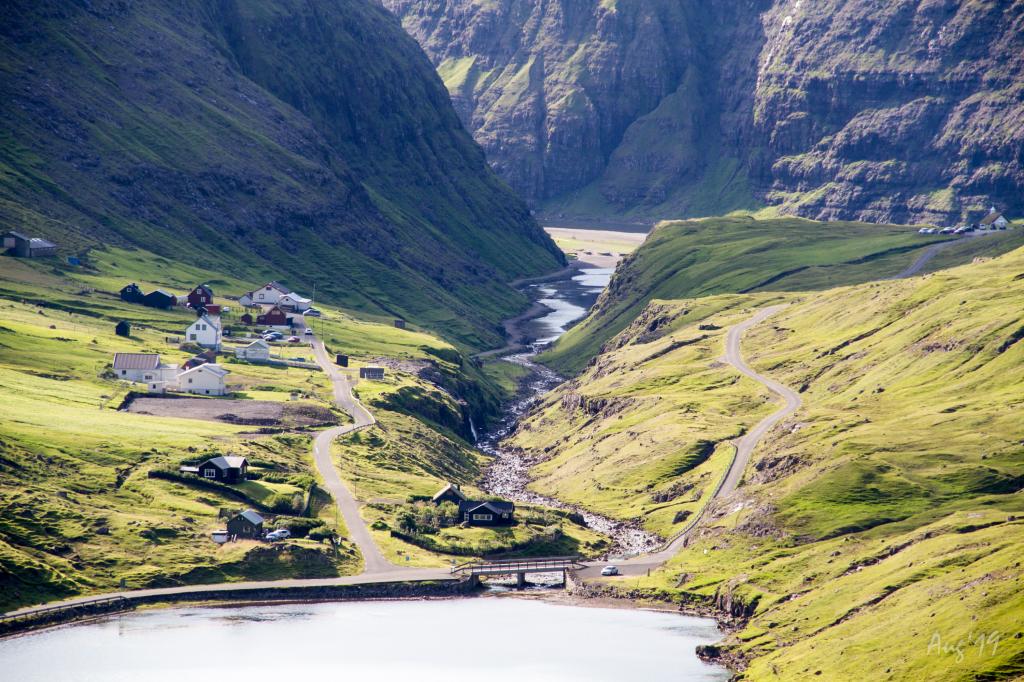
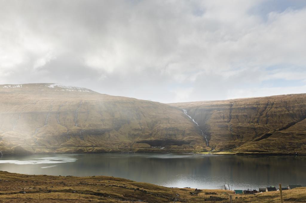 View of Svínáir and Langasandur village. Photo: Alessio Mesiano
 -
 Langasandur. Photo: Óli Gardshodn
 -
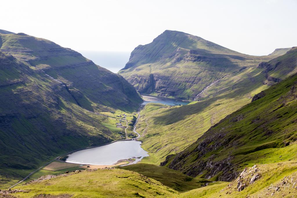
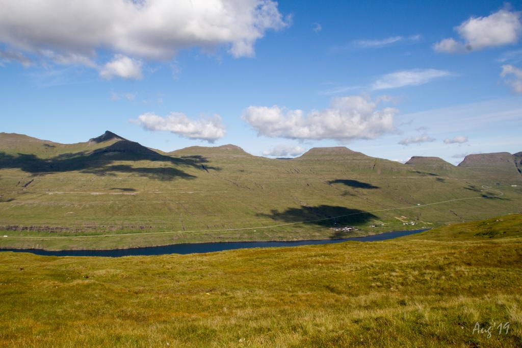 View from Grønabrekka over on the village Svínáir on the Island Eysturoy. Photo: Óli Gardshodn
 -
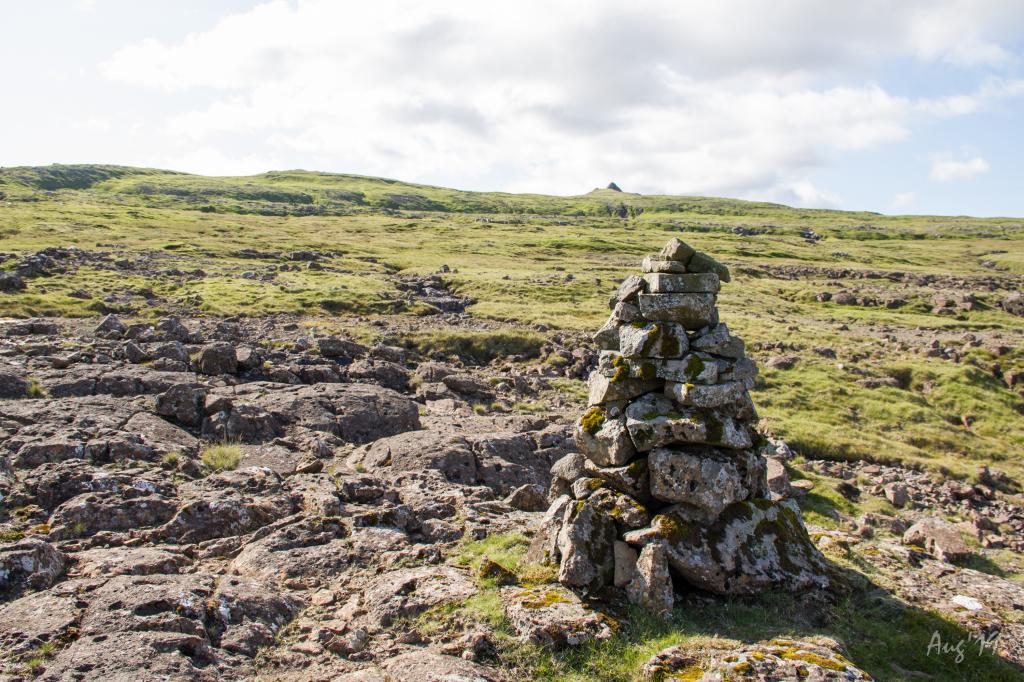 Up towards the mountain Knúkurin on the village path from Langasandur to Saksun. A cairn as signpost. Photo: Óli Gardshodn
 -
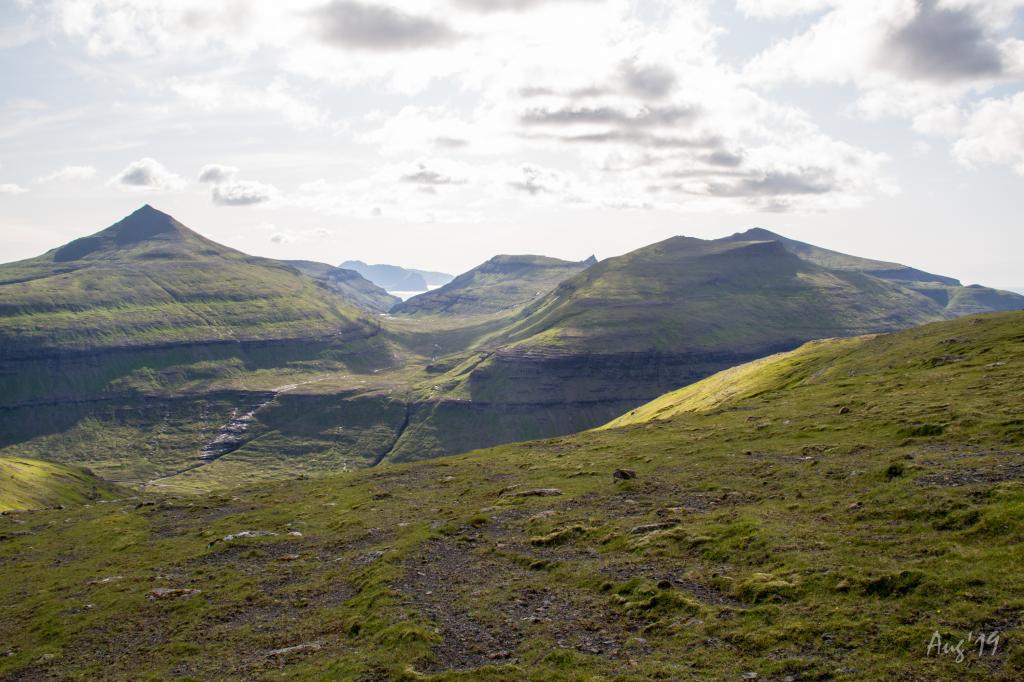 View of the outfield Úti á Dølum, which leads up into the air Dalagjógv. In the background the islands of Vágar and Mykines. Photo: Óli Gardshodn
 -
 View over Saksun from Suður á Gili in the height of 425m. Photo: Óli Gardshodn
 -
 View above Saksun. Photo: Óli Gardshodn
-
View of Svínáir and Langasandur village. Photo: Alessio Mesiano
-
Langasandur. Photo: Óli Gardshodn
-
View from Grønabrekka over on the village Svínáir on the Island Eysturoy. Photo: Óli Gardshodn
-
Up towards the mountain Knúkurin on the village path from Langasandur to Saksun. A cairn as signpost. Photo: Óli Gardshodn
-
View of the outfield Úti á Dølum, which leads up into the air Dalagjógv. In the background the islands of Vágar and Mykines. Photo: Óli Gardshodn
-
View over Saksun from Suður á Gili in the height of 425m. Photo: Óli Gardshodn
-
View above Saksun. Photo: Óli Gardshodn
Langasandur - Saksun offers a peaceful 6 km hike with stunning views, steep climbs, and serene nature in the Faroe Islands.
It is recommended to park by the sheep pen in Langasandur, where the road Rættargøta ends. From there, walk through the sheep pen and continue about 60 metres to an opening in the fence, which takes you to the outfields. Continue straight up the hill until you reach the path. Since the path is not visible from Langasandur, the use of a GPS is recommended.
There is no visible path from Saksun toward Langasandur either, since only a few people take this hike. Four cairns are along the path, all on the last stretch from Langasandur up toward Knúkur, from an elevation of 373 metres up to 505 metres.
There is a big parking lot in Saksun just north of the bridge crossing the lake Saksunarvatn.
The hike can be taken in either direction, weather and mode of transportation deciding which direction is preferable. The hike to Saksun is more beautiful.


Langasandur - Saksun
Public transport
Bus route 202 is driving to and from Langasandur. Route 450 is driving to and from Tórshavn to Oyrarbakki
Arriving by car
Parking, Langasandur
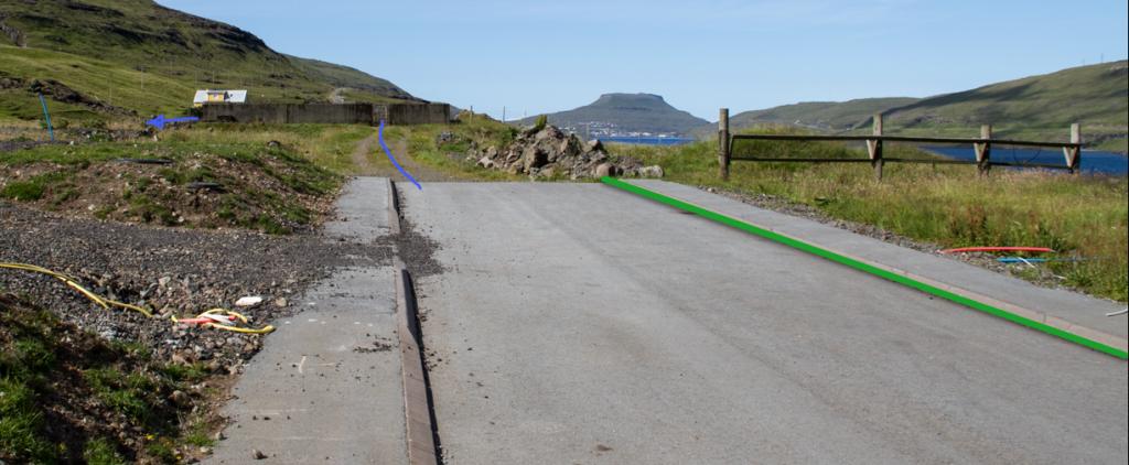
Parking is available by the sheep pen at the end of the road Rættargøta. (see the photo)
-
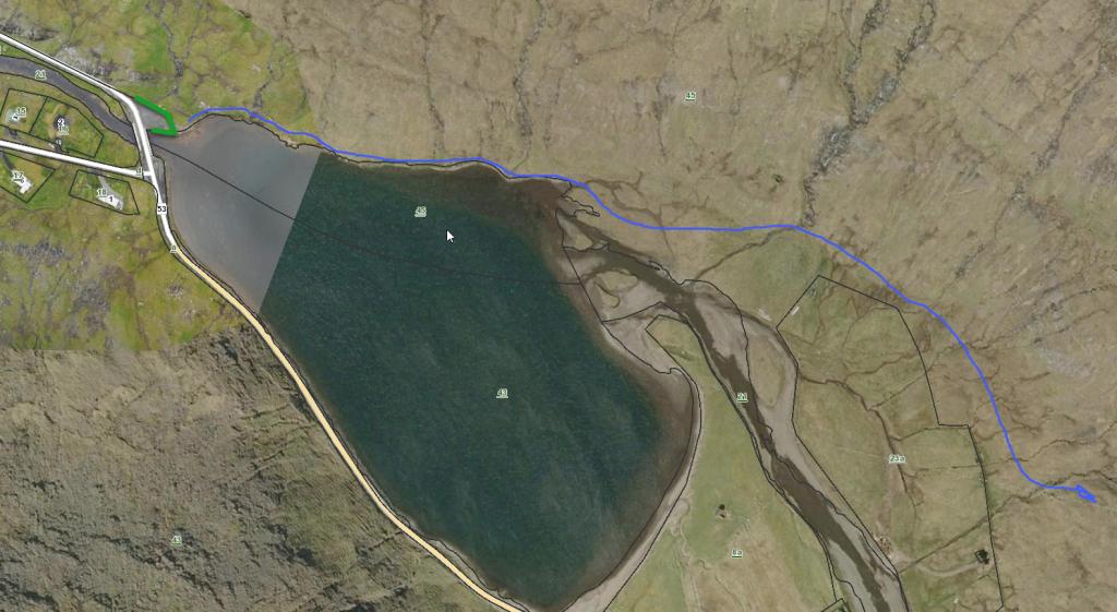
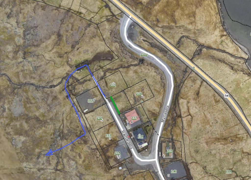 See green line for parking and blue line for starting point
 -
 See green line for parking and blue line for starting point
 -
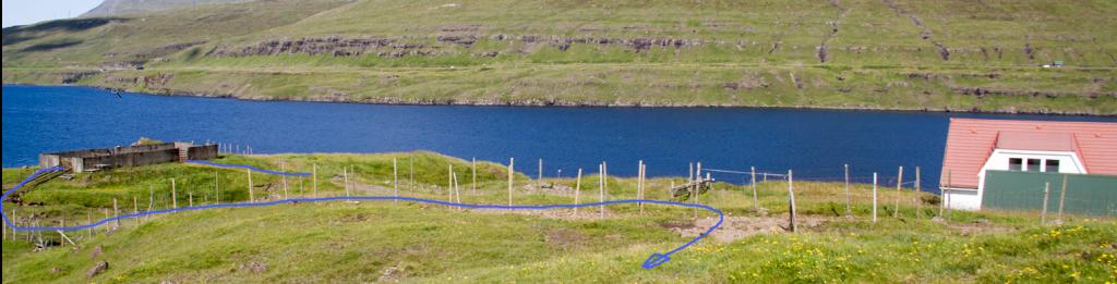 See blue line for starting point
Saksun - Langasandur
Public transport
There is no public transport rute to Saksun
Arriving by car
Parking, Saksun
There is a large parking lot just north of the bridge crossing the lake Saksunarvatn.
-
 See green line for parking and blue line for starting point
 -
 See green line for parking and blue line for starting point
Langasandur - Saksun
Saksun - Langasandur
Facts

Duration

distance

Peak

Elevation
 Suitable for children over ten years
 Difficult
- The path is easy to walk but has significant elevation gain. It is steep in places above Saksun as well as down into the gully above the hollow Koppur. Small children should not walk this stretch unattended
Difficult
- The path is easy to walk but has significant elevation gain. It is steep in places above Saksun as well as down into the gully above the hollow Koppur. Small children should not walk this stretch unattended
 Grass-covered and good for walking throughout. A little rocky, when descending toward Saksun by Koppur, a hollow
