


You haven’t got any favourites yet
This is where you can collect inspiration, articles, events and places that interest you.
Click the icon on pages and they’ll appear here.
Your favourites
Inspiration & Articles
Events & Tours
Places
Hiking
INSPIRATION & ARTICLES
EVENTS & HIKES
Places
Langasandur - Streymnes


Link Copied!

-
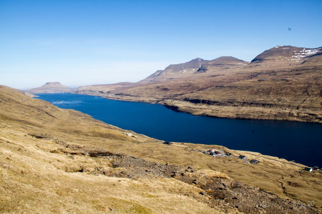 View from Stígarnir, above the village of Langasandur, over the strait between the islands Streymoy and Eysturoy. In the background the village of Eiði. Photo: Óli Gardshodn
 -
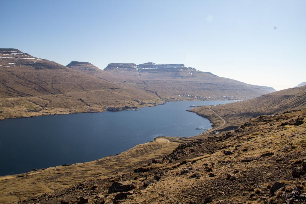 View from Stígarnir, over the village of Langasandur, over the strait between the islands of Streymoy and Eysturoy. In the background the bridge over the strait. Photo: Óli Gardshodn
 -
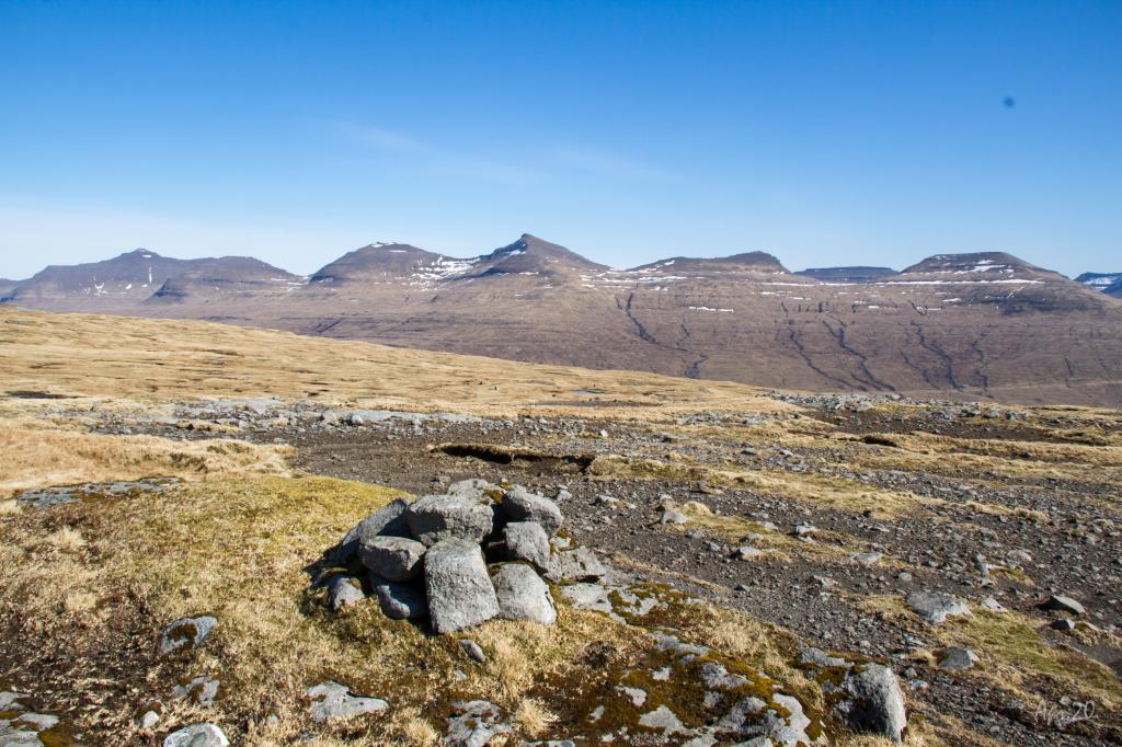 The highest point on the route at 354m. the cairn at the pass Streymneshálsur. Photo: Óli Gardshodn
 -
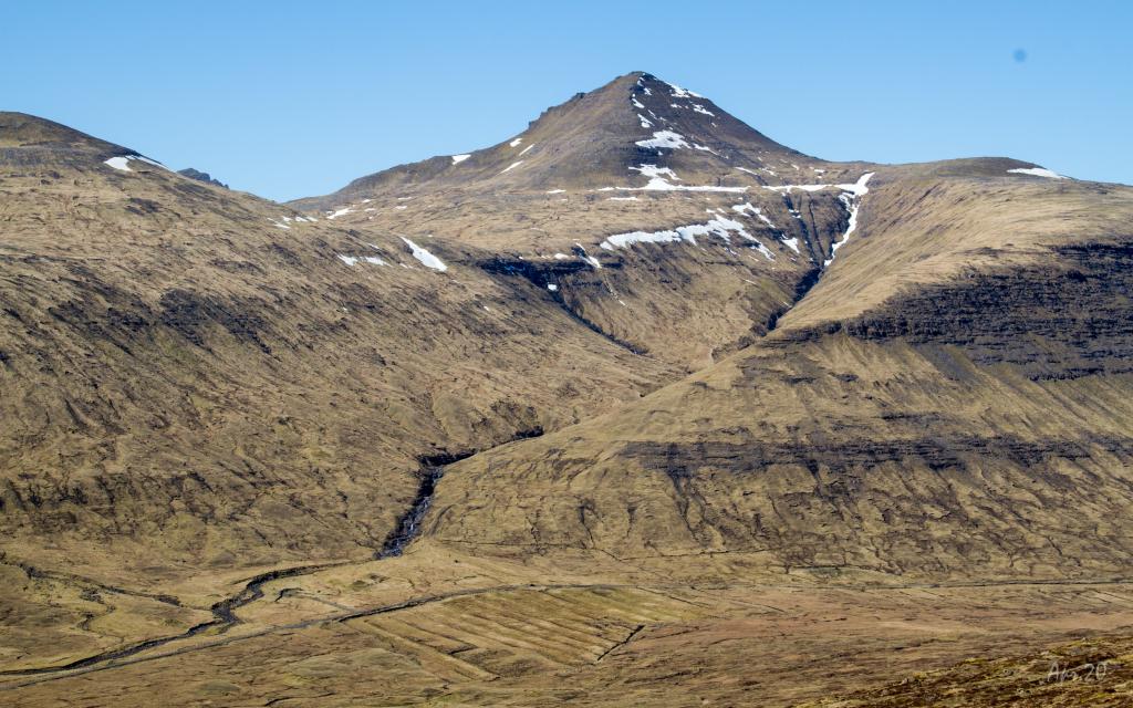 The mountain Ørvisfelli in Saksunardali. With its 783m. is the second highest mountain on Streymoy. The village path between Saksun and Vestmanna goes up through the valley to the left of Ørvisfelli. Photo: Óli Gardshodn
 -
 Stórá in Saksunardalur. If it has been dry for a few days, it is easy to get across the river. Otherwise, if much water is in the river, you need to wade or walk 800 m. north up to the bridge. Photo: Óli Gardshodn
-
View from Stígarnir, above the village of Langasandur, over the strait between the islands Streymoy and Eysturoy. In the background the village of Eiði. Photo: Óli Gardshodn
-
View from Stígarnir, over the village of Langasandur, over the strait between the islands of Streymoy and Eysturoy. In the background the bridge over the strait. Photo: Óli Gardshodn
-
The highest point on the route at 354m. the cairn at the pass Streymneshálsur. Photo: Óli Gardshodn
-
The mountain Ørvisfelli in Saksunardali. With its 783m. is the second highest mountain on Streymoy. The village path between Saksun and Vestmanna goes up through the valley to the left of Ørvisfelli. Photo: Óli Gardshodn
-
Stórá in Saksunardalur. If it has been dry for a few days, it is easy to get across the river. Otherwise, if much water is in the river, you need to wade or walk 800 m. north up to the bridge. Photo: Óli Gardshodn
Langasandur - Streymnes hike offers easy trails with stunning views of Saksunardalur valley and the Streymoy-Eysturoy strait.
Having ascended from Langasandur, go first south along Ryssheiðar and Slættin, a beautiful and pleasant plain just above Langasandur. From there, go straight up the hillside Stígarnir. This stretch is somewhat strenuous but is grass-covered and good to walk. The rest of the hike is easy.
In Langasandshagi, first cross the beautiful river Norðara Gjánagjógvará, then continue on the plain for just over a kilometre until you reach the pass Streymneshálsur. From there, descend into the valley Saksunardalur, where you, for the most part, walk along the pleasant river Streymnesá and the steep area by the waterfalls called Streymnesfossar.
When you have descended to level ground, go across Dalá, a beautiful river, where you will reach the main road. In summertime, when it is dry, it is fairly easy to cross the river if you have normal hiking boots. However, the rocks in the river may be slippery. If it is rainy, the river swells, making it necessary to wade through it. Another option is to walk about 800 metres up the river, where a bridge crosses it.
Few people take this hike, making it a peaceful walk. The views over the strait between Streymoy and Eysturoy, the valley Saksunardalur and the surrounding mountains is both beautiful and varied.
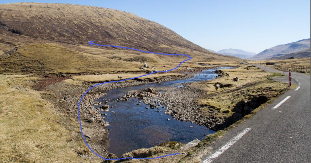
When crossing Dalá, look for the best place to cross. Weather permitting, it is possible to walk from the corner of the tributary between Dalá and Streymnesá, going a few metres down along the tributary and then straight across – as the gpx-file also shows.


Langasandur - Streymnes
Public transport
There is no bus-stop in Langasandur. The closest bus-stop is in Oyrabakki, which is a bus-stop for a few routes, incl. Tórshavn.
Arriving by car
Parking, Langasandur
Parking is available at the end of the road Rættargøta. Walk through the sheep pen and through an opening in the fence just outside the pen. (see the photo)
-
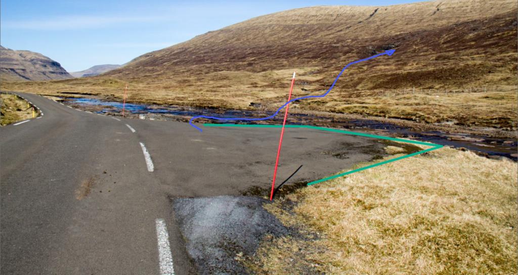
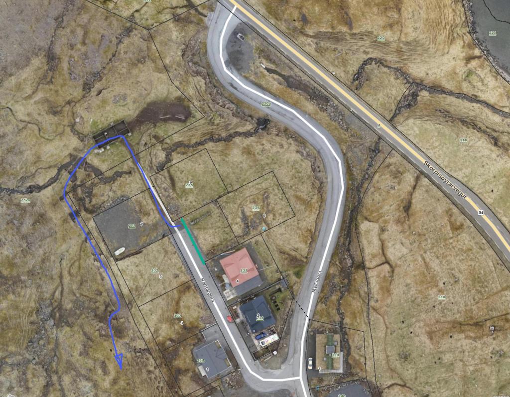 parking (green) and starting point (blue)
 -
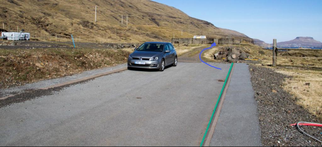 parking (green) and starting point (blue)
 -
 starting point (blue)
Streymnes - Langasandur
Public transport
Route 450 stops in Hvalvík (next to Streymnes)
Arriving by car
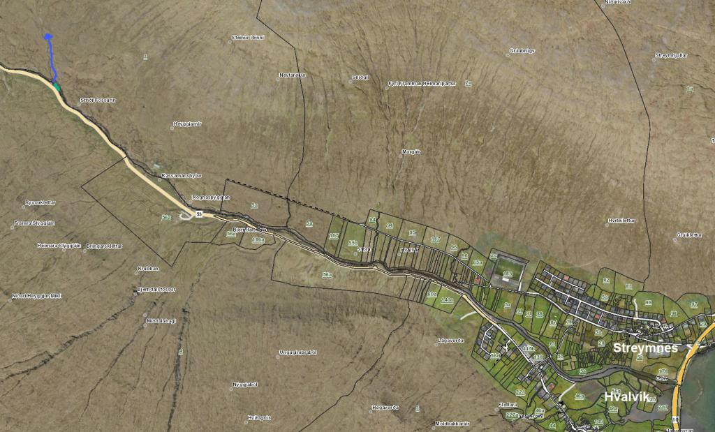
The path begins in the valley Saksunardalur, about 3.8 km from the bus stop in Hvalvík.
A fairly big parking lot is close by. From there, cross the river Dalá and follow the river Streymnesá. (see the photos)
-
 starting point (blue)
 -
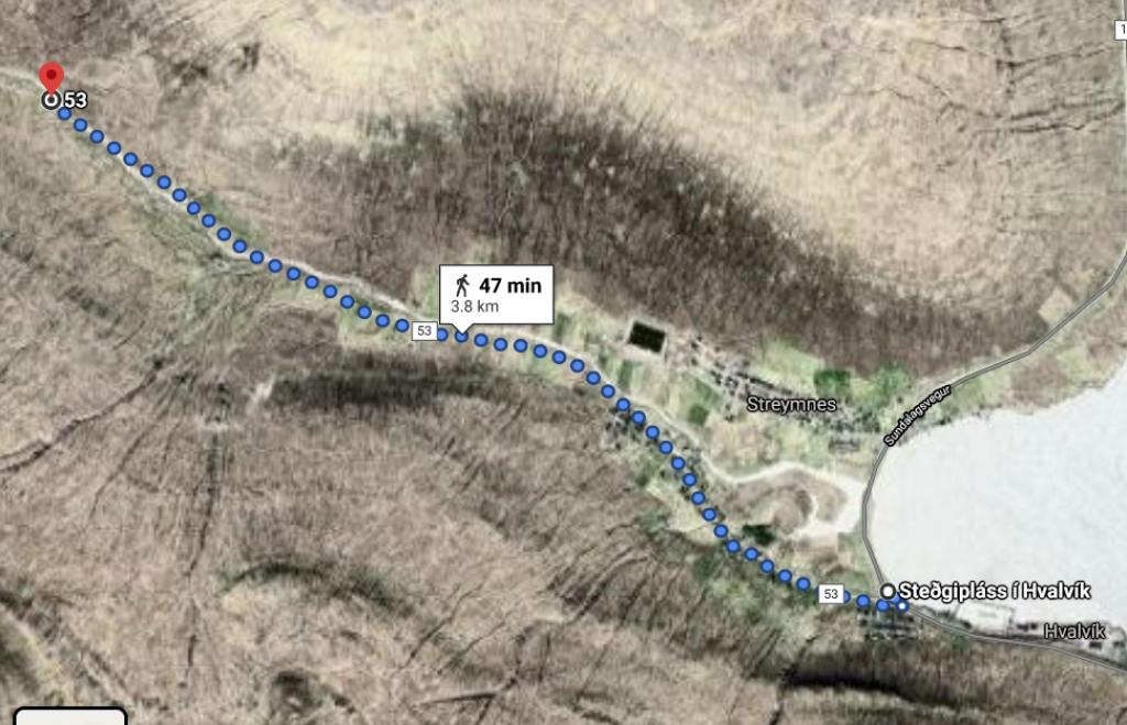 from bus stop to starting point
 -
 parking (green) and starting point (blue)
 -
 starting point (blue)
Langasandur - Streymnes
Streymnes - Langasandur
Facts

Duration

distance

Peak

Elevation
 Suitable for kids above 6 years
 Medium
- It can be a challenge to find the right place to cross Dalá if waters are high, even though the river is shallow and its current weak. Smaller children will most likely need to be carried across. Another option is to walk 800 metres toward Saksun, where a bridge crosses the river
Medium
- It can be a challenge to find the right place to cross Dalá if waters are high, even though the river is shallow and its current weak. Smaller children will most likely need to be carried across. Another option is to walk 800 metres toward Saksun, where a bridge crosses the river
 Grass-covered for the most part. There is quite a bit of heather by the river Streymnesá, turning a little rocky by the water falls Streymnesfossar
