


You haven’t got any favourites yet
This is where you can collect inspiration, articles, events and places that interest you.
Click the icon on pages and they’ll appear here.
Your favourites
Inspiration & Articles
Events & Tours
Places
Hiking
INSPIRATION & ARTICLES
EVENTS & HIKES
Places
Norðradalur – Syðradalur


Link Copied!

-
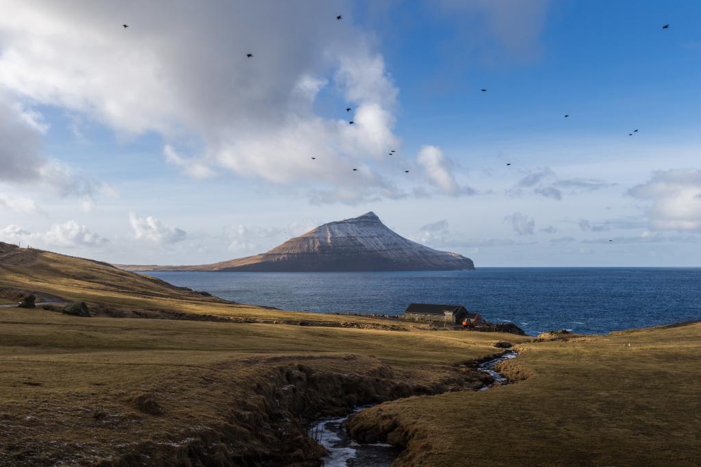 Syðradalur on Streymoy. Koltur in the background. Photo: Alessio Mesiano
 -
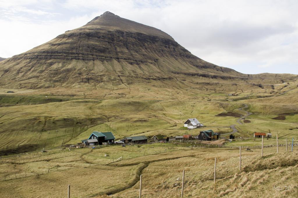 Hiking on the villagepath from Norðradalur to Syðradalur Faroe Islands. Photo: Óli Gardshodn
 -
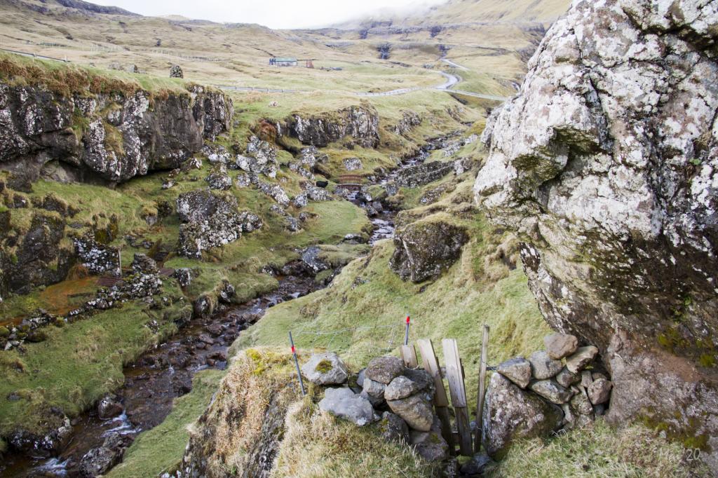 The village path starts in the beautiful gorge in Norðradalur, leading you to the southern part of the village and on to the slope of a mountain. Photo: Óli Gardshodn
 -
 The path is not maintained. At times it is difficult to spot and is also cut off by landslips in places, making it necessary to hike up over the landslips to cross them more easily. Photo: Óli Gardshodn
 -

-

-

-
Syðradalur on Streymoy. Koltur in the background. Photo: Alessio Mesiano
-
Hiking on the villagepath from Norðradalur to Syðradalur Faroe Islands. Photo: Óli Gardshodn
-
The village path starts in the beautiful gorge in Norðradalur, leading you to the southern part of the village and on to the slope of a mountain. Photo: Óli Gardshodn
-
The path is not maintained. At times it is difficult to spot and is also cut off by landslips in places, making it necessary to hike up over the landslips to cross them more easily. Photo: Óli Gardshodn
-
-
-
Norðradalur – Syðradalur offers an exciting, steep hike with stunning views and a peaceful break spot at Dalagjógv gorge.
The village path starts in the beautiful gorge in Norðradalur, leading you to the southern part of the village and on to the slope of a mountain. Walk southward along the slope under Mt. Tungliðfjall. You must be at an altitude of 108 metres when crossing the cleft Tungulíðgjógvs, otherwise the path is mostly at an elevation of 75-80 metres.
The path is not maintained. At times it is difficult to spot and is also cut off by landslips in places, making it necessary to hike up over the landslips to cross them more easily.
Several steep slopes are just south of the gorge Tunguliðgjógv, a beautiful and pleasant place. The southern stretch of the hillside may seem quite challenging since you hike close to the edge of the steep coastline.
The gate found in the fence by the gorge Tunguliðgjógv has been moved from an elevation of 30 metres to an elevation of 108 metres.


Norðradalur - Syðradalur
Public Transport
There is no public transportation to Norðradalur or Syðradalur.
Arriving by car
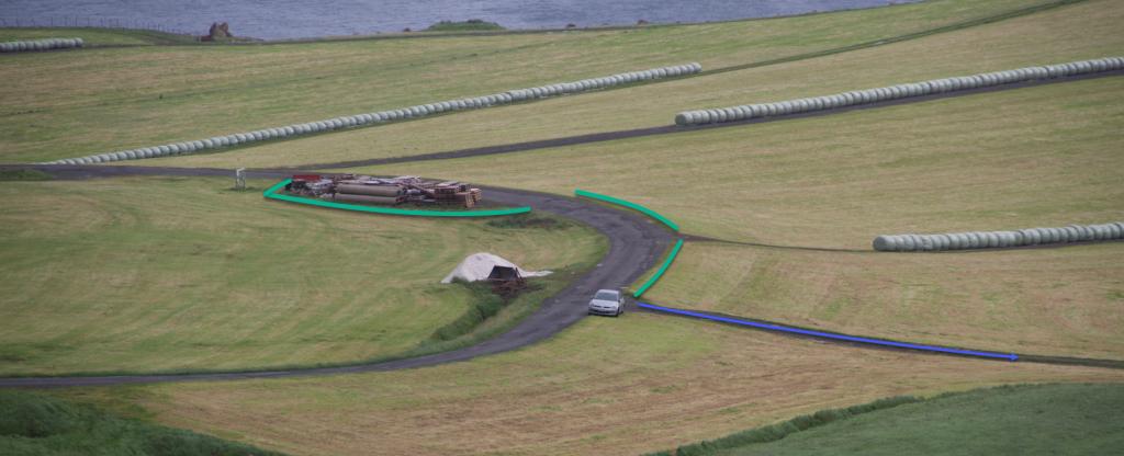
Parking, Norðradalur
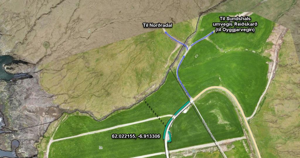
There is a large parking lot by the bridge where the road splits in two. Another parking lot is found down in the eastern part of the village. From here, walk through the gate above the easternmost house, Norðradalsvegur 1, and go uphill. (see the photos)
-
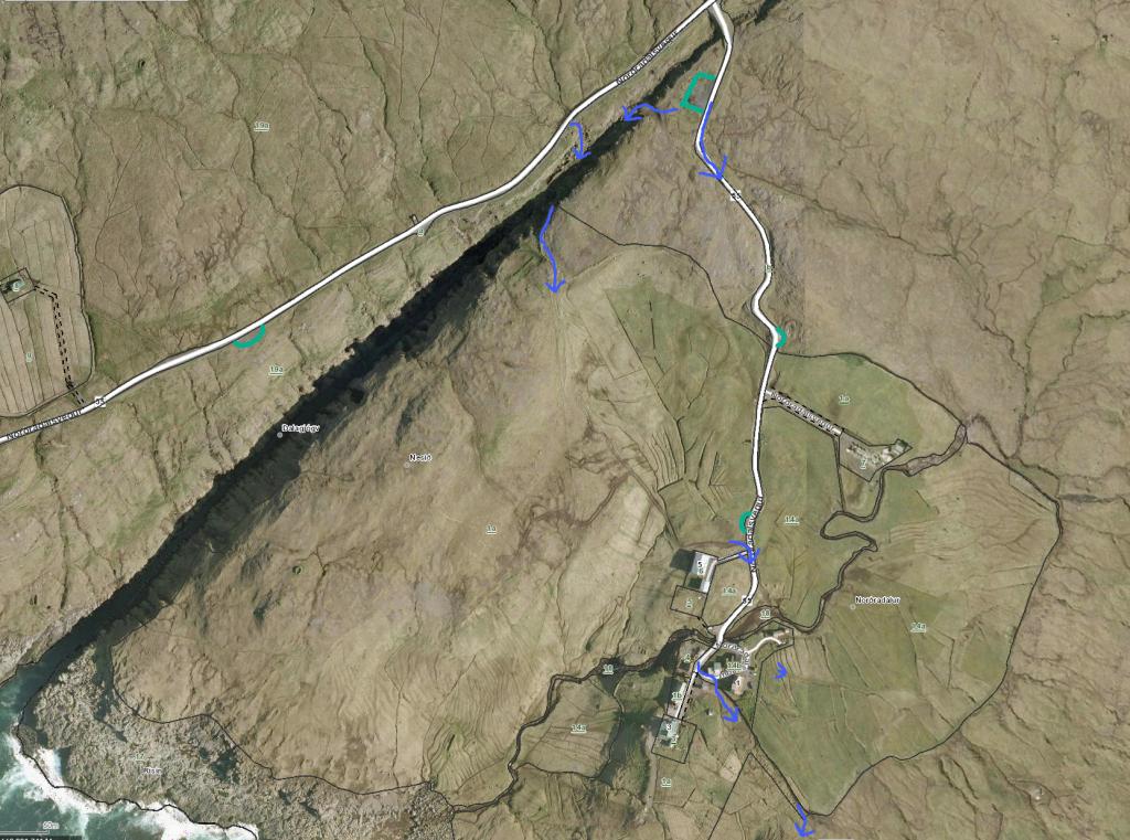 See green line for parking and blue line for starting point
 -
 See green line for parking and blue line for starting point
 -

-

Syðradalur - Norðradalur
Public Transport
There is no public transportation to Norðadalur or Syðradalur.
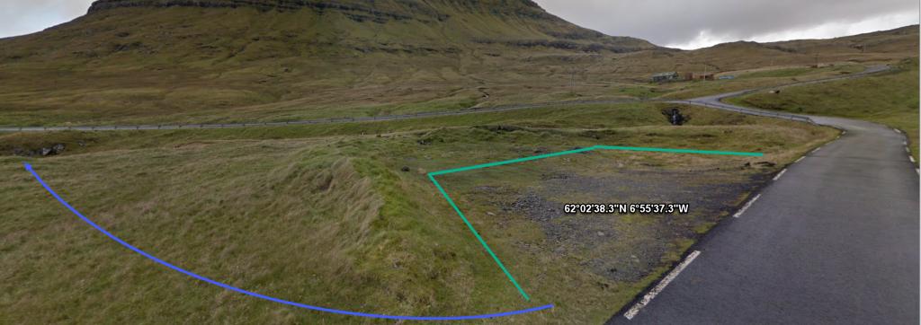
Parking, Syðradalur
There is good parking in Syðradalur. If there are no spaces left in the big parking lot, you can park your car where the road to the allotments starts. From there, walk toward the gate. (see the photos)
-
 See green line for parking and blue line for starting point
 -
 See green line for parking and blue line for starting point
 -
 See green line for parking and blue line for starting point
Norðradalur - Syðradalur
Syðradalur - Norðradalur
Facts

Duration

distance

Peak

Elevation
 Suitable with children over 10 years
 Difficult
- It is difficult to spot the path and it is cut off in places by landslips. On certain stretches you will hike close to the edge of a steep coastline, which some may find vertiginous
Difficult
- It is difficult to spot the path and it is cut off in places by landslips. On certain stretches you will hike close to the edge of a steep coastline, which some may find vertiginous
 The path is grass-covered and good for walking throughout. However, the hillside is quite steep and the path is not maintained
