


You haven’t got any favourites yet
This is where you can collect inspiration, articles, events and places that interest you.
Click the icon on pages and they’ll appear here.
Your favourites
Inspiration & Articles
Events & Tours
Places
Hiking
INSPIRATION & ARTICLES
EVENTS & HIKES
Places
Norðskála - Funningsfjørður


Link Copied!

-
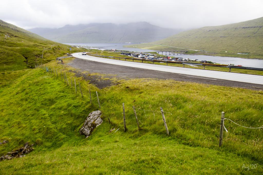
 The view in 250m. height down over the village of Norðskála and the bridge between the islands of Eysturoy and Streymoy. In the background the village Hvalvík. Photo: Óli Gardshodn
 -
 The car park by the river Tippisáin in Norðskála where the village path to Funningsfjørður begins. Photo: Óli Gardshodn
 -
 The old peat fields along the river Tippisáin in Norðskála, where you still can see the many old peat sheds. Photo: Óli Gardshodn
 -
 View over the old peat fields in Norðskála, where you still can see the many old peat sheds. Photo: Óli Gardshodn
 -
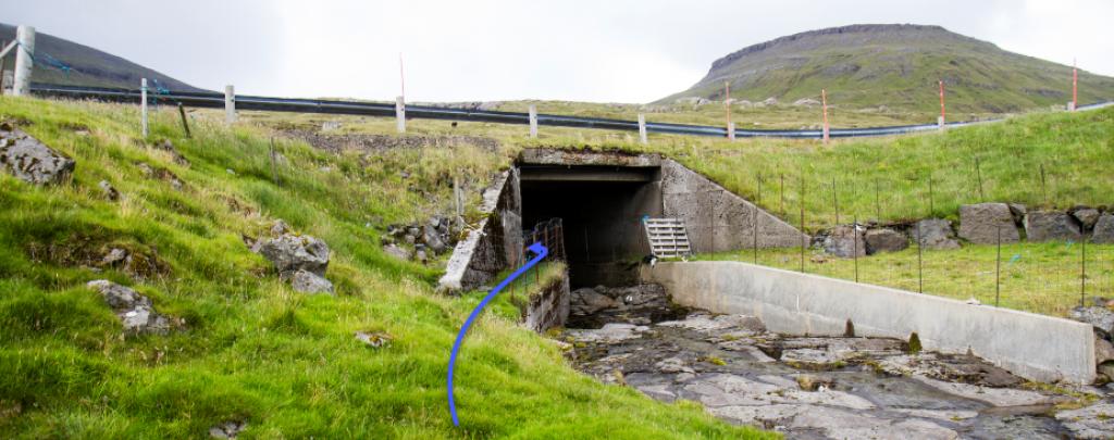
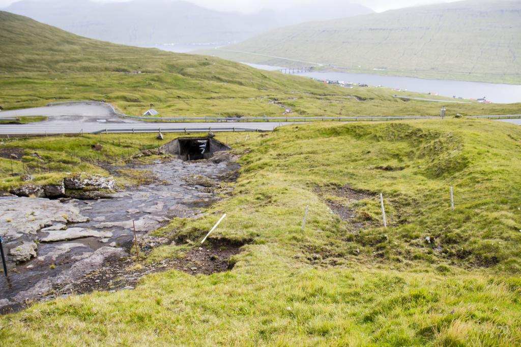 The passage under the bridge at the river Tippisáin. Photo: Óli Gardshodn
 -
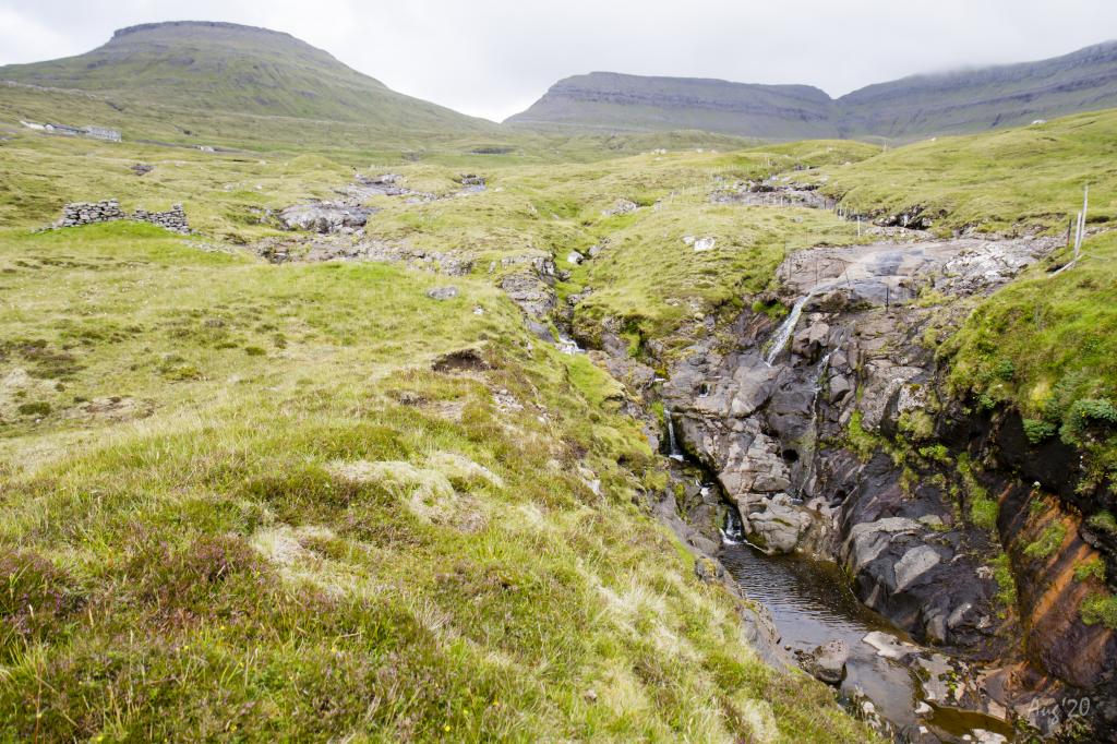
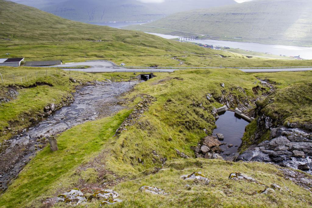 In many places in areas, dams are seen leading the water into underground tunnels that carry the water up to the hydropower plant at the village of Eiði. Photo: Óli Gardshodn
 -
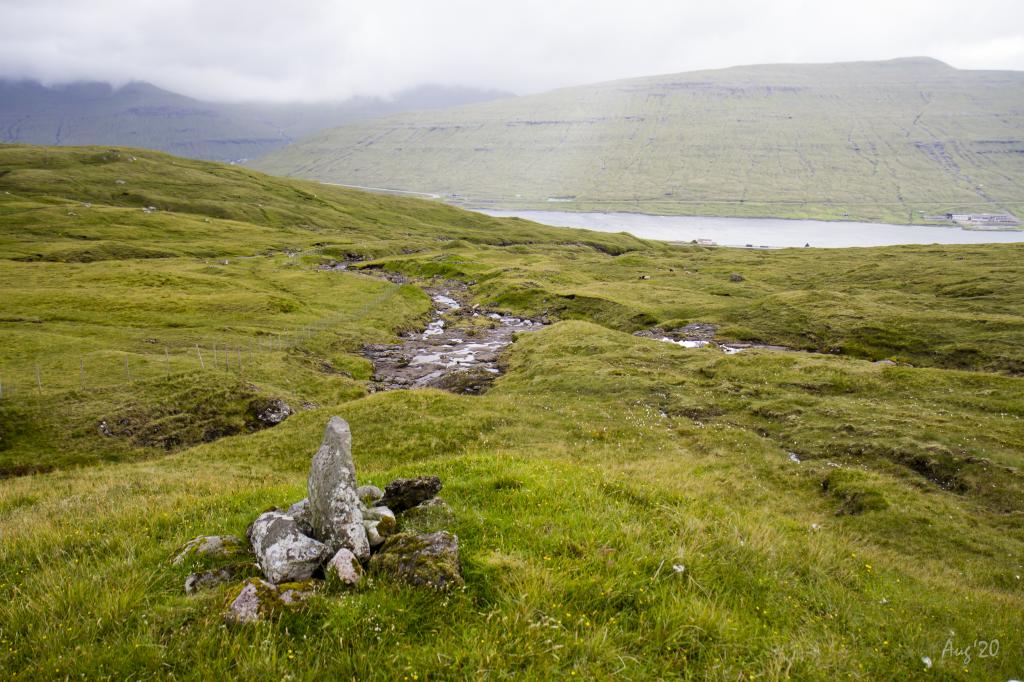
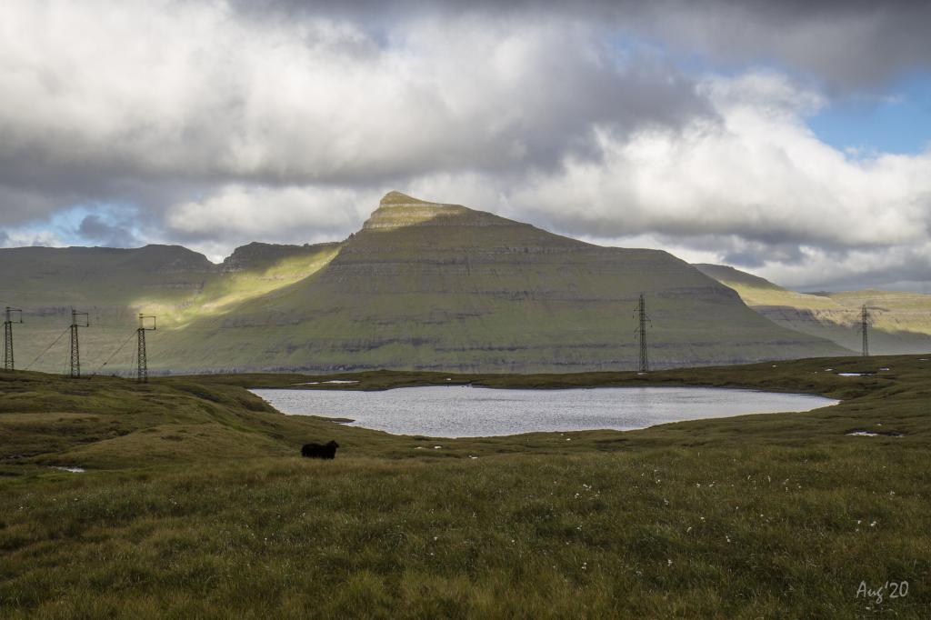 View from the pass Skálaskarð down over the lake Hagavatn. In the background the mountain Múlatindur. Photo: Óli Gardshodn
 -
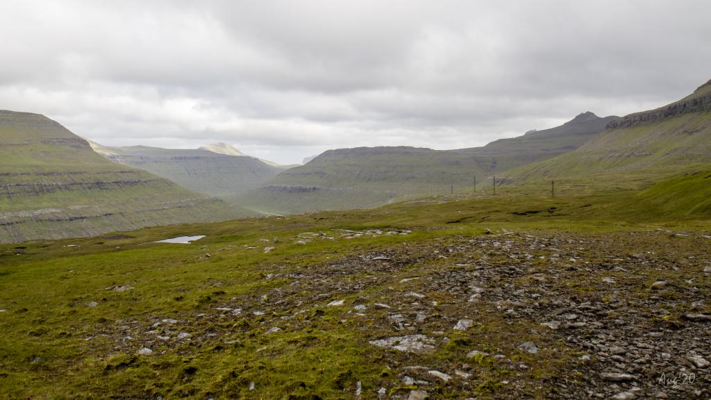 The view below Hagavatn in a southerly direction towards Millum Fjarða leading to the fjord Skálafjørður. Photo: Óli Gardshodn
 -
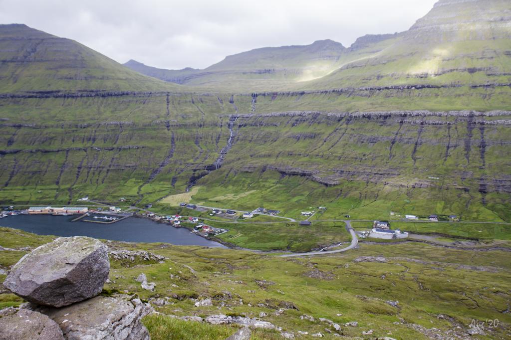 Funningsfjørður up from Reiðgøta. At the top of the picture to the left we see the wide pass that leads to the valley down to the village of Elduvík. Photo: Óli Gardshodn
-
The view in 250m. height down over the village of Norðskála and the bridge between the islands of Eysturoy and Streymoy. In the background the village Hvalvík. Photo: Óli Gardshodn
-
The car park by the river Tippisáin in Norðskála where the village path to Funningsfjørður begins. Photo: Óli Gardshodn
-
The old peat fields along the river Tippisáin in Norðskála, where you still can see the many old peat sheds. Photo: Óli Gardshodn
-
View over the old peat fields in Norðskála, where you still can see the many old peat sheds. Photo: Óli Gardshodn
-
The passage under the bridge at the river Tippisáin. Photo: Óli Gardshodn
-
In many places in areas, dams are seen leading the water into underground tunnels that carry the water up to the hydropower plant at the village of Eiði. Photo: Óli Gardshodn
-
View from the pass Skálaskarð down over the lake Hagavatn. In the background the mountain Múlatindur. Photo: Óli Gardshodn
-
The view below Hagavatn in a southerly direction towards Millum Fjarða leading to the fjord Skálafjørður. Photo: Óli Gardshodn
-
Funningsfjørður up from Reiðgøta. At the top of the picture to the left we see the wide pass that leads to the valley down to the village of Elduvík. Photo: Óli Gardshodn
Norðskála - Funningsfjørður offers a scenic 4km hike across Skálaskarð pass by lake Hagavatn with stunning views.
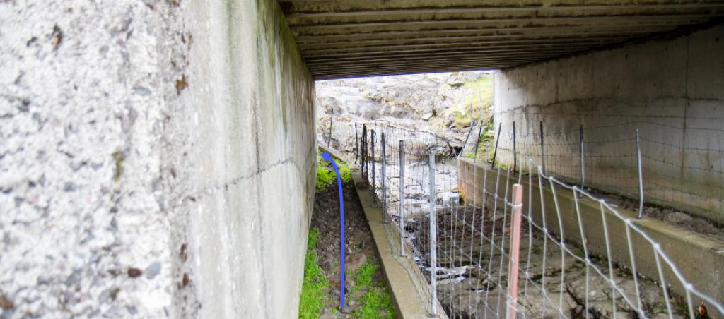
The hike commences by the large parking lot above the gorge Skálagjógv. Walk up along the beautiful river Tippisá, and when you reach the valley Uppi í Dal, continue up through the old peat fields, where you still can see the many old peat sheds. To cross the high road, go under the left side of the bridge. You need to open a fence to cross it. Above the road, you will reach the fascinating gorge Fossagjógv. Here you can enjoy good views over Sundini (the strait between Eysturoy and Streymoy), the village of Streymnes, and the peaks above it. Continue up along the river Tippisá and across the pass Skálaskarð. As the gate is blocked (August 2020), you must climb the fence. The stretch down to Funningsfjørður runs along the 170-metre-long lake Hagavatn; from there, continue straight down to the sheep shed by the road to the village Funningur opposite the village itself. The last grass-covered hills down to the village are steep, so be careful not to slip. If a ladder has not been installed, you must climb over a fence down to the fiord. The hike can be taken in either direction. Taking the trip from Funningsfjørður is significantly more strenuous.


Norðskáli - Funningsfjørður
Public transportation
Oyrarbakki is one of the major stops in the public transportation network in the Faroe Islands. SSL route 450 (Skálafjørður —Kollafjørður) also stops there. It is about 1,225 metres from the bus stop to the village path.
There is no bus connection to Funningsfjørður.
Arriving by car
Parking, Norðskáli
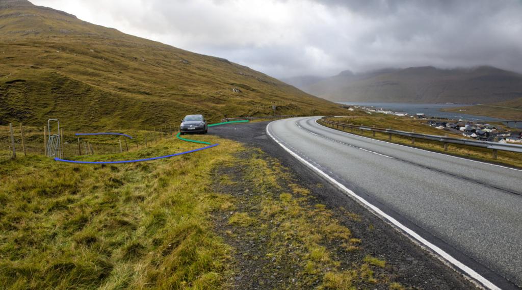
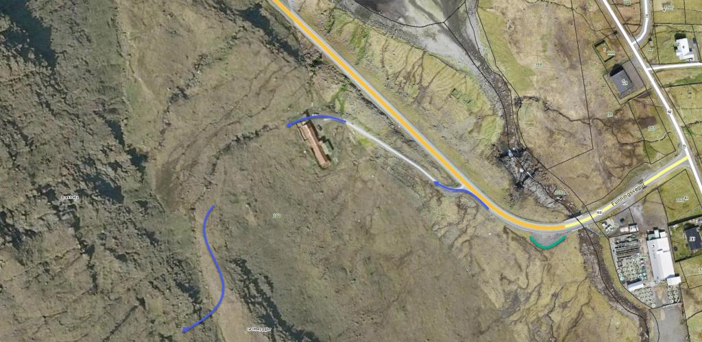
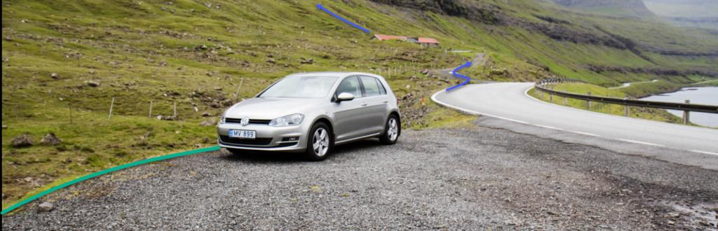
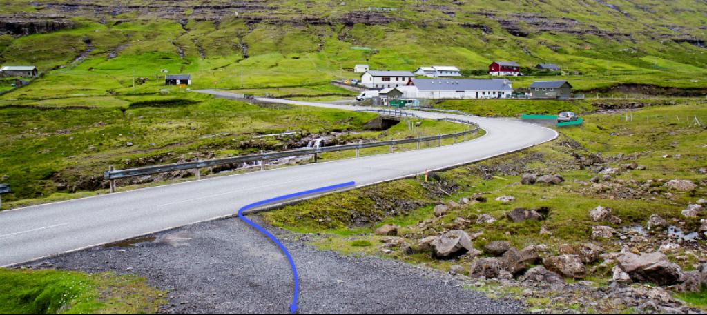
In Norðskáli, you can park in the parking lot next to where the village path starts. Drive up the hill from the petrol station Magn for 975 metres to reach the parking lot (see the green line). From there, follow the blue line up along the northern riverbank. To cross the main road, go under the bridge close to the tunnel portal.
You will find the first cairn just above the bridge. From here, cairns will lead you the whole way to Funningsfjørður.
-
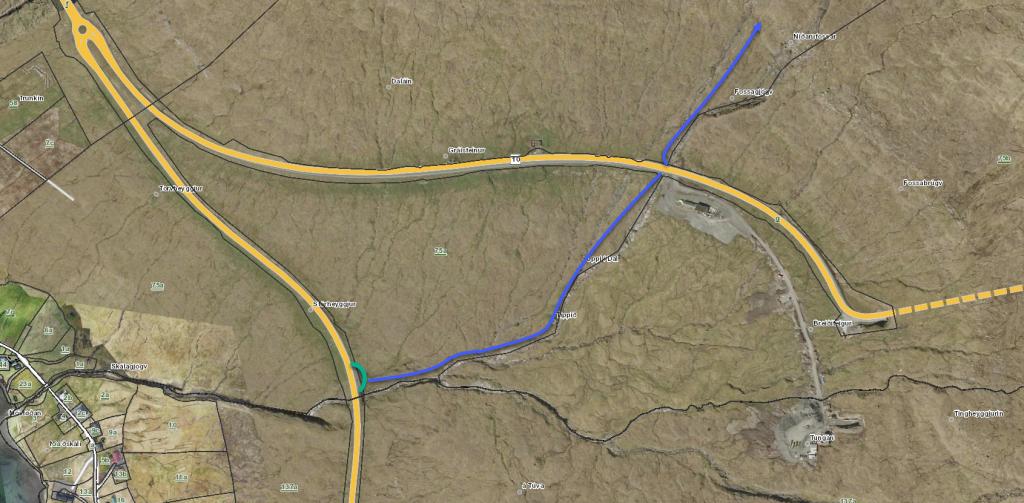 See green line for parking and blue line for starting point
 -
-
-
-
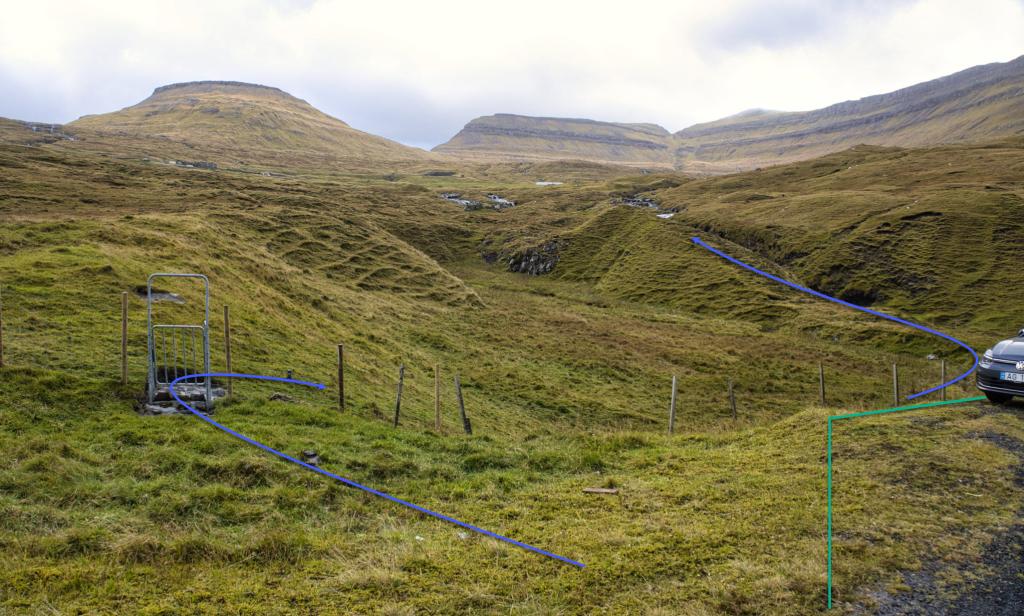
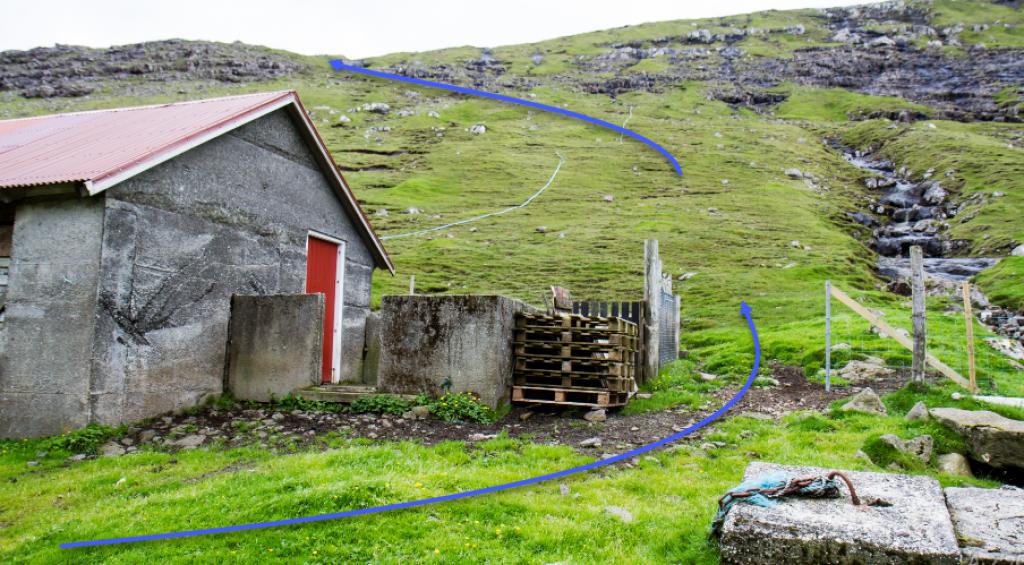
 See blue line for starting point.
 -
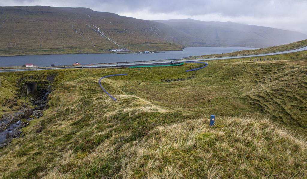
 See blue line for starting point.
Funningsfjørður - Norðskáli
Public Transport
There is no bus connection to Funningsfjørður.
Arriving by car
Parking, Funningsfjørður
Park in the big parking lot close to where the village path starts (see the green line).
From there, follow the blue line, go north of the sheep shed, through the gate and straight up the hill. After the first rise you will spot the first cairn. From here, cairns will lead you all the way to Norðskáli.
The gate by the pen outside the sheep shed is sometimes closed. If it is, make sure to close it again when you go through it. If you are unable to open the gate, climb over the fence. You will find another fence at an elevation of 190 metre. As there is no ladder, you need to climb over it. Another fence needs to be climbed over in the pass.
-
 See green line for parking and blue line for starting point
 -
 See green line for parking and blue line for starting point
 -
 See blue line for starting point
 -
 See blue line for starting point and green line for parking
Norðskáli - Funningsfjørður
Funningsfjørður - Norðskáli
Facts

Duration

distance

Peak

Elevation
 Suitable with children over the age of 8. This is a fairly long hike with significant elevation gain. The slopes up from Funningsfjørður are somewhat steep
 Medium
- The stretch up from Funningsfjørður is grass-covered but quite steep in places
Medium
- The stretch up from Funningsfjørður is grass-covered but quite steep in places
 Grass-covered and good for walking throughout. In places, it is a little wet, especially at the pass east of the lake Hagavatn. The stretch up from Funningsfjørður is somewhat steep in places
