


You haven’t got any favourites yet
This is where you can collect inspiration, articles, events and places that interest you.
Click the icon on pages and they’ll appear here.
Your favourites
Inspiration & Articles
Events & Tours
Places
Hiking
INSPIRATION & ARTICLES
EVENTS & HIKES
Places
Norðskála - Skálafjørður


Link Copied!

-
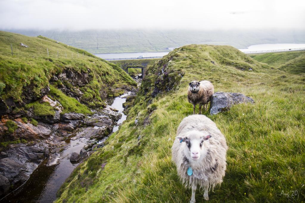 From the lower parking lot in Norðskáli, you will walk up along the cozy river. Photo: Óli Gardshodn.
 -
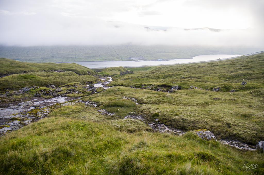 Peaceful up at Toppið, above the village of Norðskáli, where the rivers Tippisáin and Skálá meet. Here you see peat bogs and a collapsed peat house. Photo: Óli Gardshodn.
 -
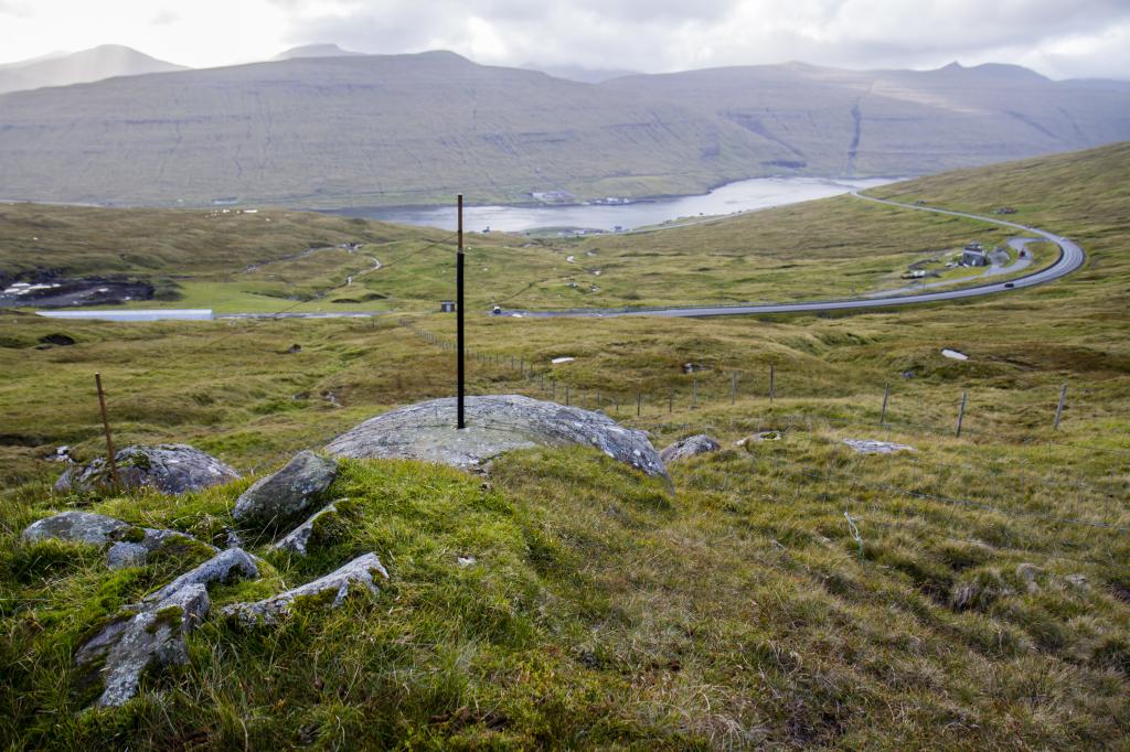 The view from above the tunnel in Norðskáli. Photo: Óli Gardshodn.
 -
 The view up from the pass Skarðið undir Nøvini, above Norðskáli. In the background the island of Streymoy. Photo: Óli Gardshodn.
 -
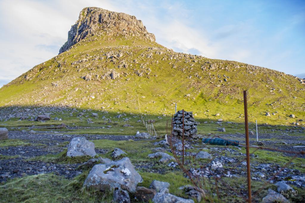 The mountain Nøvin – view up from the pass Skarðið undir Nøvini. Photo: Óli Gardshodn.
 -
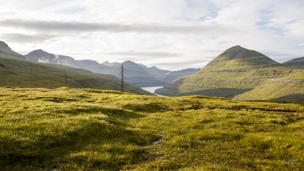 View from the pass Skarðið undir Nøvini, north over the fjord Funningsfjørður. Photo: Óli Gardshodn.
 -
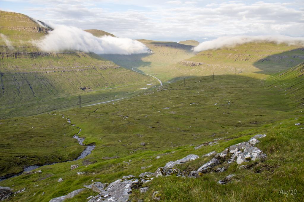 The view up from the pass Skarðið undir Nøvini, eastward over Millum Fjarða. Photo: Óli Gardshodn.
 -
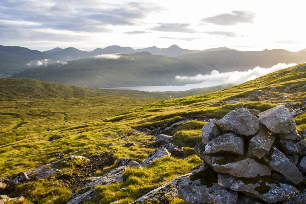
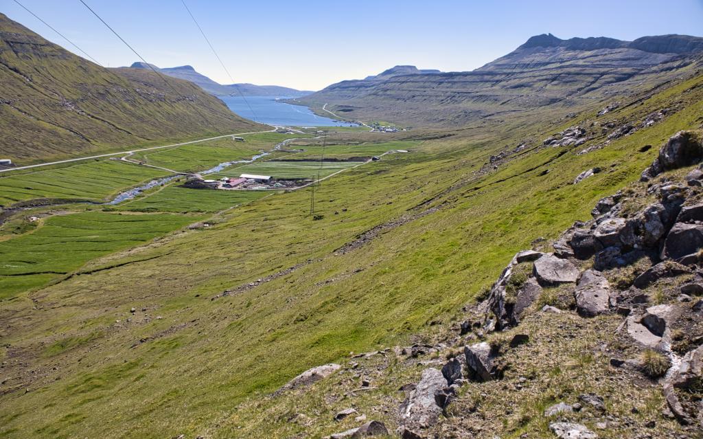 View south over the fjord Skálafjørður. Photo: Óli Gardshodn.
 -
 The gorge Øksnagjógv. Photo: Óli Gardshodn.
 -
 The waterfall Tipppafossur, below the gorge Øksnagjógv. Photo: Óli Gardshodn.
-
From the lower parking lot in Norðskáli, you will walk up along the cozy river. Photo: Óli Gardshodn.
-
Peaceful up at Toppið, above the village of Norðskáli, where the rivers Tippisáin and Skálá meet. Here you see peat bogs and a collapsed peat house. Photo: Óli Gardshodn.
-
The view from above the tunnel in Norðskáli. Photo: Óli Gardshodn.
-
The view up from the pass Skarðið undir Nøvini, above Norðskáli. In the background the island of Streymoy. Photo: Óli Gardshodn.
-
The mountain Nøvin – view up from the pass Skarðið undir Nøvini. Photo: Óli Gardshodn.
-
View from the pass Skarðið undir Nøvini, north over the fjord Funningsfjørður. Photo: Óli Gardshodn.
-
The view up from the pass Skarðið undir Nøvini, eastward over Millum Fjarða. Photo: Óli Gardshodn.
-
View south over the fjord Skálafjørður. Photo: Óli Gardshodn.
-
The gorge Øksnagjógv. Photo: Óli Gardshodn.
-
The waterfall Tipppafossur, below the gorge Øksnagjógv. Photo: Óli Gardshodn.
A varied hike with great views over Sundini and the two largest fjords
The route passes old peat banks and crosses the wide area “Millum Fjarða,” full of stories about bold sheep thieves — among them Ormur the farmer.The hike starts in Norðskála at the large parking lot above Skálagjógv. It is also possible to begin fr the tunnel entrance on the Norðskála side to avoid some fences. Walk the first 300 m up along the charming Tippisá stream. There are many peat banks in the valley from when people cut peat here in the old peatlands. At Tippið, cross the stream and continue straight up, just south of the tunnel entrance, then further straight up to the 409 m high pass, Skarðið undir Nøvini. There are fine views over Sundini, across to Hvalvík and the mountains west between Vestmanna and Saksun. The path is good, but there are some fences to climb over, and unfortunately, there are no stiles.
East of the pass, continue onto the Reiðgøta plateau, and along it down into Vesturdalur. Walking in the moorland with views north through Funningsfjørður and south across Millum Fjarða is beautiful. Above are the high rock formations and the large scree under Nøvini. Cairns mark the way all the way down. It is easy to imagine the well-known story of Ormur riding around this vast and remote area. He was known for stealing sheep from neighbouring farmers — the one in Funningur north and the one on Oyri west. There are also many other stories of daring sheep thieves, including Jákup Dintil from Syðrugøta.
East of Vesturdalur, continue along the plateau under Skálafjall, called Høgi Hvítahjalli. Walking here is good, with mixed grassy and rocky terrain and a fine view over the valley. At the eastern end, you will see a small pointed hill by the river called Stevnuválur, the ancient assembly site of Eysturoy.
East of Rustin, descend just far enough to get below the steepest part, then keep to the same height and walk straight toward Skálafjørður. Stay above the farmer’s fence, leading you to Tippafoss, below Øksnagjógv. It is best to follow the GPX file here.
It is gorgeous and peaceful to arrive at the high and lovely Tippafoss. Above, by the large Øksnagjógv, the stream runs through a deep gorge down to the waterfall, into a large deep pool, and further into Fjarðará. According to legend, this is where Ormur hid the bodies of the farmer from Oyri and his son after killing them. He let it slip in his sleep, saying: “The clothes are under the mill, and the bodies under Tippafoss!” His farmhands heard him, found the bodies and the blood-stained clothes. He was summoned and sentenced to death at Stevnuválur. When the sentence was given, he fled on horseback toward Skála. After a chase, he was caught on horseback and then on foot, and his heel was cut over. He was brought back to Stevnuválur on horseback, executed and buried there.
Continue the last stretch just above Stórheyggj and then down to the sheepfold by the large Keldan building in Skálafjørður, where there is a bridge across the river. The gate is above the fold.


Norðskála - Skálafjørður
Parking:
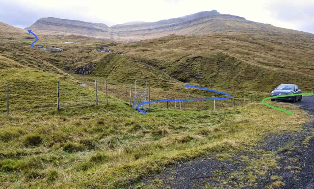
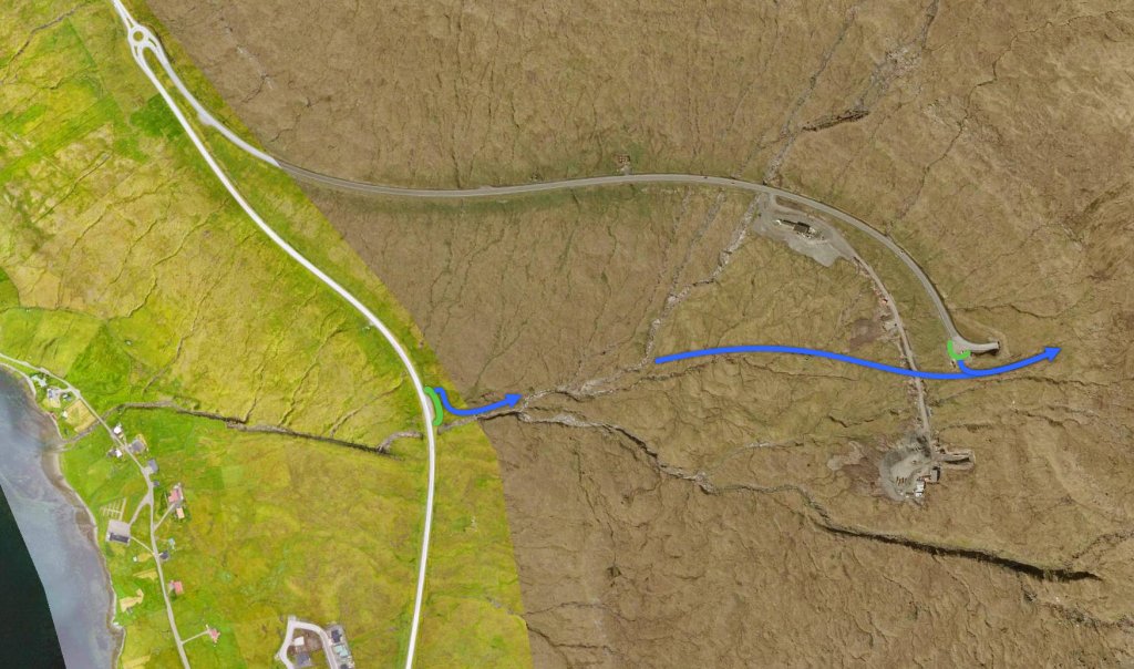
In Norðskála, you should park at the large parking lot where the village path begins, by the main road above Skálagjógv, 975 m uphill from the Magn station — see the green marking. From there, please go through the gate located right next to it. Up by Tippið, about 300 m along the Tippisá stream, cross the river, climb over the fence, and continue straight up south of the tunnel entrance — see the blue lines.
It is also possible to park by the tunnel entrance — see the green lines — and go through the gate.
Public transport:
There is an excellent bus connection for this village path. Norðskála and Skálafjørður are two of the main bus stops on Route 400 between Tórshavn and Klaksvík.
SSL Route 400: https://www.ssl.fo/en/timetable/bus/400-klaksvik-torshavn/
Several local bus routes also ru

Skálafjørður - Norðskála
Parking:
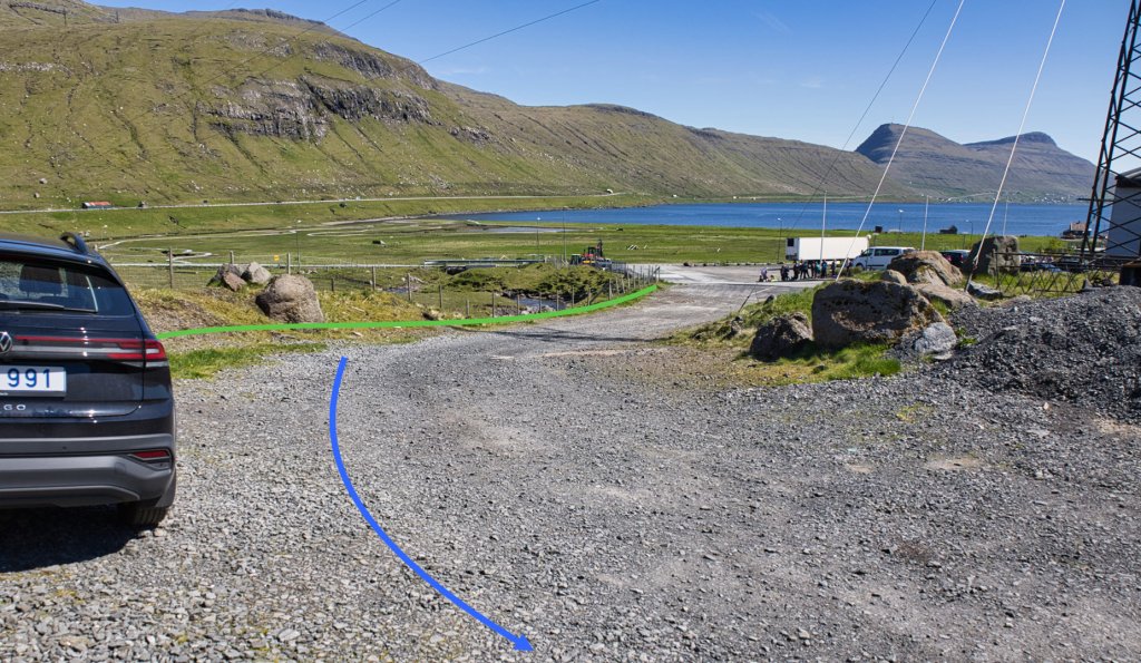
In Skálafjørður, there are good parking options, for example, along the road leading up to the sheepfold, which is located just north of Keldan — see the green marking. From there, go through the gate located just above the fold. After passing through the gate, walk past the fold, cross the bridge, and then continue towards Stórheyggj — see the blue line.
Public transport:
There is an excellent bus connection for this village path. Norðskála and Skálafjørður are two of the main bus stops on Route 400 between Tórshavn and Klaksvík.
SSL Route 400: https://www.ssl.fo/en/timetable/bus/400-klaksvik-torshavn/
Several local bus routes also run to these bus stops.


Norðskála - Skálafjørður
Skálafjørður - Norðskála


Facts

Duration

distance

Peak

Elevation
 10y+ because the hike is lengthy
 Easy
- A little steep down through Skákugil and across Tippafoss.
Easy
- A little steep down through Skákugil and across Tippafoss.
 Easy and good terrain all the way. In some places, the ground is wet.
