


You haven’t got any favourites yet
This is where you can collect inspiration, articles, events and places that interest you.
Click the icon on pages and they’ll appear here.
Your favourites
Inspiration & Articles
Events & Tours
Places
Hiking
INSPIRATION & ARTICLES
EVENTS & HIKES
Places
Øravík - Fámjin


Link Copied!

-
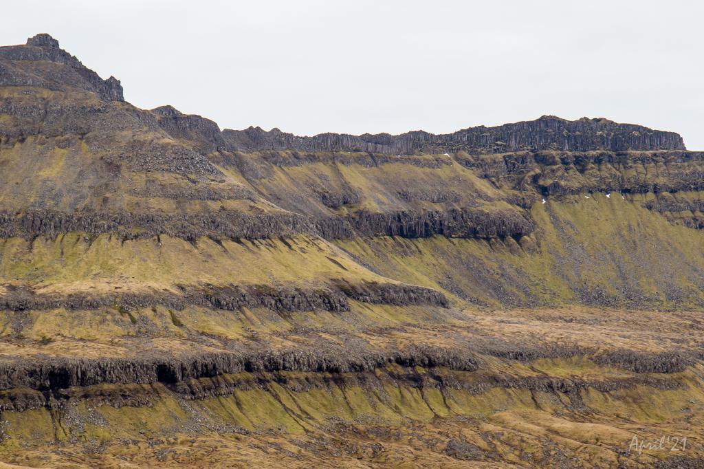 Two of the mountains south of Fámjin. On the left Mt. Borgin (570m) and on the right Mt. Glopprókin (535m). The ridge between the two mountains is made up by a extraordinary beautiful and very narrow row of columnar basalt. Photo: Óli Gardshodn
 -
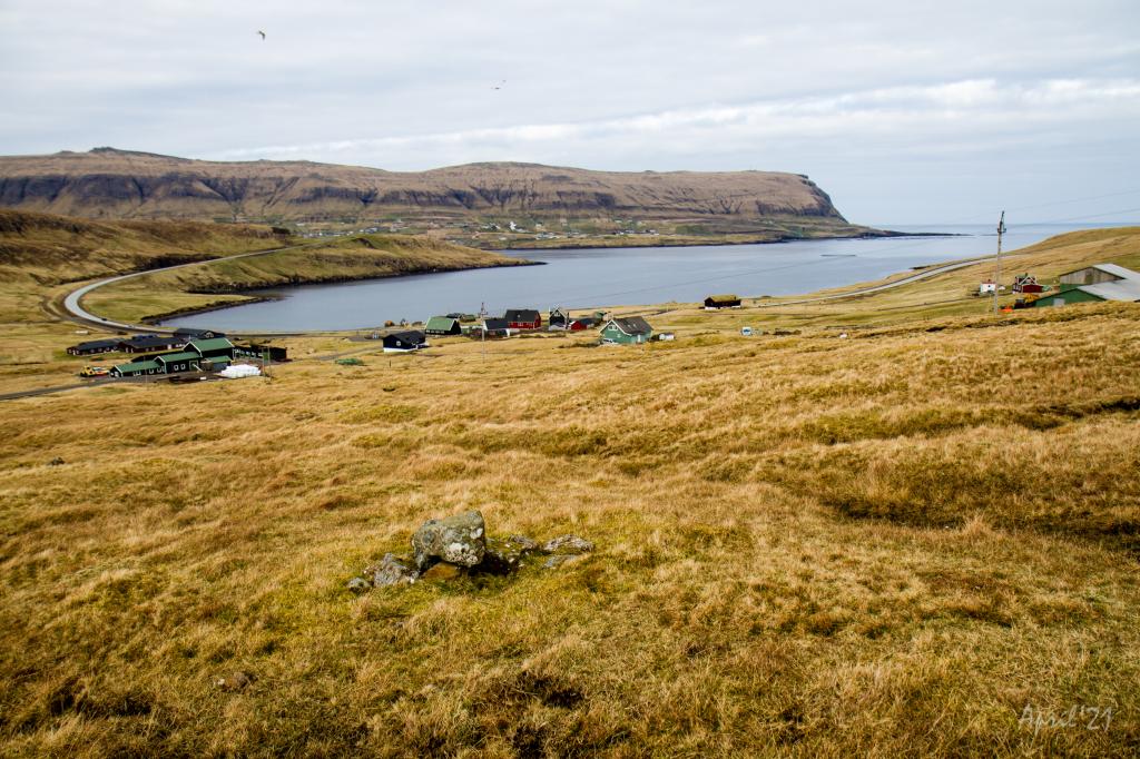 The village of Øravík. In the background the village of Froðba. Photo: Óli Gardshodn
 -
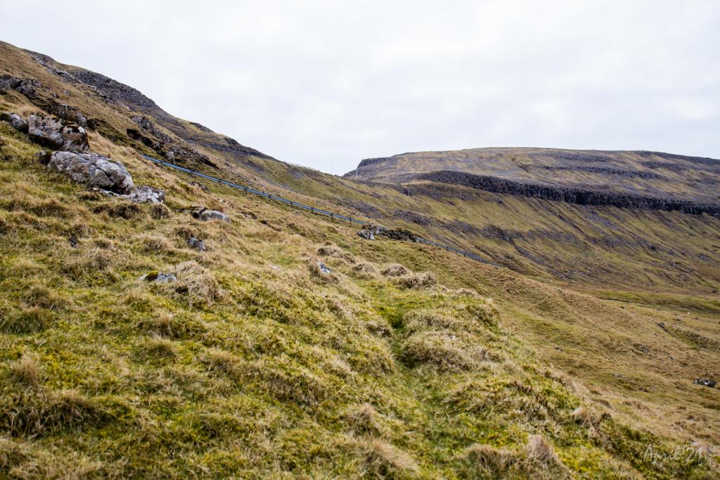 The last stretch up to the pass Øraskarð (278m.) is fairly steep. Photo: Óli Gardshodn
 -
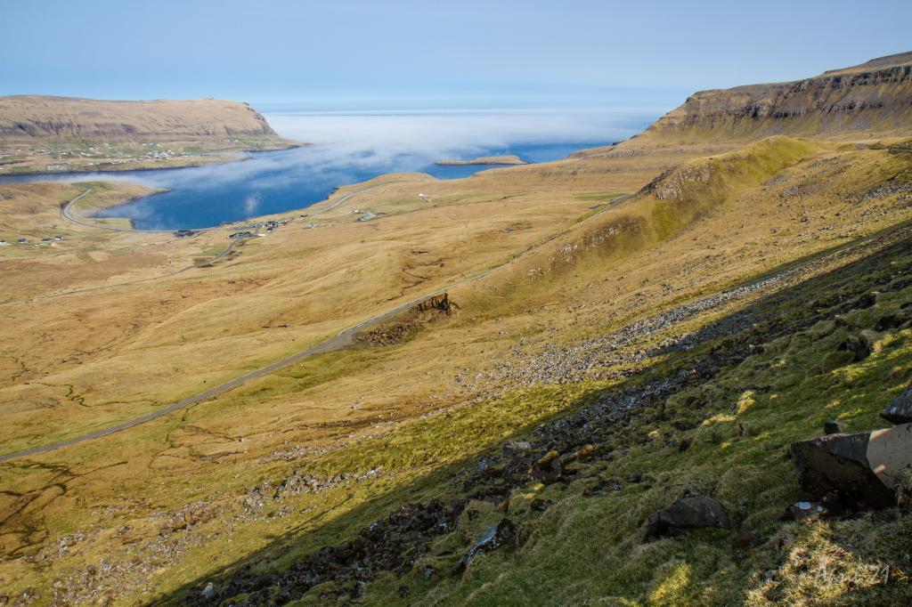
 View from the side of Fámjinsklovningur as we have just passed the road. Photo: Óli Gardshodn
 -
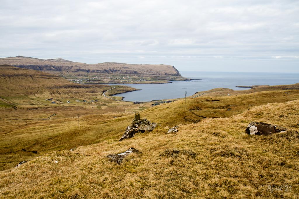
 View over Øravík from the pass Øraskarð. On the other side of the fjord Trongisvágsfjørður the village Froðba. Photo: Óli Gardshodn
 -
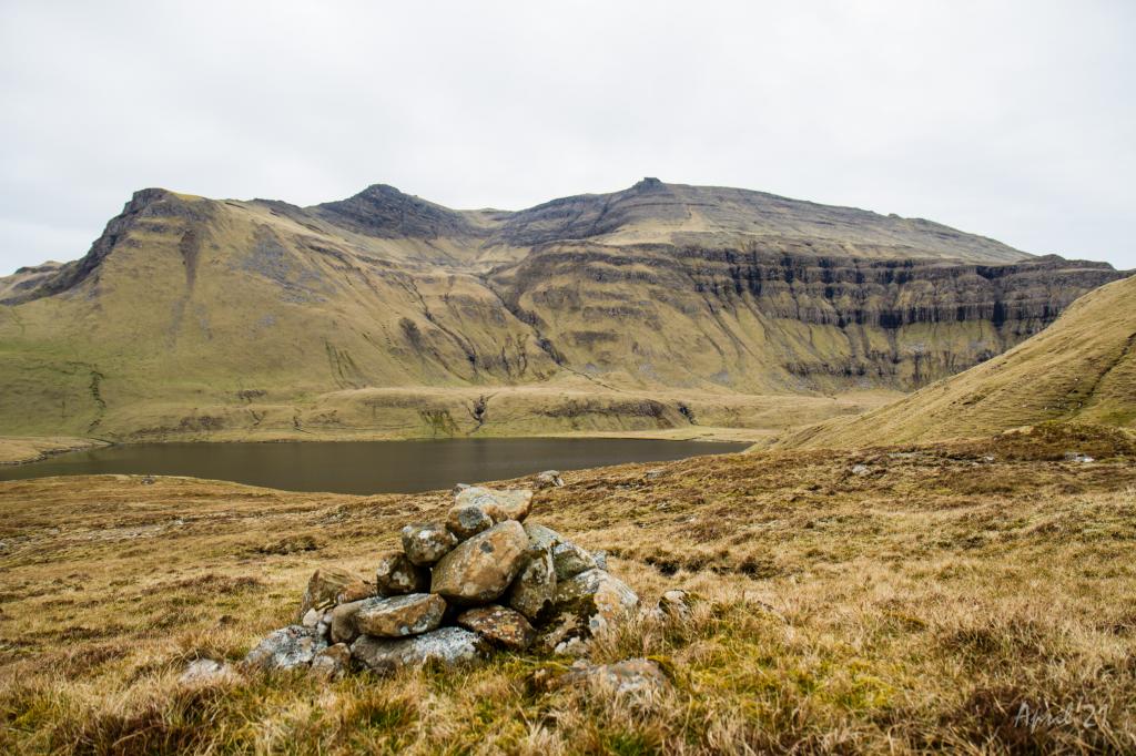 Lake Kirkjuvatn above Fámjin. Photo: Óli Gardshodn
 -
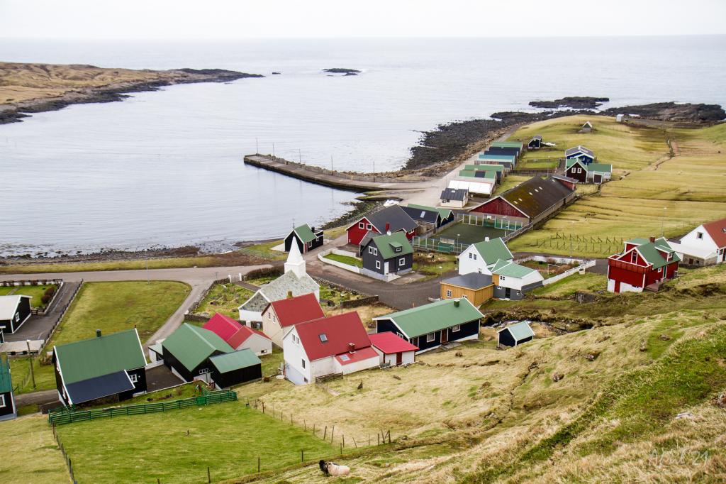 The northern part of the village Fámjin. Photo: Óli Gardshodn
-
Two of the mountains south of Fámjin. On the left Mt. Borgin (570m) and on the right Mt. Glopprókin (535m). The ridge between the two mountains is made up by a extraordinary beautiful and very narrow row of columnar basalt. Photo: Óli Gardshodn
-
The village of Øravík. In the background the village of Froðba. Photo: Óli Gardshodn
-
The last stretch up to the pass Øraskarð (278m.) is fairly steep. Photo: Óli Gardshodn
-
View from the side of Fámjinsklovningur as we have just passed the road. Photo: Óli Gardshodn
-
View over Øravík from the pass Øraskarð. On the other side of the fjord Trongisvágsfjørður the village Froðba. Photo: Óli Gardshodn
-
Lake Kirkjuvatn above Fámjin. Photo: Óli Gardshodn
-
The northern part of the village Fámjin. Photo: Óli Gardshodn
Discover the scenic Øravík - Fámjin hike with stunning views of Kirkjuvatn, Trongisvágsfjørð, and peaceful Fámjinsdal valley.
Øravík - Fámjin
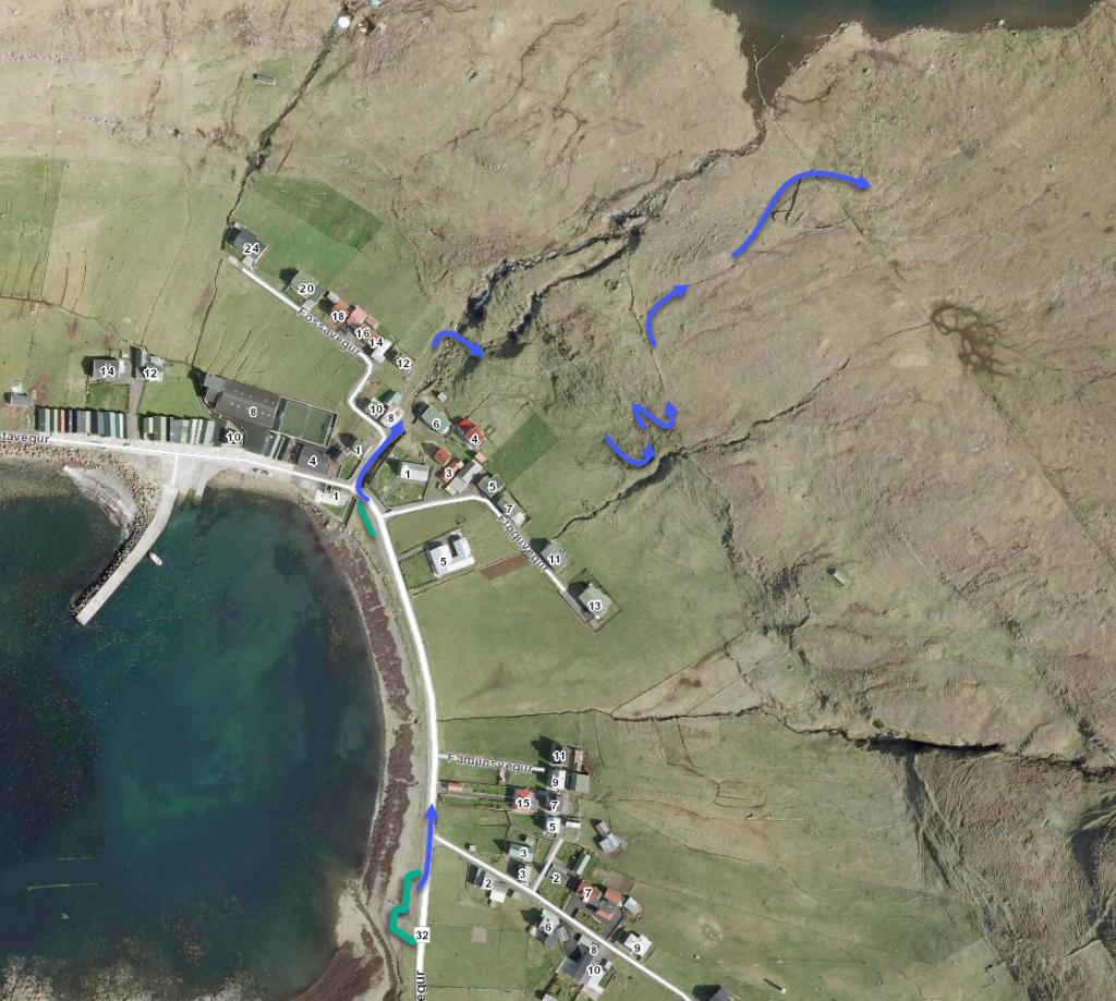
Start at the stone fence gate in Øravík, signposted “Øravík—Vágur”. The pathway leading to Fámjin also starts here, so make sure not to confuse the two paths. Unfortunately, the only stone cairn visible from the gate is the one leading to Vágur. For this reason, start walking towards the main road leading to Øraskarð.
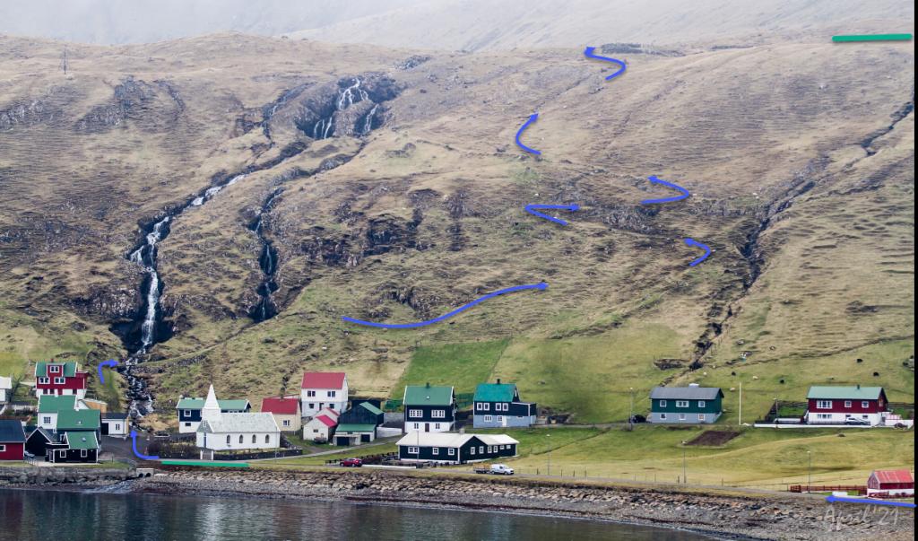
A little less than 400 meters up, by Svartáfoss waterfall, keep close to the corners of the village fence. Then continue down to the main road, on the north side of Fámjinskloving. This type of hilly terrain is also seen in other parts of the Faroe Islands such as on the east side of the mountain Endan á Trøðum in Sandoy, and the on east side of Stiðjafjall located above Kaldbaksbotn. It is easy to envision “huldufólk” (grey people) and trolls in this landscape. Finally, walk a short stretch along the steep incline towards Øraskarð, bearing in mind that this area is only partly covered by grass.
The route from Øraskarð to the sheep pen by the lake of Kirkjuvatn is on a continuous slope. The stone cairns leading the way are positioned close to each other, making it unlikely to take a wrong turn. Once through the sheep pen, continue walking until you reach the lowest stone cairn, directly opposite the church spire. The final section after the gate is slightly less obvious, but it is only a 30-meter stretch southward and then a northward turn towards the river, where you can cross a bridge to the church.
The route through Fámjinsdal is tranquil and provides ample opportunities to stop and admire nature, leaving the walker with a healthy glow and feeling of calm. There are gorgeous views in every direction - ranging from the dramatic basalt columns of Glopprókin to the peaceful lake of Kirkjuvatn - and the valley is surrounded by a horseshoe of several majestic mountain peaks including Borgarknappur and Borgin.
When arriving at the sheep pen and looking towards Valdaskarð, there is a route to Trongisvág. Once you have made it through the sheep pen and are walking towards the church tower, you will suddenly find yourself in the historic village of Fámjin. Wonderful!
It is possible to complete this trip from both ends; however, starting in Porkeri and walking towards Fámjin is the prettier route and, on arrival in Fámjin, it is pleasant to relax and stroll around the village. Due to two paths coming from the same area of Ørkavík and Fámjin, you must ensure that you choose the right path. Here the GPX file provides helpful guidance.


Øravík - Fámjin
Public Transport:
There is a good bus connection from Hov on route 701 There are several trips throughout the day, but all require pre-ordering– check the website via the link
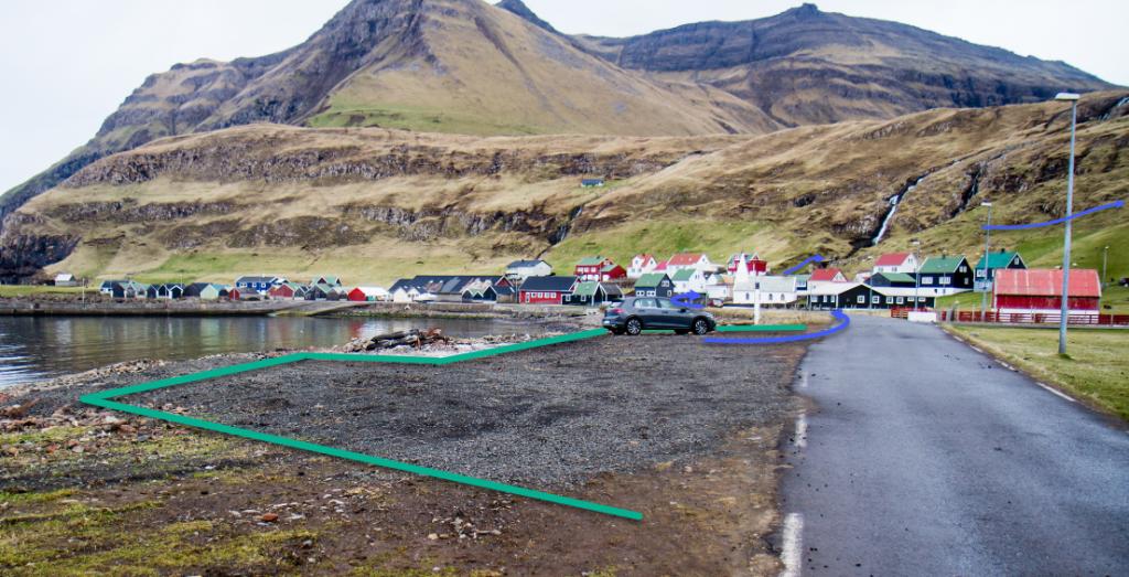
Parking, Øravík:
Park by the prayer house- check the green markings. Then walk 195 meters up the road called Vestan Garða and continue towards the stonewall gate following the blue line.
-
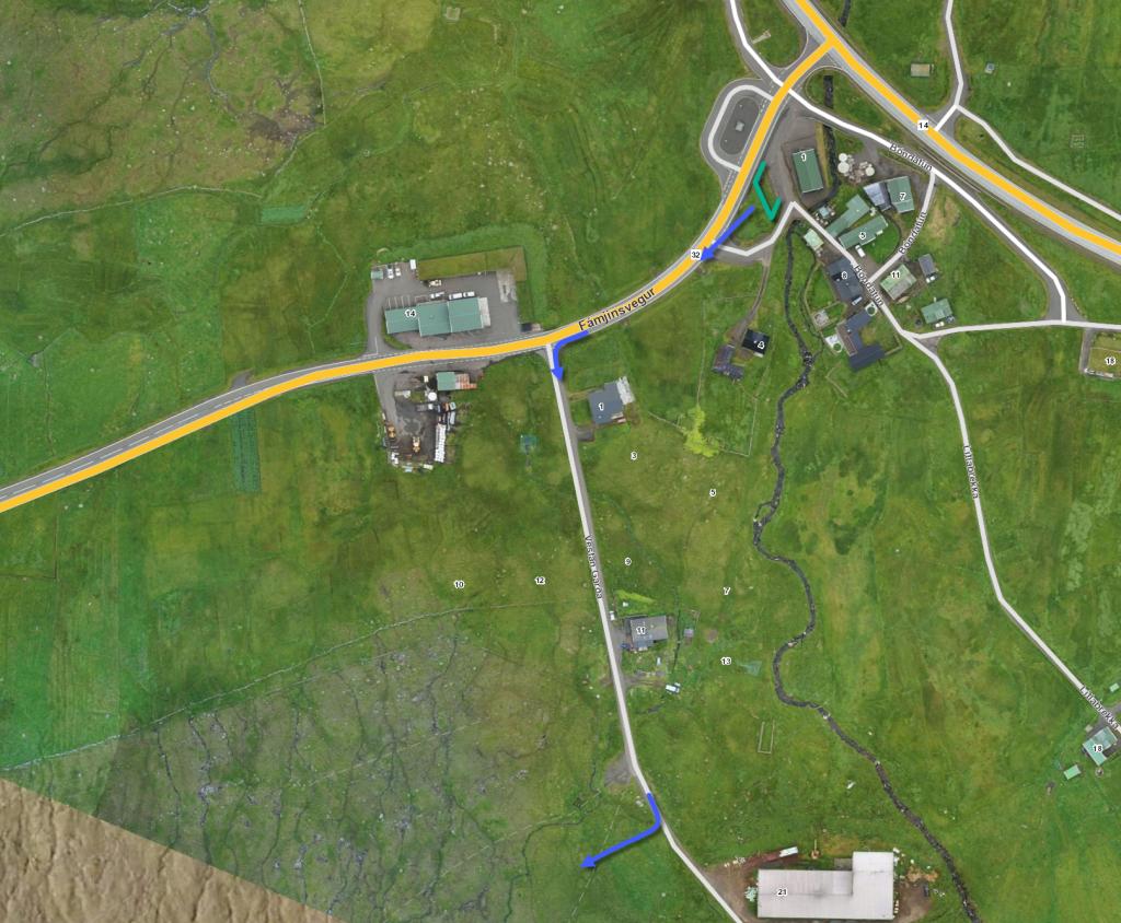 See green line for parking and blue line for starting point. The parking lot marked with green lines is just beside the adress Bóndatún 1, Ørðavík
 -
 See green line for parking and blue line for starting point. The parking lot marked with green lines is just beside the adress Bóndatún 1, Ørðavík
Fámjin - Øravík
Public Transport:
There is a good busconnection to Øravíkar on route 700
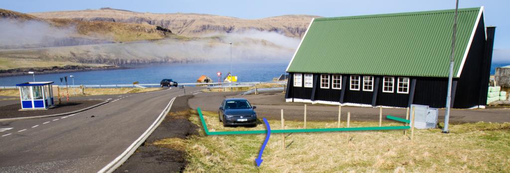
Parking, Fámjin:
It is possible to park just below the church or at a large parking area just before Traðarvegur. Check green markings. Here you have to walk on the right side following the blue line.
-
 See green line for parking and blue line for starting point
 -
 See green line for parking and blue line for starting point
 -
 See green line for parking and blue line for starting point
Øravík - Fámjin
Fámjin - Øravík
Facts

Duration

distance

Peak

Elevation
 Suitable for children above 8 years
 Medium
-
Medium
-
 The terrain is grass-covered for most of the route, except on the landing between Fámjinsklovn and Øraskarð, where the pathway is stony, steep and less visible.
The terrain is wet in some areas.
The terrain is grass-covered for most of the route, except on the landing between Fámjinsklovn and Øraskarð, where the pathway is stony, steep and less visible.
The terrain is wet in some areas.
