


You haven’t got any favourites yet
This is where you can collect inspiration, articles, events and places that interest you.
Click the icon on pages and they’ll appear here.
Your favourites
Inspiration & Articles
Events & Tours
Places
Hiking
INSPIRATION & ARTICLES
EVENTS & HIKES
Places
Øravík - Vágur


Link Copied!

-
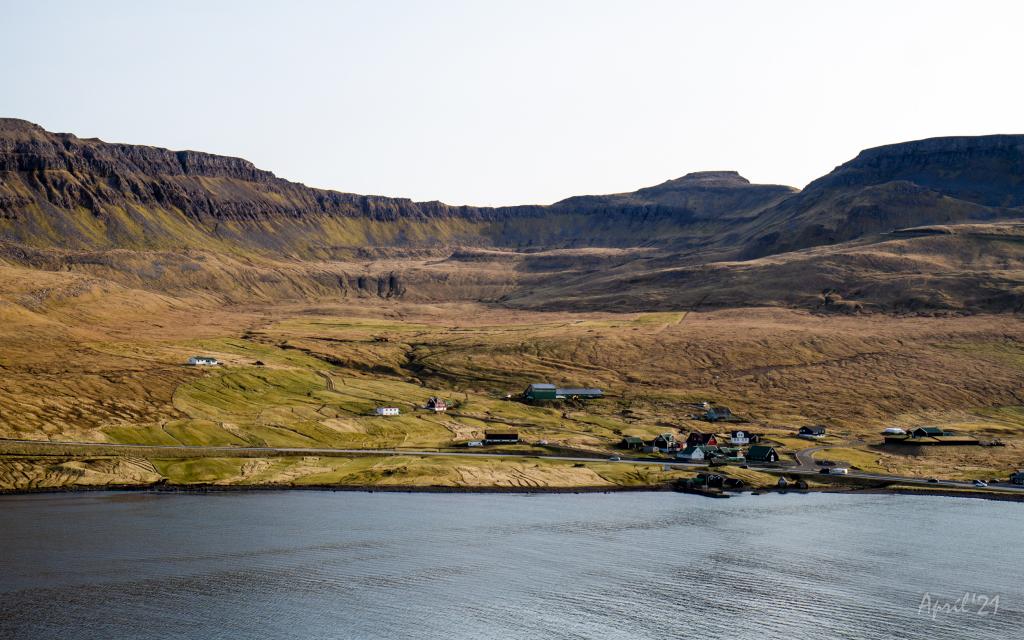 View over the southern part of the village of Øravík. The village path to Vágur goes up through this valley and up through the pass Mannaskarð that is located just to the left of the mountain Laðanfelli in the middle. To the right Mt. Nónfjall (427m.). Photo: Óli Gardshodn
 -
 View from the pass Mannaskarð over the village Øravík. Far left just below the centre of the image is the lower part of Tingstovan, the ancient thingstead of Suðuroy, also called "Uppi millum Stovur". Photo: Óli Gardshodn
 -
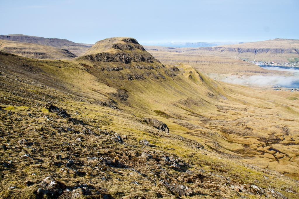
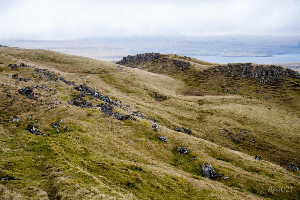 On the way up from the village of Øravík, we walk along Rossatindur, the small knoll in the picture, where the horses of those who were present at Tingstovan were tethered. This area is characterized by hills and knolls that are formed due to a special geological pressure phenomenon. Photo: Óli Gardshodn
 -
 View over Tingstovan, the ancient thingstead of Suðuroy, also called "Uppi millum Stovur". Photo: Óli Gardshodn
 -
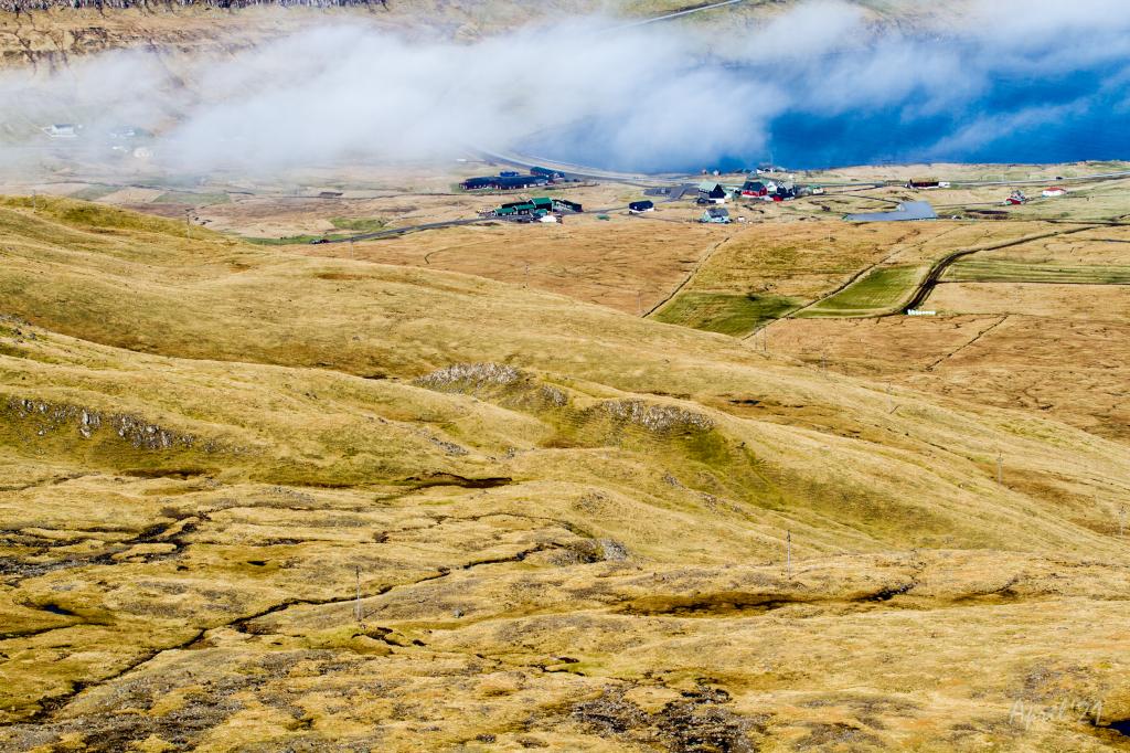
 From the pass Mannaskarð we have a good view over the valley above the village Øravík and the mountain Nónfjall (427m.) on the left side, as well as the old thingstead Tingstovan, located at the foot of Nónfjall. On a clear day we can also see the islands north of Suðuroy. To the right we can see a glimpse of the village Øravík with Tvøroyri on the other side of the fjord Trongisvágsfjørður. Photo: Óli Gardshodn
 -
 View from the pass Mannaskarð over the valley up from Øravík village. To the left is lake Nykavatn with Mt. Enni (424m.) to the right. In the background the village Froðba. Photo: Óli Gardshodn
 -
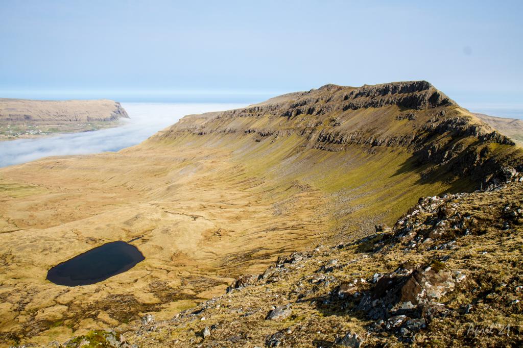
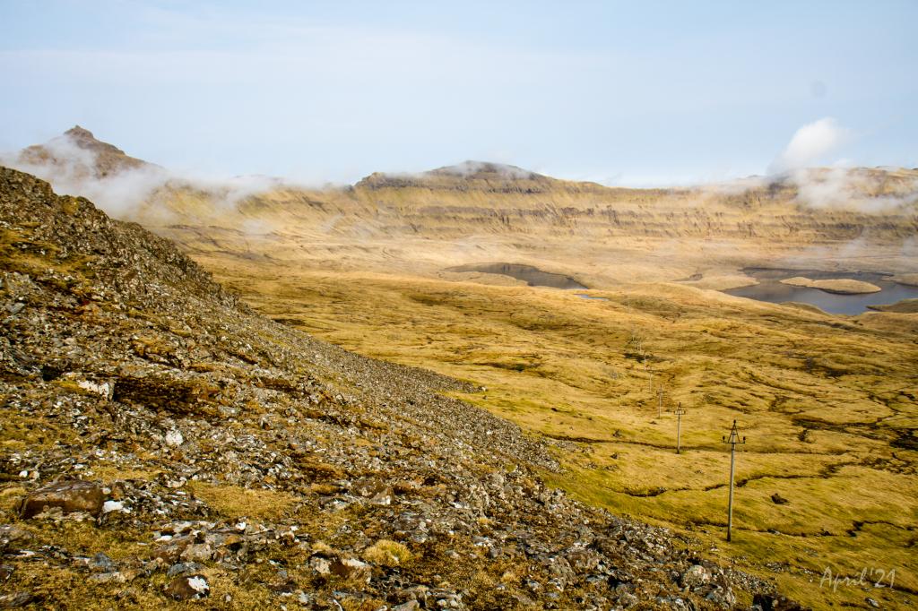
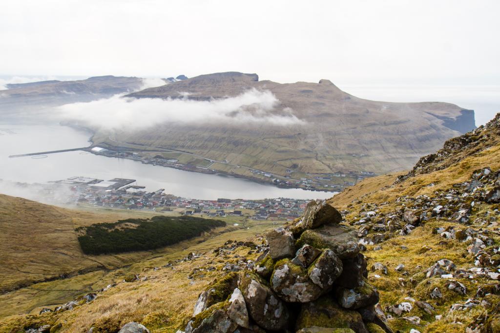
 The view from the pass Mannaskarð across Trongisvágur and the deep and beautiful valley Hvannhagi. In the background the islands of Skúgoy and Sandoy. In the distant background, the radar on Mt. Sornfelli (749m.) and Mt. Skælingur (767m.) 62km and 65km away respectively. Photo: Óli Gardshodn
 -
 View from Mannaskarð over the fjord Trongisvágsfjørður with the village Øravík in the foreground and Tvøroyri and Froðba in the background. Photo: Óli Gardshodn
 -
 View of the village Hov from the pass Mannaskarð. To the right you can just see the lake Vatnsnes come into view. Photo: Óli Gardshodn
 -
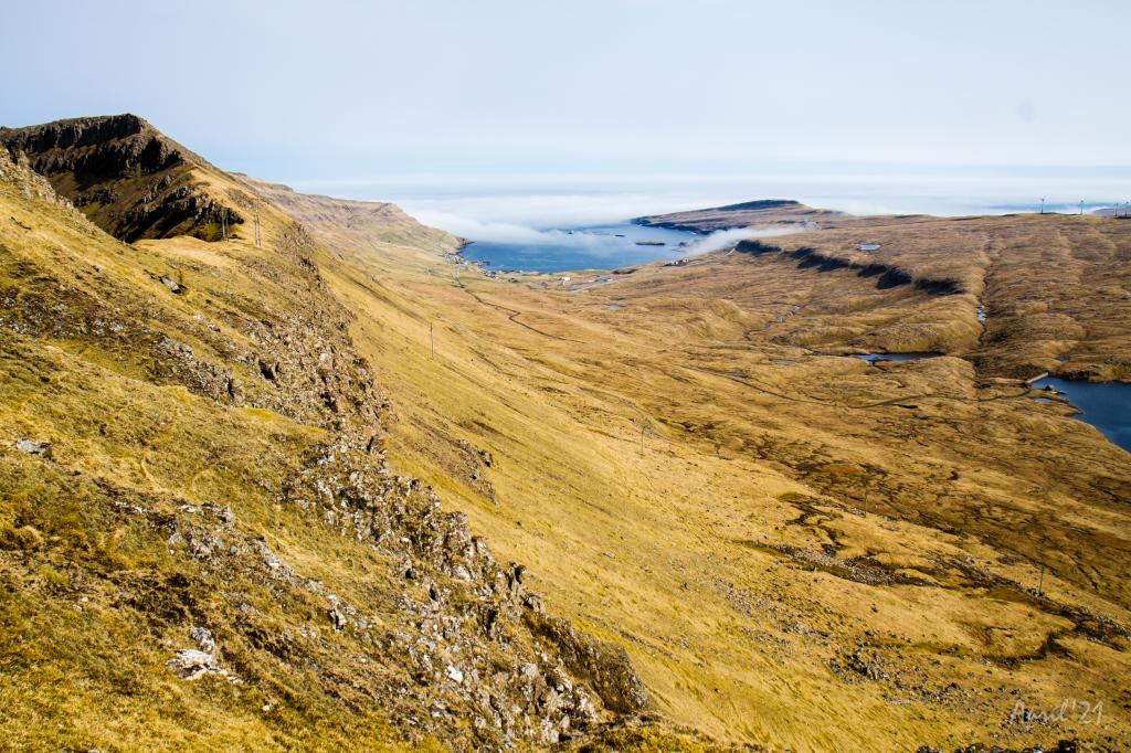
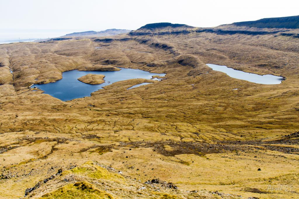 View from the pass Mannaskarð over the valley of Hov and the large lakes Vatnsnes and Bessavatn. Photo: Óli Gardshodn
 -
 Down by the parking lot near the lake Vatnsnes in the valley above the village Hov. Farthest to the left is the pass Vágsskarð, which we have to cross to get to the village Vágur. The mountain in the middle is Hvannafelli (560m), and to the right the majestic Borgarknappur (574m.). Photo: Óli Gardshodn
 -
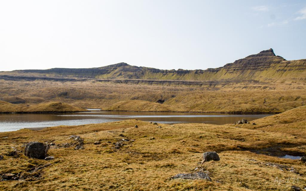
 View just below the pass Vágsskarð across the valley Hovsdalur. The village trail goes between the lakes Bessavatn and Vatnsnes and up over the pass Mannaskarð which is just to the right of the mountain in the middle. The mountains from left to right are Borgarknappur (574m.), Laðanfelli (485m.) and Enni (424m.). Photo: Óli Gardshodn
 -
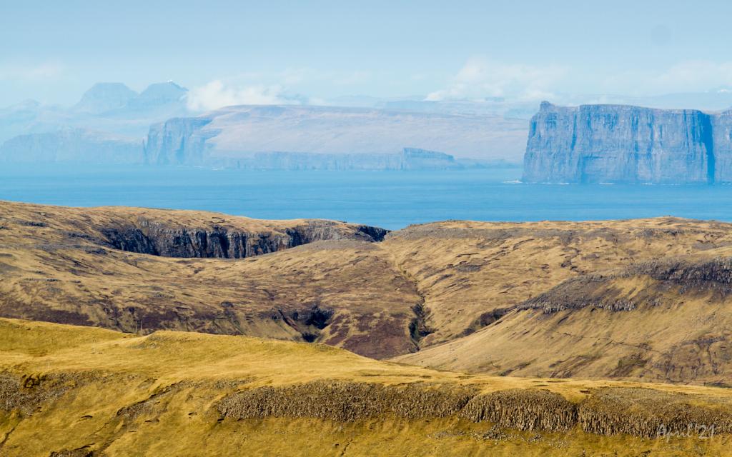
 View from the pass Vágsskarð in a southerly direction. Farthest away, slightly to the left, the famous promontory Beinisvørð (470m.). In the middle are the mountains Rávan (432.) and Rútafelli (356m.). Photo: Óli Gardshodn
 -
 View down the valley Hvannadalur and the village Vágur. The upper part is fairly steep. Photo: Óli Gardshodn
 -
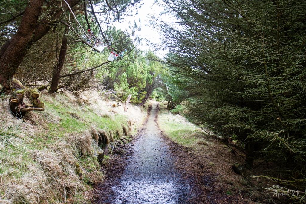 The village path runs through the cozy forest of the village of Vágur. Here the children in the village go up to hang their pacifiers to get rid of them. Photo: Óli Gardshodn
-
View over the southern part of the village of Øravík. The village path to Vágur goes up through this valley and up through the pass Mannaskarð that is located just to the left of the mountain Laðanfelli in the middle. To the right Mt. Nónfjall (427m.). Photo: Óli Gardshodn
-
View from the pass Mannaskarð over the village Øravík. Far left just below the centre of the image is the lower part of Tingstovan, the ancient thingstead of Suðuroy, also called "Uppi millum Stovur". Photo: Óli Gardshodn
-
On the way up from the village of Øravík, we walk along Rossatindur, the small knoll in the picture, where the horses of those who were present at Tingstovan were tethered. This area is characterized by hills and knolls that are formed due to a special geological pressure phenomenon. Photo: Óli Gardshodn
-
View over Tingstovan, the ancient thingstead of Suðuroy, also called "Uppi millum Stovur". Photo: Óli Gardshodn
-
From the pass Mannaskarð we have a good view over the valley above the village Øravík and the mountain Nónfjall (427m.) on the left side, as well as the old thingstead Tingstovan, located at the foot of Nónfjall. On a clear day we can also see the islands north of Suðuroy. To the right we can see a glimpse of the village Øravík with Tvøroyri on the other side of the fjord Trongisvágsfjørður. Photo: Óli Gardshodn
-
View from the pass Mannaskarð over the valley up from Øravík village. To the left is lake Nykavatn with Mt. Enni (424m.) to the right. In the background the village Froðba. Photo: Óli Gardshodn
-
The view from the pass Mannaskarð across Trongisvágur and the deep and beautiful valley Hvannhagi. In the background the islands of Skúgoy and Sandoy. In the distant background, the radar on Mt. Sornfelli (749m.) and Mt. Skælingur (767m.) 62km and 65km away respectively. Photo: Óli Gardshodn
-
View from Mannaskarð over the fjord Trongisvágsfjørður with the village Øravík in the foreground and Tvøroyri and Froðba in the background. Photo: Óli Gardshodn
-
View of the village Hov from the pass Mannaskarð. To the right you can just see the lake Vatnsnes come into view. Photo: Óli Gardshodn
-
View from the pass Mannaskarð over the valley of Hov and the large lakes Vatnsnes and Bessavatn. Photo: Óli Gardshodn
-
Down by the parking lot near the lake Vatnsnes in the valley above the village Hov. Farthest to the left is the pass Vágsskarð, which we have to cross to get to the village Vágur. The mountain in the middle is Hvannafelli (560m), and to the right the majestic Borgarknappur (574m.). Photo: Óli Gardshodn
-
View just below the pass Vágsskarð across the valley Hovsdalur. The village trail goes between the lakes Bessavatn and Vatnsnes and up over the pass Mannaskarð which is just to the right of the mountain in the middle. The mountains from left to right are Borgarknappur (574m.), Laðanfelli (485m.) and Enni (424m.). Photo: Óli Gardshodn
-
View from the pass Vágsskarð in a southerly direction. Farthest away, slightly to the left, the famous promontory Beinisvørð (470m.). In the middle are the mountains Rávan (432.) and Rútafelli (356m.). Photo: Óli Gardshodn
-
View down the valley Hvannadalur and the village Vágur. The upper part is fairly steep. Photo: Óli Gardshodn
-
The village path runs through the cozy forest of the village of Vágur. Here the children in the village go up to hang their pacifiers to get rid of them. Photo: Óli Gardshodn
Øravík - Vágur hike offers scenic views from Mannaskarð, historic trails, lush valleys, and a charming forest walk.
Øravík - Vágur
Even though the village route is called Øravík to Vágur, it is possible to split the journey into two by driving up towards Hovsdal and starting the tour on the village path heading to Porkeri. This path leads you up to the area below Mannaskarð, where it meets with the path running between Øravík and Vágur. From there you can choose whether to walk to Øravík by going through Mannaskarð, or to Vágar by going through Vágsskarð. It is also possible to walk up Mannaskarð, enjoy the beautiful view, and then walk to Vágur through Vágsskarð. GPX files are available for all three trips, including the full-length trip and the two half trips.
The path starts in Øravík. Gorges and ridges with sharp edges mark the landscape as the path follows Tinggili Uppi Millum Stovur, which was once the assembly point of Suðuroy; the old assembly table is visible here. According to Faroese folklore, farmhand Snæbjørn, from Hvalba, was sentenced, upon this very spot, to four years of penal servitude in Bremerholm (Copenhagen) as punishment for buying a scarf from an illegal merchant vessel. Unsurprisingly, Snæbjørn was not content with his punishment and attacked the figures of authority. He failed to kill the judge, but struck the sheriff with a fatal blow. Snæbjørn escaped from the assembly point and lived on the outskirts of the mountains of Suðuroy for several years.
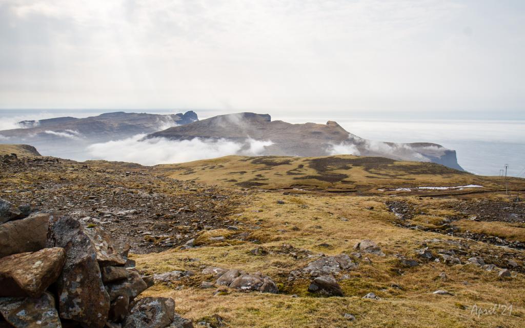
The road up Mannaskarð is difficult and, towards the end, it is very stony. You will need to tread carefully to avoid loosening any rocks and stones underfoot.
On top of Mannaskarð is a fantastic view of the valleys of Vatnsnes and Bessavatn. In the 1960s, SEV built a hydroelectric dam and dug a tunnel from Vatnsnes down to Botn. There you have Vágsskarð, which the road passes, and Hvannafelli. On the other side, it is possible to see Borgarknappur with peaks that remind you of a castle from the middle-ages.
The path follows Vatnaryggur beside the lake, where you can see a variety of birds. It is said that there is an unusually high amount of "huldufólk" living there. To the left of the path on Vatnaryggur lies Ærgidalur, where archaeologists of the Faroese Museum found long-abandoned ruins. During Viking times, this valley was used for grazing, and in those days, it was customary for people to live in fields during the summertime to care for their flock.
Past Vágsskarð, there is a gradual descent to Hvannadal, then the slopes become steep. The stone cairns guide the way to Hvanndalsá, leading you across a stream and towards a plantation or grove of trees. Then follow the signposts along the side of the grove until the path turns into the heart of it. A stroll through the trees is lovely, especially after the Closed for Maintenance campaign, in which Faroese locals spent the spring of 2021 working on improving the area. There is a table with benches, making it possible for you to sit down and rest whilst enjoying the view and a picnic, if you have brought one. (But please remeber to take your litter home with you!)


Øravík - Vágur
Public transport:
Decent bus connection to Øravík with route 700
The closest bus stop in Hovi and Hovsdal is approximately 2 km away from the start of the Porkeri pathway.
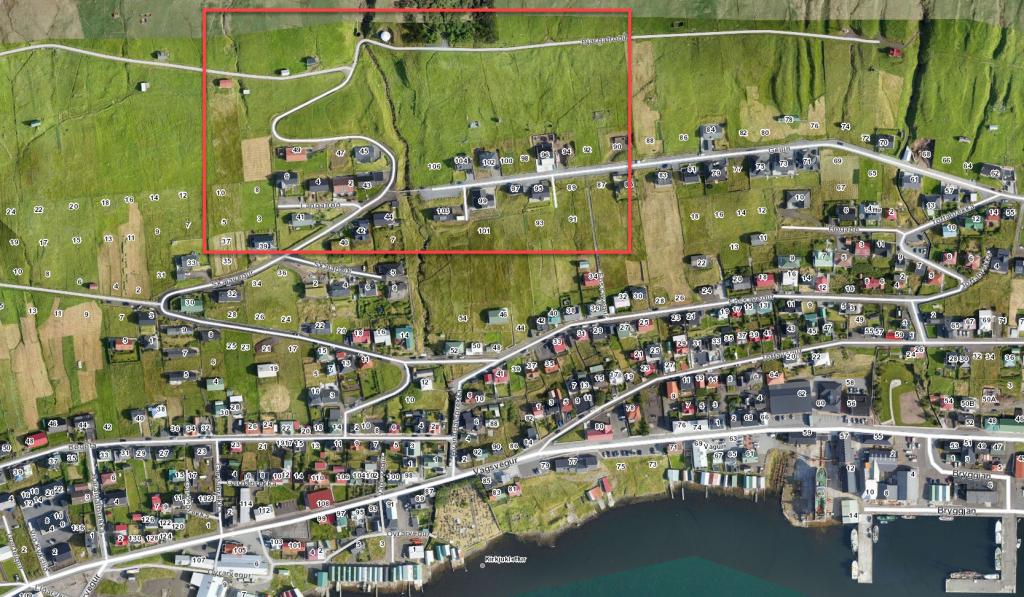
Parking, Øravík:
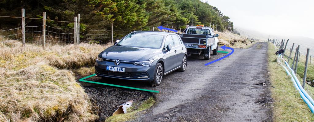
Parking is available by the prayer house – check the green line. From there, you have to walk 195 meters on the Vestan Garða road and pass the stone fence along the blue line.
-
 See green line for parking and blue line for starting point. The parking lot marked with green lines is just beside the adress Bóndatún 1, Ørðavík
 -
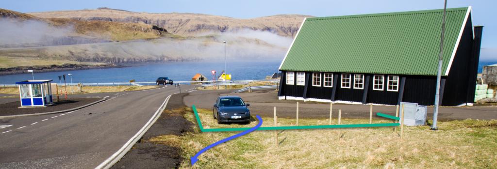 See green line for parking and blue line for starting point. The parking lot marked with green lines is just beside the adress Bóndatún 1, Ørðavík
Vágur - Øravík
Public transport:
Decent bus connection to Øravík with route 700
Parking, Vágur:
It is possible to park right outside the grove, where there is space for two cars, or to go further down where there is a parking area at the end of the road Geilin, right before the scout house (Geilin 103). Check the green line. From there, you have to walk through the grove, checking for blue signposts.
-
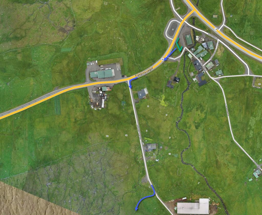
 See next picture zooming in on the area just below the forrest where the route starts
 -
 See green line for parking and blue line for starting point. The lower parking lot, marked with green lines, is at the address Geilin 103, Vágur
 -
 See green line for parking and blue line for starting point. The parking lot marked with green lines is at the adress Geilin 103, Vágur
 -
 See green line for parking and blue line for starting point
Øravík - Vágur
Vágur - Øravík
Facts

Duration

distance

Peak

Elevation
 The entire route is long and quite steep. Not recommended to kids younger than 10 years.
 Medium
- The slope in Hvannadal is a little steep; however, it is grassy and decent to walk on.
Medium
- The slope in Hvannadal is a little steep; however, it is grassy and decent to walk on.
 Decent grass terrain all the way. There is some loose material on the path north of Mannaskarð.
Terrain is wet in some areas. It is steep in Hvannadal, in the areas just above the grove in Vágur.
Decent grass terrain all the way. There is some loose material on the path north of Mannaskarð.
Terrain is wet in some areas. It is steep in Hvannadal, in the areas just above the grove in Vágur.
