


You haven’t got any favourites yet
This is where you can collect inspiration, articles, events and places that interest you.
Click the icon on pages and they’ll appear here.
Your favourites
Inspiration & Articles
Events & Tours
Places
Hiking
INSPIRATION & ARTICLES
EVENTS & HIKES
Places
Oyndarfjørður - Hellurnar


Link Copied!

-
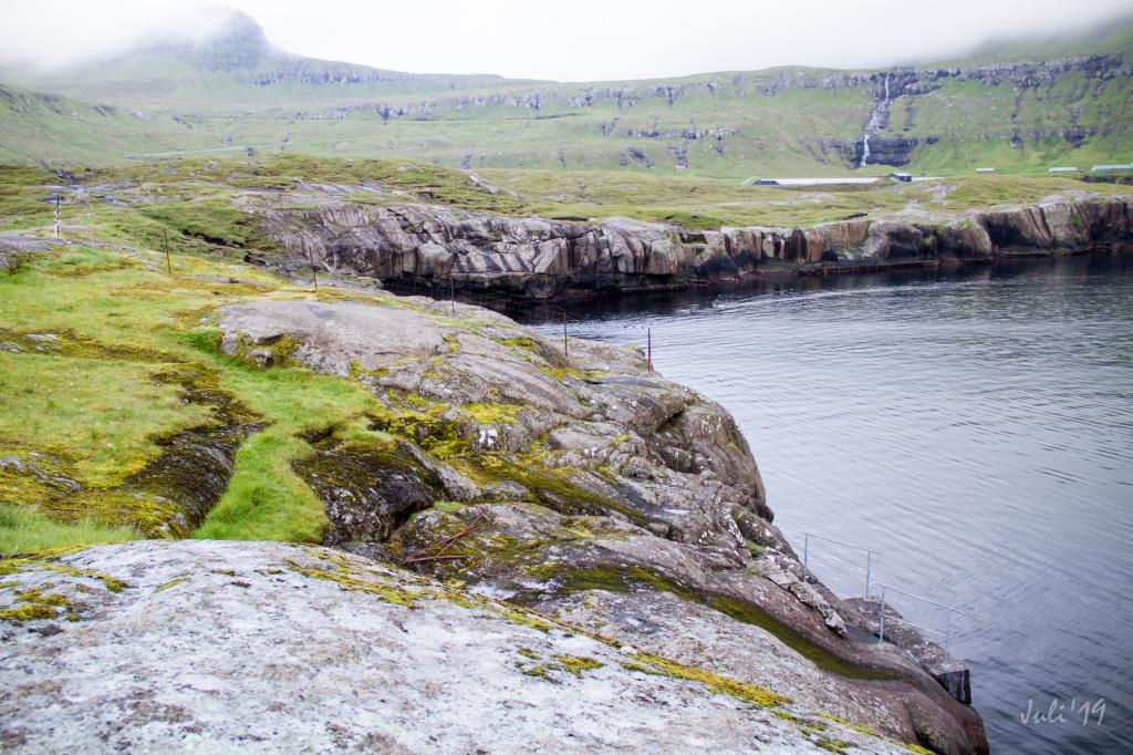 It was here, at this small quay, that the ships docked in the old days to hand over fish to lay up on the cliff to dry. Photo: Óli Gardshodn
 -
 It is beautiful and relaxing to walk along the shore and enjoy the view. Photo: Óli Gardshodn
 -
 With so many eider ducks along the rocky beach, it gets a little more lively and cozy. Photo: Óli Gardshodn
 -
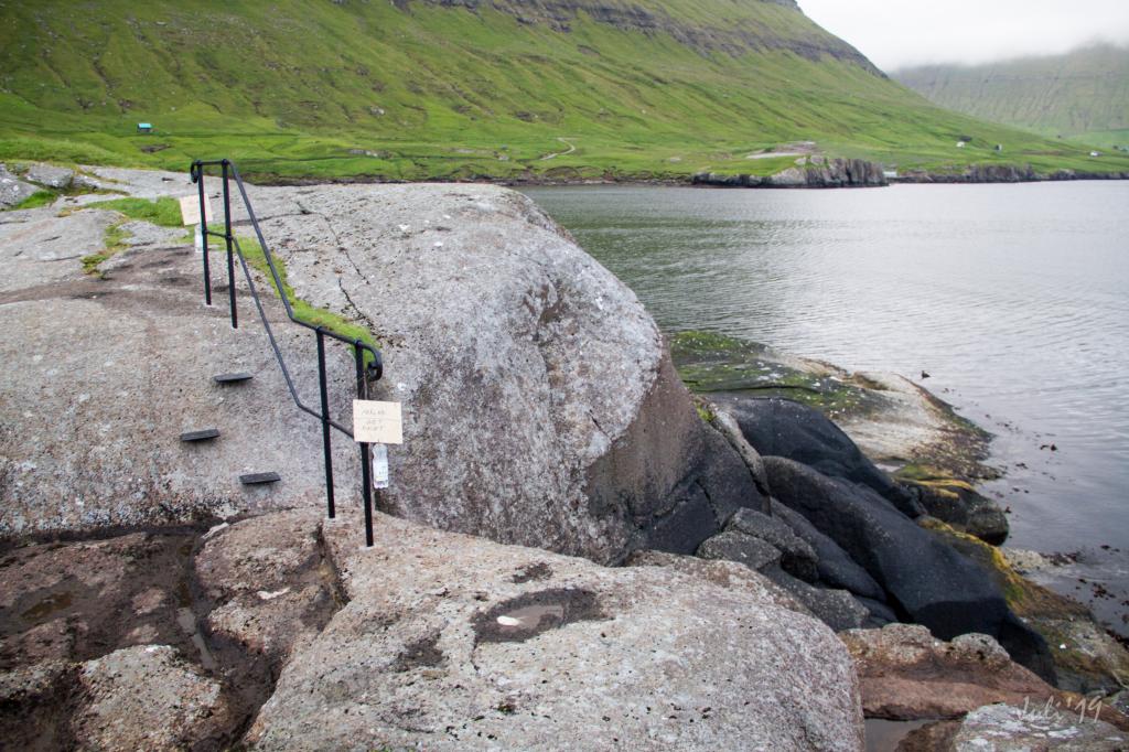 The local forces are good at maintaining the area. Photo: Óli Gardshodn
 -
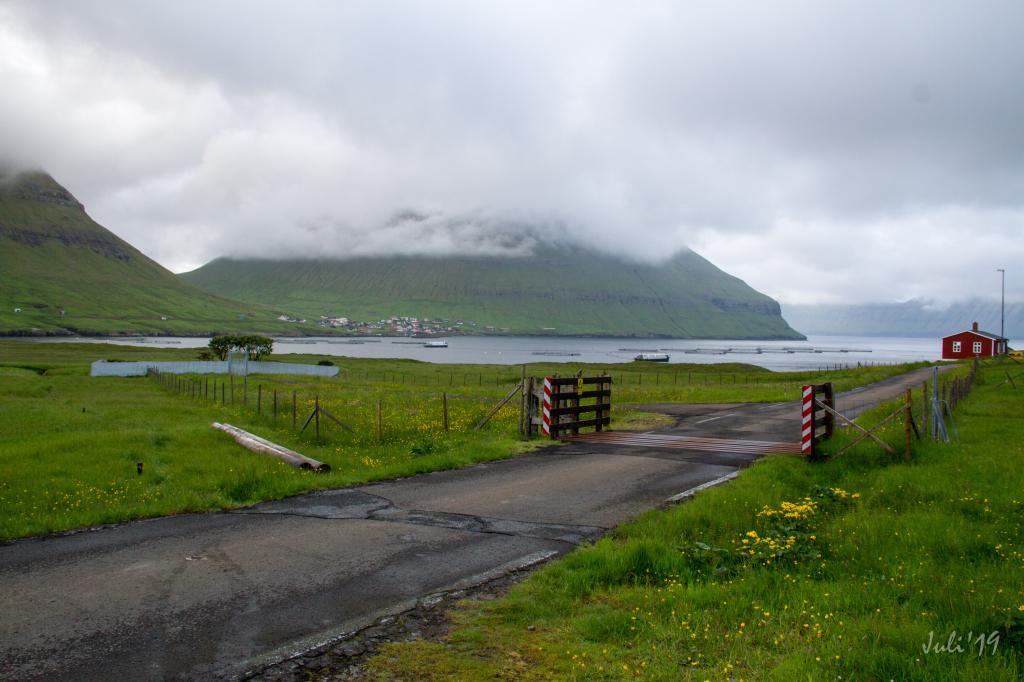
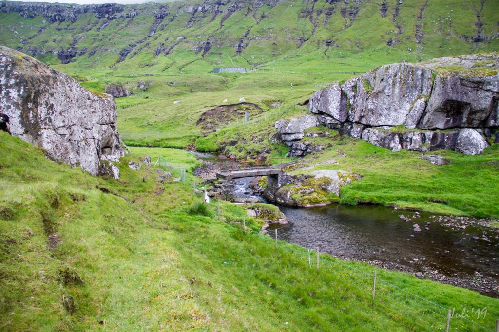 The old bridge between the villages Oyndarfjørður and Hellurnar. Photo: Óli Gardshodn
 -
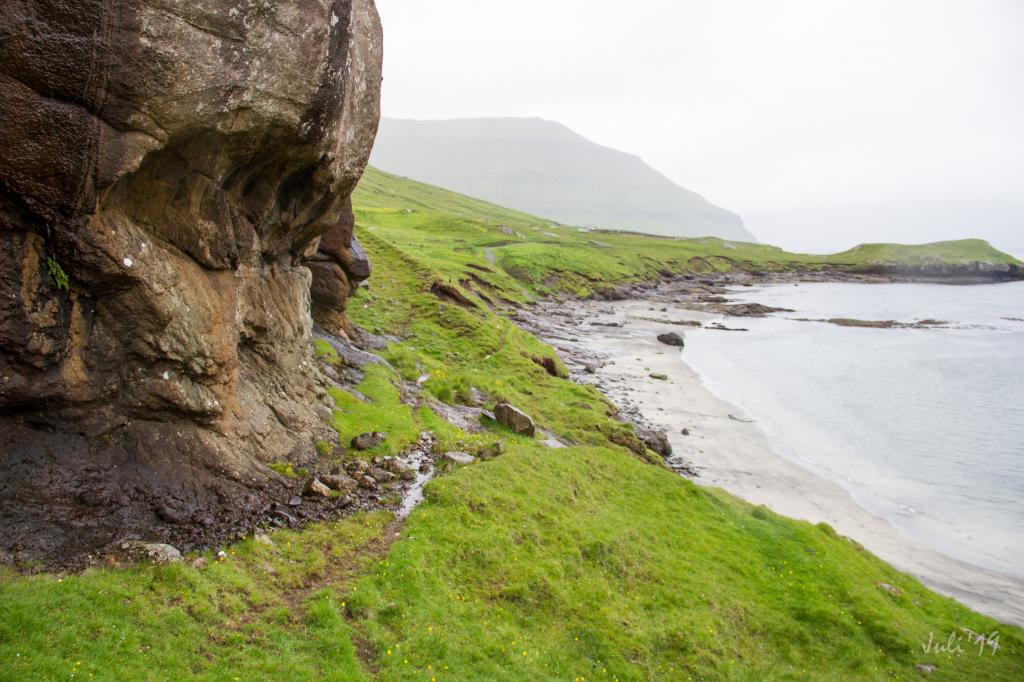 The sandy beach, between Høvdið and Durhús, at the bottom of the fjord Oyndarfjørður, is frequently visited on a good summer day. Photo: Óli Gardshodn
 -
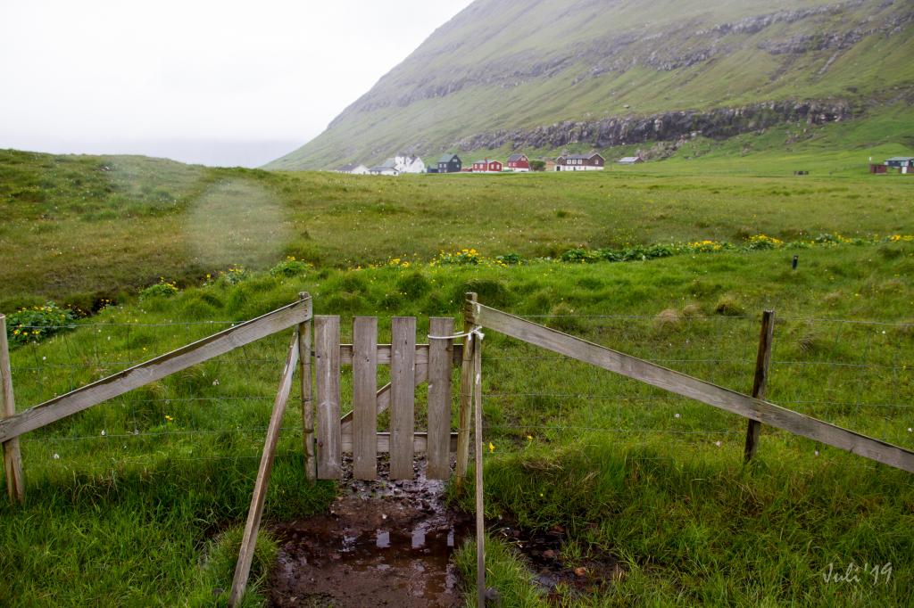 The gate on the path that goes over to the cemetery at the village Hellurnar. Photo: Óli Gardshodn
 -
 The view from the village Hellurnar over to Oyndarfjørður on the other side of the fjord. Photo: Óli Gardshodn
-
It was here, at this small quay, that the ships docked in the old days to hand over fish to lay up on the cliff to dry. Photo: Óli Gardshodn
-
It is beautiful and relaxing to walk along the shore and enjoy the view. Photo: Óli Gardshodn
-
With so many eider ducks along the rocky beach, it gets a little more lively and cozy. Photo: Óli Gardshodn
-
The local forces are good at maintaining the area. Photo: Óli Gardshodn
-
The old bridge between the villages Oyndarfjørður and Hellurnar. Photo: Óli Gardshodn
-
The sandy beach, between Høvdið and Durhús, at the bottom of the fjord Oyndarfjørður, is frequently visited on a good summer day. Photo: Óli Gardshodn
-
The gate on the path that goes over to the cemetery at the village Hellurnar. Photo: Óli Gardshodn
-
The view from the village Hellurnar over to Oyndarfjørður on the other side of the fjord. Photo: Óli Gardshodn
Discover the easy, scenic Oyndarfjørður - Hellurnar hike along the Faroe Islands' stunning seashore with historic views.
The village path between Oyndarfjørður and Hellurnar is well marked, although there is no indication where the path starts at the main road.
In Oyndarfjørður the path starts in the area á Høvdanum, where the new path begins down by the beach, about 800 metres before you reach the village cattle grid. Signposts are set in the grass to show where the path bridge crosses the river Laksá.
From here, two paths lead to Hellurnar. One goes along the seashore while the older path, which is noted on a map of the Faroe Islands from 1900 goes a little bit further in from the seashore.
The path over the bedrock by the seashore is the more scenic of the two. This path was worn well when ships arrived to unload fish. People came to receive the fish and laid it out on the bedrock to dry. This is probably why the place is called Hellurnar. The old landing quay can still be seen. The old handrails have been recently replaced (in 2019) and new handrails are installed to make the path safer.
At Hellurnar, the old path starts just inside the graveyard while the seashore path begins after you have passed the bedrock between Rættarvegur 8 and 12. Both paths are marked with posts that are visible from the main road.
The hike can be taken in either direction.


Oyndarfjørður - Hellurnar
Public transport
Route 481 connects Oyndarfjørður with Skálabotn. In Skálabotnur, there are several other connections, eg. to Tórshavn.
Arriving by car
Parking, Oyndarfjørður
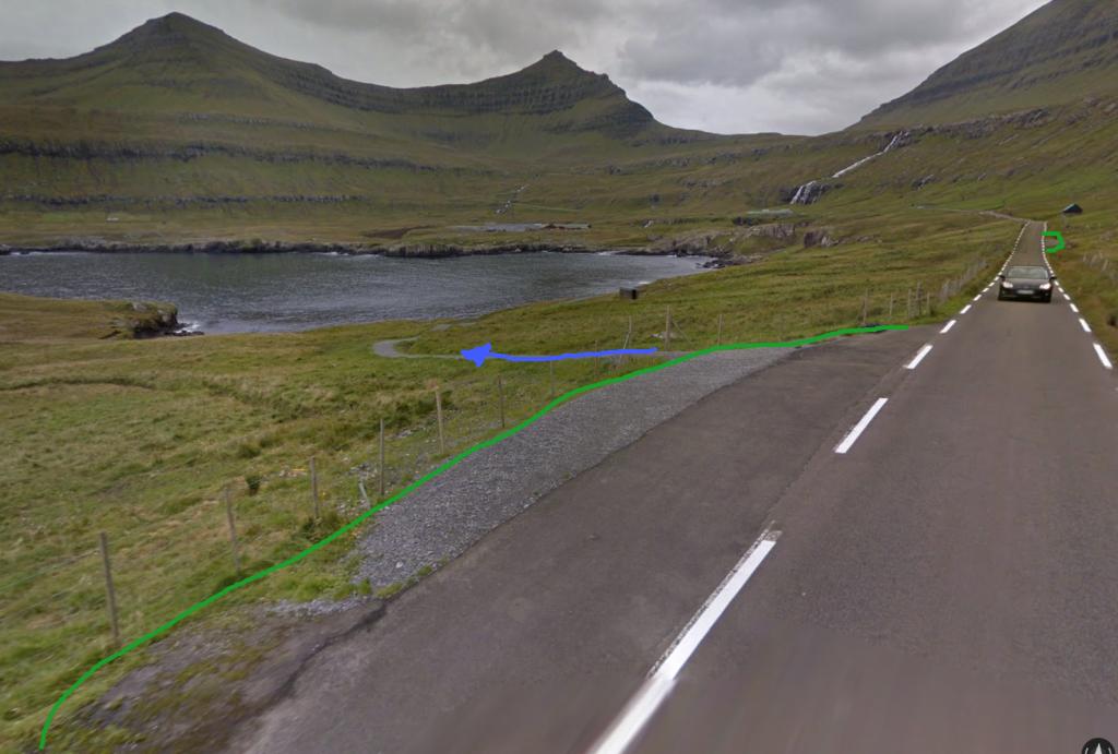
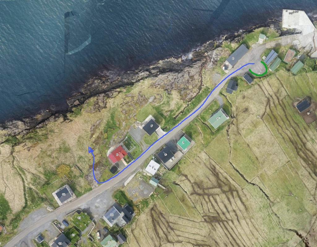
Good parking is available in Oyndarfjørður. You can park in the lay-by where the path start (see photo). If there are no available places in the parking lot, you can park on the bedrock or by the fish farming plant at the bottom of the village.
-
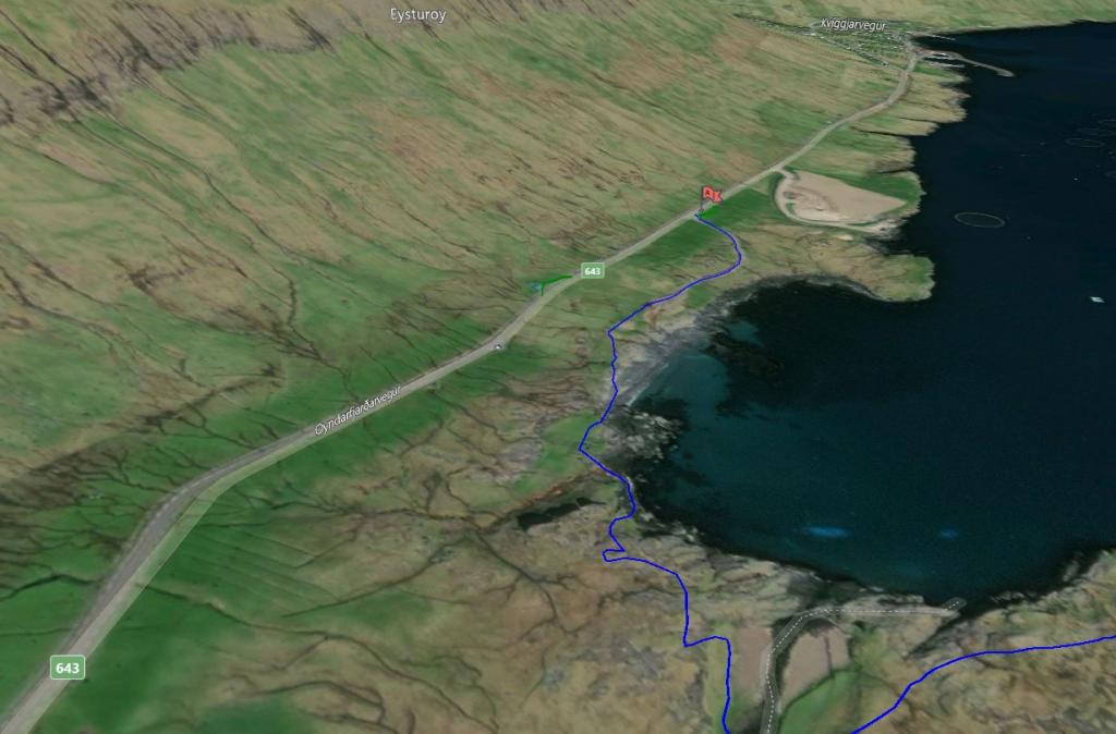 See green line for parking and blue line for startingpoint and hike
 -
 See green line for parking and blue line for startingpoint
Hellurnar - Oyndarfjørður
Public transport
Route 481 connects Oyndarfjørður with Skálabotn. In Skálabotnur, there are several other connections, eg. to Tórshavn.
Arriving by car
Parking, Hellurnar
Good parking is available in Hellurnar, especially if you choose to take the path along the seashore. There is a parking lot by the landing. (see the photo)
-
 parking: green line, startingpoint: blue line
 -
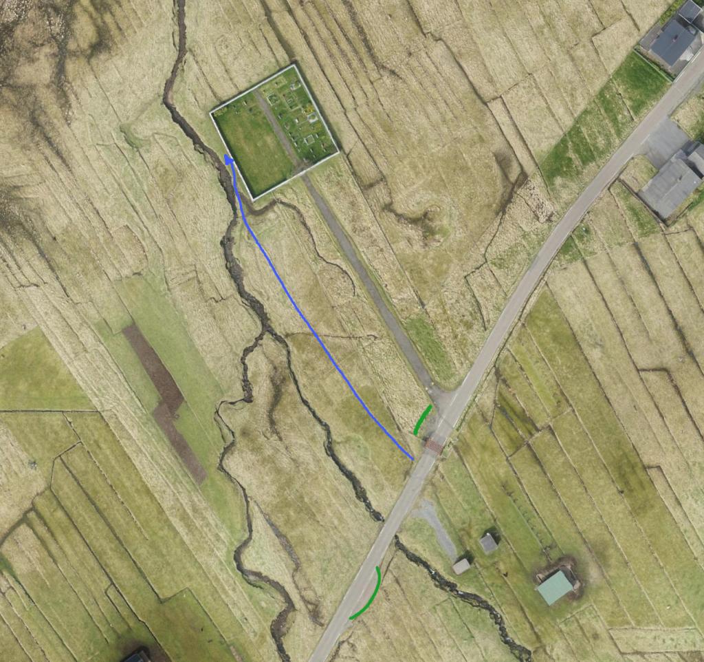 parking: green line, startingpoint: blue line
Oyndarfjørður - Hellurnar
Hellurnar - Oyndarfjørður
Facts

Duration

distance

Peak

Elevation
 The walk is suitable for all
 Easy
- Very even and easy hike. A few hills are along the way and balustrades are installed where you have to be careful
Easy
- Very even and easy hike. A few hills are along the way and balustrades are installed where you have to be careful
 Even, bedrock and grass covered
