


You haven’t got any favourites yet
This is where you can collect inspiration, articles, events and places that interest you.
Click the icon on pages and they’ll appear here.
Your favourites
Inspiration & Articles
Events & Tours
Places
Hiking
INSPIRATION & ARTICLES
EVENTS & HIKES
Places
Saksun - Tjørnuvík


Link Copied!

-
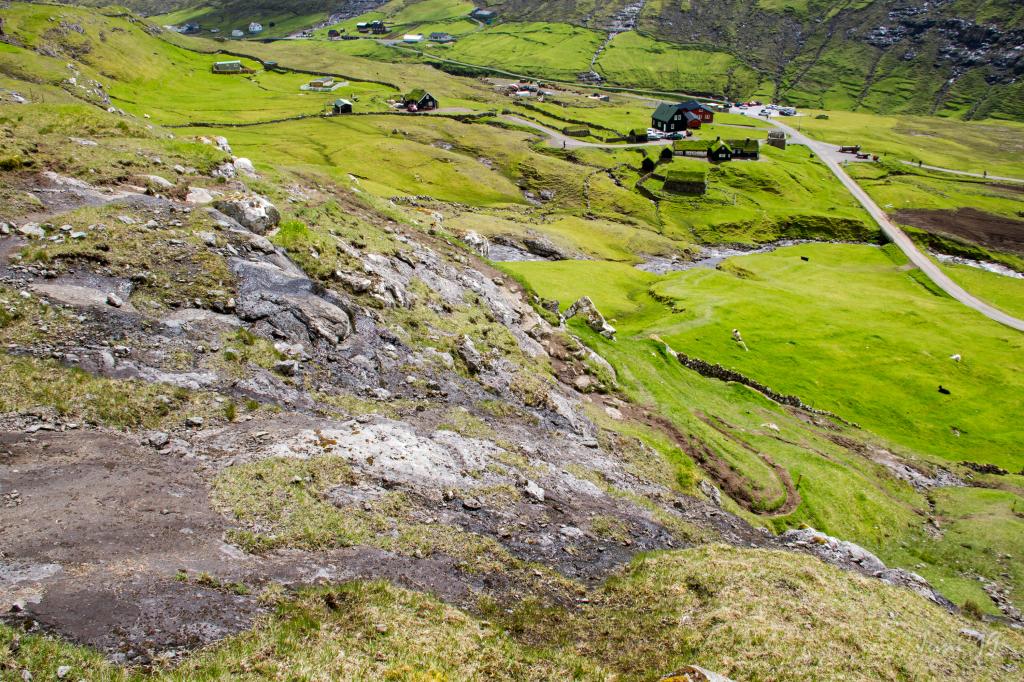
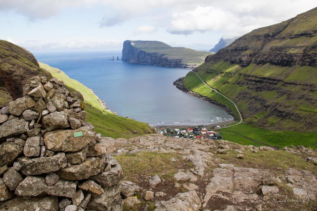
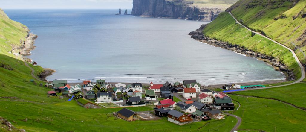
 View above Tjørnuvík village. Photo: @dpc_photography
 -
 The path up from Saksun. To the right the ancient Dúvugarður in Saksun. Photo: Óli Gardshodn
 -
 The very beautiful iconic narrow canal into Pollin í Saksun. Photo: Óli Gardshodn
 -
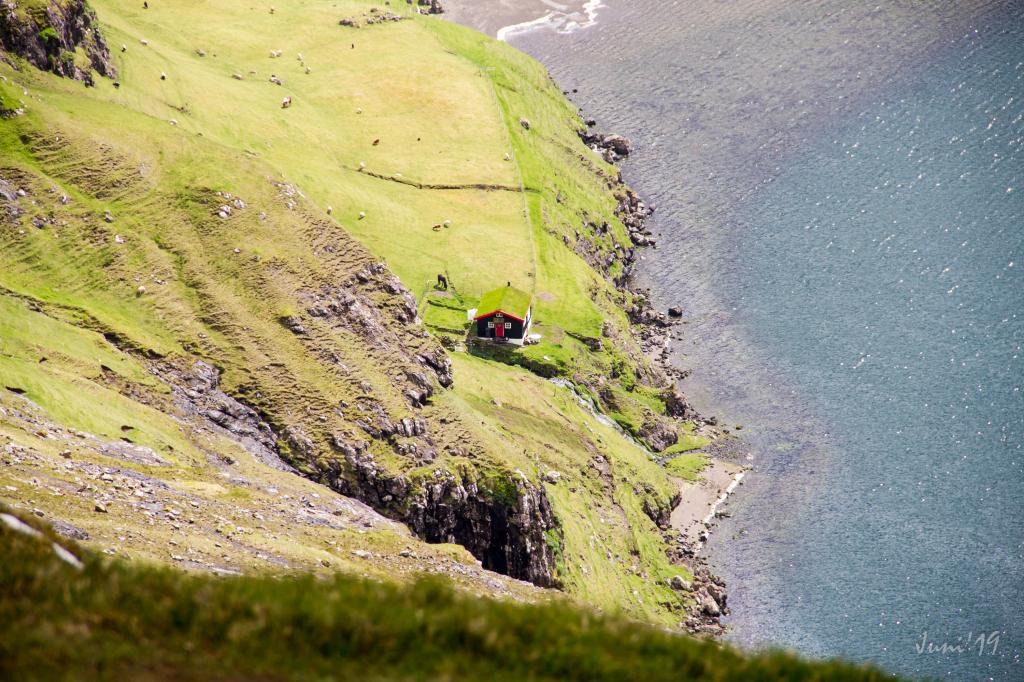 Cottage by the lake Pollin í Saksun. Óli Gardshodn
 -
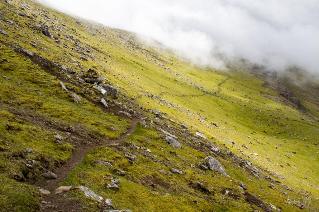 The path is visible most of the hike. Photo: Óli Gardshodn
 -
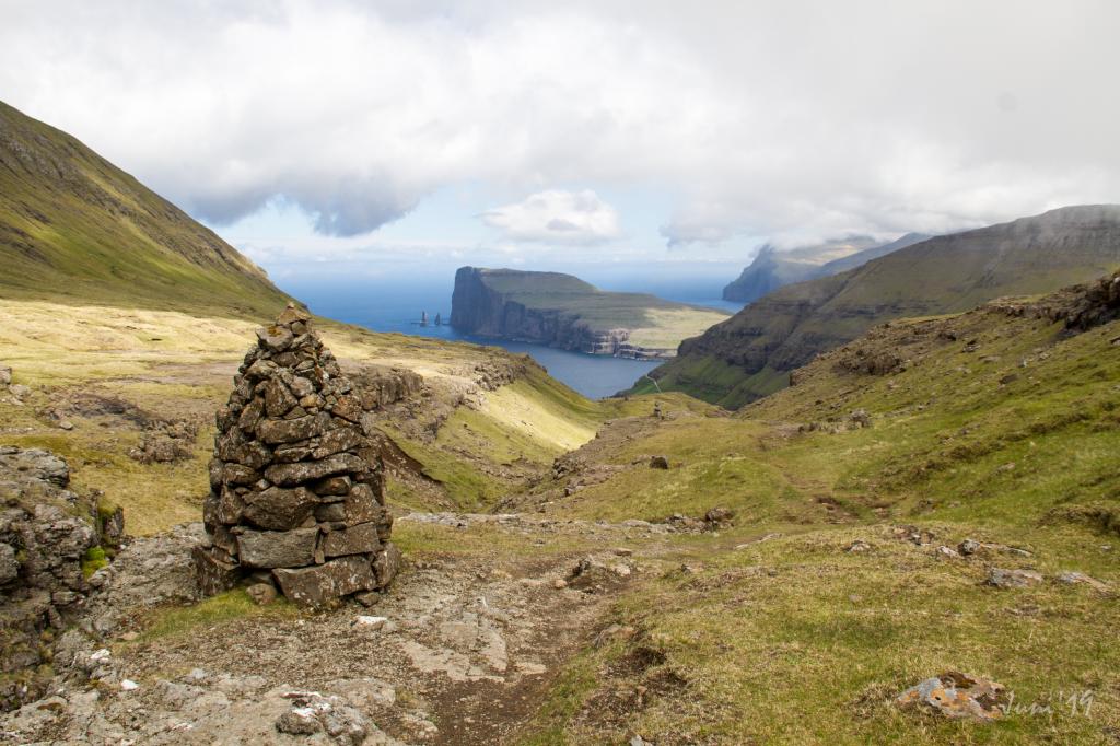 Cairn at Støðilsgil above Tjørnuvík. Photo: Óli Gardshodn
 -
 View above Tjørnuvík village. Cairn as signpost. Photo: Óli Gardshodn
-
View above Tjørnuvík village. Photo: @dpc_photography
-
The path up from Saksun. To the right the ancient Dúvugarður in Saksun. Photo: Óli Gardshodn
-
The very beautiful iconic narrow canal into Pollin í Saksun. Photo: Óli Gardshodn
-
Cottage by the lake Pollin í Saksun. Óli Gardshodn
-
The path is visible most of the hike. Photo: Óli Gardshodn
-
Cairn at Støðilsgil above Tjørnuvík. Photo: Óli Gardshodn
-
View above Tjørnuvík village. Cairn as signpost. Photo: Óli Gardshodn
Breathtaking views, unique landscapes, and charming villages
In Saksun, the village path begins just above the church, a few metres up the road to Dúvugarðar. The trail climbs diagonally eastwards into the valley and curves in a horseshoe shape up around the old infield area surrounding the farm.From the entrance to Dúvugarðar, follow the blue markers for about 300 metres until you reach the gate in the old horse trail. After passing it, the path climbs steeply. Beneath the cliffs, the trail climbs diagonally out through the valley and up onto the ridge above Dúvugarðar. From the ridge, walk about 350 metres straight out through the valley across the Miðá river.
As you walk, there are magnificent views over Saksun, Dúvugarðar, and the beautiful lagoon, Pollurin, and the narrow Ósin. The high mountains surrounding the village create both a mysterious atmosphere and extraordinary beauty. Pollurin once served as a natural harbour, but after a violent storm in the 1600s, sand blocked the fjord.
Beyond Miðá, the path ascends diagonally along the mountainside before climbing to the plateau at Øksl, marked by a large cairn. Parts of the trail may be unclear on the way up, but from the cairn onwards, a continuous cairn path leads all the way to Tjørnuvík. Pause here to enjoy the stunning view over Saksun before continuing inland towards Tjørnuvíksskarð, at 522 metres, the eighth-highest village path crossing in the Faroe Islands.
The cairns guide you north into the valley Frammi í Dal, where the river Gellingará winds peacefully through the landscape. There is a special tranquillity here that brings a sense of calm.
At Tjørnuvíksskarð, there are spectacular views towards the northern cliffs of Eiði and the famous sea stacks, Risin and Kellingin (the Giant and the Witch). According to legend, they came from Iceland to pull the Faroe Islands back with them. While the Giant stood in the sea, the Witch climbed Eiðiskollur to tie the islands together. The work took too long, sunrise caught them, and they turned to stone. From here, you can also see Slættaratindur and Gráfelli, the two highest mountains in the Faroe Islands, rising 880 and 856 metres above sea level.
Follow the cairns all the way down to Tjørnuvík. Notice how beautifully many of them are built – perhaps there has long been a friendly rivalry between the people of Tjørnuvík and nearby Haldórsvík because their cairns are at least as beautiful and majestically built.
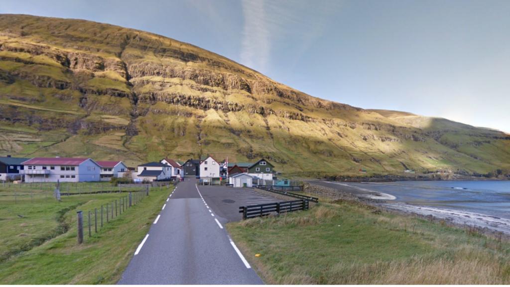
At around 220 metres above sea level, the village gradually comes into view. As you enter the old clustered black-tarred houses, many with traditional turf roofs, it somehow feels cosy and homely. Below lies the wide sandy beach and powerful surf that attract many visitors.
Tjørnuvík is also famous for its traditional Kingo singing, an ancient Faroese hymn tradition originating from the Danish hymn writer Thomas Kingo. The village choir still performs these beautiful hymns today.


Saksun - Tjørnuvík
Public transport
Saksun is not reachable by public transport. Route 202 from Oyrarbakki is driving to and from Tjørnuvík.
Arriving by car
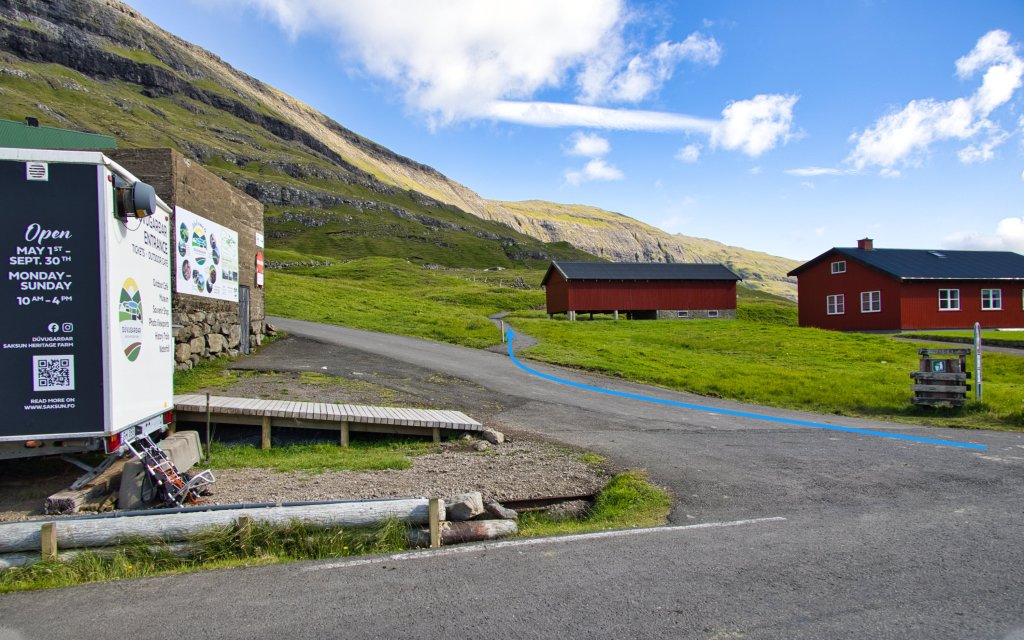
Parkering, Saksun
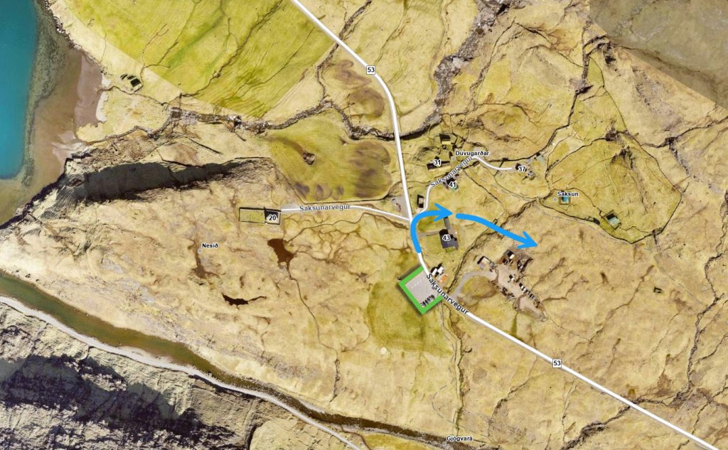
The public parking lot near the church in Saksun is a good place to park. From here, walk towards the church, where you will find the start of the path (indicated by a blue line in the picture).
Tjørnuvík - Saksun
Public transport
Saksun is not reachable by public transport. Route 202 from Oyrarbakki is driving to and from Tjørnuvík.
Arriving by car
Parkering, Tjørnuvík
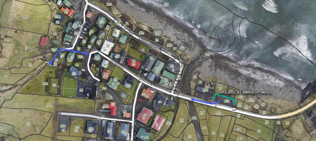
The public parking lot situated by the main road when you enter the village. From there, you walk across the bridge, along the church and through the village to the point where the path begins (illustrated with a blue line on the picture).
-
 See green line for parking and blue line for startingpoint
 -
 parking in Tjørnuvík
 -
 See green line for parking and blue line for startingpoint
Saksun - Tjørnuvík
Tjørnuvík - Saksun
Facts

Duration

distance

Peak

Elevation
 The route is suitable for children above 8 years
 Medium
- Somewhat difficult from Saksun and up to the first cairn
Medium
- Somewhat difficult from Saksun and up to the first cairn
 Grass path. In some places stones and rocks the first leg. Then cairn path, mostly with grass surface
