


You haven’t got any favourites yet
This is where you can collect inspiration, articles, events and places that interest you.
Click the icon on pages and they’ll appear here.
Your favourites
Inspiration & Articles
Events & Tours
Places
Hiking
INSPIRATION & ARTICLES
EVENTS & HIKES
Places
Sandvík - Hvalba


Link Copied!

-
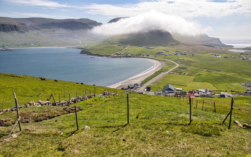
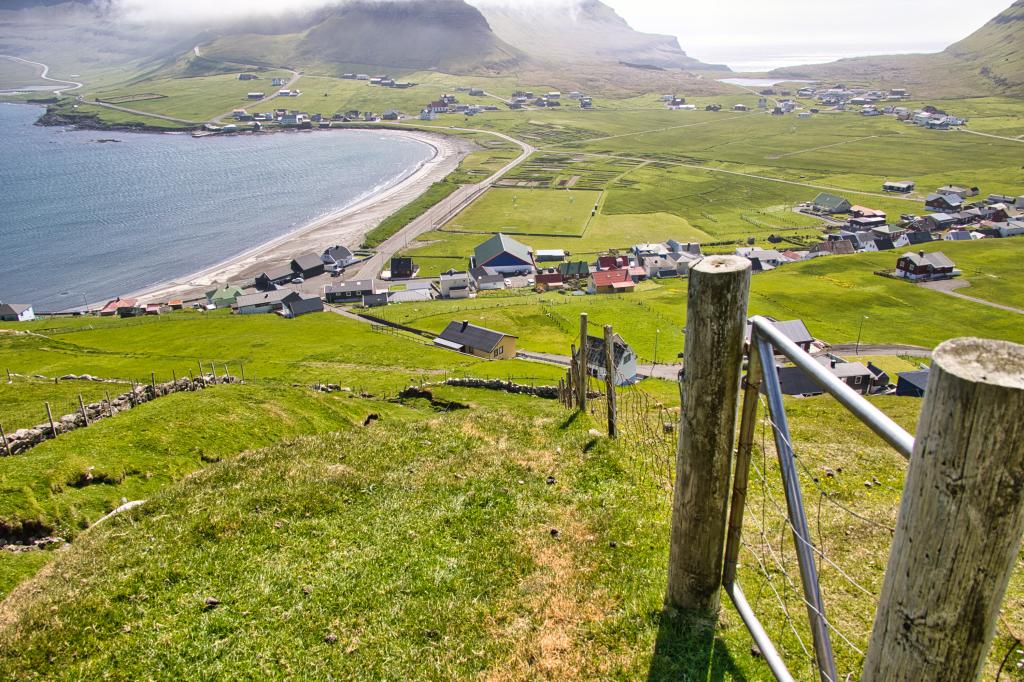
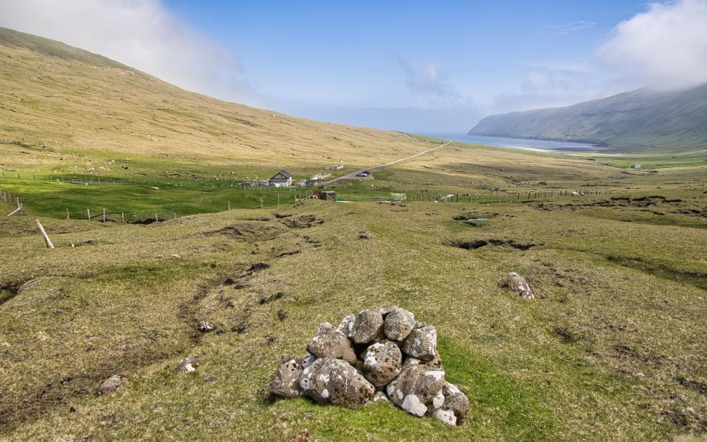 The view from the first cairn above the village gate to the infield in the village of Sandvík. At the end of the road on Mýrarnar you can see the car park right next to the sheep house and the sheepfold. On the right you can see the big sand in Sandvík. Photo: Óli Gardshodn.
 -
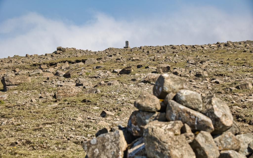 The memorial up on Sandvíksegg, at an altitude of approx. 363 m, which the parish erected for the 14 men who died in the grind catch in Sandvík in 1915. Photo: Óli Gardshodn
 -
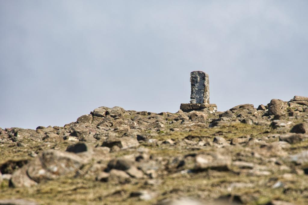 The memorial up on Sandvíksegg, at an altitude of approx. 363 m, which the parish erected for the 14 men who died in the grind catch in Sandvík in 1915. Photo: Óli Gardshodn
 -
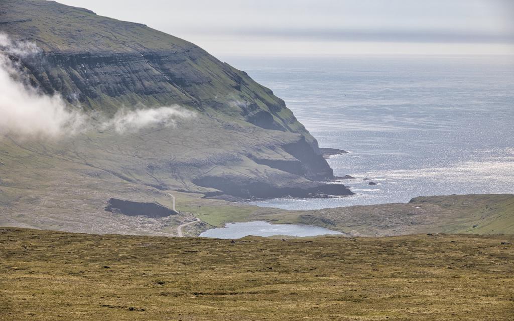 The view from the ridge Sandvíksegg south over Hvalbiareiði, also called Fiskieiði, where we see the water Heygsvatn with the mountain Prestfjall in the background. Photo: Óli Gardshodn
 -
 The view from the Giljabrekka hillside down over the village of Hvalba. In the background to the left is the village of Nes. Photo: Óli Gardshodn
 -
 The village of Hvalba. The last stretch down to the village gate, where it is fairly steep. Photo: Óli Gardshodn
-
The view from the first cairn above the village gate to the infield in the village of Sandvík. At the end of the road on Mýrarnar you can see the car park right next to the sheep house and the sheepfold. On the right you can see the big sand in Sandvík. Photo: Óli Gardshodn.
-
The memorial up on Sandvíksegg, at an altitude of approx. 363 m, which the parish erected for the 14 men who died in the grind catch in Sandvík in 1915. Photo: Óli Gardshodn
-
The memorial up on Sandvíksegg, at an altitude of approx. 363 m, which the parish erected for the 14 men who died in the grind catch in Sandvík in 1915. Photo: Óli Gardshodn
-
The view from the ridge Sandvíksegg south over Hvalbiareiði, also called Fiskieiði, where we see the water Heygsvatn with the mountain Prestfjall in the background. Photo: Óli Gardshodn
-
The view from the Giljabrekka hillside down over the village of Hvalba. In the background to the left is the village of Nes. Photo: Óli Gardshodn
-
The village of Hvalba. The last stretch down to the village gate, where it is fairly steep. Photo: Óli Gardshodn
Discover the scenic Sandvík - Hvalba hike in Suðuroy, featuring historic memorials and stunning views over villages and nature.
The hike starts at the end of the road leading west from Sandvík. Go through the gate and follow the cairns leading upwards the hillside.
Sandvík is among the oldest Faroese village. According to Færeyinga Saga the viking cheiftan Sigmundur Brestisson, who christened the Faroe Islands, swam from Skúvoy to Sandvík in the 11th century after being attacked by his enemies. He arrived exhausted on the beach, and was killed by Torgrímur Illa who stole Sigmundur’s golden arm ring.
The first part of the trip is quite easy, but the path gets steeper. The distance between the cairns gets larger, so it can be difficult to find the way in dark or foggy weather conditions.
In clear weather the view towards Sandvík and the island of Lítli Dímun is fantastic. A memorial stone that commemorates the 14 men who died during a whaling disaster in 1915 is located close to the top. By 1958 the stone had been badly damaged by wind and rain and so it was repaired and replaced.
Continue down towards the village of Hvalba. This is a straightforward and easy path on grassy grounds. During the summer you’ll notice a rich birdlife. The village of Hvalba is situated on large and flat fields and has historically been one of the most populous and wealthy settlements on the islands. Towards the end can be a bit tricky to see the path. Look for the path along the river where a stone wall is on the left and a fence is so the right. Continue to the concrete water tanks, where the outfield gate is situated.


Sandvík - Hvalba
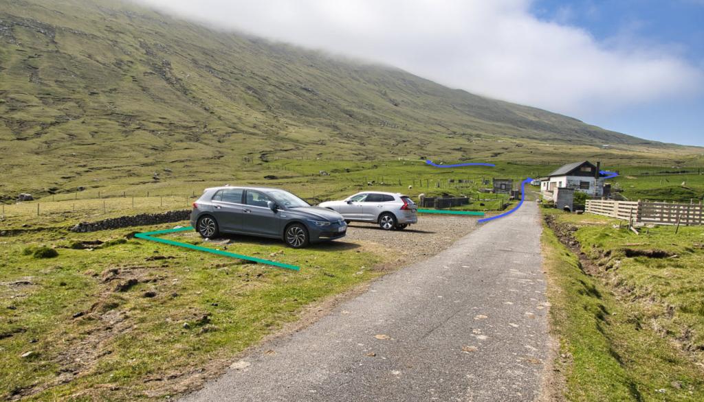
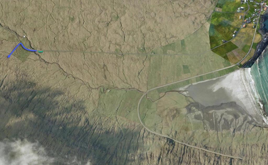
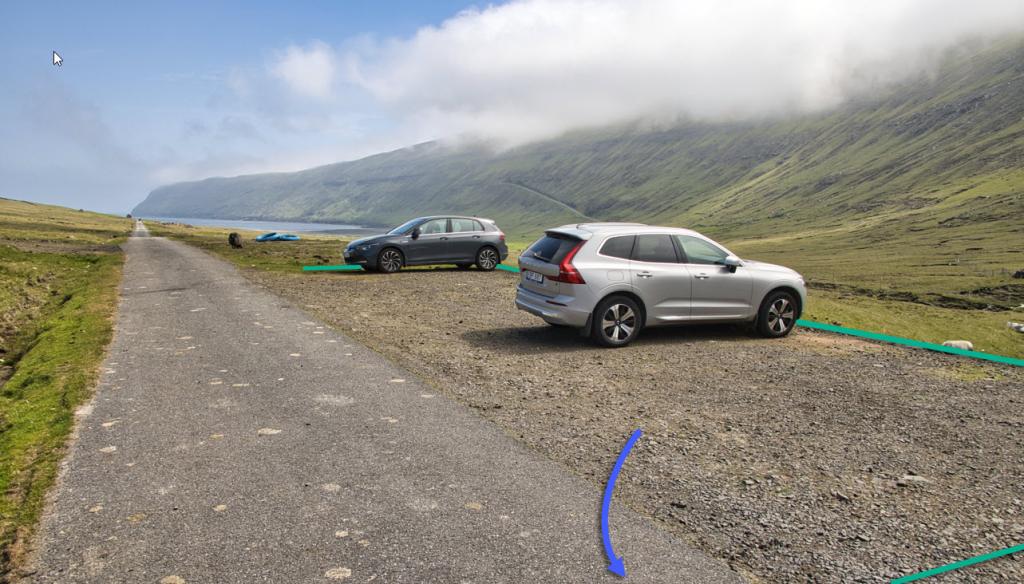
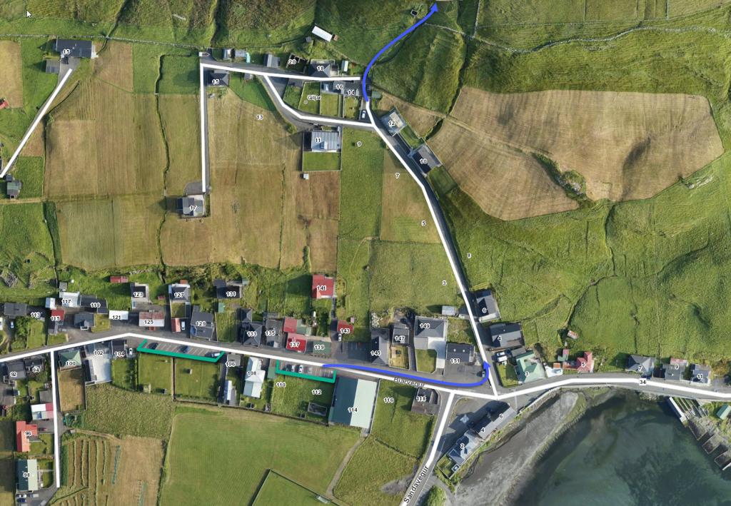
Plenty of parking along the road by the sheepfold, right before the river. See the green lines on the photos. From there follow the path (blue lines)
Hvalba - Sandvík
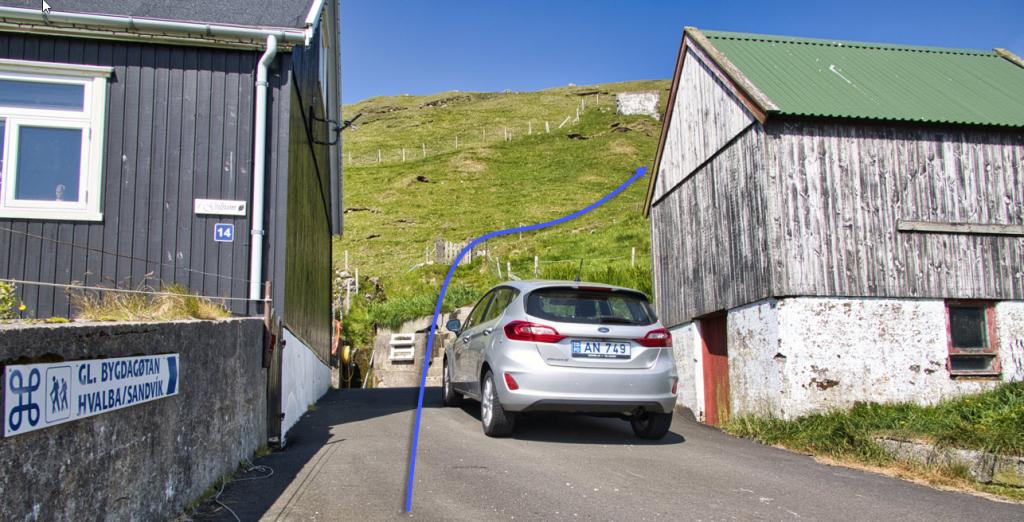
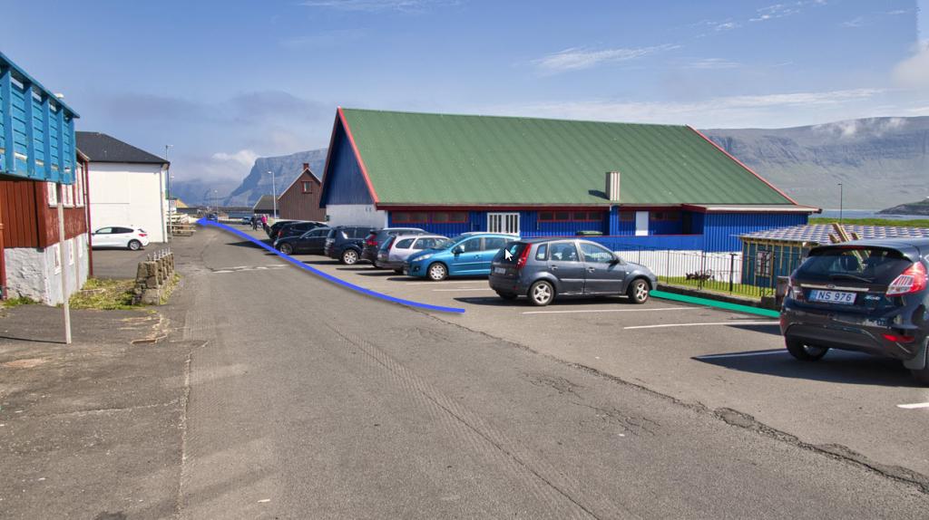
Plenty of parking by the football field, address Bíarveg 114. The path starts on Giljageil 14, see the green lines on the photo. From here follow the village path (blue lines)
Sandvík - Hvalba
Hvalba - Sandvík
Facts

Duration

distance

Peak

Elevation
 8+
8+
 Medium
- From Sandvík it is a bit difficult during the steep and short bit before the highest point.
Medium
- From Sandvík it is a bit difficult during the steep and short bit before the highest point.
 Most of the hike is on grassy fields. Parts are on rocky surface.
