


You haven’t got any favourites yet
This is where you can collect inspiration, articles, events and places that interest you.
Click the icon on pages and they’ll appear here.
Your favourites
Inspiration & Articles
Events & Tours
Places
Hiking
INSPIRATION & ARTICLES
EVENTS & HIKES
Places
Skála – Selatrað


Link Copied!

-
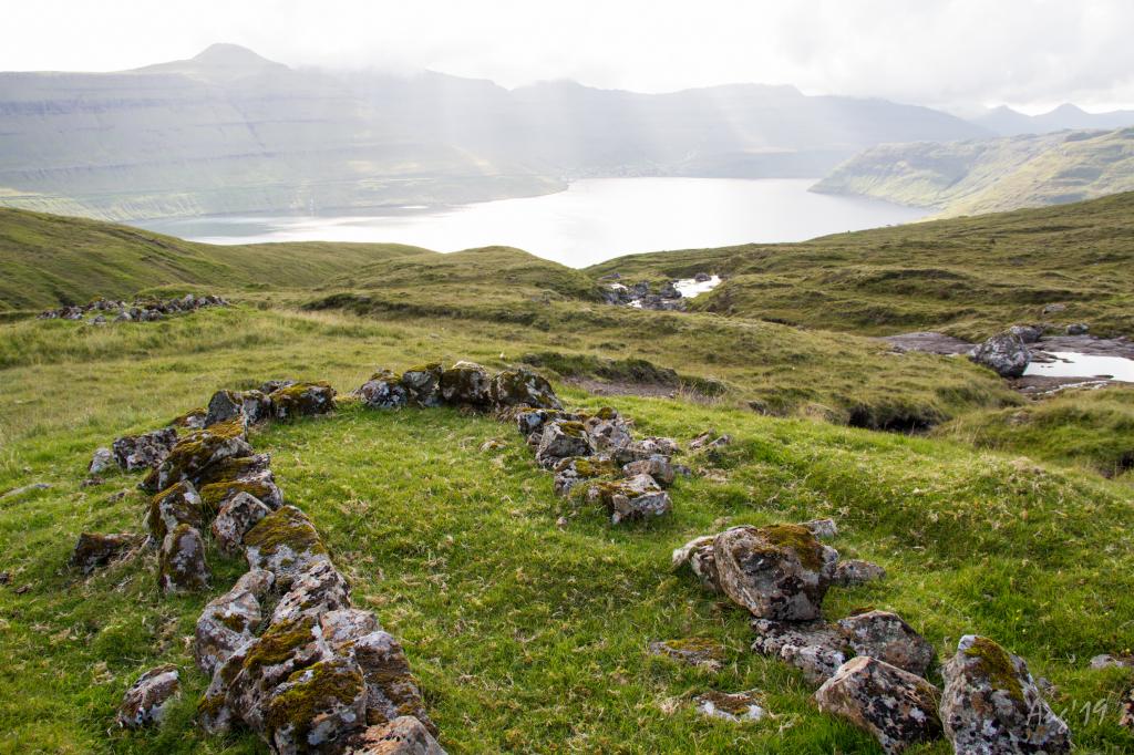
 Well-maintained cairns are throughout the hike except for the last stretch down to Selatrað, which has no cairns. Photo: Óli Gardshodn
 -
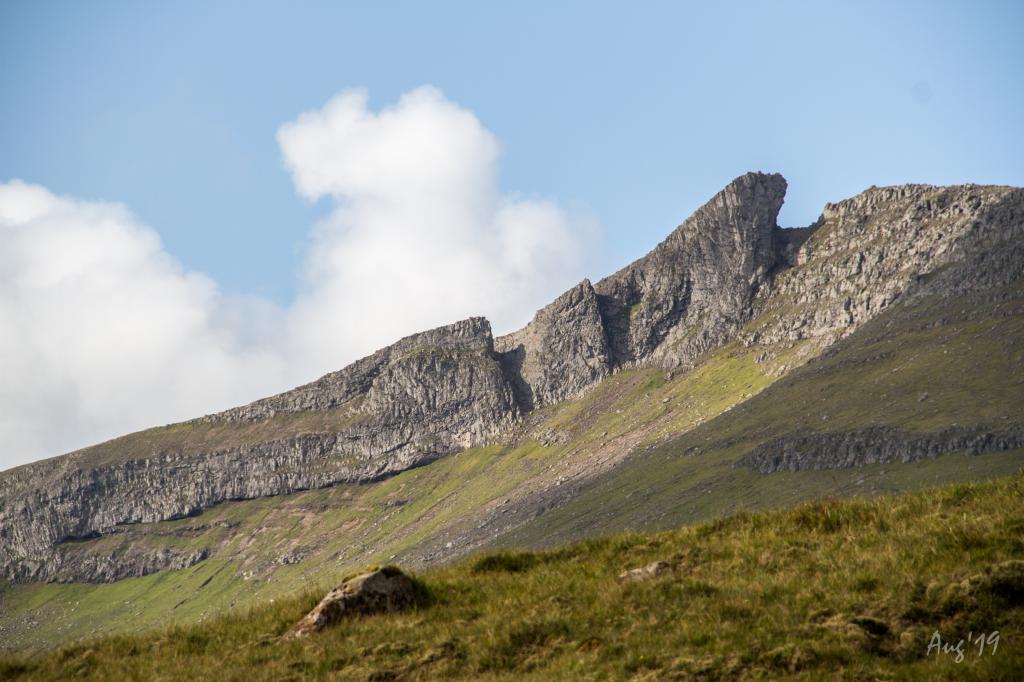 A beautiful and peaceful hike. The stretch from the pass and the next kilometre down through the gorge Trongannagjógv to Skála is especially interesting. Photo: Óli Gardshodn
 -
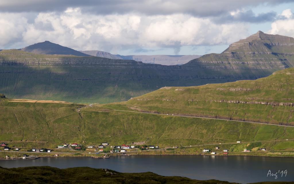
 Many small peat storage huts are by the river Tvørá close to Selatrað. Photo: Óli Gardshodn
 -
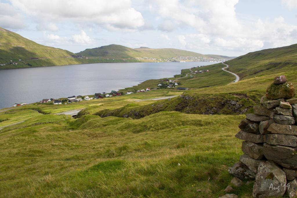
 On the hike you have a great view of the villages on the eastern side of the Skálafjørður. Photo: Óli Gardshodn
-
Well-maintained cairns are throughout the hike except for the last stretch down to Selatrað, which has no cairns. Photo: Óli Gardshodn
-
A beautiful and peaceful hike. The stretch from the pass and the next kilometre down through the gorge Trongannagjógv to Skála is especially interesting. Photo: Óli Gardshodn
-
Many small peat storage huts are by the river Tvørá close to Selatrað. Photo: Óli Gardshodn
-
On the hike you have a great view of the villages on the eastern side of the Skálafjørður. Photo: Óli Gardshodn
Skála – Selatrað offers a beautiful, easy hike with stunning views along the western arm of Skálafjørður fjord.
A beautiful and peaceful hike. The stretch from the pass and the next kilometre down through the gorge Trongmannagjógv to Skála is especially interesting.
Many small peat storage huts are by the river Tvørá close to Selatrað.
The terrain is grass-covered and good for walking throughout, except west of the pass, where it is a little rocky. Two fences with ladders have to be crossed. Another fence must be climbed over by the village wall in Selatrað.
It is easier to find the path when starting in Skála. Here, you walk up through the gate by the river Gjógvará, heading south toward an opening in the fence, from where you will see the first cairn that you need to follow. Well-maintained cairns are throughout the hike except for the last stretch down to Selatrað, which has no cairns.
It is necessary to bring the GPX file with you on the hike since it is easy to take the path toward Skálabotnur instead of the one toward Skála—the lower stretch by Selatrað, descending from the river Breiðá, is shared with the path to Skálabotnur.


Skála – Selatrað
Public transport
It is preferable to arrive by car in Selatrað as public transportation is poor.
Arriving by car
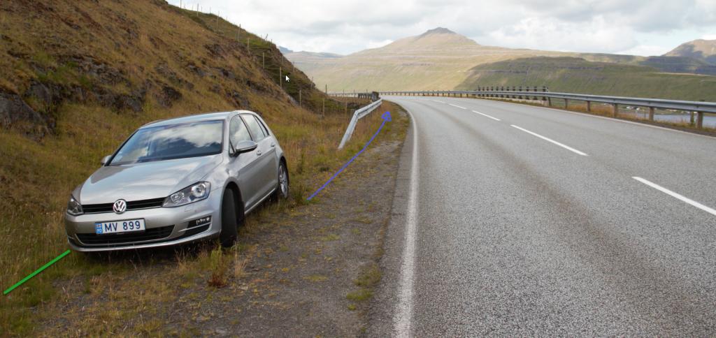
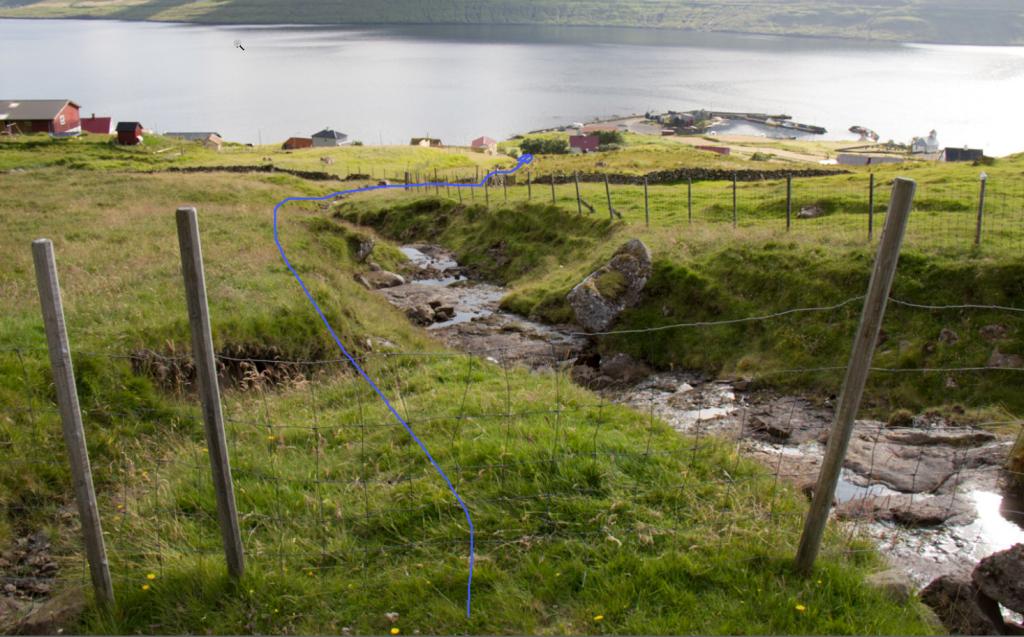
Parking, Skála
There is a parking lot by the sheep shed 460 metres north of the gate. Parking is also available south of the crash fence by the river Gjógvará, 150 metres south of the gate – see the green lines. From there, follow the blue line out through the gate and the fenced area above it.
-
 See green line for parking and blue line for starting point.
 -
 See green line for parking and blue line for starting point.
 -
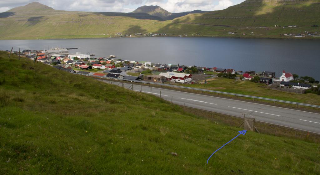 Follow the blue line for starting point.
Selatrað – Skála
Public transport
It is preferable to arrive by car in Selatrað as public transportation is poor. Route 440 drives there occasionally.
Arriving by car
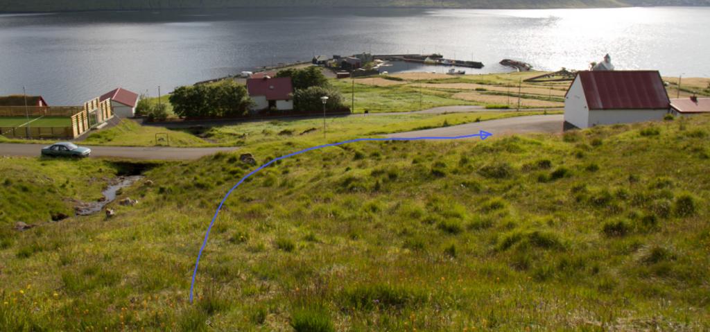
Parking, Selatrað
Parking is available by the mission hall – see the green lines. The mission hall is only used Sunday evenings in winter, leaving ample parking the rest of the time.
From here, follow the old cattle trail up along the northern bank of the river Mittúnsá until you reach the rock wall, where you pass through an iron gate. Continue along the southern bank of Mittúnsá until you reach a fence which you need to climb over at its lowest point.
Plans are to install a ladder or gate here – see the blue line.
-
 See green line for parking and blue line for starting point.
 -
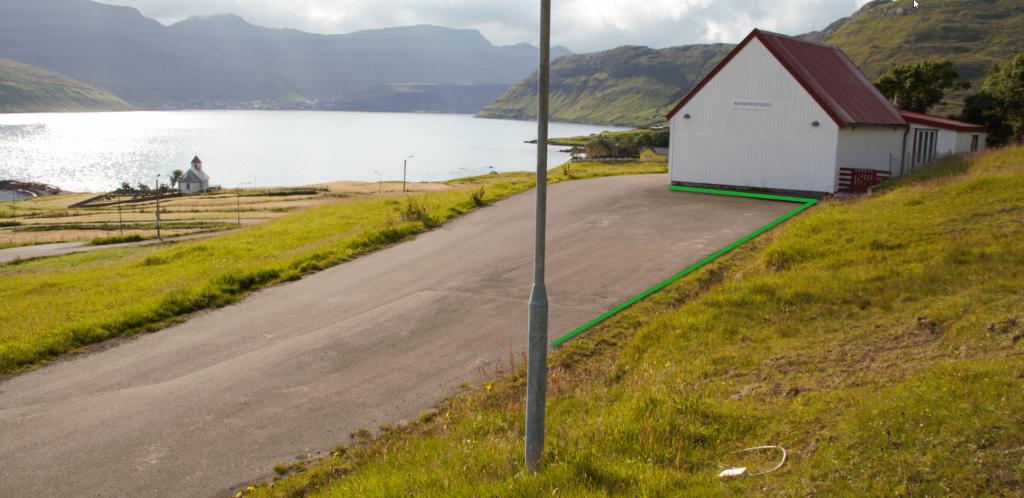 See green line for parking.
 -
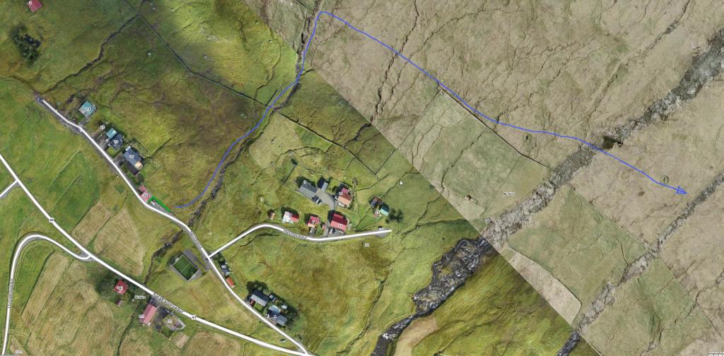
 Follow the blue line for the starting point.
 -
 Follow the blue line for the starting point.
 -
 Follow the blue line for the starting point.
Skála – Selatrað
Selatrað – Skála
Facts

Duration

distance

Peak

Elevation
 Suitable for children 8 years and older
 Medium
- The entire path is easy to walk with no crags to be navigated
Medium
- The entire path is easy to walk with no crags to be navigated
 Grass-covered and good for walking throughout, though a little rocky west of the pass.
You need to go over two gates that have ladders. The hike also goes along a gorge, and another fence must be climbed over by the village wall in Selatrað
Grass-covered and good for walking throughout, though a little rocky west of the pass.
You need to go over two gates that have ladders. The hike also goes along a gorge, and another fence must be climbed over by the village wall in Selatrað
