


You haven’t got any favourites yet
This is where you can collect inspiration, articles, events and places that interest you.
Click the icon on pages and they’ll appear here.
Your favourites
Inspiration & Articles
Events & Tours
Places
Hiking
INSPIRATION & ARTICLES
EVENTS & HIKES
Places
Skálafjørður – Oyri


Link Copied!

-
 Skálafjørður/Skálabotnur. Photo: @dominiclars
 -
 "Behind every corner on the Faroe Islands there are new things to see so just keep on exploring." Photo: @dominiclars
 -
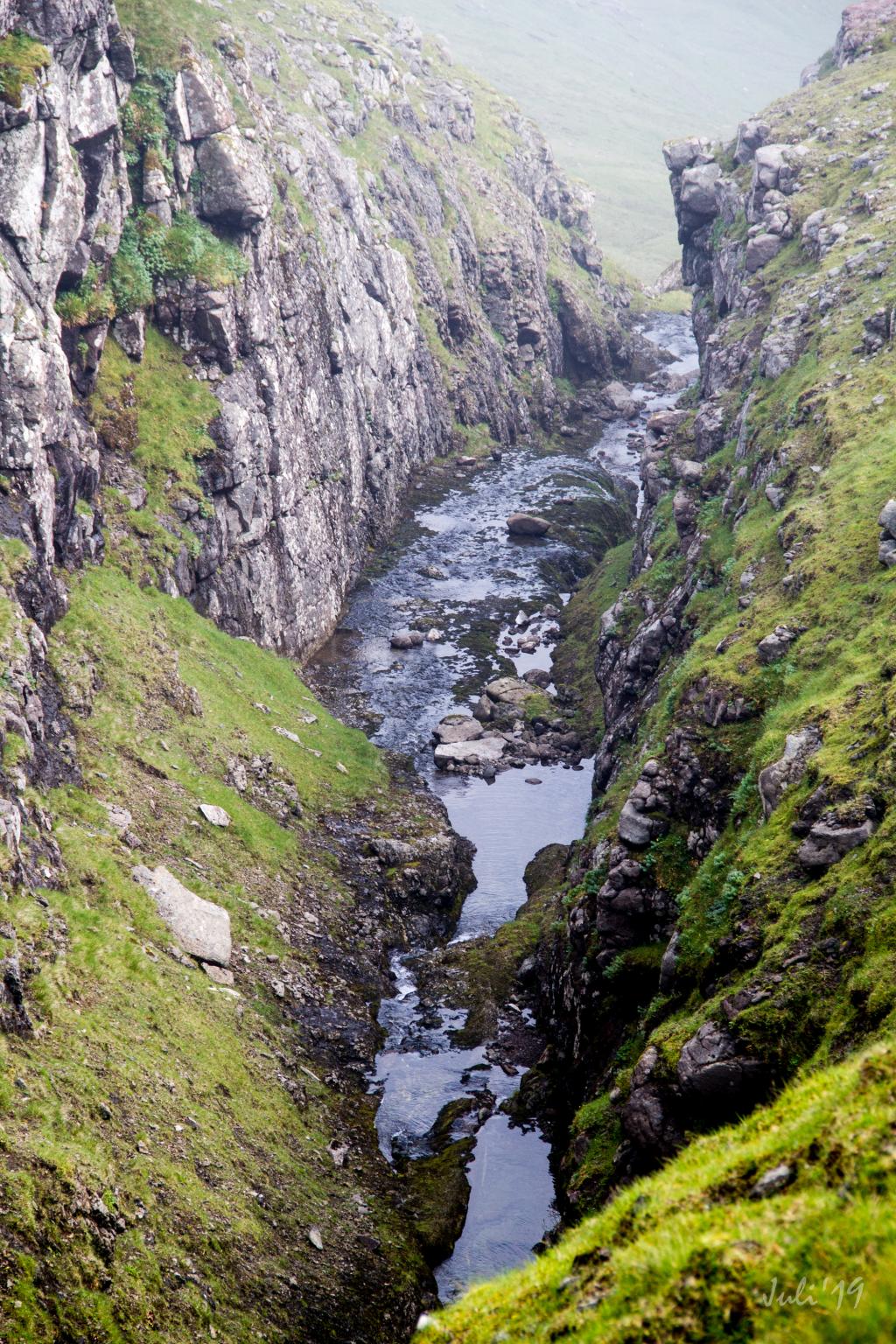 View down over the gorge Øksnagjógv above Skálafjørður. Photo: Óli Gardshodn
 -
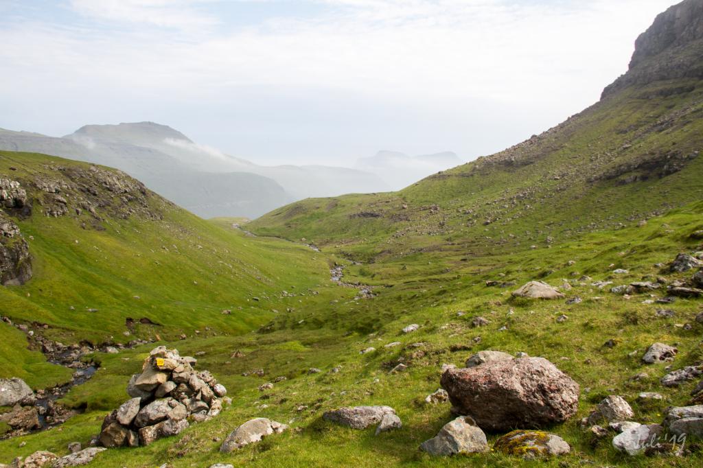 Tranquillity, while we walk up through this nice valley in Gjómunum, just south of the mountain Skálafjall. Photo: Óli Gardshodn
 -
 From the pass Høgukinnaskarð by Skálafjall up to the pass Oyrarskarð you walk through a special landscape. The stones have a special shape, and the colour is kind of brown. Photo: Óli Gardshodn
 -
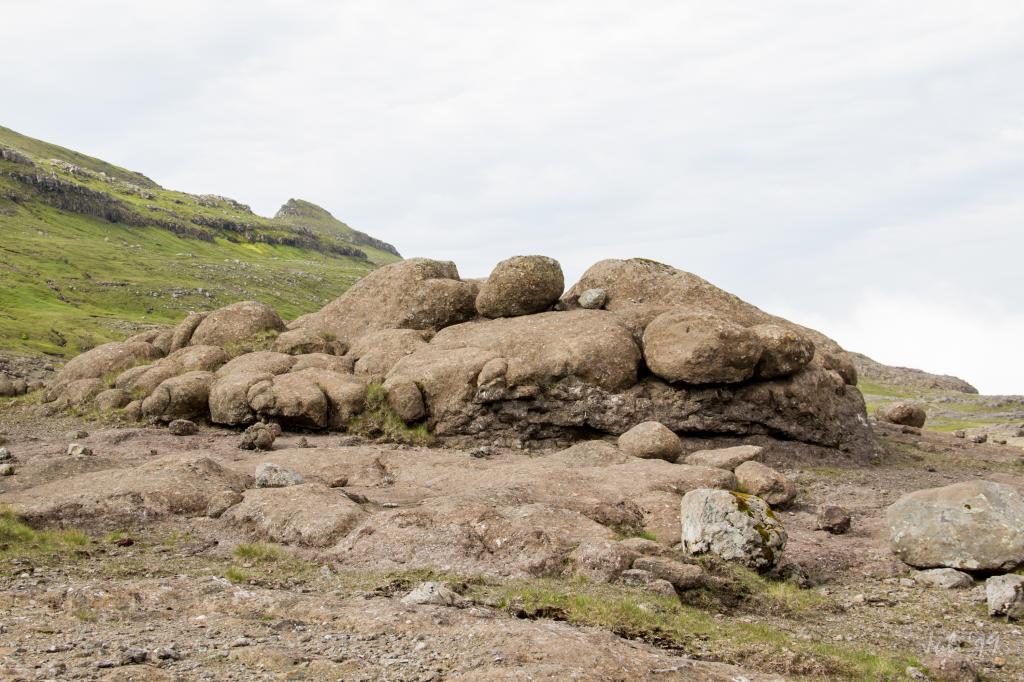 Brown and special - but very good to sit on and enjoy a cup of coffee - 350m east of the pass Oyrarskarð. Photo: Óli Gardshodn
 -
 The view from the pass Oyrarskarð eastwards down on this special and beautiful brown landscape that you walk through on the way up from the village Skálafjørður. Photo: Óli Gardshodn
 -
 On the beautiful and scenic path down to the village of Oyri, here with the view from Sandfelsbrekkan, down over the place Ræðslan where we can see the special rock in the sill Eysturoyarsyllin in 200m. height. We will walk through this sill on our way down to Oyri. Photo: Óli Gardshodn
-
Skálafjørður/Skálabotnur. Photo: @dominiclars
-
"Behind every corner on the Faroe Islands there are new things to see so just keep on exploring." Photo: @dominiclars
-
View down over the gorge Øksnagjógv above Skálafjørður. Photo: Óli Gardshodn
-
Tranquillity, while we walk up through this nice valley in Gjómunum, just south of the mountain Skálafjall. Photo: Óli Gardshodn
-
From the pass Høgukinnaskarð by Skálafjall up to the pass Oyrarskarð you walk through a special landscape. The stones have a special shape, and the colour is kind of brown. Photo: Óli Gardshodn
-
Brown and special - but very good to sit on and enjoy a cup of coffee - 350m east of the pass Oyrarskarð. Photo: Óli Gardshodn
-
The view from the pass Oyrarskarð eastwards down on this special and beautiful brown landscape that you walk through on the way up from the village Skálafjørður. Photo: Óli Gardshodn
-
On the beautiful and scenic path down to the village of Oyri, here with the view from Sandfelsbrekkan, down over the place Ræðslan where we can see the special rock in the sill Eysturoyarsyllin in 200m. height. We will walk through this sill on our way down to Oyri. Photo: Óli Gardshodn
Discover the scenic Skálafjørður – Oyri hike featuring fascinating rock formations, peaceful paths, and stunning mountain views.
The often-underestimated village path between Skálabotnur and Oyri is fascinating and peaceful as well as pleasant to walk. As you meander through rough rocky areas and Eysturoyarsillin, a magnificent sill, you will find ball-shaped rocks and have views over the many peaks of Eysturoy and Streymoy.
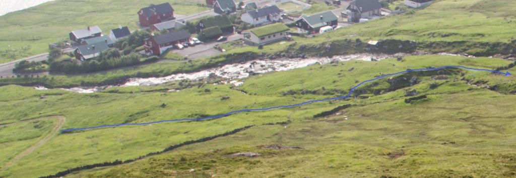
At Skálabotnur, the path is easy to find. From the sheep pen north of the church Keldan, cross the wide bridge over the river, where signposts with yellow marks will lead you onward (note that some posts might have toppled).
When you have reached an elevation of 350 metres by Skála, follow the old cairns that clearly indicate the right path all the way to Oyri.
If starting in Oyri, walk up to the first bend in the road Tungugøta. From here, follow the river just above the bend up through the gate, where you see the first signposts. You will also spot the first cairn at the gate in Oyri and signposts will lead you up to it.
The path is difficult to spot, so you need to follow the signposts and the cairns all the way.


Skálabotnur – Oyri
Public transport
Bus route 450 Skálafjørður - Kollafjørður is driving to both Skálabotnur and Oyri which makes it easy to go by public transport.
Arriving by car
Parking, Skálabotnur/Skálafjørður
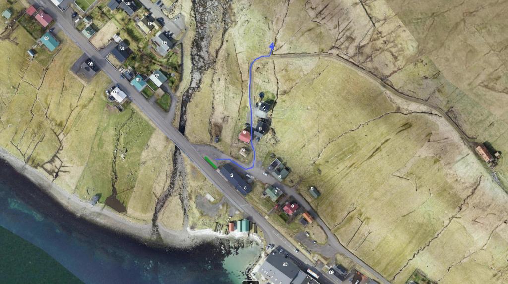
Good parking is available in Skálabotnur, e.g. by the road from the church Keldan up to the sheep pen north of the church. (see the photo)
-
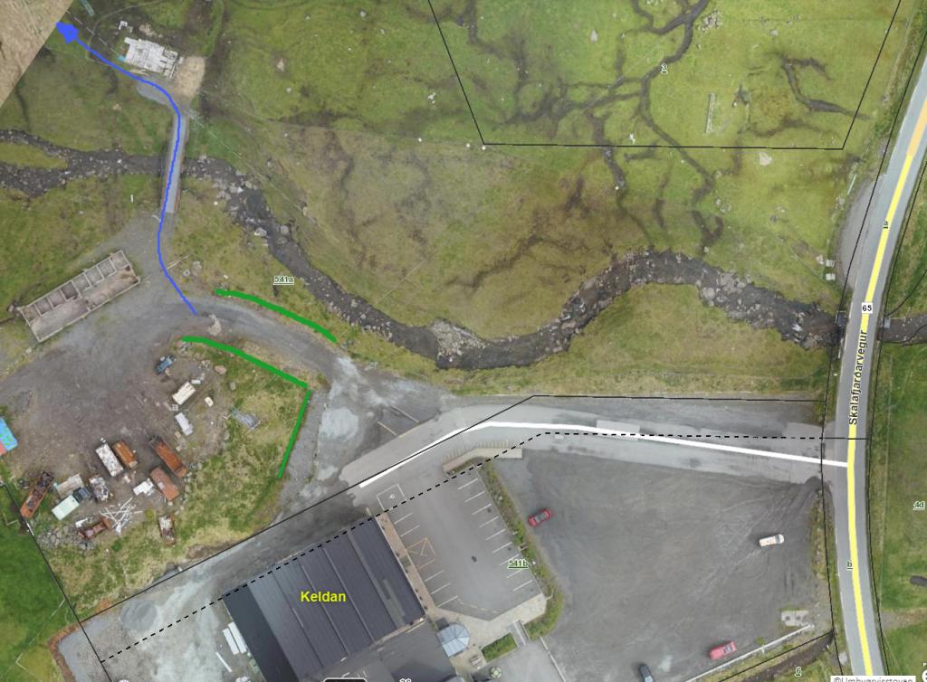 See green line for parking and blue line for startingpoint
 -
 See green line for parking and blue line for startingpoint
Oyri - Skálabotnur
Public transport
Bus route 450 Skálafjørður - Kollafjørður is driving to both Skálabotnur and Oyri which makes it easy to go by public transport.
Arriving by car
Parking, Oyri
In Oyri there is a parking lot by Garnhúsið. (see the photo)
-
 See green line for parking and blue line for startingpoint
 -
 See blue line for startingpoint
Skálabotnur – Oyri
Oyri - Skálabotnur
Facts

Duration

distance

Peak

Elevation
 Suitable for children
 Medium
- Very good for walking throughout, although quite a long hike
Medium
- Very good for walking throughout, although quite a long hike
 Grass-covered and good for walking throughout. On the way down to Oyri, it is nice and fascinating to walk between all the large rocks that lie up the mountainside on Sandfelli.
