


You haven’t got any favourites yet
This is where you can collect inspiration, articles, events and places that interest you.
Click the icon on pages and they’ll appear here.
Your favourites
Inspiration & Articles
Events & Tours
Places
Hiking
INSPIRATION & ARTICLES
EVENTS & HIKES
Places
Skálafjørður – Selatrað


Link Copied!

-
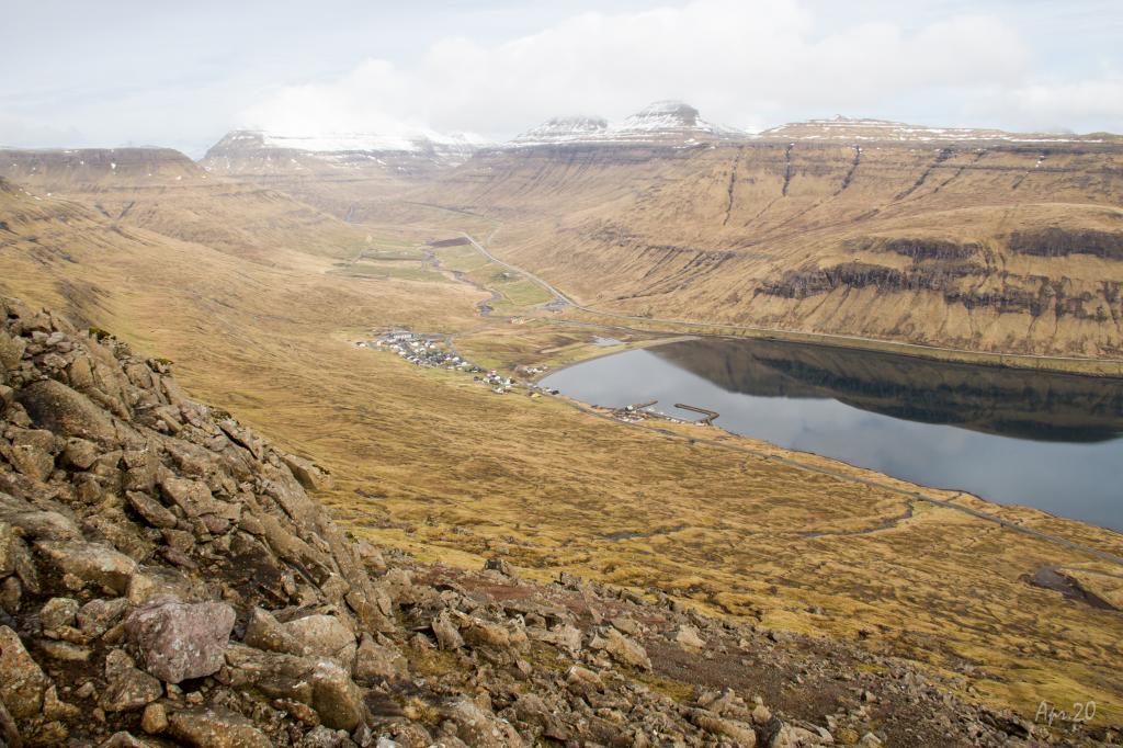
 The village of Skálafjørður. Photo: @dominiclars
 -
 The walk up from the village Skálafjørður, to Ennisstígar in 350m. height, is fairly steep. Photo: Óli Gardshodn
 -
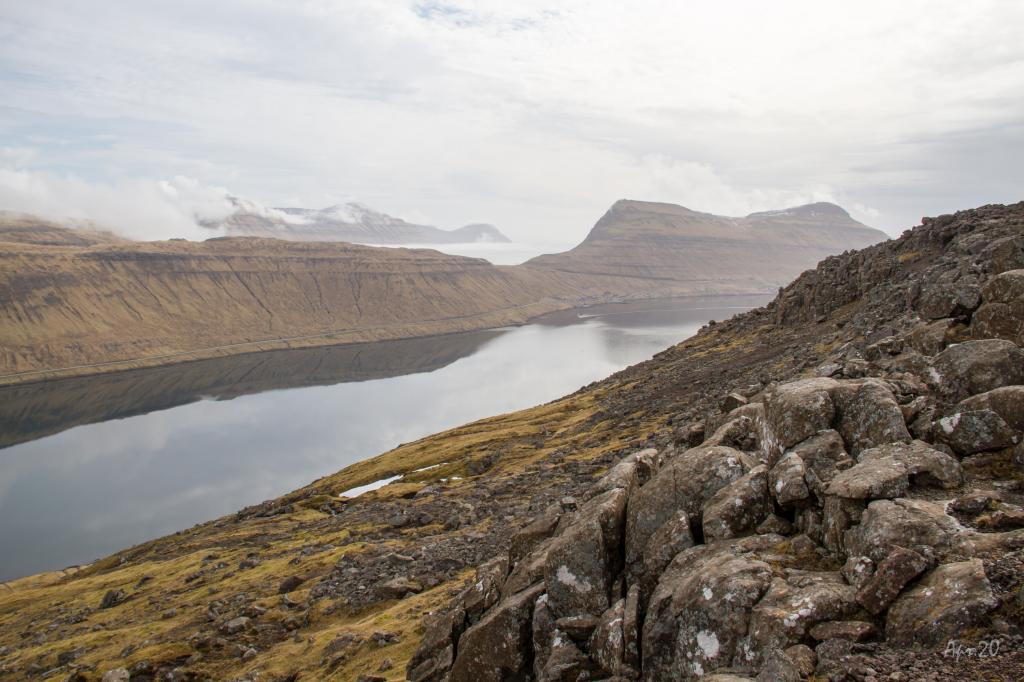 The view from Ennisstígar, south over the fjord Skálafjørðurin. Photo: Óli Gardshodn
 -
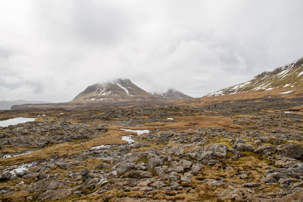 Smuk natur og fredeligt mens vi går langs små søer og store varde oppe på den store slette øst for fjeldet Reyðafelstindur. Photo: Óli Gardshodn
 -
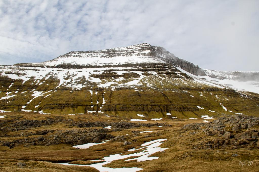 View up to the mountain Reyðafelstindur, 764m. Photo: Óli Gardshodn
-
The village of Skálafjørður. Photo: @dominiclars
-
The walk up from the village Skálafjørður, to Ennisstígar in 350m. height, is fairly steep. Photo: Óli Gardshodn
-
The view from Ennisstígar, south over the fjord Skálafjørðurin. Photo: Óli Gardshodn
-
Smuk natur og fredeligt mens vi går langs små søer og store varde oppe på den store slette øst for fjeldet Reyðafelstindur. Photo: Óli Gardshodn
-
View up to the mountain Reyðafelstindur, 764m. Photo: Óli Gardshodn
Skálafjørður – Selatrað offers a steep, scenic hike through plains, ponds, and some of the largest cairns in the Faroes.
The ascent from Skálabotnur is quite steep, and it is strenuous to come up to the plain. A large plain with bedrock, ponds and bogs stretches all the way from the path through the crags called Ennistígar to the pass Millum Fjalla. It is peaceful to walk among all the birds that live here. At Selatrað the terrain is grass-covered and good for walking. The view over this lovely village is unique, the marina, church, park and gardens with large trees defining the village.
The cairns are particularly big and fascinating between Skálabotnur and Millum Fjalla.
It is not possible to hike from Skálabotnur up along the river Ennisá since fenced-off private plots of land are on both sides. It is recommended to walk up between the rivers Vakará and Skipá, where the old cattle grid was. Hike up south of the old water reservoir to the corner of the fence, where you can pass through an opening.
At Selatrað, the best route is to go from the mission hall up the old cattle trail on the northern bank of the river Mittúnsá until you reach a rock wall, where you go through an iron fence. From here, continue along the southern bank of Mittúnsá until you reach a fence where you need to find the best place to climb over it. Continue on the village path.


Skálafjørður – Selatrað
Public transport
Route 440, called Skálafjarðarleiðin, stops in Skálabotnur and Selatrað. However, if you want to get on the bus at Selatrað, you must notify SSL, the public transportation company, ahead of time.
Arriving by car
Parking, Skálabotnur
A large parking lot is next to where the path begins. Parking is also available at the parking spaces close to the marina. (see the photos)
-
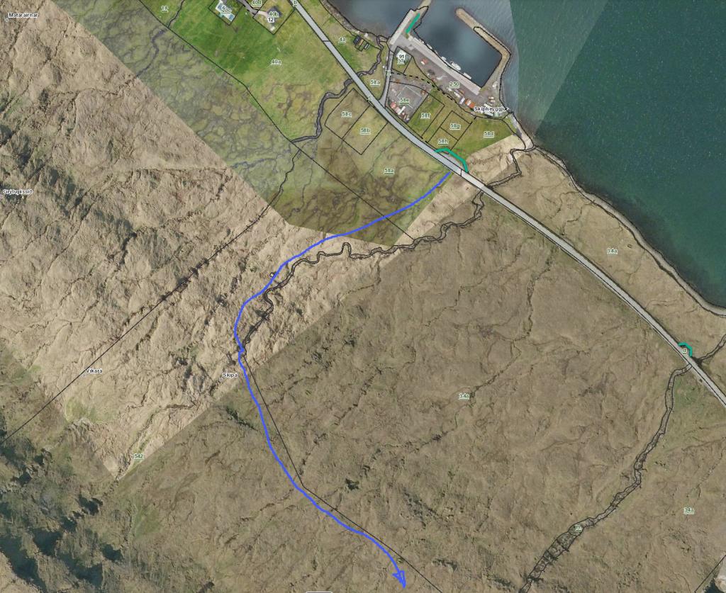 See green line for parking and blue line for starting point.
 -
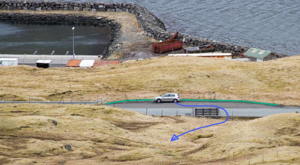 See green line for parking and blue line for starting point.
Selatrað - Skálabotnur
Public transport
Route 440, called Skálafjarðarleiðin, stops in Skálabotnur and Selatrað. However, if you want to get on the bus at Selatrað, you must notify SSL, the public transportation company, ahead of time.
Arriving by car
Parking, Selatrað
Parking is available by the mission hall. From there, follow the blue line. (see the photo)
-
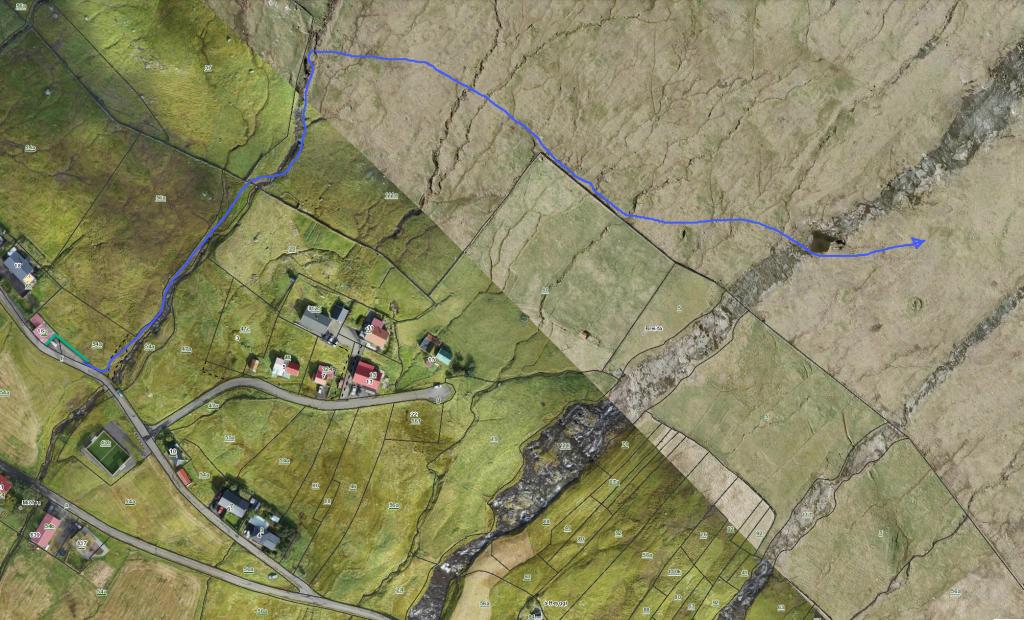 Follow the blue line for the starting point.
 -
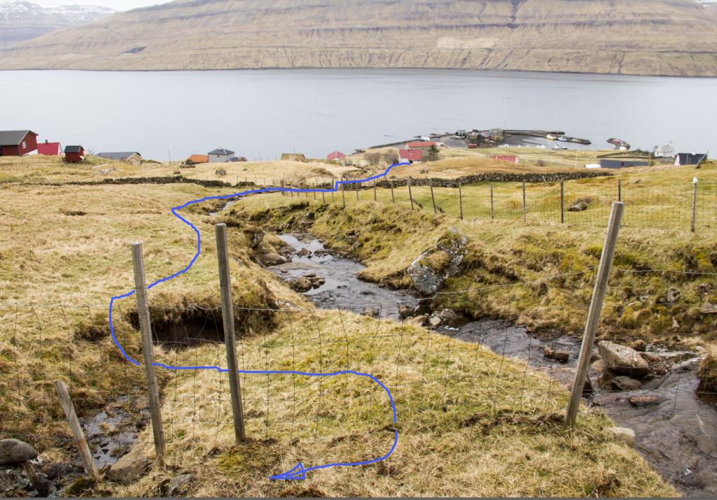 Follow the blue line for the starting point.
 -
 See green line for parking and blue line for starting point.
Skálafjørður – Selatrað
Selatrað - Skálafjørður
Facts

Duration

distance

Peak

Elevation
 Suitable for children 10 years and older
 Difficult
- The ascent from Skálabotnur is steep. The path through the crag Ennistígar is quite rugged, where you have to climb in places
Difficult
- The ascent from Skálabotnur is steep. The path through the crag Ennistígar is quite rugged, where you have to climb in places
 The ascent from Skálabotnur up to the plain is steep and rugged in places. Otherwise, the terrain is grass-covered and good for walking
