WHAT'S ON


Language:


Sites
You haven’t got any favourites yet
This is where you can collect inspiration, articles, events and places that interest you.
Click the icon on pages and they’ll appear here.
Your favourites
Inspiration & Articles
Events & Tours
Places
Hiking
Search
Search results
INSPIRATION & ARTICLES
Read More
EVENTS & HIKES
Read More
Places
Read More
Skálavík - Skálhøvdi - Skálavík


Link Copied!

-

-
-
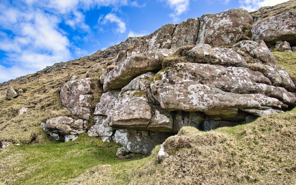 the rock shelter Barnhús
 -
-
-
-
the rock shelter Barnhús
-
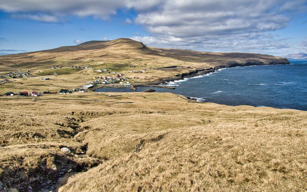
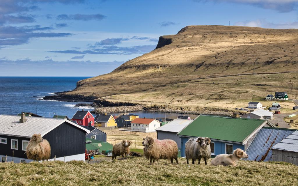
Skálavík - Skálhøvdi - Skálavík: Enjoy a beautiful, easy 2 km hike with stunning views, local legends, and peaceful nature in Sandoy.
The hike starts at the eastern end of the lower road, Sótabakki, leading to the sheepfold on the southern side of the bay. This road was originally intended for a new harbour, but the plan was abandoned in the late 1980s. Today, the area is used for sheep farming, and the land is closed off three times a year—this is marked with a sign at the sheepfold gate.Pass through both gates by the sheepfold and continue towards Torvheyggjar, where you will see Fiskavarðin on the headland. This cairn was traditionally used to ensure good fishing luck—people would throw stones into it when fish were scarce.
From Fiskavarðin, the path leads up to the rock shelter Barnhús. A tragic local legend tells of a woman at Dalsgarður who could not carry a child to term. One day, she finally gave birth successfully, but that same night, the midwife who helped her lost her child. The land the midwife was offered as thanks became known for bringing misfortune, and to this day, no one in Skálavík dares to own it.
Continue southwards along the stream, enjoying views over Skálavík and the surrounding mountains. From the top of Skálhøvdi, you can see Húsavík, Lítla Dímun, Beinisvørð, and across Sandoy and the northern islands. This spot was historically used for watchkeeping, and the remains of an old guard post can still be seen.
Do not step beyond the flat area around the cairn at the summit for safety reasons. Return via the same route.


Tórshavn - Skálavík
Tórshavn - Skálavík
Take bus 650 from Tórshavn to Sandur
and then change to bus 601 from Sandur: Dalur - Húsavík - Skálavík – Sandur
Skálavík, Sótarbakki
Skálavík, Sótarbakki
There is excellent parking by the Sheepfold at the end of Sótabakki road – see the green lines. From there, follow the blue line through both gates at the sheepfold and continue east to Fiskavarðin.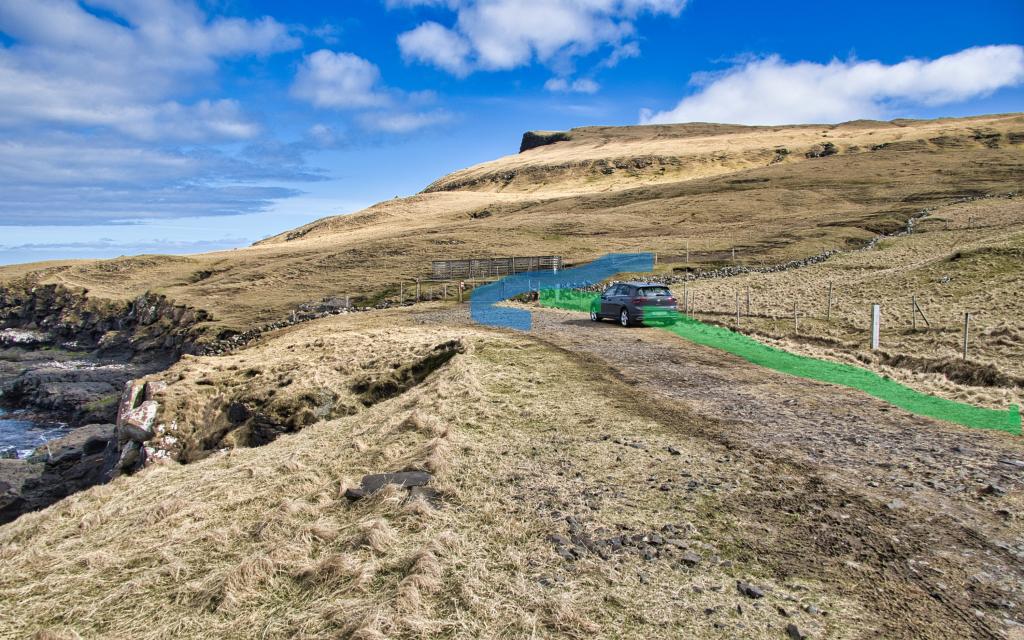
Facts

Duration

distance

Peak

Elevation
 Suitable for children 6 years and above
 Medium
-
Medium
-
 Grassy and good surface
