


You haven’t got any favourites yet
This is where you can collect inspiration, articles, events and places that interest you.
Click the icon on pages and they’ll appear here.
Your favourites
Inspiration & Articles
Events & Tours
Places
Hiking
INSPIRATION & ARTICLES
EVENTS & HIKES
Places
Sundshálsur - Syðradalur


Link Copied!

-
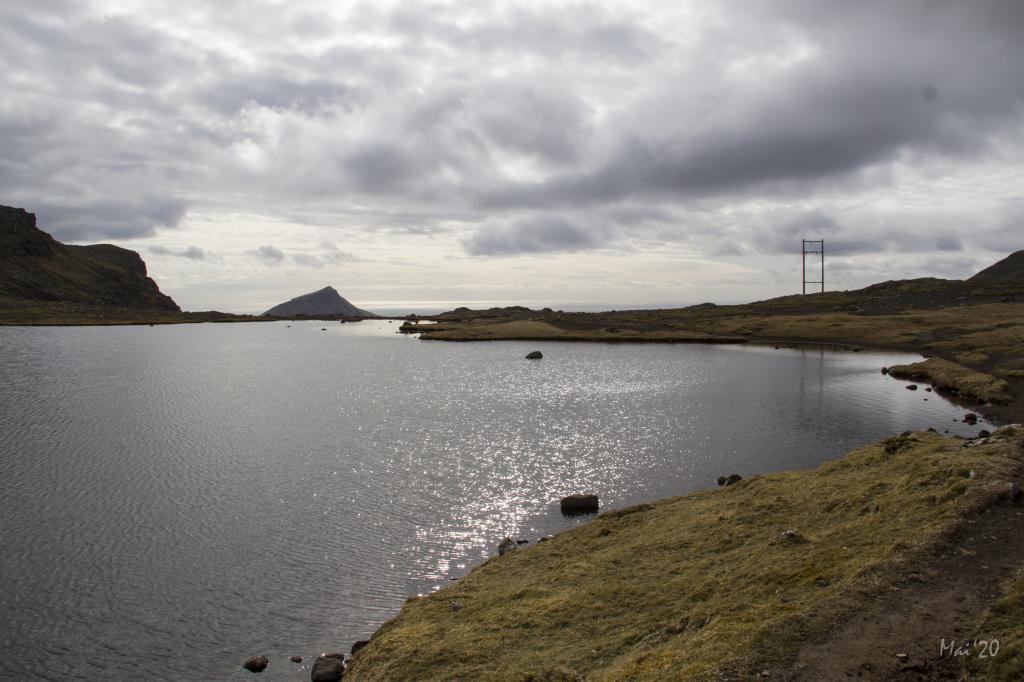 The hike up the path to the pass Reiðskarð is easy to walk, the area around the pond being particularly beautiful. Photo: Óli Garðshorn
 -
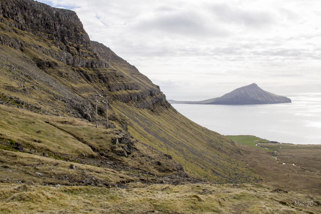 People from Tórshavn enjoy taking the first part of this hike from the pass Sundshálsur and up to the pass Reiðskarð, an easily accessible hike with lovely views. Photo: Óli Garðshorn
 -
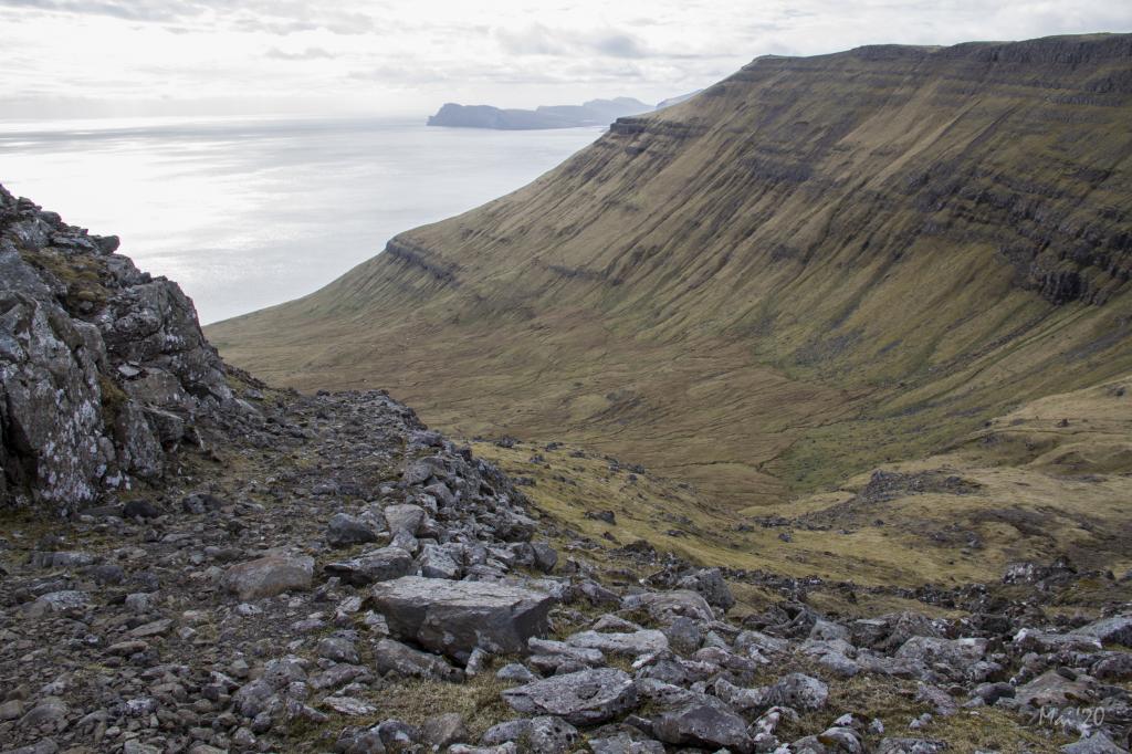 The old road that men from Norðradalur constructed in order to transport the first tractor to Syðradalur. Photo: Óli Gardshorn
 -
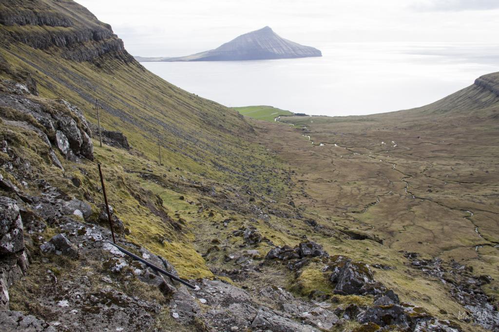 Photo: Óli Gardshorn
 -
 Syðradalur. Photo: @Alessio Mesiano
 -
 The view of Vágoy from the village Syðradalur. Photo: Remo Jacobs
-
The hike up the path to the pass Reiðskarð is easy to walk, the area around the pond being particularly beautiful. Photo: Óli Garðshorn
-
People from Tórshavn enjoy taking the first part of this hike from the pass Sundshálsur and up to the pass Reiðskarð, an easily accessible hike with lovely views. Photo: Óli Garðshorn
-
The old road that men from Norðradalur constructed in order to transport the first tractor to Syðradalur. Photo: Óli Gardshorn
-
Photo: Óli Gardshorn
-
Syðradalur. Photo: @Alessio Mesiano
-
The view of Vágoy from the village Syðradalur. Photo: Remo Jacobs
Sundshálsur - Syðradalur offers a beautiful, easy hike over passes and an old tractor road with stunning views.
People from Tórshavn enjoy taking the first part of this hike from the pass Sundshálsur and up to the pass Reiðskarð, an easily accessible hike with lovely views.
It is less common to walk the latter half of the path down to Syðradalur, which nevertheless is a great hike. It becomes particularly fascinating if you expand the hike by going north to Norðradalur and loop back to Sundshálsur via the pass Fólkaskarð (known in Norðradalur as Syðraskarð). This detour takes you around Mt. Tungulíðfjall. This way you get a good and long hike of 12 km with an elevation gain of 700 metres, full of varied experiences. If you take this round trip to Norðradalur and you do not go all the way down to the cleft in Norðradalur, then the hike will be good 10 km.
The hike starts in the rocky area at the pass Sundshálsur. Many people walk her every day, and the many small cairns is a nice touch. The hike up the path to the pass Reiðskarð is easy to walk, the area around the pond being particularly beautiful.
On your way down to Syðradalur, you walk on an old road, which was originally constructed to get a tractor down to the village.
You continue down to a new unpaved road in the area called Ovari botnur. Here you have a view over the large valley and the farm in Syðradalur. From there, hike down to the gate by the main road.
If you wish to walk to Norðradalur, go through the gate to your right, about 400 metres further down, just before you reach the main road. (see the hike for Syðradalur - Norðradalur).
The hike can be taken in either direction, but it is easier to start at Sundshálsur. Many believe it is also more beautiful to walk westward from Sundshálsur, and from there to Norðradalur and back to Sundshálsur via the pass Fólkaskarð.


Sundshálsur - Syðradalur
Public transportation
There is no public transportation, Neither to Syðradalur nor to Sundshálsur/Oyggjarvegurin.
Arriving by car
Parking, Sundshálsur
Good parking is by the main road at Sundshálsur. (see the photo)
-
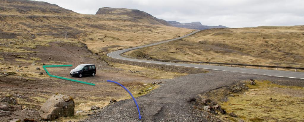 See green line for parking and blue line for starting point
Syðradalur - Sundshálsur
Public transportation
Public transportation is neither to Syðradalur nor to Sundshálsur/Oyggjarvegurin.
Arriving by car
Parking, Syðradalur
Parking is available in Syðradalur at the parking lot marked with green lines. As the parking spaces often are taken, it is also possible to park by the main road next to it—see the green lines on the photo.
-
 See green line for parking and blue line for starting point.
 -
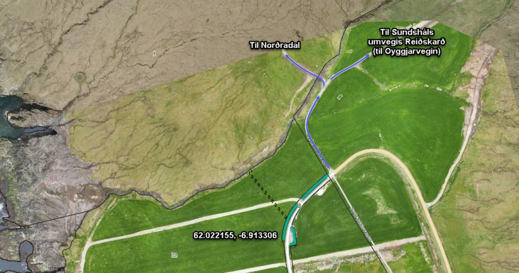 See green line for parking and blue line for starting point.
Sundshálsur - Syðradalur
Syðradalur - Sundshálsur
Facts

Duration

distance

Peak

Elevation
 The hike is suitable for children accompanied by adults. But care must be taken in the rocky terrain
 Medium
- The pass is good for walking even though rocks have fallen down on the path. In places the path is invisible
Medium
- The pass is good for walking even though rocks have fallen down on the path. In places the path is invisible
 The terrain is very rocky in places – especially from the pass Sundshálsur up toward the pass Reiðskarð. But many people walk that stretch, so it is easy to traverse. The path is a little steep in places on the way to Syðradalur. But if you keep to the path, it is good for walking. Toward Syðradalur, the path is not maintained. A fair bit of rocks is therefore on the path. Otherwise it is grass-covered and easy to walk
