You haven’t got any favourites yet
This is where you can collect inspiration, articles, events and places that interest you.
Click the icon on pages and they’ll appear here.
Your favourites
Inspiration & Articles
Events & Tours
Places
Hiking
INSPIRATION & ARTICLES
EVENTS & HIKES
Places
Tórshavn - Kirkjubøur


Link Copied!

-
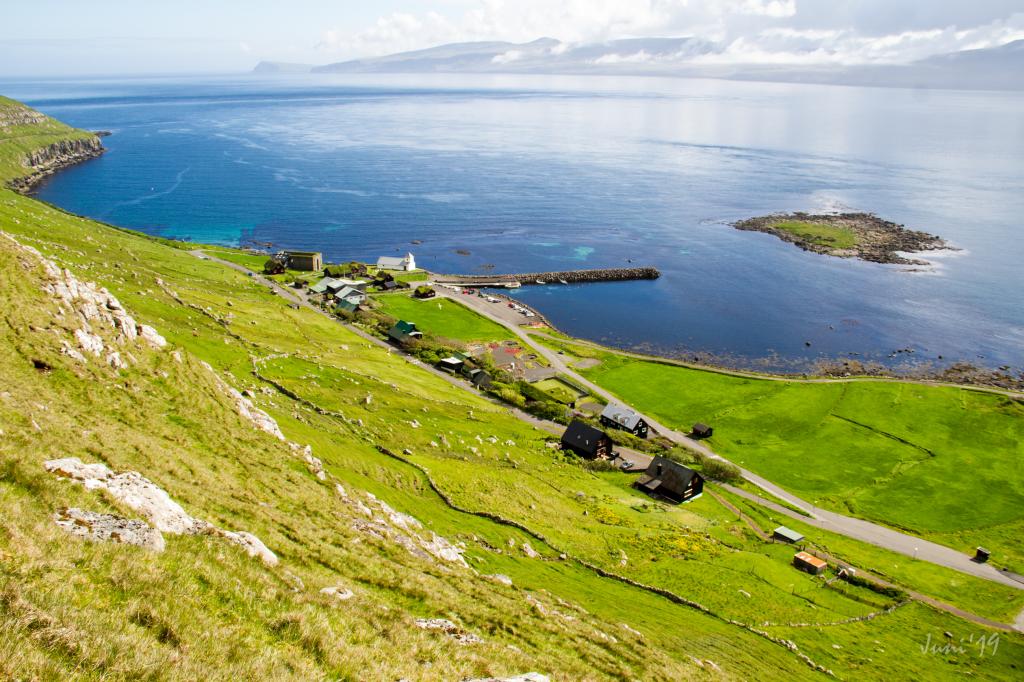 View over the ancient village of Kirkjubø. Photo: Óli Gardshodn
 -
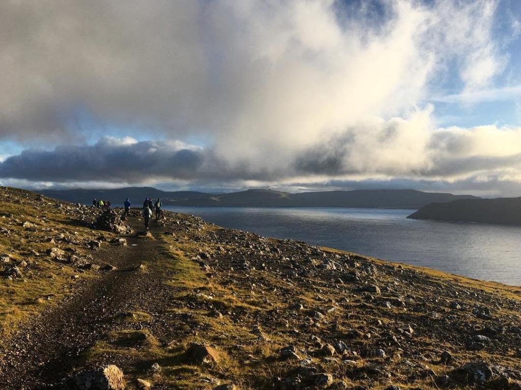
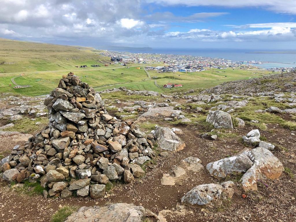
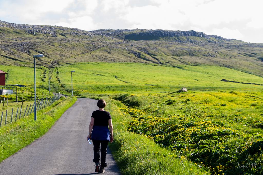 The village path is clearly visible all the way up to the first cain that you see in the centre at the top. Photo: Óli Gardshodn
 -
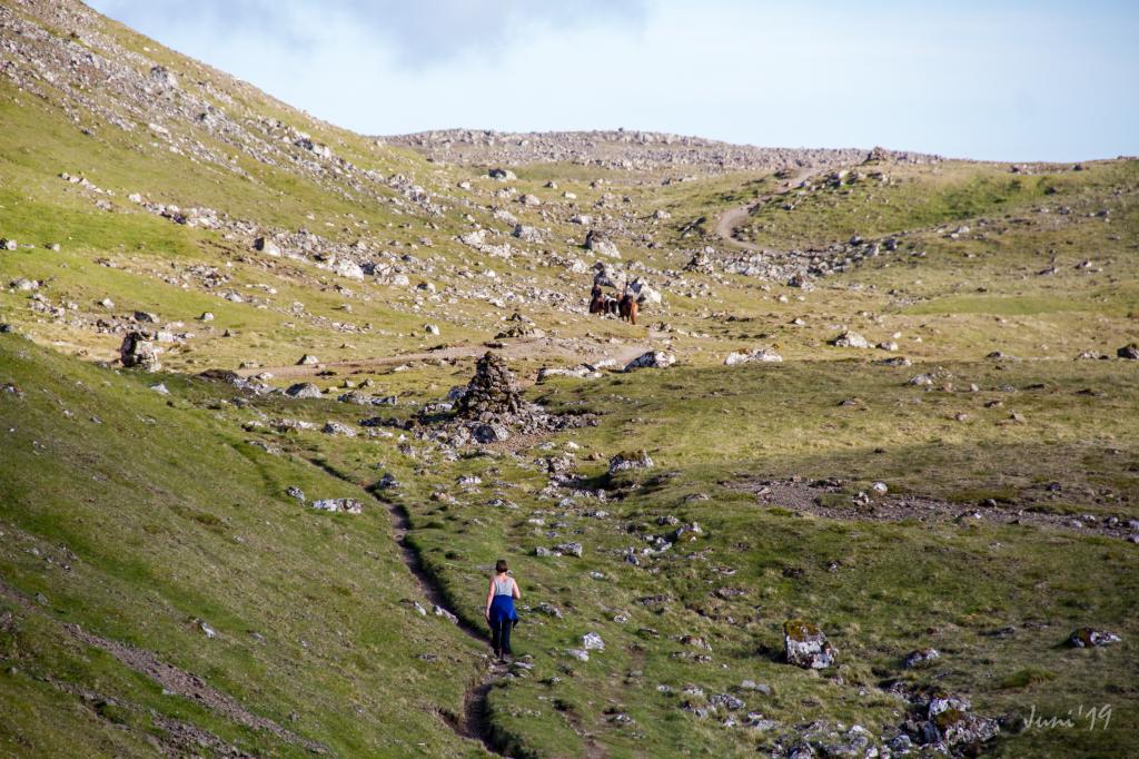
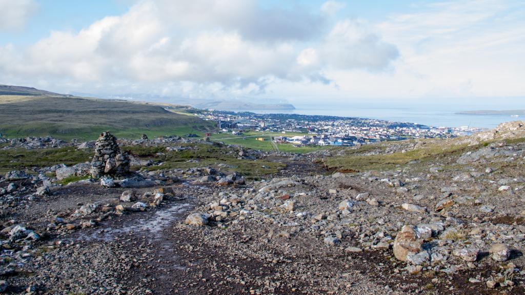 Up from the first cain in 190m, you have a beautiful view over Tórshavn with the island of Eysturoy and the northern islands in the background. Photo: Óli Gardshodn
 -
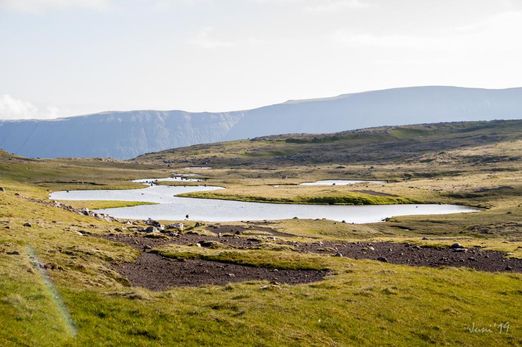 Up on the plain, everything is beautiful and peaceful while the birds gather on the water. Photo: Óli Gardshodn.
 -
 The cosy stroll over to the old gathering place, Reynsmúlalág, where the great speeches were held from the stone pulpit and the folk songs sung by the audience up on the grassy slope. Here it is only the imagination that sets the limits... Photo: Óli Gardshodn
 -
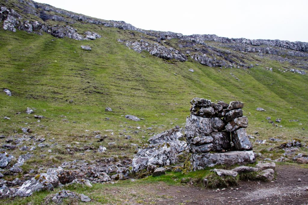 The rostrum at Reynsmúlalág, built of stones, used in those days when folk meetings were held in open air from the 19th century up to the 1960s.
 -
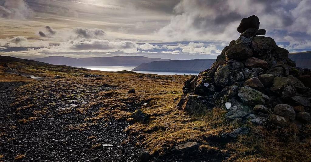
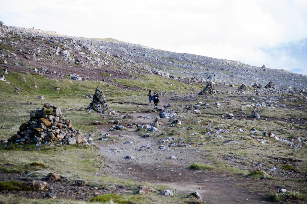 The cairns stand close along the path. Photo: Óli Gardshodn
 -
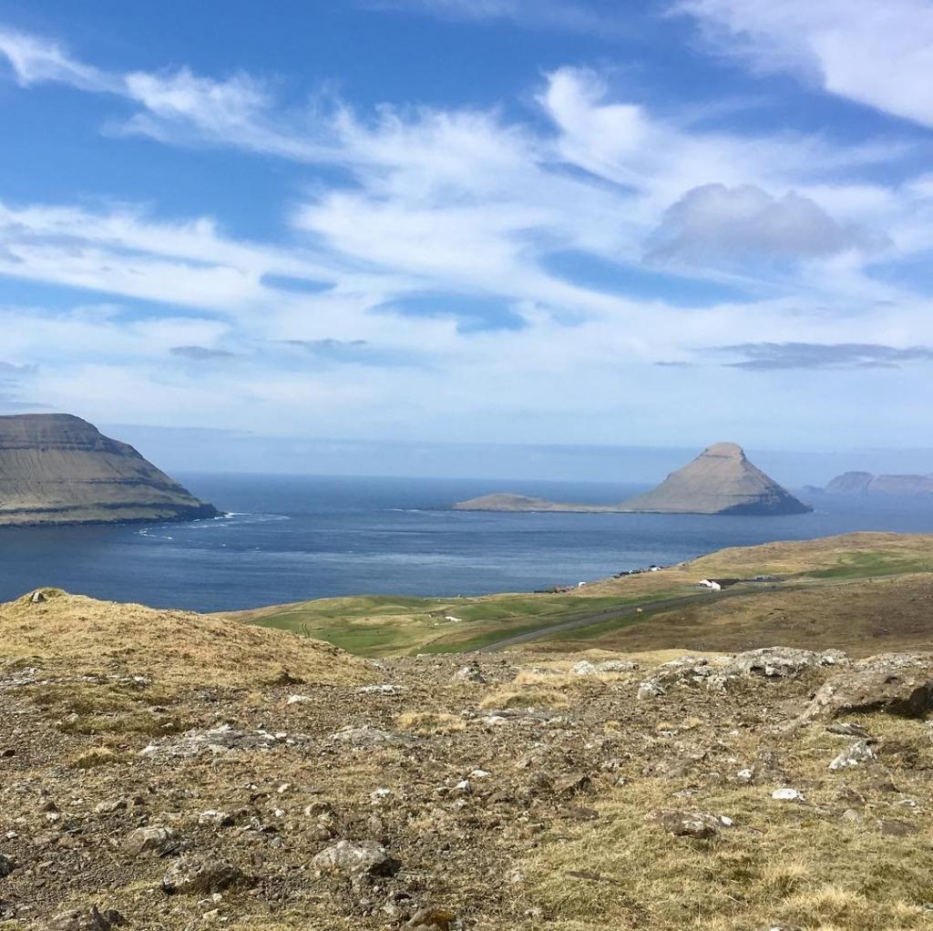
 Along the path there is a good view of the beautiful island of Koltur. In the background is the island of Vágar Photo: Óli Gardshodn
 -
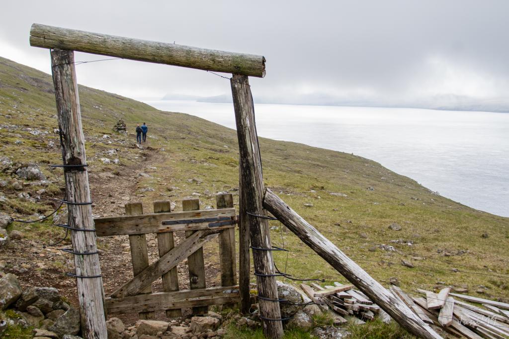 Gate between parts of the outfield in Kirkjubø. Photo: Óli Gardshodn
 -
 The path up from Kirkjubø. Photo: Óli Gardshodn
 -
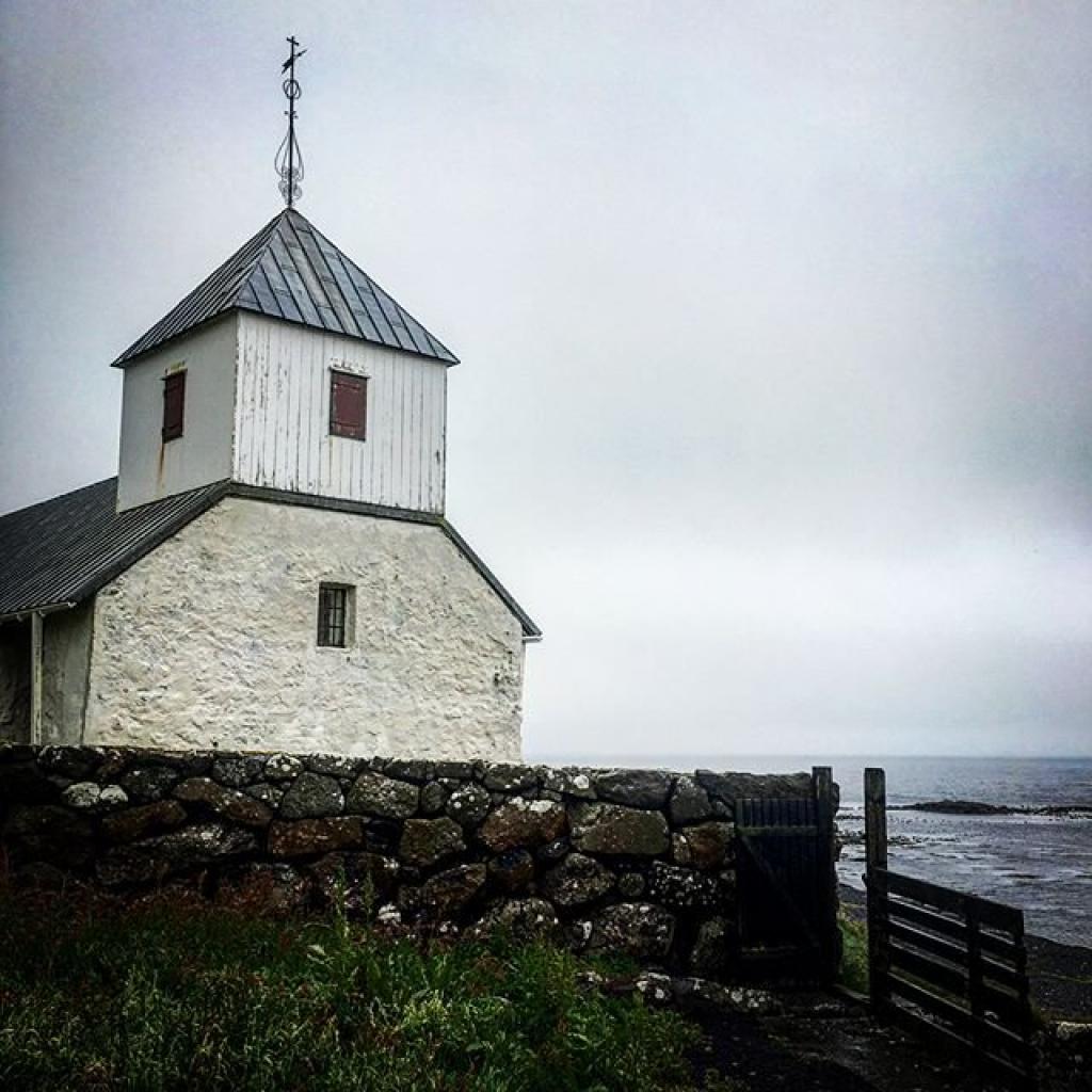
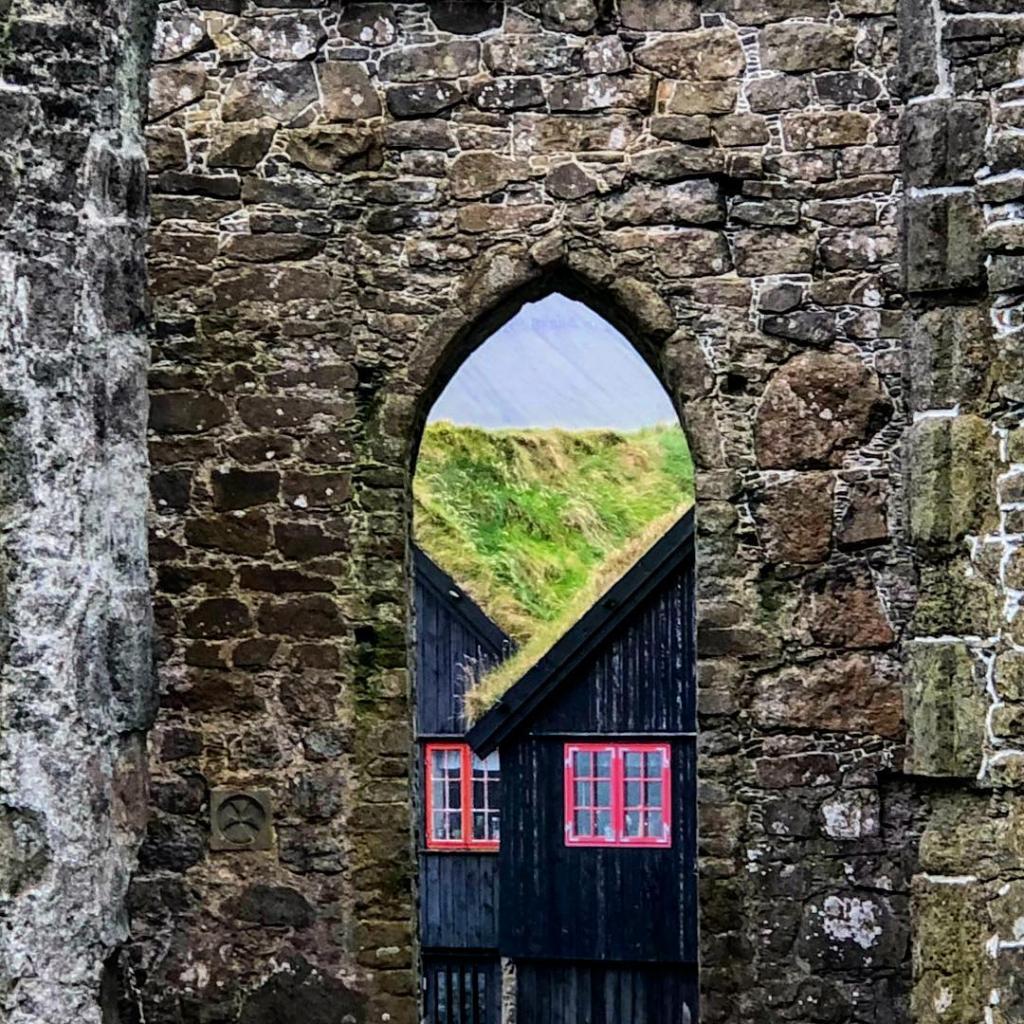
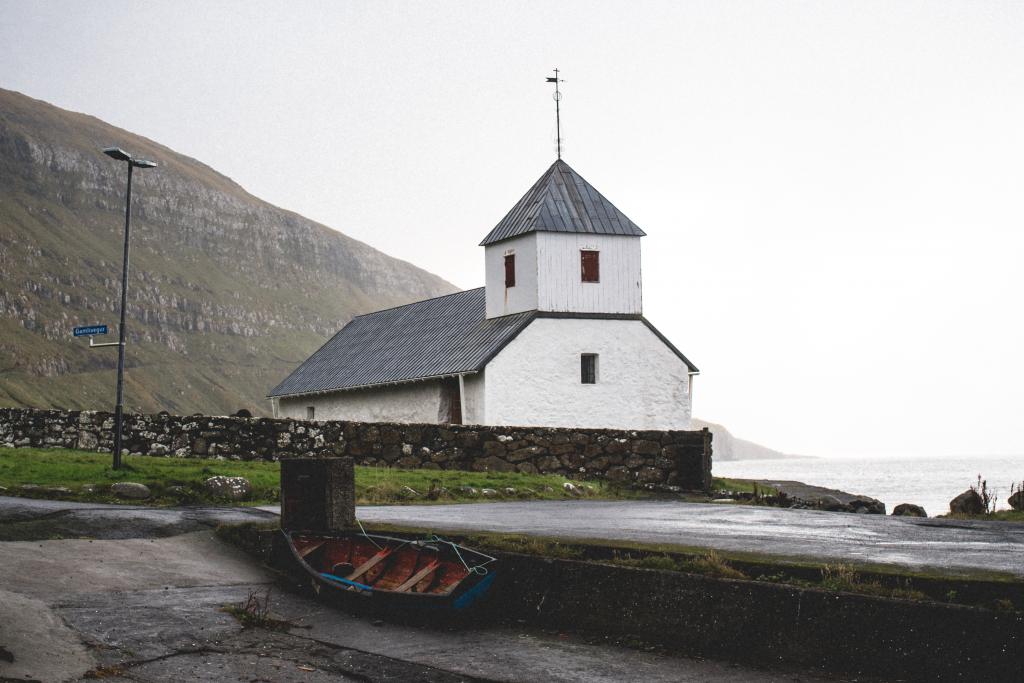 Kirkjubøur Church is the oldest church in the Faroe Islands still in use. It was built in the 13th century. Photo: Abdellah Ihadian
-
View over the ancient village of Kirkjubø. Photo: Óli Gardshodn
-
The village path is clearly visible all the way up to the first cain that you see in the centre at the top. Photo: Óli Gardshodn
-
Up from the first cain in 190m, you have a beautiful view over Tórshavn with the island of Eysturoy and the northern islands in the background. Photo: Óli Gardshodn
-
Up on the plain, everything is beautiful and peaceful while the birds gather on the water. Photo: Óli Gardshodn.
-
The cosy stroll over to the old gathering place, Reynsmúlalág, where the great speeches were held from the stone pulpit and the folk songs sung by the audience up on the grassy slope. Here it is only the imagination that sets the limits... Photo: Óli Gardshodn
-
The rostrum at Reynsmúlalág, built of stones, used in those days when folk meetings were held in open air from the 19th century up to the 1960s.
-
The cairns stand close along the path. Photo: Óli Gardshodn
-
Along the path there is a good view of the beautiful island of Koltur. In the background is the island of Vágar Photo: Óli Gardshodn
-
Gate between parts of the outfield in Kirkjubø. Photo: Óli Gardshodn
-
The path up from Kirkjubø. Photo: Óli Gardshodn
-
Kirkjubøur Church is the oldest church in the Faroe Islands still in use. It was built in the 13th century. Photo: Abdellah Ihadian
Historic sites, scenic views over Hestur, Koltur, and peaceful Faroese nature
Follow the cairns, and you will see a dais built of rocks. The dais was used for open-air folk meetings from the 19th century up to the 1960s. At these meetings, speeches were held, patriotic songs (written for the occasion) were sung, and flags were waved. It is easy to imagine crowds gathering on the hill in front of the dais to listen to speakers like Jóannes Patursson (1866-1946), a pioneer of the Faroese national separatist movement. The tradition of having folk meetings is still alive in the Faroe Islands, e.g., in Tórshavn during the national holiday Ólavsøka, held on 28-29 July. After Reynsmúlalág, the path continues southwards. En route, enjoy the incredible views over Sandoy, Hestur, Koltur, and Vágoy islands.According to legend, there was a young man from Koltur named Magnus who courted a girl from Hestur. The girl’s father was to be kept in the dark about their relationship. So, when the tidal current flowed southward, Magnus swam from Koltur to Hestur to spend time with the girl; when the tide turned, he swam back to Koltur. The girl’s father discovered their trysts. And one day, when Magnus came ashore, the father stood before him with an axe and threatened to kill him. Magnus was forced back to sea and was never seen again; the current undoubtedly dragged him out to sea. The legend has it that as an act of revenge, the eddy Grísarnir appeared soon after this in the strait Kolturssund, where it still churns and turns to this day. As you approach Kirkjubøur, you will see a small islet, Kirkjubøhólmur, which used to be part of the mainland and the village. You can still see the ruins of old houses on the islet. Continue on the path as it gradually descends to the village and ends at a cattle grid some 50 metres from the nearest houses. Kirkjubøur is a beautiful and charming village, where most homes are built in the old style. The village has a wealth of attractions such as Kirkjubømúrurin (the ruins of an old cathedral believed to have been built around AD 1300), Stokkastovurnar (the old farmhouses from about AD 1350, built on the ruins of the old bishop’s seat), and Kirkjubøur Church, which is the oldest church in the Faroe Islands still in use. It was built in the 13th century. The hike can be taken in either direction, with the route toward Kirkjubøur being slightly less strenuous.


Tórshavn - Kirkjubøur
Public Transport
The municipal buses in Tórshavn go quite frequently to Kirkjubøur. For departure times, look up route 6 (mon-fri) and route 8 (sat & sun). You can plan your trip here.
Arriving by car
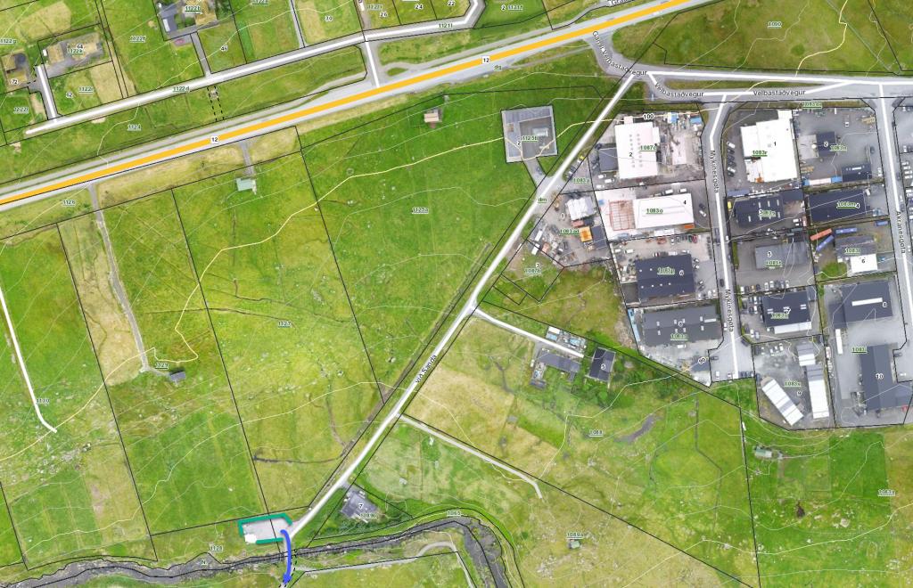
Parking, Tórshavn
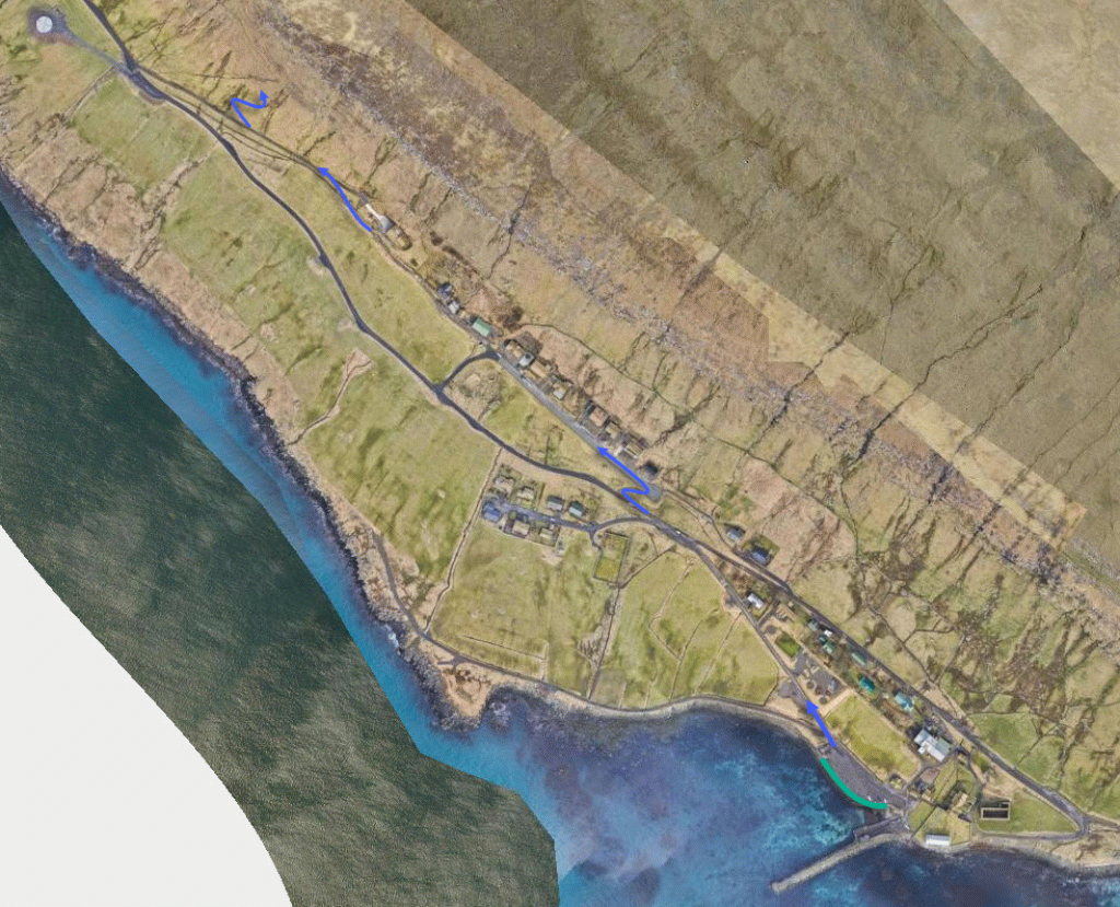
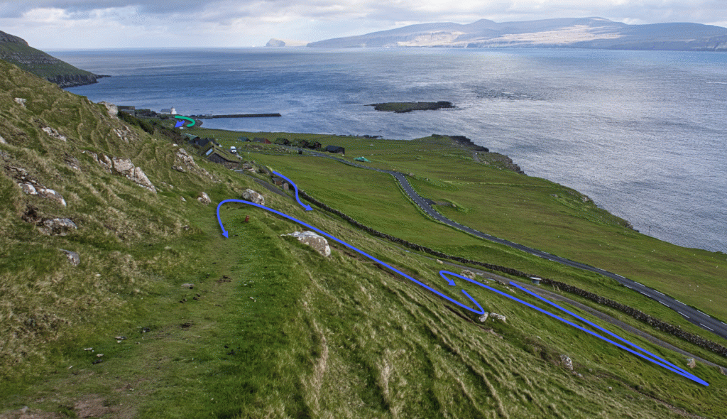
Good parking is found in the public parking lot down by the bridge crossing the river Sandá—see the green lines. From there, take the road up beside the farm until you reach the village path—see the blue line.
-
 See green line for parking and blue line for starting point
 -
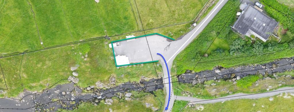 See green line for parking and blue line for starting point
 -
 See green line for parking
Kirkjubøur - Tórshavn
Public Transport
The municipal buses in Tórshavn go quite frequently to Kirkjubøur. For departure times, look up route 6 (mon-fri) and route 8 (sat & sun). You can plan your trip here.
Arriving by car
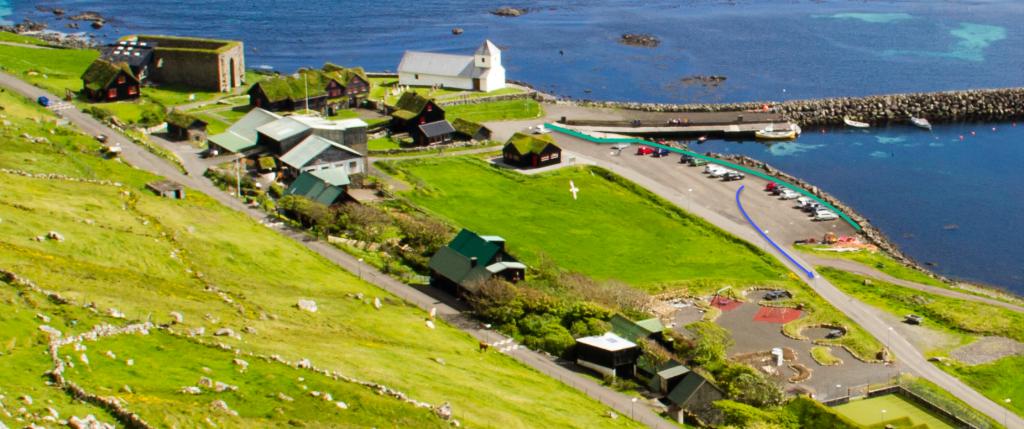
Parking, Kirkjubøur
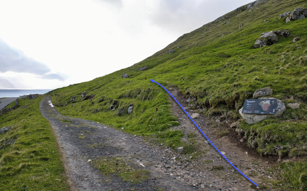
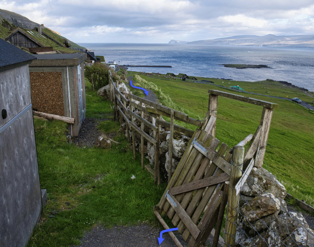
You can park your car in the public parking lot down by the harbour in Kirkjubøur, close to the church—see the green line. From there, walk along the main road for about 825 metres, north to the cattle grid, where the village path starts—see the blue line in the picture.
-
 See green line for parking and blue line for starting point.
 -
-
-
-
Tórshavn - Kirkjubøur
Kirkjubøur - Tórshavn
Facts

Duration

distance

Peak

Elevation
 Suitable for children over 6 years, accompanied by adults.
Kindergarteners and school children often go on this hike. Care must be taken on the stretch down to Kirkjubøur, which is a little steep
Suitable for children over 6 years, accompanied by adults.
Kindergarteners and school children often go on this hike. Care must be taken on the stretch down to Kirkjubøur, which is a little steep
 Medium
- It is a little steep when you depart from Tórshavn and when you approach Kirkjubøur
Medium
- It is a little steep when you depart from Tórshavn and when you approach Kirkjubøur
 The first stretch up from Tórshavn is a little bumpy and rocky. If it has been raining and many people have taken the path, it can be muddy in places.