


You haven’t got any favourites yet
This is where you can collect inspiration, articles, events and places that interest you.
Click the icon on pages and they’ll appear here.
Your favourites
Inspiration & Articles
Events & Tours
Places
Hiking
INSPIRATION & ARTICLES
EVENTS & HIKES
Places
Trongisvágur - Fámjin


Link Copied!

-
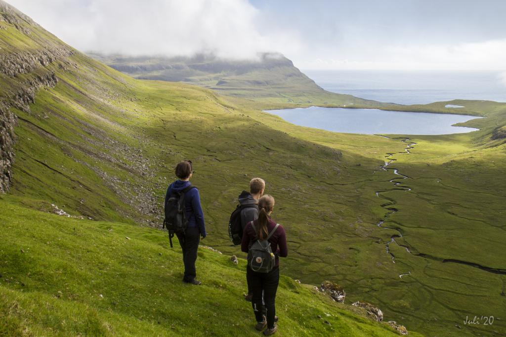
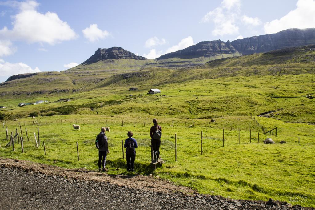 The village path starts in the place Mangibakki in the village Trongisvágur, and goes up to the pass Oyrnaskarð, which can be seen at the top in the middle of the picture. Photo: Óli Gardshodn
 -
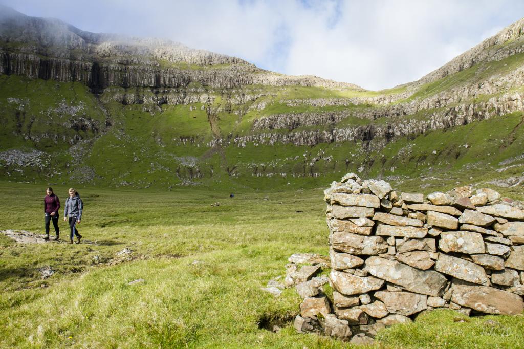
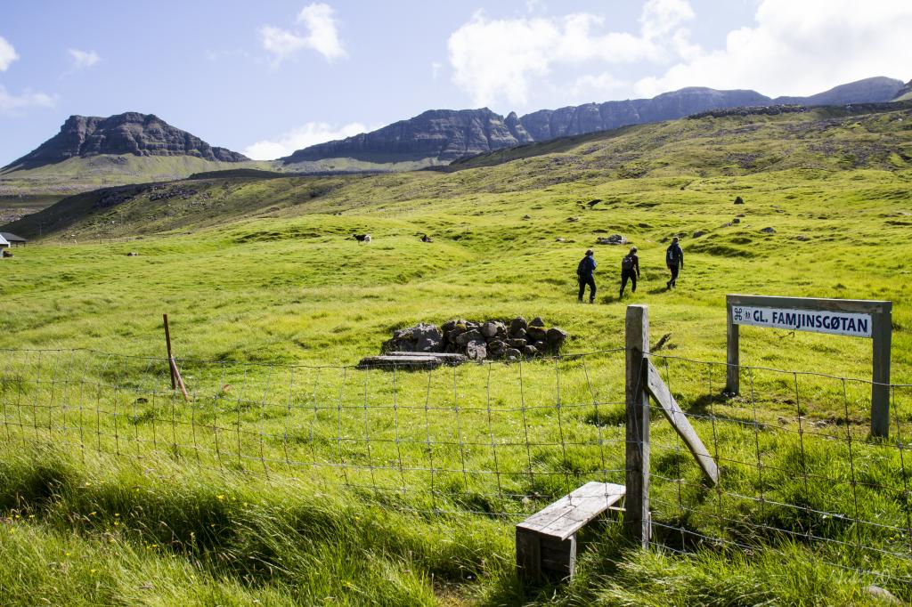 In the village of Trongisvágur there is good signage with cairns and signs. There are also steps at most fences, so it is easy to get across them. Photo: Óli Gardshodn
 -
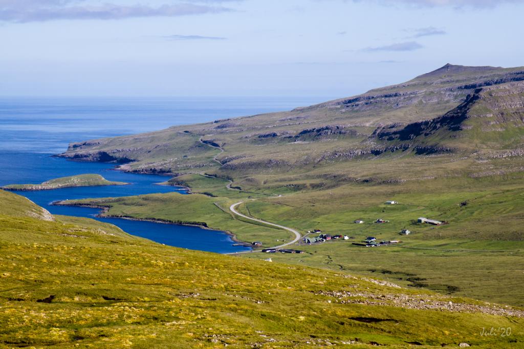
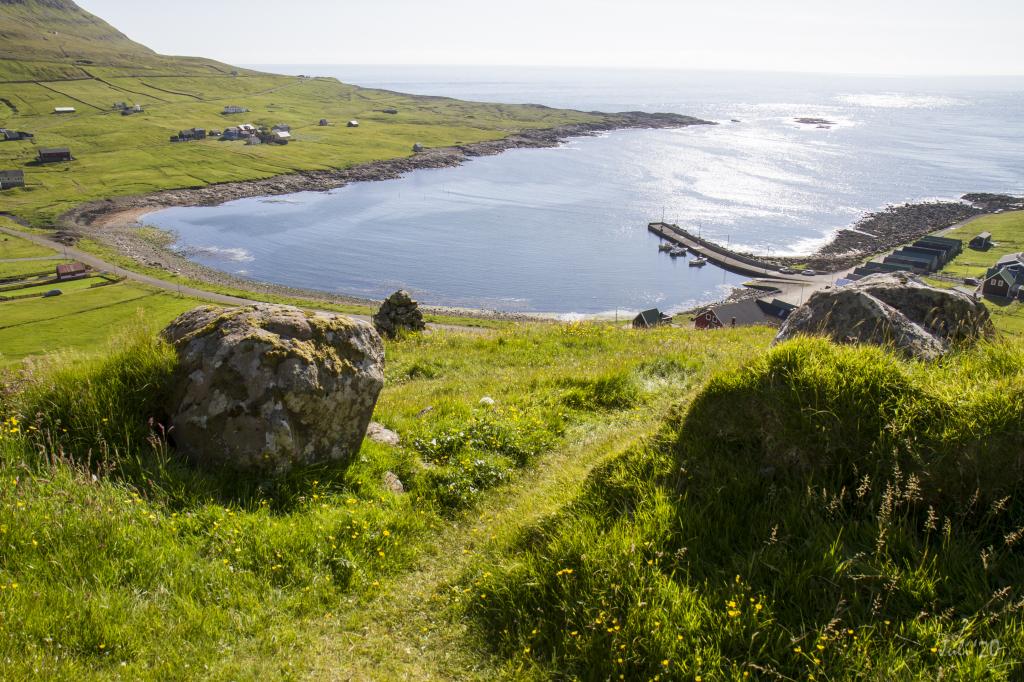
 The view out through the fjord Trongisvágsfjørður, where you can see from the left to the right the villages Trongisvágur, Tvøroyri and Froðba. Photo: Óli Gardshodn
 -
 The view from the base of the mountain Oyrnafjall down to the starting point at the plantation in Trongisvági. Photo: Óli Gardshodn
 -
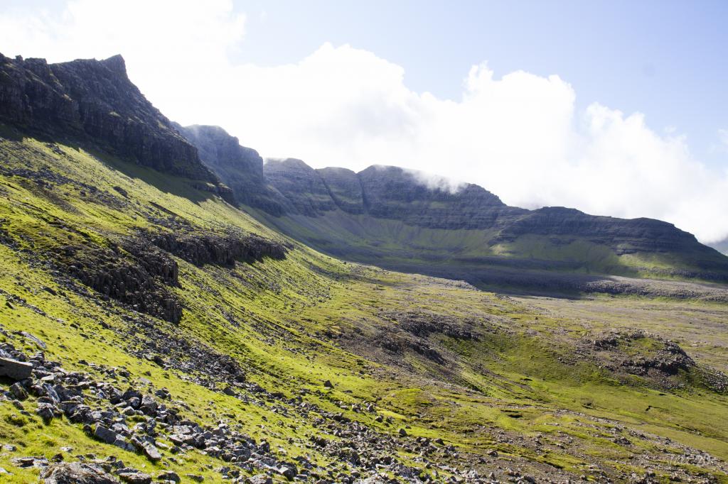 The view towards the cirque-shaped Hvammabotnur valley in Trongisvágur. In the middle of the picture is the island's highest mountain, Gluggarnir, 610m. Just to the left of Gluggarnir between the two deep gorges, is the so-called Herðablaðið - named after a shoulder blade, which it also looks like. Photo: Óli Gardshodn
 -
 The view from the pass Oyrnaskarð in 346m. height, down towards the village of Trongisvágur. Photo: Óli Gardshodn
 -
 The view from the cairn up on the pass Oyrnaskarð in the direction of the village Øravík. Photo: Óli Gardshodn
 -
 The view 200 m south of the pass Oyrnaskarð, down towards the village Øravík. In the background we can see the old road winding across the ridge, to the village of Hov. It has now been replaced by a tunnel. Photo: Óli Gardshodn
 -
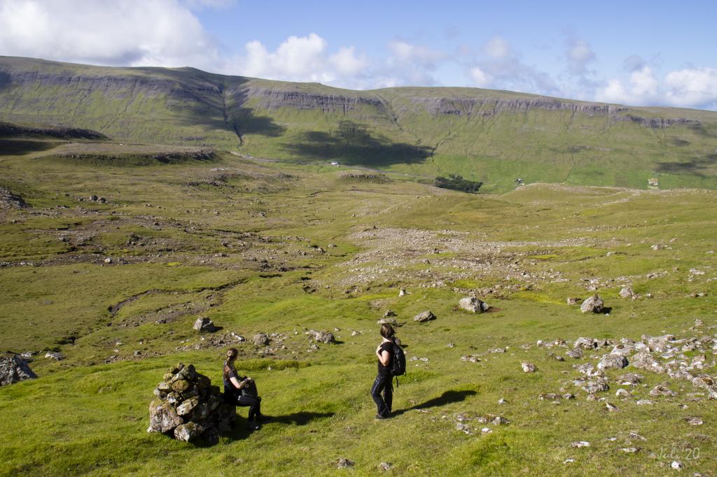
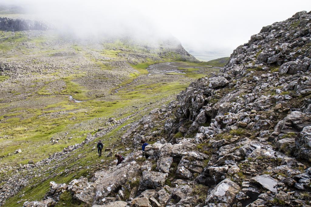 The view at the lower crag up by Harðgreipur down towards the pass Valdaskarð, which leads down to Kirkjuvatn in Fámjin. Photo: Óli Gardshodn
 -
 The village path through the Valdaskarð pass. In the background the lake Kirkjuvatn and the village Fámjin. Photo: Óli Gardshodn
 -
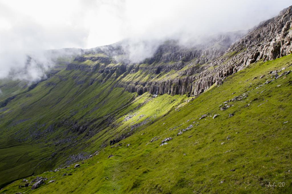 Column basalt in the crag north of Valdaskarð. Photo: Óli Gardshodn
 -
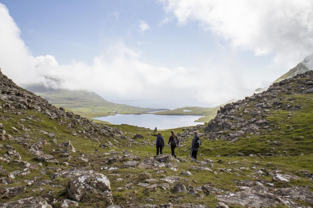
 The beautiful view from the pass Valdaskarð, down towards the lake Kirkjuvatn. In the background the village of Fámjin. Photo: Óli Gardshodn
 -
 The path from the lake Kirkjuvatn up to the pass Valdaskarð. Photo: Óli Gardshodn
 -
 Through the sheepfold by the lake Kirkjuvatn up above the village Fámjin. Photo: Óli Gardshodn
 -
 View from up above Fámjin. Photo: Óli Gardshodn
-
The village path starts in the place Mangibakki in the village Trongisvágur, and goes up to the pass Oyrnaskarð, which can be seen at the top in the middle of the picture. Photo: Óli Gardshodn
-
In the village of Trongisvágur there is good signage with cairns and signs. There are also steps at most fences, so it is easy to get across them. Photo: Óli Gardshodn
-
The view out through the fjord Trongisvágsfjørður, where you can see from the left to the right the villages Trongisvágur, Tvøroyri and Froðba. Photo: Óli Gardshodn
-
The view from the base of the mountain Oyrnafjall down to the starting point at the plantation in Trongisvági. Photo: Óli Gardshodn
-
The view towards the cirque-shaped Hvammabotnur valley in Trongisvágur. In the middle of the picture is the island's highest mountain, Gluggarnir, 610m. Just to the left of Gluggarnir between the two deep gorges, is the so-called Herðablaðið - named after a shoulder blade, which it also looks like. Photo: Óli Gardshodn
-
The view from the pass Oyrnaskarð in 346m. height, down towards the village of Trongisvágur. Photo: Óli Gardshodn
-
The view from the cairn up on the pass Oyrnaskarð in the direction of the village Øravík. Photo: Óli Gardshodn
-
The view 200 m south of the pass Oyrnaskarð, down towards the village Øravík. In the background we can see the old road winding across the ridge, to the village of Hov. It has now been replaced by a tunnel. Photo: Óli Gardshodn
-
The view at the lower crag up by Harðgreipur down towards the pass Valdaskarð, which leads down to Kirkjuvatn in Fámjin. Photo: Óli Gardshodn
-
The village path through the Valdaskarð pass. In the background the lake Kirkjuvatn and the village Fámjin. Photo: Óli Gardshodn
-
Column basalt in the crag north of Valdaskarð. Photo: Óli Gardshodn
-
The beautiful view from the pass Valdaskarð, down towards the lake Kirkjuvatn. In the background the village of Fámjin. Photo: Óli Gardshodn
-
The path from the lake Kirkjuvatn up to the pass Valdaskarð. Photo: Óli Gardshodn
-
Through the sheepfold by the lake Kirkjuvatn up above the village Fámjin. Photo: Óli Gardshodn
-
View from up above Fámjin. Photo: Óli Gardshodn
Explore the scenic Trongisvágur - Fámjin hike with stunning views over Oyrnaskarð and Valdaskarð passes. Easy and varied 6 km trail.
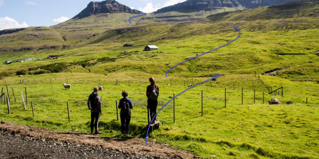
The village path commences just above the woods in Trongisvágur. First, cross the river Stórá and continue up into the field Hvammhagi. From here, you will have views up toward the valley Hvammabotnur with its unique wide and level rock strata surrounded by steep hills. At the head of the valley, you will see the crag Herðablaðið flanked by the gorges Herðablaðsgjáir. To the right of Herðablaðið stands Mt. Gluggarnir 610 metres tall, the highest mountain in Suðuroy. During your ascent, you have good views over Trongisvágur and toward the field of Hvannhagi with the islands Stóra Dímun and Lítla Dímun in the background.
Having crossed the pass Oyrnaskarð, you continue a short distance to reach the pass Valdaskarð, going down through the crags called Harðgreipshamrar. As you approach Valdaskarð, you have views over the field of Øravíkshagi.
It is beautiful to cross Valdaskarð as the lake Kirkjuvatn and Fámjin come into view. Descending toward Kirkjuvatn, you are flanked by magnificent crags. To you right, as you walk through the hill Undir Homrum, you will walk just below the lowest lying crag, which fascinating columnar basalt rises high into the air.
From here, walk along Kirkjuvatn and continue south of the river, passing through the sheep pen down toward Fámjin.
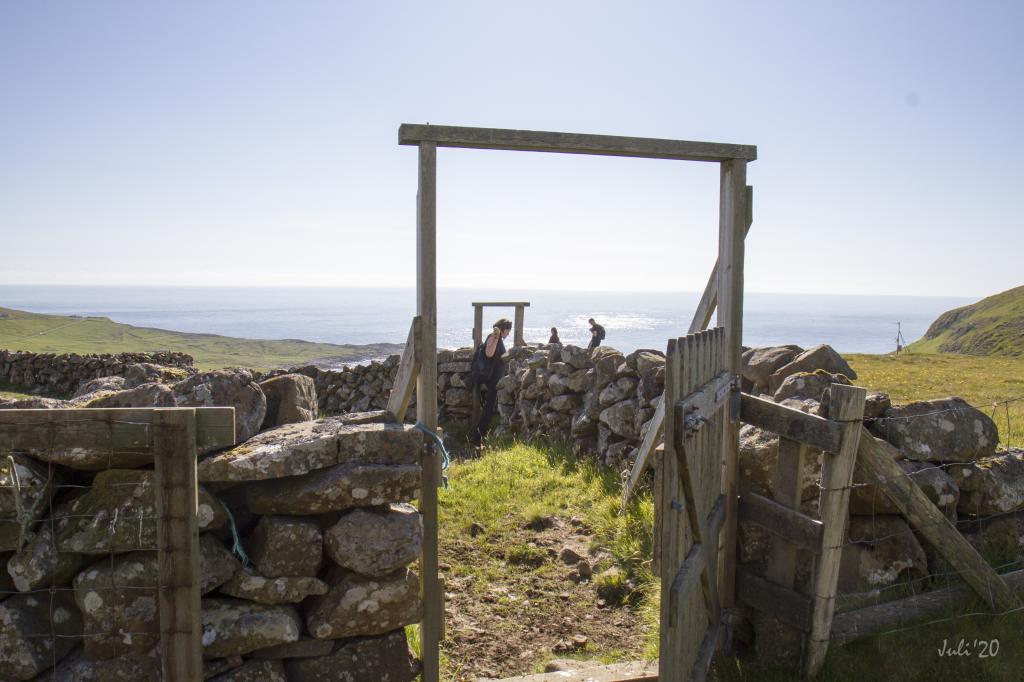
The path is easy to follow, cairns leading you all the way from the parking lot in Trongisvágur to Fámjin.
The hike can be taken in either direction, beginning in Trongisvágur being a little less strenuous


Trongisvágur - Fámjin
Public transportation
Take Route 701 Fámjin – Tvøroyri – Sandvík. Most of the trips are so-called T-trips, i.e., you must notify SSL, the public transportation company, an hour in advance. For further information, see ssl.fo.
Parking, Trongisvágur
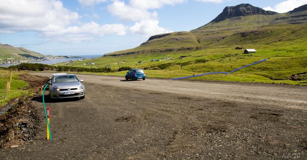
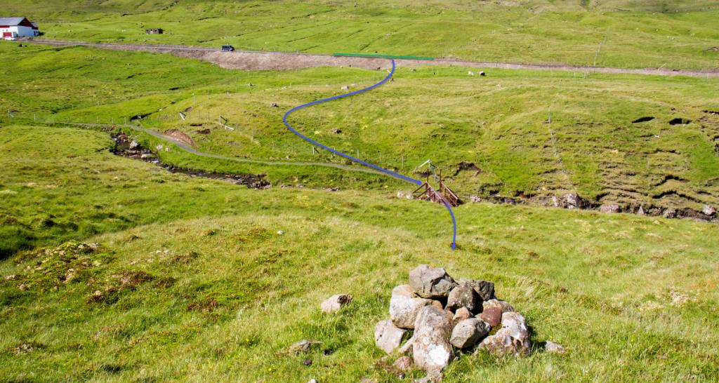
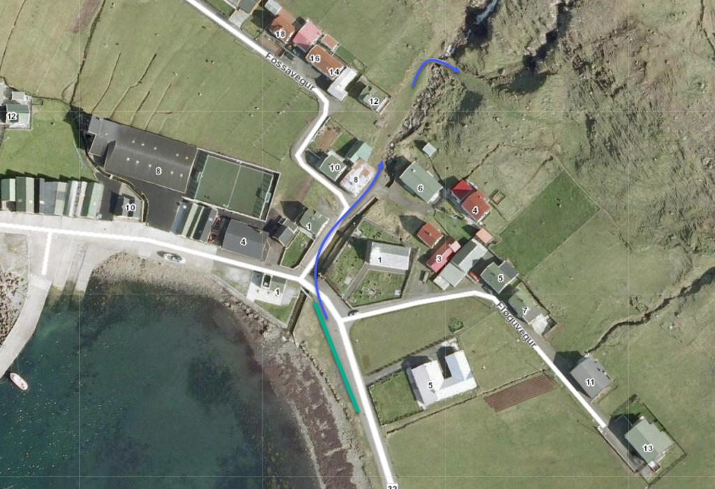
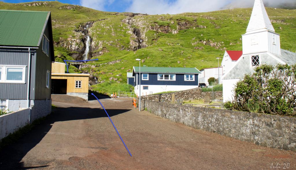
In Trongisvágur you can part by the side of the main road, 175 metres west of the woods – see the green line. From there cross the river and go up over the road í Lambabyrgi, where a sign labelled “Gl. Fámjinsgøtan” (The Old Fámjin Path) guides you up to the village path – see the blue lines.
-
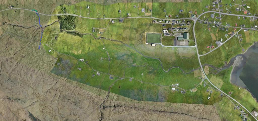 See green line for parking and blue line for starting point
 -
 See green line for parking and blue line for starting point
 -
 See green line for parking and blue line for starting point
 -
 See blue line for starting point
Fámjin - Trongisvágur
Public Transport
Take Route 701 Fámjin – Tvøroyri – Sandvík. Most of the trips are so-called T-trips, i.e., you must notify SSL, the public transportation company, an hour in advance. For further information, see ssl.fo.
Parking, Fámjin
Good parking is found by the church in Fámjin, e.g., by the side of the road running down toward the shore (the pebble beach) – see the green line. From there, follow the blue line across the bridge and up through the sheep pen.
-
 See green line for parking and blue line for starting point
 -
 See green line for parking and blue line for starting point
 -
 See blue line for starting point
Trongisvágur - Fámjin
Fámjin - Trongisvágur
Facts

Duration

distance

Peak

Elevation
 Suitable for children over 8 years. Some of the hills are quite steep and the path passes through a few smaller crags. The hike is also somewhat long with significant elevation gain
 Medium
- Although it is quite steep from the pass Valdaskarð down to the lake Kirkjuvatn, the path is grass-covered and good for walking
Medium
- Although it is quite steep from the pass Valdaskarð down to the lake Kirkjuvatn, the path is grass-covered and good for walking
 Grass-covered and good for walking for the most part.
Some loose gravel on the path through the small crags of Harðgreipshamrar.
The descent down from Valdaskarð and down to Fámjin is quite steep
Grass-covered and good for walking for the most part.
Some loose gravel on the path through the small crags of Harðgreipshamrar.
The descent down from Valdaskarð and down to Fámjin is quite steep
