


You haven’t got any favourites yet
This is where you can collect inspiration, articles, events and places that interest you.
Click the icon on pages and they’ll appear here.
Your favourites
Inspiration & Articles
Events & Tours
Places
Hiking
INSPIRATION & ARTICLES
EVENTS & HIKES
Places
Víkarbyrgi - Sumba


Link Copied!

-
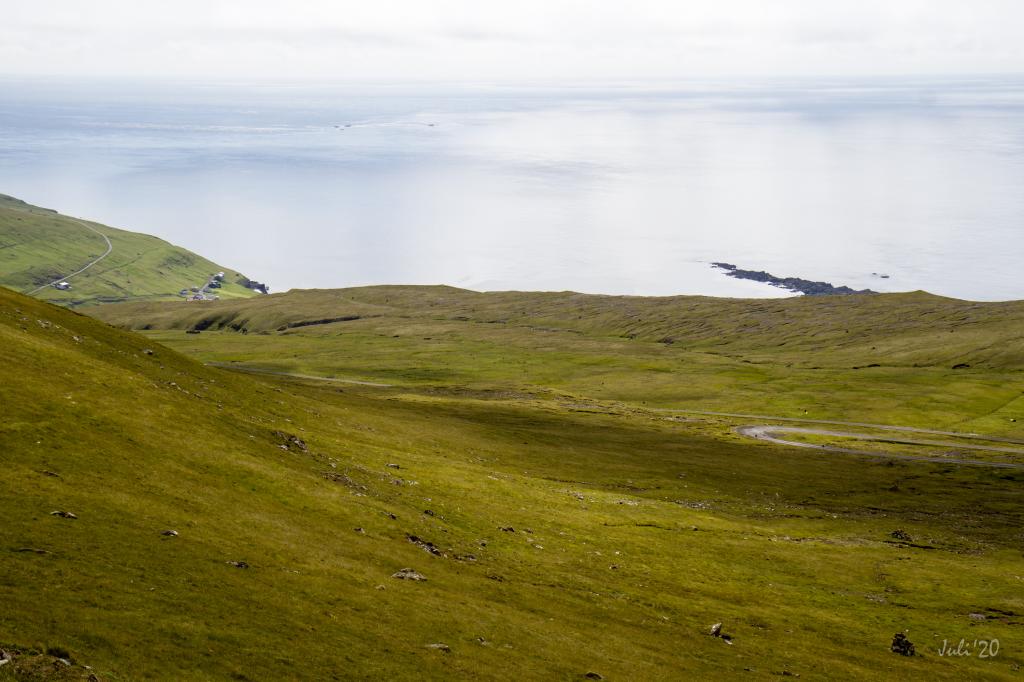
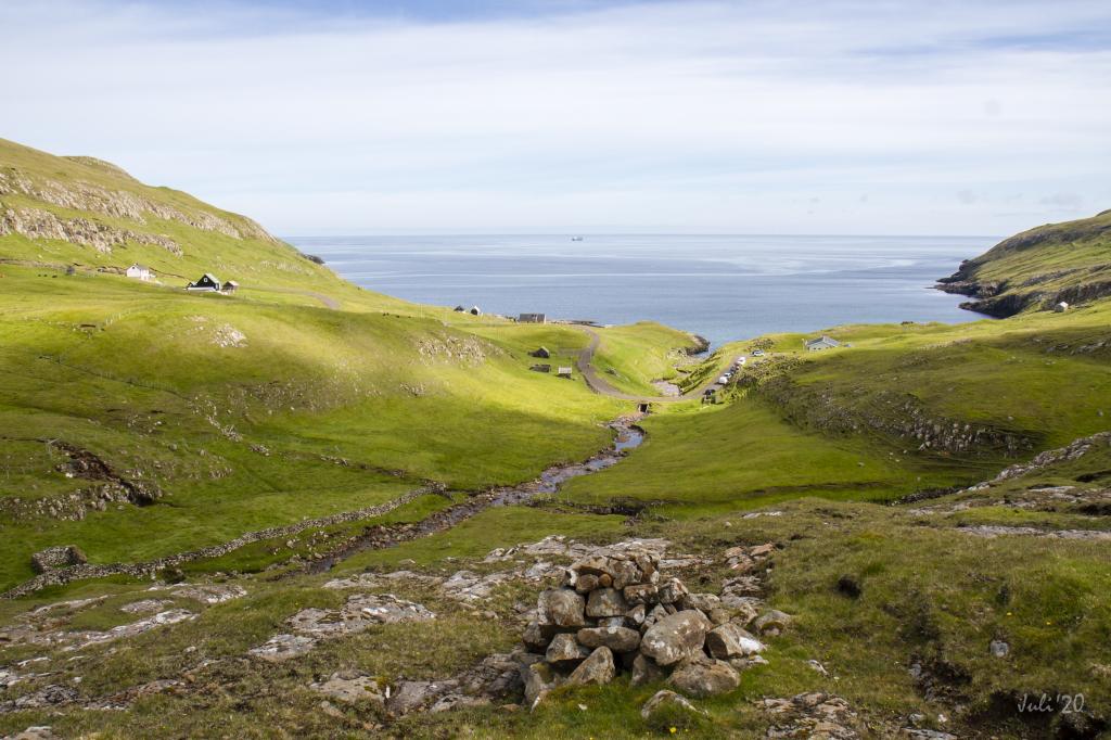 Víkarbyrgi, once a important settlement, now a beautiful remote tranquil place. Walking up along the river to the first cain gives you a good view over the area. Photo: Óli Gardshodn
 -
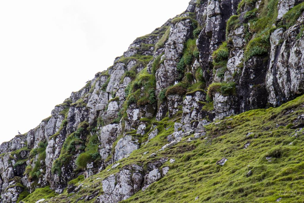 On your way up through the steep grass-grown track Moldstíggjur, you walk close to the northern fulmar that live in the rock face. Photo: Óli Gardshodn
 -
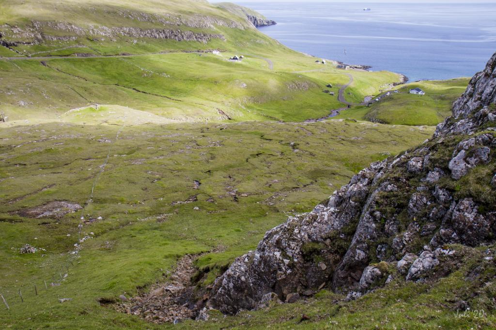 View down on Víkarbyrgi from above the steep Moldstíggjur. Photo: Óli Gardshodn
 -
 The characteristic white stones that looks like shiny silver. Photo: Óli Gardshodn
 -
 From Akslarenda, beneath the mountain of Spáafelli, you see the two small mountains Knúkin and Skálin. Eastwards below Skálin is the famous Blæing with the tremendous amount of big and small white rocks and stones. Photo: Óli Gardshodn
 -
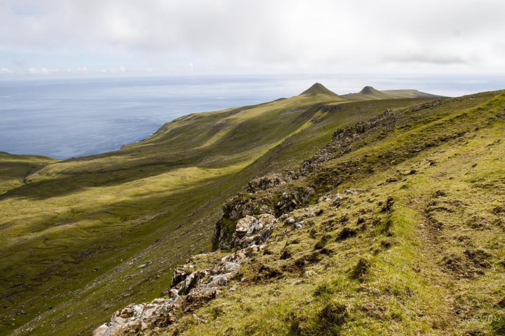
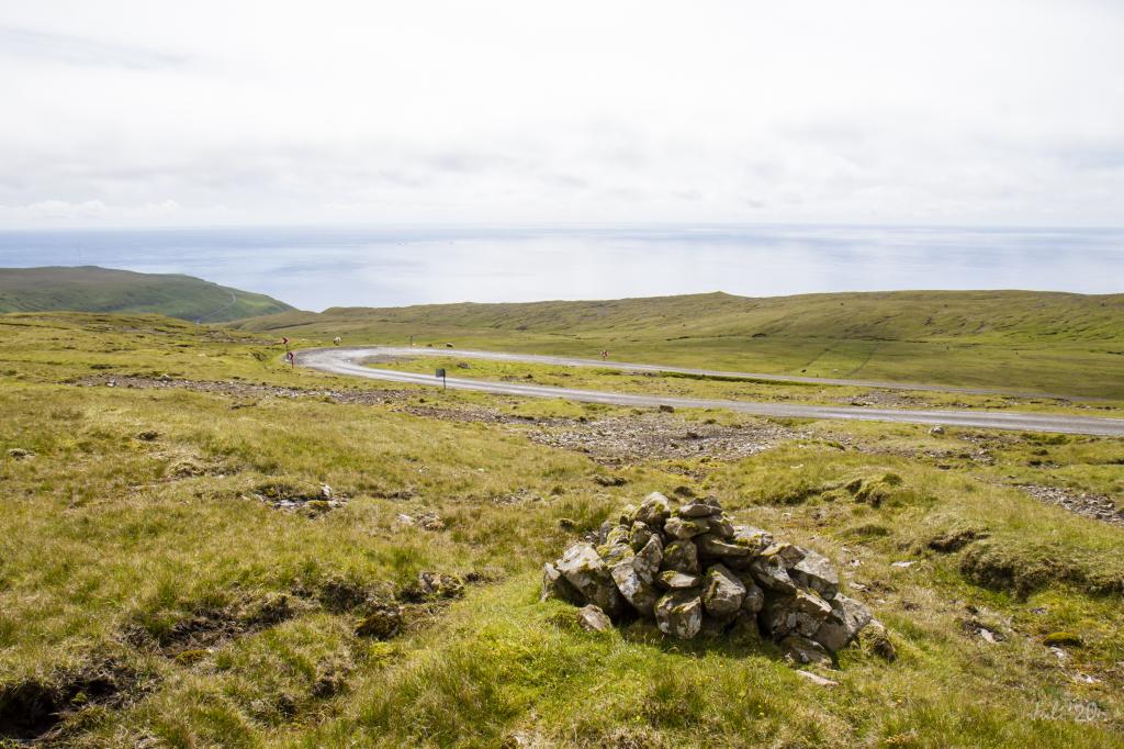
 View up on the ridge south of the mountain of Spáafelli. In the far you can see the village of Sumba over Photo: Óli Gardshodn
-
Víkarbyrgi, once a important settlement, now a beautiful remote tranquil place. Walking up along the river to the first cain gives you a good view over the area. Photo: Óli Gardshodn
-
On your way up through the steep grass-grown track Moldstíggjur, you walk close to the northern fulmar that live in the rock face. Photo: Óli Gardshodn
-
View down on Víkarbyrgi from above the steep Moldstíggjur. Photo: Óli Gardshodn
-
The characteristic white stones that looks like shiny silver. Photo: Óli Gardshodn
-
From Akslarenda, beneath the mountain of Spáafelli, you see the two small mountains Knúkin and Skálin. Eastwards below Skálin is the famous Blæing with the tremendous amount of big and small white rocks and stones. Photo: Óli Gardshodn
-
View up on the ridge south of the mountain of Spáafelli. In the far you can see the village of Sumba over Photo: Óli Gardshodn
Discover the Víkarbyrgi - Sumba hike with stunning views of Suðuroy’s unique white screes and tranquil, scenic landscapes.
From Víkarbyrgi, the hike starts down by the bridge crossing the river Víkará. From there, walk out through the small sheep pen and up along the river to the fence, which you need to climb over.
From there, go straight up to the first rise, where you will find the first cairn. From the cairn you have a lovely view over Víkarbyrgi, which before it was decimated by the Black Death in 1349 was a major village. This area, up to the waterfall below the hill Krílheyggur, is beautiful, a rock wall running along the broad river.
From here, continue on Moldstíggjur, a path through a crag, and go straight up to the pass Oyrnaskarð. The white screes, which cover almost the whole hillside east toward the crag Hornið lend a special feel to the ascent. These white screes on the south-eastern side of Suðuroy are quite unique. The best known are found a little further south, in the fields of Blæing. Blæing is an old word for rocks, and the white growth on these rocks is cork.
Having come south of Oyrnaskarð, the valley Bótin is grass-covered and easy to cross. Here too, you walk through several white screes. Just above the path, you will notice a unique rocky knoll, known as Trøllhúsið, the Troll House, which, when it is foggy, really does look like a real troll house. And it cannot be denied, the whole area seems enchanted.
On the route through the valley, you need to climb over a low fence. Having come south of the ridge under the slope Akslarendi, follow the cairns down to the road to Sumba.
The hike can be taken in either direction. Going in the direction of Víkarbyrgi, though, is far more beautiful as you commence your hike at an elevation of 290 metres—that is, if you park your car by the main road above the village of Sumba.


Víkarbyrgi - Sumba
Public transport
There is no bus connection to where the path starts in Víkarbyrgi or above Sumba.
Arriving by car
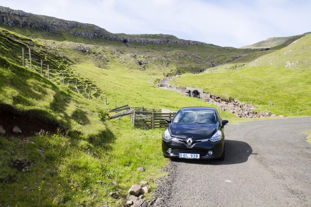
Parking, Víkarbyrgi
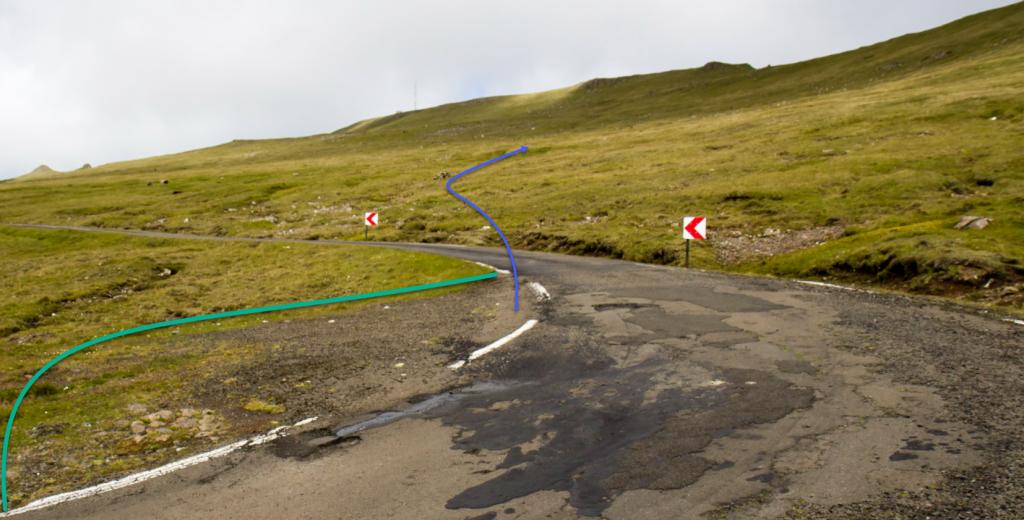
Good parking is found close to the sheep pen at the bottom of the village, by the bridge crossing the river Víkará (see the green lines). From here, go through the gate in the sheep pen and continue along the river (see the blue line).
-
 See green line for parking and blue line for strating point
 -
 Parking in Víkarbyrgi
 -
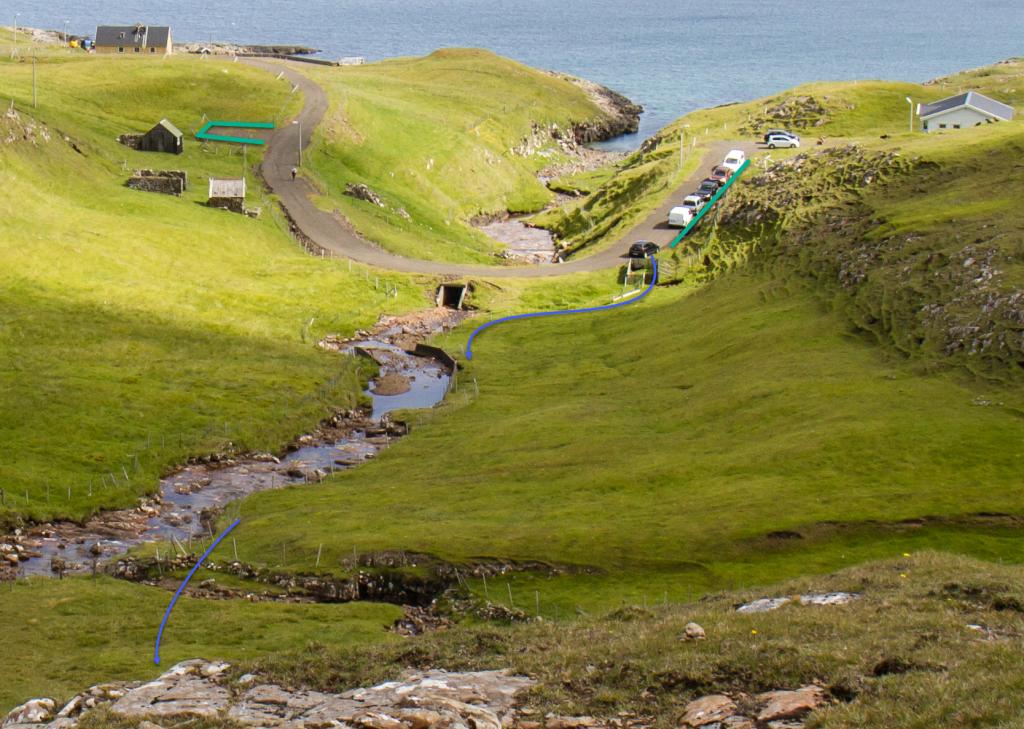 See green line for parking and blue line for strating point
Sumba - Víkarbyrgi
Public transport
There is no bus connection to where the path starts in Víkarbyrgi or above Sumba.
Arriving by car
Parking, Sumba
You can park your car above the village of Suma, at an elevation of 290 metres, where the main road bends, quite a distance from the village (see the green line). From here, follow the cairns due north (blue line.)
-
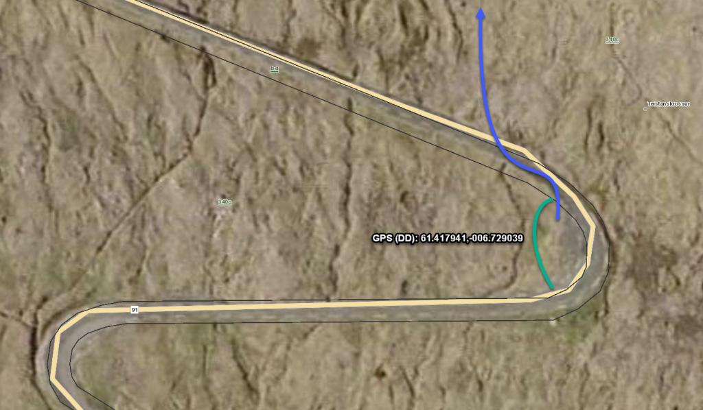 See green line for parking and blue line for strating point
 -
 See green line for parking and blue line for strating point
 -
 Startingpoint in Sumba
Víkarbyrgi - Sumba
Sumba - Víkarbyrgi
Facts

Duration

distance

Peak

Elevation
 Hike is suitable for children over the age of 8. Although grass-covered for the most part, the path is steep as well as rocky in places
 Medium
- Although grass-covered, Moldstíggjur, the path up through the crags above Víkarbyrgi, is somewhat steep
Medium
- Although grass-covered, Moldstíggjur, the path up through the crags above Víkarbyrgi, is somewhat steep
 Grass-covered and good for walking throughout. Moldstíggjur, the path up through a crag, is somewhat steep
