You haven’t got any favourites yet
This is where you can collect inspiration, articles, events and places that interest you.
Click the icon on pages and they’ll appear here.
Your favourites
Inspiration & Articles
Events & Tours
Places
Hiking
INSPIRATION & ARTICLES
EVENTS & HIKES
Places
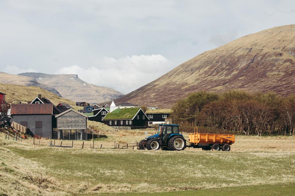
Hvalvík - Leynar


Link Copied!

-
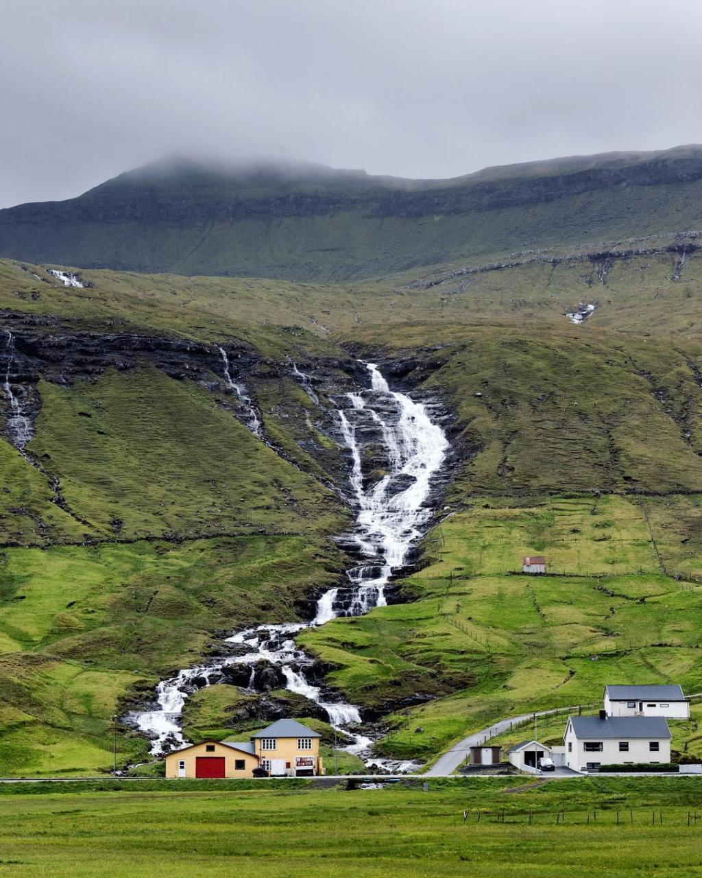
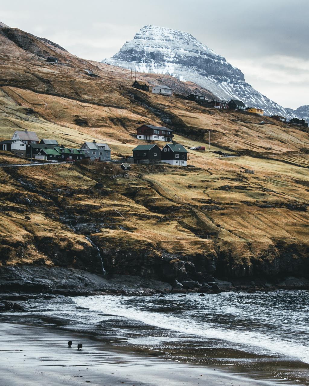
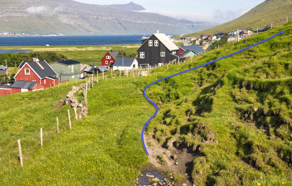
 Hvalvík village. Photo: @kirstinvang
 -
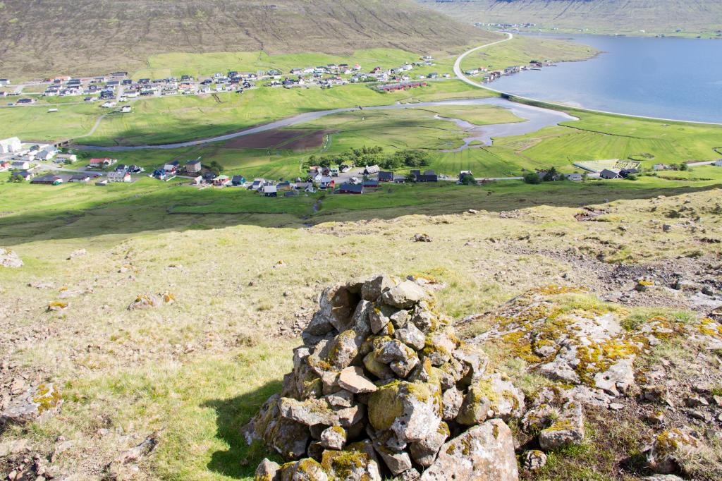 The first cairn above Hvalvík village. Photo: Óli Gardshodn
 -
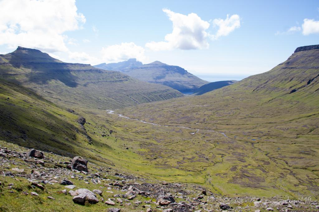 View from Húsadalsskarð down over the large valley, which leads down to the lake Leynavatn. Photo: Óli Gardshodn
 -
 The hike takes you by the renowned Michelin restaurant Koks which is situated Frammi við Gjónna. Photo: Óli Gardshodn
 -
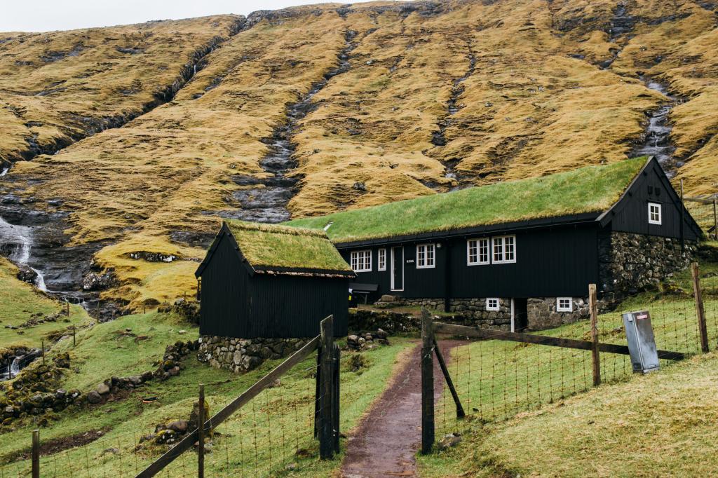 The hike takes you by the renowned Michelin restaurant Koks which is situated Frammi við Gjónna. Photo: KOKS
 -
 The lake Leynavatn. Photo: Óli Gardshodn
 -
 Leynar beach 'Leynasandur' Photo: Pelle Faust - @pelle.faust
 -
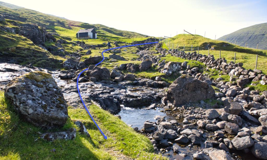
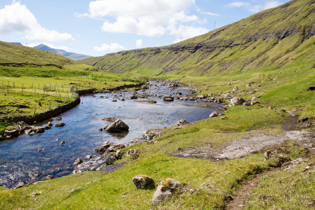 Along the river from the lake Leynavatn down to the village Leynar. Photo: Óli Gardshodn
-
Hvalvík village. Photo: @kirstinvang
-
The first cairn above Hvalvík village. Photo: Óli Gardshodn
-
View from Húsadalsskarð down over the large valley, which leads down to the lake Leynavatn. Photo: Óli Gardshodn
-
The hike takes you by the renowned Michelin restaurant Koks which is situated Frammi við Gjónna. Photo: Óli Gardshodn
-
The hike takes you by the renowned Michelin restaurant Koks which is situated Frammi við Gjónna. Photo: KOKS
-
The lake Leynavatn. Photo: Óli Gardshodn
-
Leynar beach 'Leynasandur' Photo: Pelle Faust - @pelle.faust
-
Along the river from the lake Leynavatn down to the village Leynar. Photo: Óli Gardshodn
Discover the peaceful Hvalvík - Leynar hike, a scenic 3.5-hour trail through valleys, rivers, and stunning Faroese nature.
The village path between Hvalvík and Leynar is a wonderful and tranquil path. The long walk in the peaceful environment, where only a few birds break the silence, is balm to the soul. The hike up through the gorge to the pass Húsadalsskarð is challenging and a bit of an adventure. Having ascended the steep hill and reaching the pass, you enter a magnificent wide valley through which the path meanders.
As you approach Leynar, you come to a big, wide and beautiful river, Dalá. Lovely columnar basalt is found just above the gully Djúpagil.
If you start to walk in Hvalvík follow the new path by the Mission House in Hvalvík. Walk out through the village gate and up along the little house (hay barn). Continue up along the river Myllá until you surpass the upper stone wall. Then turn slightly left in a straight south direction and go diagonally uphill to the first cairn at an altitude of 145 metres.
The path can be taken in either direction, weather and transportation options deciding which one to taske. The hike from Hvalvík is perhaps more scenic.


Hvalvík - Leynar
Public transport
Buss 400 is driving to and from Hvalvík.
Arriving by car
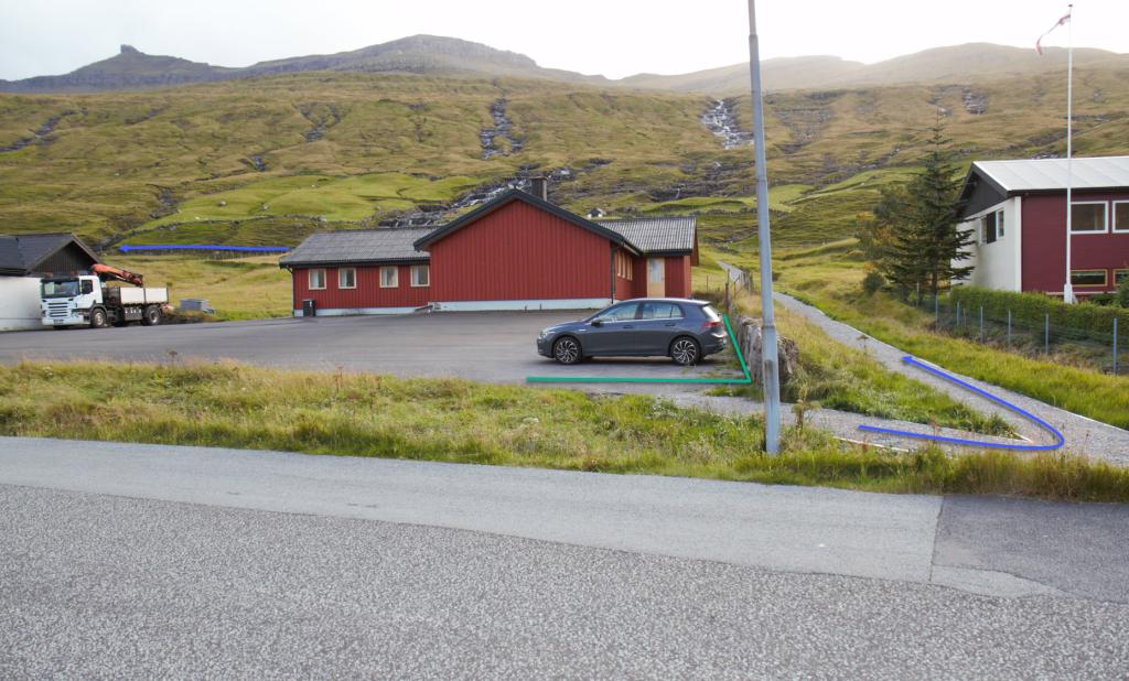
Parking, Hvalvík
There are good parking conditions at the library in Hvalvík, Hvalvíksvegur 75 (see the photo)
-
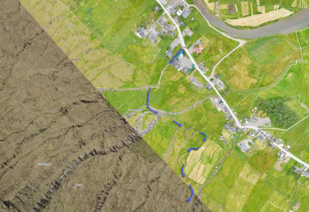 See green line for parking and blue line for starting point
 -
 See green line for parking and blue line for starting point
 -
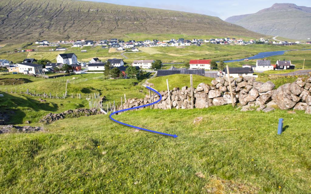 Follow the blue line through the Iron gate in Hvalvík
 -
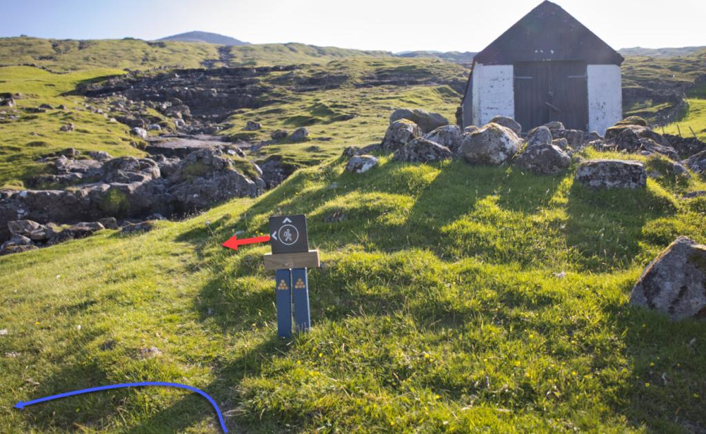 Turn left at the signpost just below the hayloft
 -
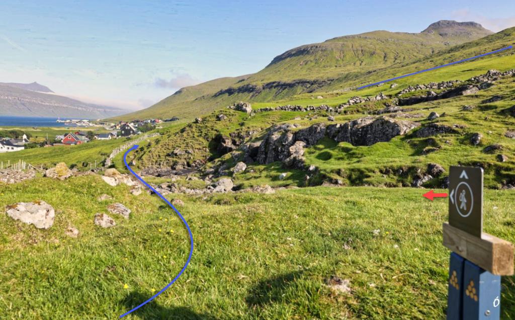 Go south along the fence, across the river Myllá
 -
 Go south along the fence, across the river Myllá
 -
 Turn up just before the wooden gate. Follow the fence and later the stone fence. Above the stone wall, turn slightly south towards the river Mataráin. Follow the river Mataráin further up. In 150m. altitude you will reach the first cairn.
Leynar - Hvalvík
Public transport
Rout 100/300 is driving from Tórshavn to Vestmanna, makes a stop in Leynar.
Arriving by car
Parking, Leynar
There is a parking lot by the tunnel portal or in the village. (see the photo)
-
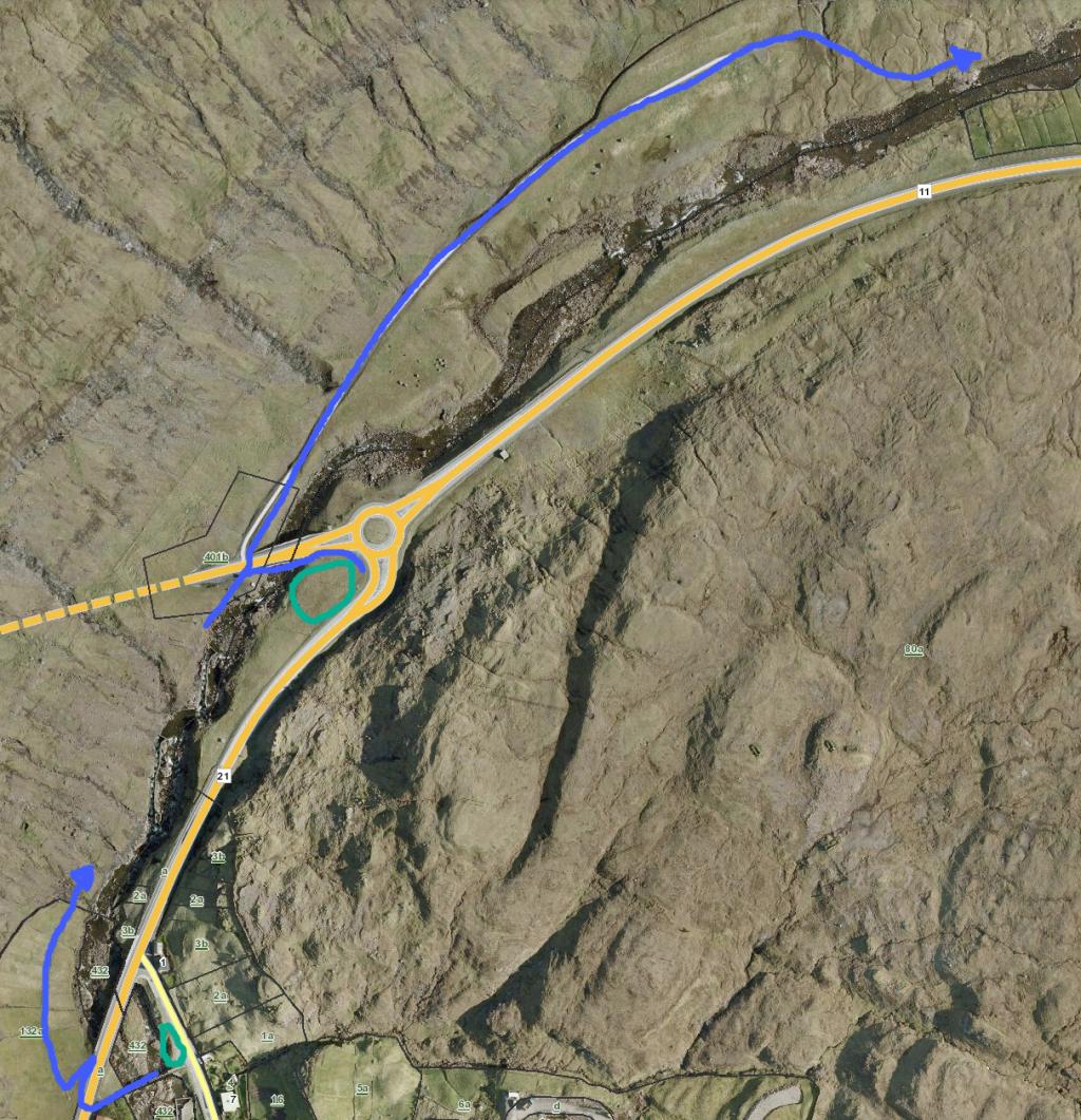 See green line for parking and blue line for starting point
Hvalvík - Leynar
Leynar - Hvalvík
Facts

Duration

distance

Peak

Elevation
 Suitable for children 10 years and older
 Difficult
- The first stretch up to the pass Húsadalsskarð (529 m) is grade 3. Otherwise, the path is easy to walk, with no crags or rock ledges to be navigated
Difficult
- The first stretch up to the pass Húsadalsskarð (529 m) is grade 3. Otherwise, the path is easy to walk, with no crags or rock ledges to be navigated
 Grass-covered but some loose surface through the gorge (Gjótan) up to the pass Húsadalsskarð. The ascent up to the plateau is fairly steep