


Tú hevur ongar yndis enn
Her kanst tú savna íblástur, greinar, tiltøk og støð, sum tú hevur áhuga fyri.
Trýst á ikonið á síðurnar, so koma tær fram her.
Tínir yndis
Íblástur & Greinir
Tiltøk & Túrar
Støð
Bygdagøtur
Leita
Leitingarúrslit
INSPIRATIÓNIR & ARTIKLAR
Read More
TILTØK & GONGUTÚRAR
Read More
Støð
Read More
Funningsfjørður (Sniðsgil) - Elduvík


Link Copied!

-
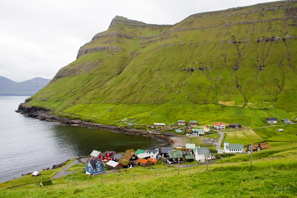 The village of Elduvík. Photo: Óli Gardshodn
 -
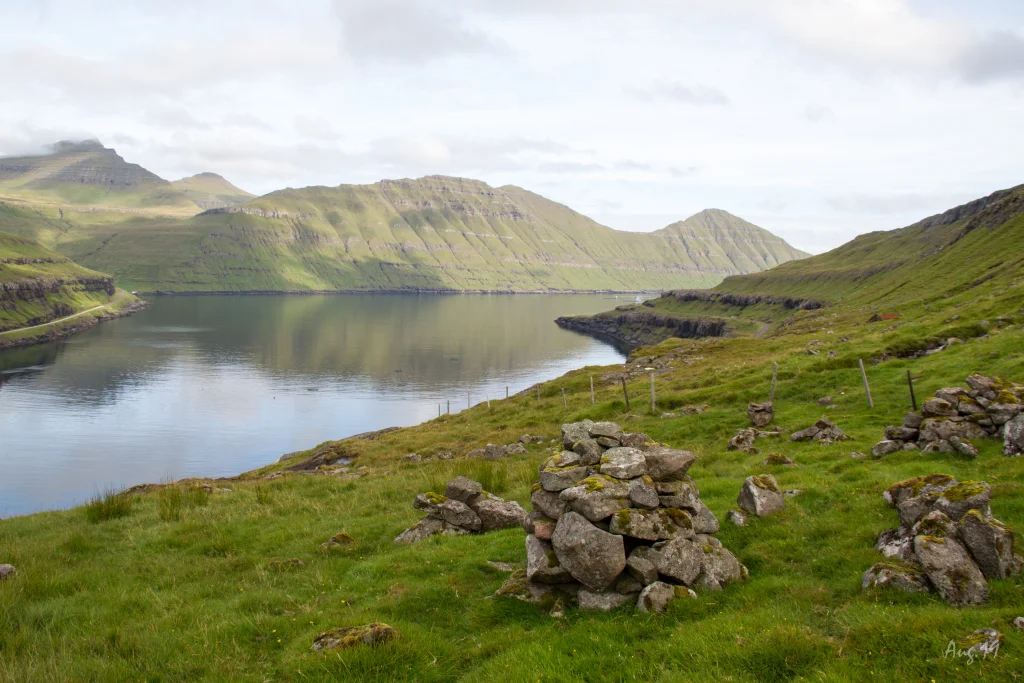 The view north through the fjord Funningsfjørður. After walking the 60 altitude meters from the road up the mountain gorge Sniðsgil, we have reached the highest point on the village path. The rest of the trip to Elduvík is a 3km pleasant walk - except for a small slippage which we must cross. Photo: Óli Gardshodn
 -
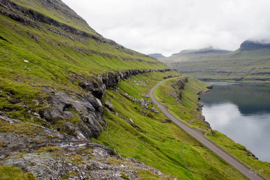 View from the headland Elduvíksnes into the fjord Funningsfjørður. The village path is all the way up on this rock wall that we stand on, and it goes as far in as we can see, after which it goes down the road through a mountain gorge. It is actually a very nice and quiet walk. Photo: Óli Gardshodn
 -
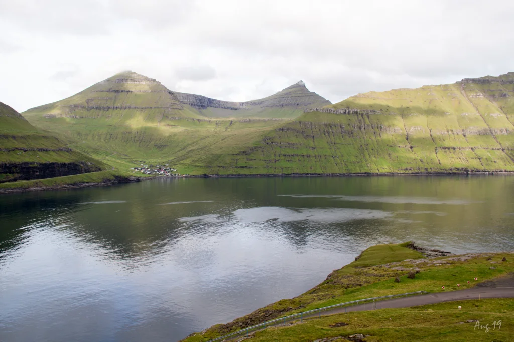 View from the headland Elduvíksnes over to the village Funningur. In the background to the left the ridge up to the highest mountain on the Faroe Islands, Slættaratindur 882m., And to the right Gráfelli, the second highest mountain. Photo: Óli Gardshodn


-
The village of Elduvík. Photo: Óli Gardshodn
-
The view north through the fjord Funningsfjørður. After walking the 60 altitude meters from the road up the mountain gorge Sniðsgil, we have reached the highest point on the village path. The rest of the trip to Elduvík is a 3km pleasant walk - except for a small slippage which we must cross. Photo: Óli Gardshodn
-
View from the headland Elduvíksnes into the fjord Funningsfjørður. The village path is all the way up on this rock wall that we stand on, and it goes as far in as we can see, after which it goes down the road through a mountain gorge. It is actually a very nice and quiet walk. Photo: Óli Gardshodn
-
View from the headland Elduvíksnes over to the village Funningur. In the background to the left the ridge up to the highest mountain on the Faroe Islands, Slættaratindur 882m., And to the right Gráfelli, the second highest mountain. Photo: Óli Gardshodn
Ein stuttur, góður og vakur túrur, har útsýnið niðan á Dalkinsfjall, yvir um fjørðin og út í Kalsoynna er stórbart. Gott útsýni er eisini yvir á hægstu fjøll okkara
ÁVARING: ein skriða ávegis aftur til elduvíkar ger túrin torføran.Túrurin úr Funningsfirði til Elduvíkar um Sniðsgil er onnur av tveimum bygdagøtum millum bygdirnar báðar. Tað er lætt at ganga úr Funningsfirði niðan gjøgnum Sniðsgil og um hamaran til Gøtuhjalla. Haðan gongur tú heim eftir hjallanum til Elduvíkar. Tvey tey fyrstu gilini frá Elduvíksnesi til Elduvíkar (inni í Barmi) eru bæði rapað, so at heldur torført er at sleppa yvirum hjá illa gongdum. Gøtan á Hjallanum fram við Funningsfirði liggur beint oman fyri landsvegin millum Funningsfjørð og Elduvík, so her er ikki fullkomiliga friðarligt. Fyrsti varðin í Sniðsgili sæst frá vegnum. Varðarnir síggjast ikki úr bygdini elduvíkarmegin.


Funningsfjørður (Sniðsgil) - Elduvík
Elduvík - Funningsfjørður (Sniðsgil)
Funningsfjørður (Sniðsgil) - Elduvík
Public transport
There is no public transportation to Elduvík or Funningsfjørður.
Arriving by car
Parking in Funningsfjørður
Parking is available by the gully Sniðsgil, where the path starts (see photo)
-
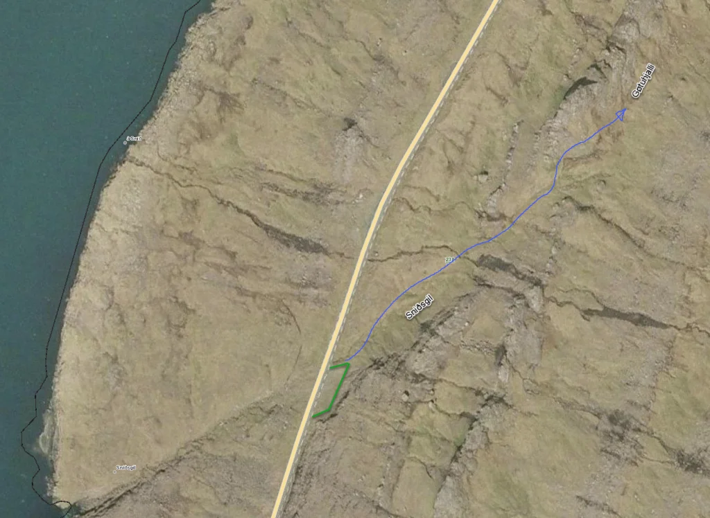 parking (green line) and strating point (blue line) - Funningsfjørður (Sniðsgil)
 -
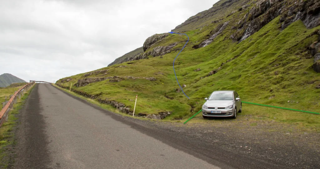 parking (green line) and strating point (blue line) - Funningsfjørður (Sniðsgil)
 -
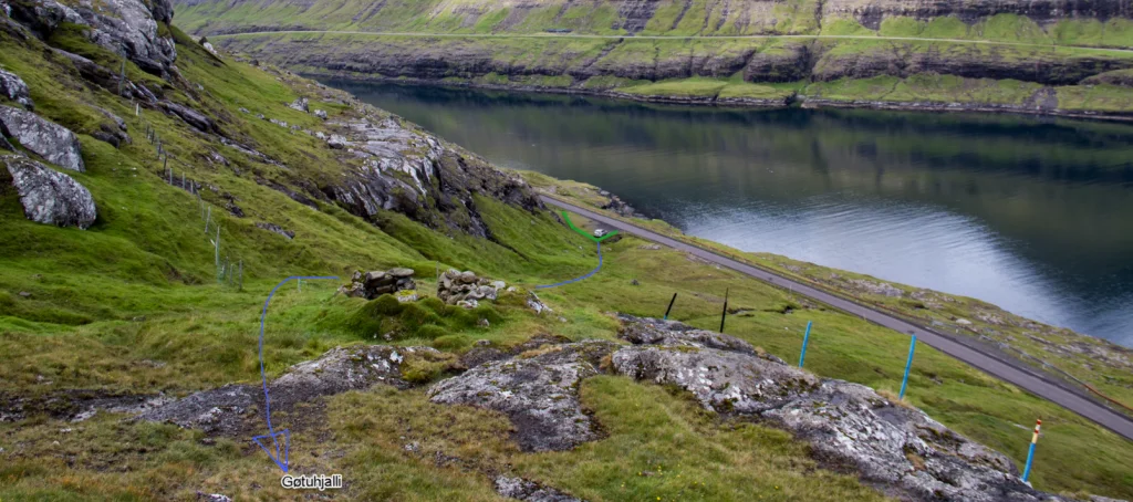 parking (green line) and strating point (blue line) - Funningsfjørður (Sniðsgil)


Elduvík - Funningsfjørður (Sniðsgil)
Public transport
There is no public transportation to Elduvík or Funningsfjørður.
Parking Elduvík
Good parking is found near the church in Elduvík (see photo)
-
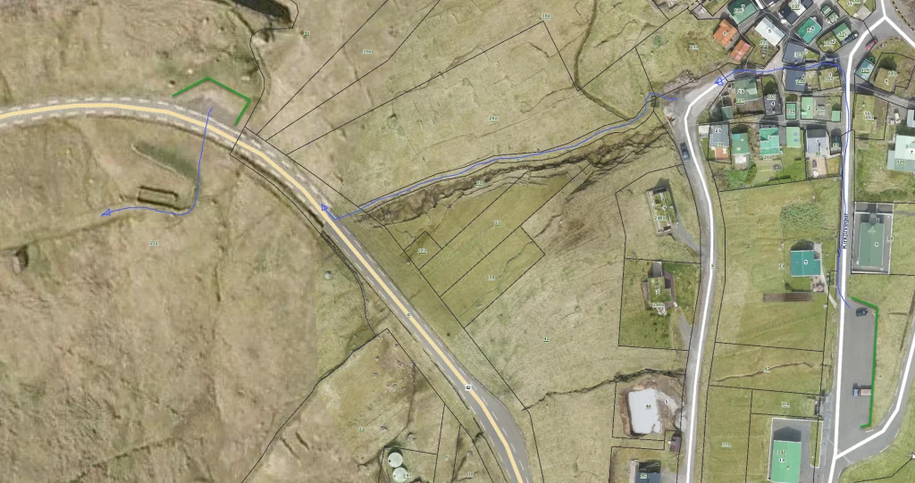 map of parking and starting point
 -
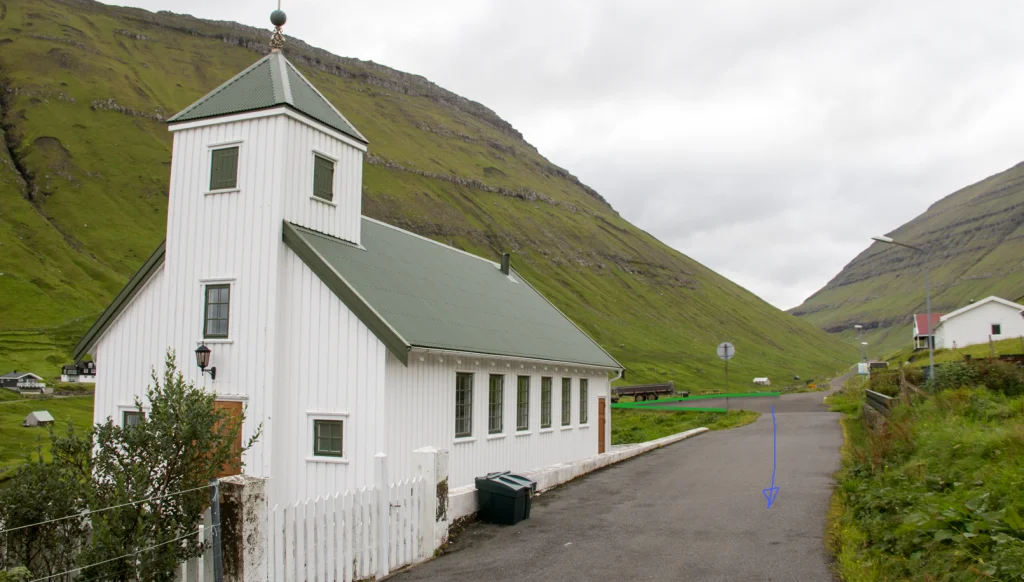 parking (green line) and strating point (blue line)
 -
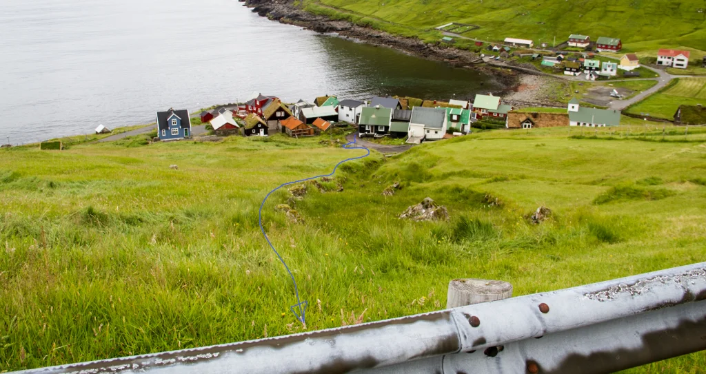 parking (green line) and strating point (blue line)
 -
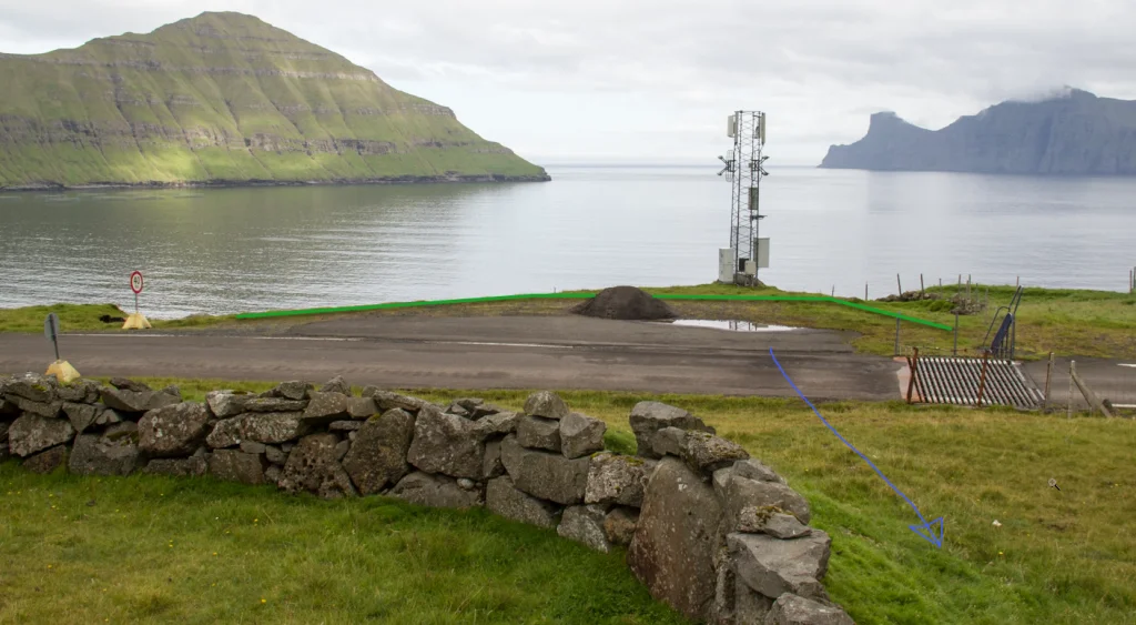 parking (green line) and strating point (blue line)


Funningsfjørður (Sniðsgil) - Elduvík
Elduvík - Funningsfjørður (Sniðsgil)
Funningsfjørður (Sniðsgil) - Elduvík
Elduvík - Funningsfjørður (Sniðsgil)
Fakta

Tíð

longd

Hægsta stað

Hæddarmetrar
 Suitable for children above approx. 10 years
 Medium
- It is easy to walk, although at times steep, which might be a challenge for people with fear of heights
Medium
- It is easy to walk, although at times steep, which might be a challenge for people with fear of heights
 Grass-covered and easy to walk but wet in places. However, the path is in bad condition in two gullies near Elduvík. One must climb over a fence at the Cape of Elduvík



Líknandi gongutúrar
Øki / Torleikastig

 Miðal
Miðal
 10 km /
2t
45m
10 km /
2t
45m

 4 km /
1t
10m
4 km /
1t
10m


