


Tú hevur ongar yndis enn
Her kanst tú savna íblástur, greinar, tiltøk og støð, sum tú hevur áhuga fyri.
Trýst á ikonið á síðurnar, so koma tær fram her.
Tínir yndis
Íblástur & Greinir
Tiltøk & Túrar
Støð
Bygdagøtur
INSPIRATIÓNIR & ARTIKLAR
TILTØK & GONGUTÚRAR
Støð
Skála – Selatrað


Link Copied!

-
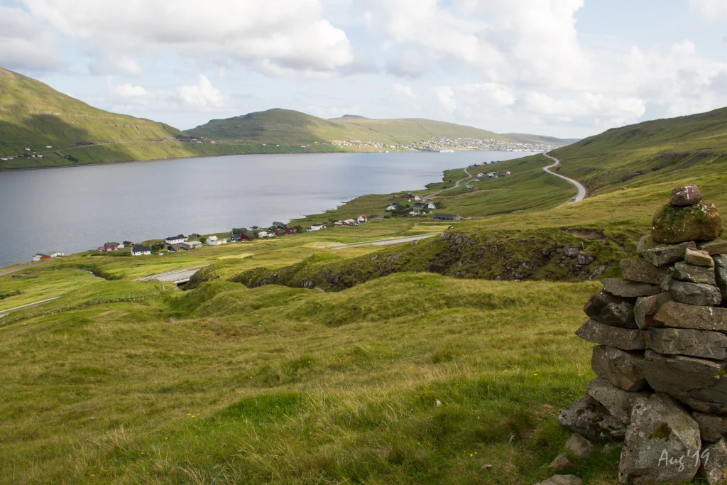 Well-maintained cairns are throughout the hike except for the last stretch down to Selatrað, which has no cairns. Photo: Óli Gardshodn
 -
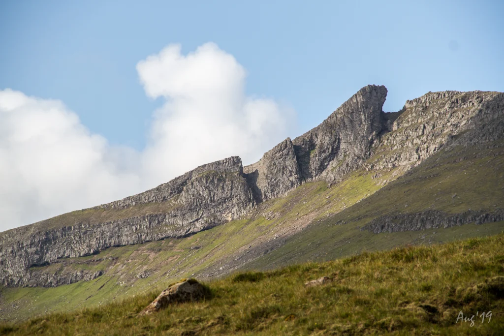 A beautiful and peaceful hike. The stretch from the pass and the next kilometre down through the gorge Trongannagjógv to Skála is especially interesting. Photo: Óli Gardshodn
 -
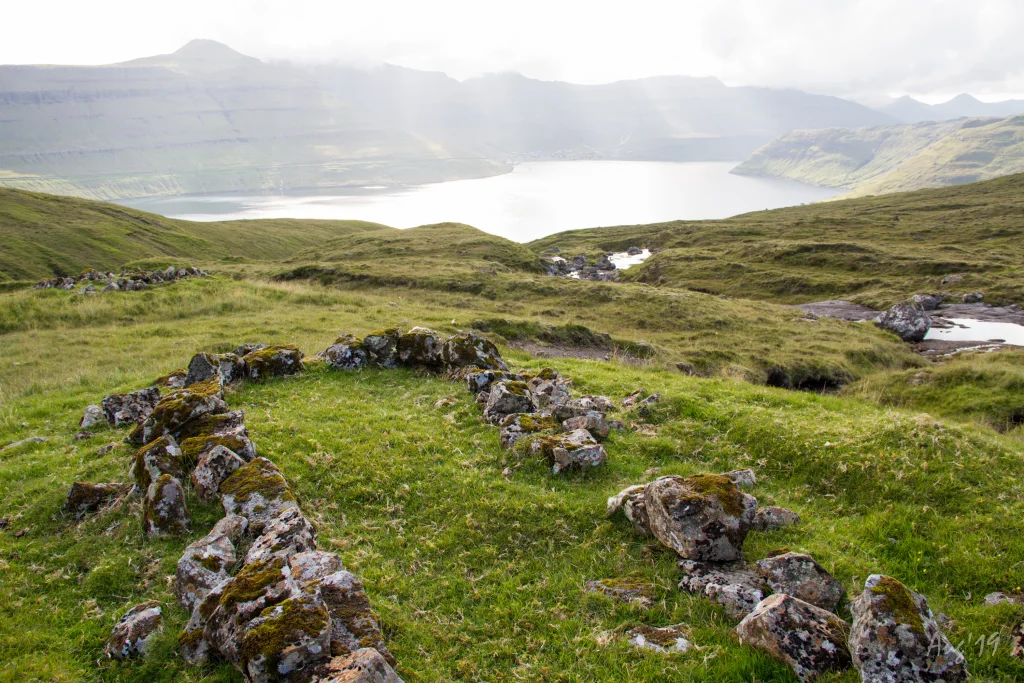 Many small peat storage huts are by the river Tvørá close to Selatrað. Photo: Óli Gardshodn
 -
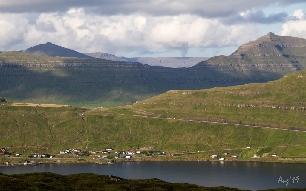 On the hike you have a great view of the villages on the eastern side of the Skálafjørður. Photo: Óli Gardshodn


-
Well-maintained cairns are throughout the hike except for the last stretch down to Selatrað, which has no cairns. Photo: Óli Gardshodn
-
A beautiful and peaceful hike. The stretch from the pass and the next kilometre down through the gorge Trongannagjógv to Skála is especially interesting. Photo: Óli Gardshodn
-
Many small peat storage huts are by the river Tvørá close to Selatrað. Photo: Óli Gardshodn
-
On the hike you have a great view of the villages on the eastern side of the Skálafjørður. Photo: Óli Gardshodn
Ein lættur og vakur túrur eftir vestara armi á Skálafjørðinum
Vakur og friðarligur túrur, sum er serliga áhugaverdur frá skarðinum og á leið ein kilometur oman til Skála ígjøgnum Trongmannagjógv.
Nógvar torvkráir eru at síggja við Tvørá tætt við Selatrað. Vallað og gott lendi allan vegin. Eitt sindur grýtut nakað vestan fyri skarðið. Gangast skal um tvey hegn, har stigi er. Gleivast skal um eitt hegn við bøgarðin á Selatrað.
Tað er lættast at finna gøtuna, tá ið gingið verður av Skála. Á Skála verður gingið niðan gjøgnum portrið við Gjógvará og síðan suður til gjónna, har eitt op er í hegninum, niðan til fyrsta varðan, sum sæst haðani. Góðir varðar eru allan vegin uttan seinasta strekkið oman til Selatraðar, har ongir eru.
Neyðugt er at hava GPX-fíluna við á túrinum, tí lætt er at fara skeivur av gøtuni og enda í Skálabotni heldur enn á Skála. Hetta kemst av, at niðasta strekkið við Selatrað – frá Breiðá og omaneftir – er sama gøta sum til Skálabotns.


Skála – Selatrað
Public transport
It is preferable to arrive by car in Selatrað as public transportation is poor.
Arriving by car
Parking, Skála
There is a parking lot by the sheep shed 460 metres north of the gate. Parking is also available south of the crash fence by the river Gjógvará, 150 metres south of the gate – see the green lines. From there, follow the blue line out through the gate and the fenced area above it.
-
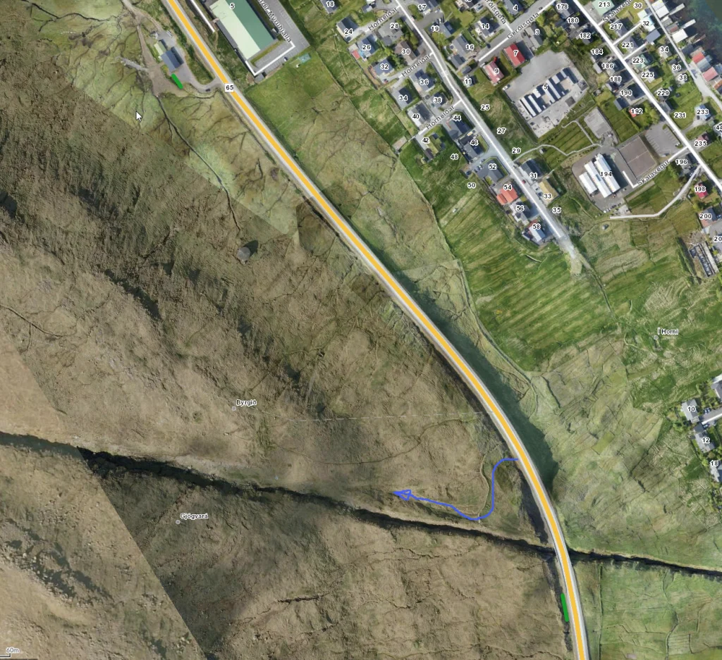 See green line for parking and blue line for starting point.
 -
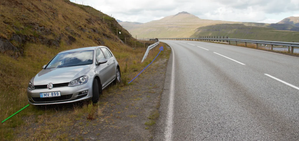 See green line for parking and blue line for starting point.
 -
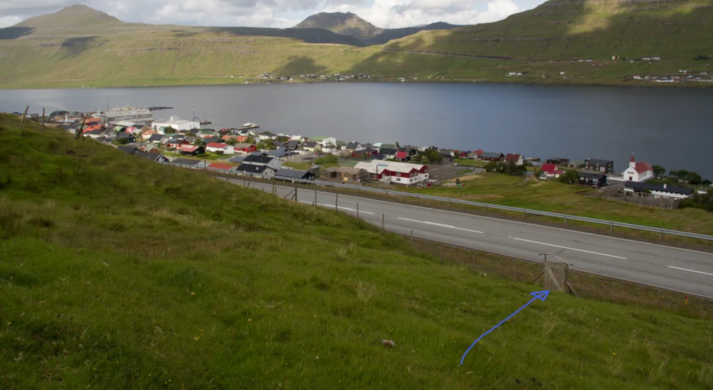 Follow the blue line for starting point.


Selatrað – Skála
Public transport
It is preferable to arrive by car in Selatrað as public transportation is poor. Route 440 drives there occasionally.
Arriving by car
Parking, Selatrað
Parking is available by the mission hall – see the green lines. The mission hall is only used Sunday evenings in winter, leaving ample parking the rest of the time.
From here, follow the old cattle trail up along the northern bank of the river Mittúnsá until you reach the rock wall, where you pass through an iron gate. Continue along the southern bank of Mittúnsá until you reach a fence which you need to climb over at its lowest point.
Plans are to install a ladder or gate here – see the blue line.
-
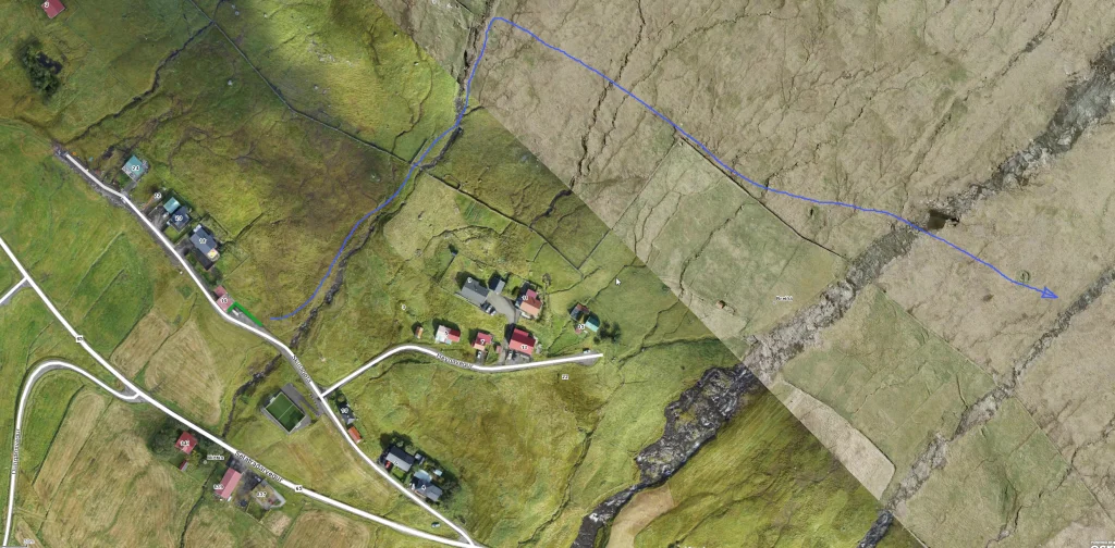 See green line for parking and blue line for starting point.
 -
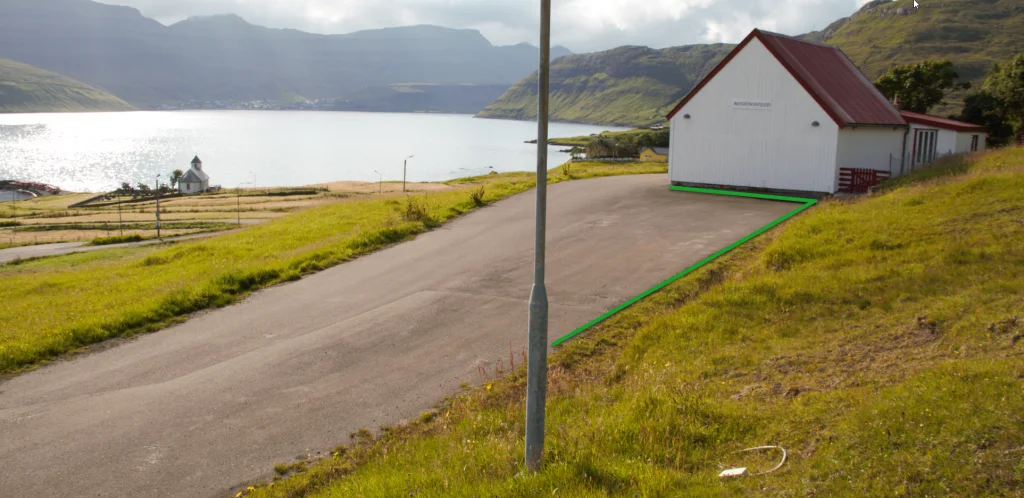 See green line for parking.
 -
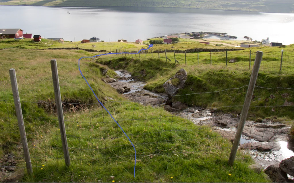 Follow the blue line for the starting point.
 -
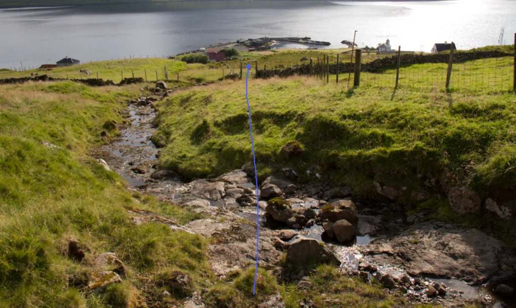 Follow the blue line for the starting point.
 -
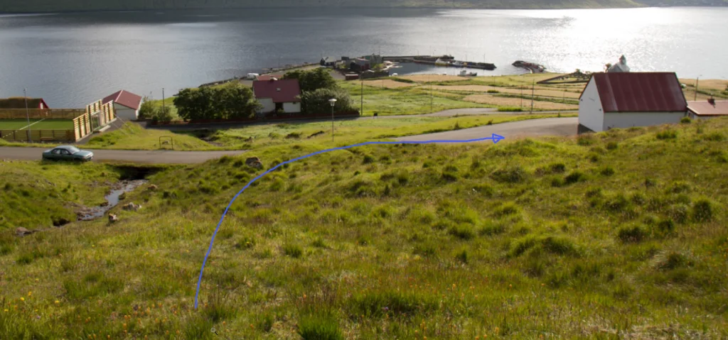 Follow the blue line for the starting point.


Skála – Selatrað
Selatrað – Skála
Fakta

Tíð

longd

Hægsta stað

Hæddarmetrar
 Suitable for children 8 years and older
 Medium
- The entire path is easy to walk with no crags to be navigated
Medium
- The entire path is easy to walk with no crags to be navigated
 Grass-covered and good for walking throughout, though a little rocky west of the pass.
You need to go over two gates that have ladders. The hike also goes along a gorge, and another fence must be climbed over by the village wall in Selatrað
Grass-covered and good for walking throughout, though a little rocky west of the pass.
You need to go over two gates that have ladders. The hike also goes along a gorge, and another fence must be climbed over by the village wall in Selatrað

Øki / Torleikastig

 Miðal
Miðal
 10 km /
2t
45m
10 km /
2t
45m

 4 km /
1t
10m
4 km /
1t
10m


