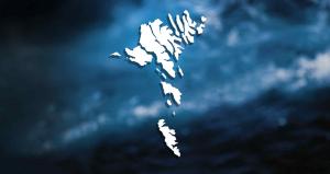


Operation Valentine
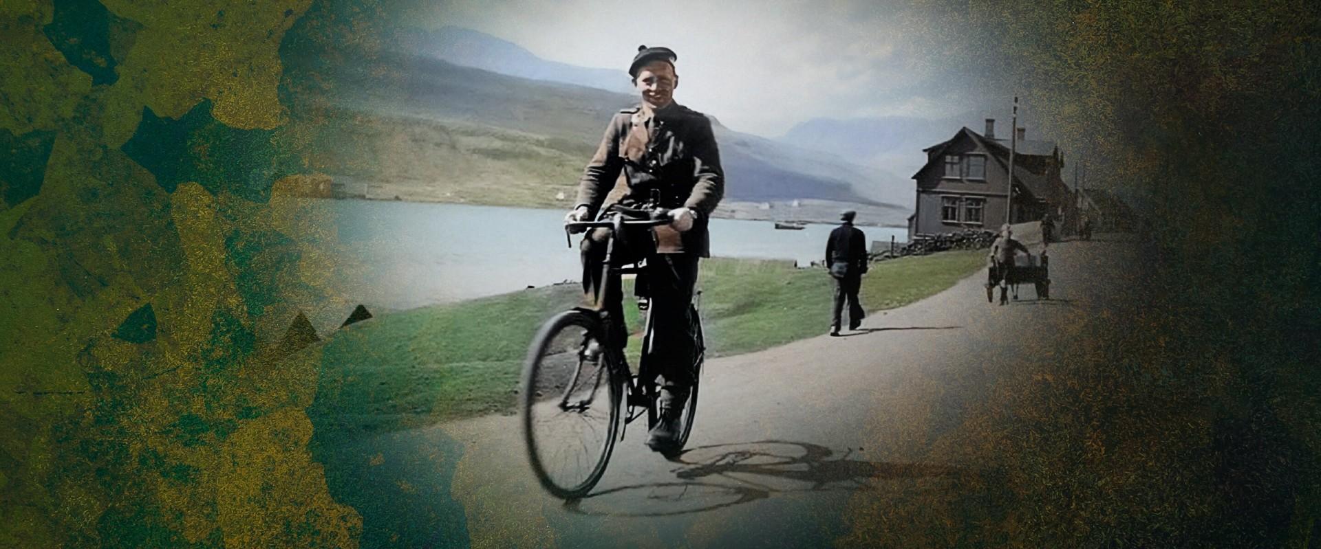
During World War II, the British occupied the Faroe Islands from 1940 to 1945 after the German invasion of Denmark and Norway. This occupation was code-named Operation Valentine, also called The Friendly Occupation. Operation Valentine has left a lasting impact on the islands—physically, culturally, and culinarily—which continues to be seen, tasted, and felt today.
Explore stories from the wartime period of the friendly invasion as reflected in today's Faroese landscape.
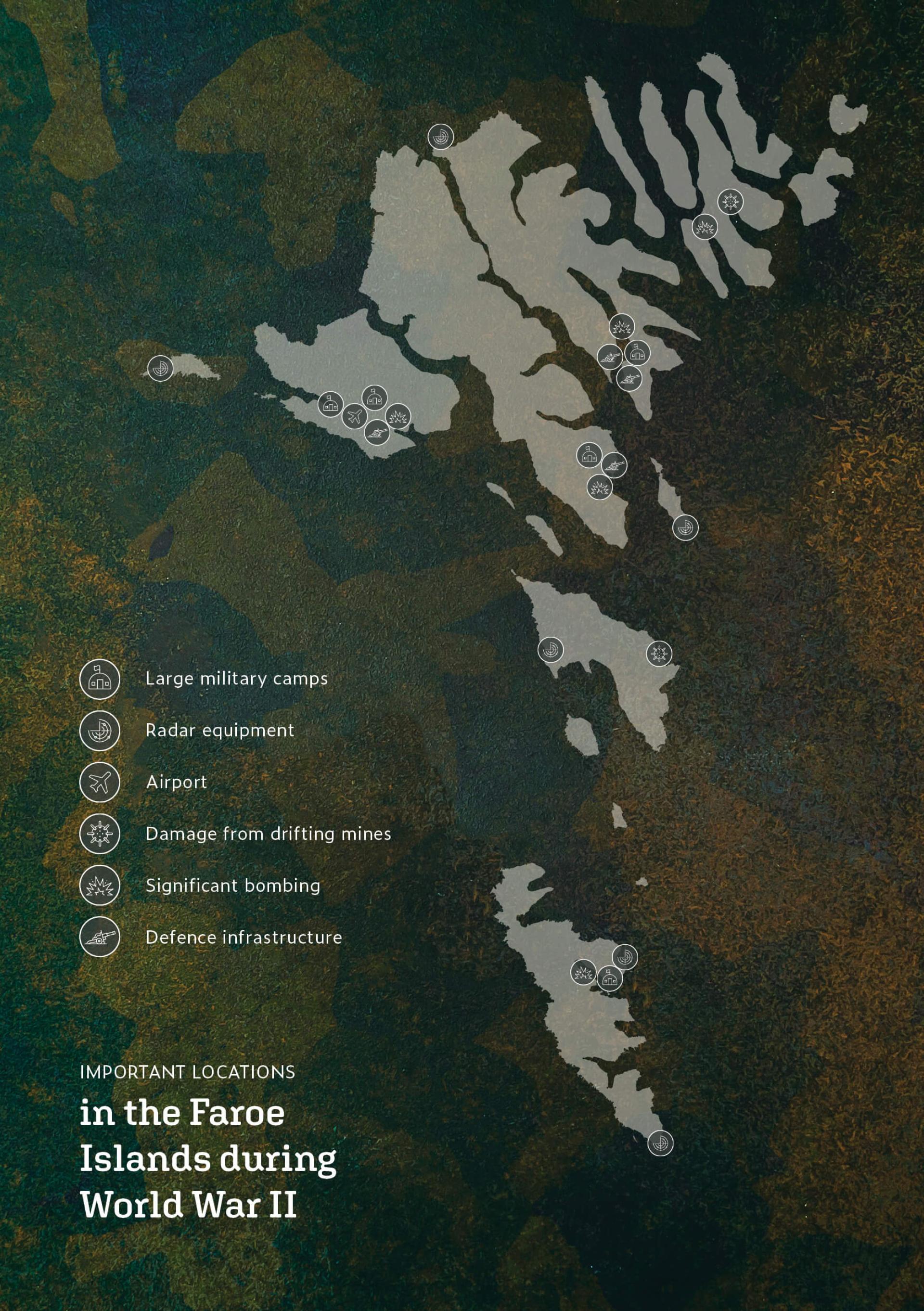
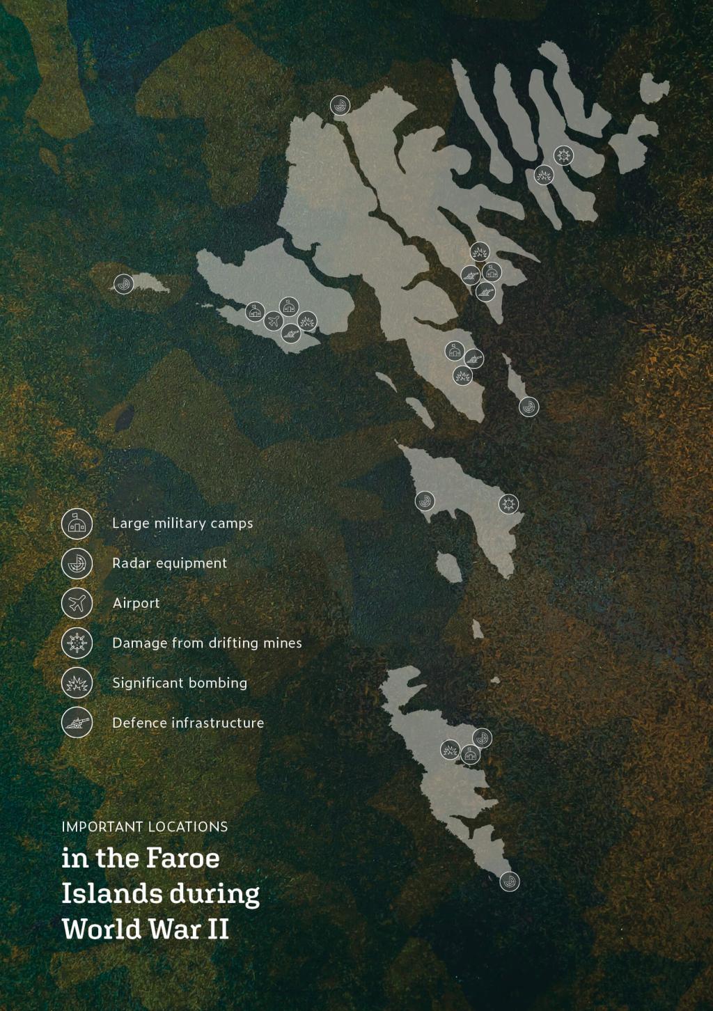
Locations of Interest


Mines Under the Faroe Islands
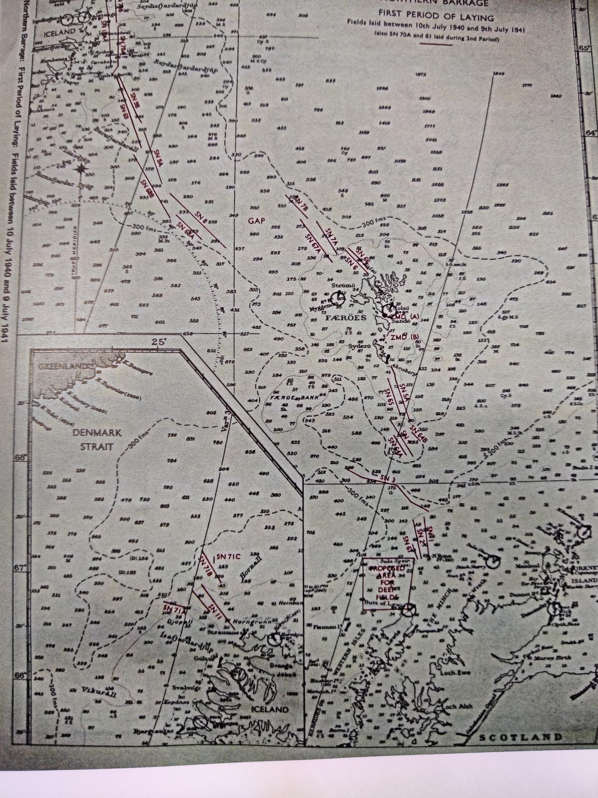
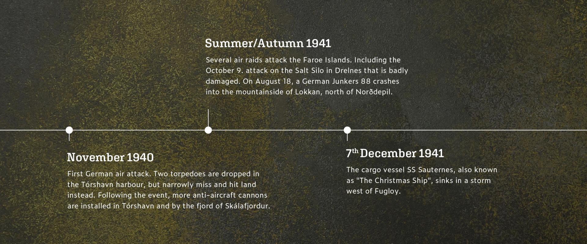
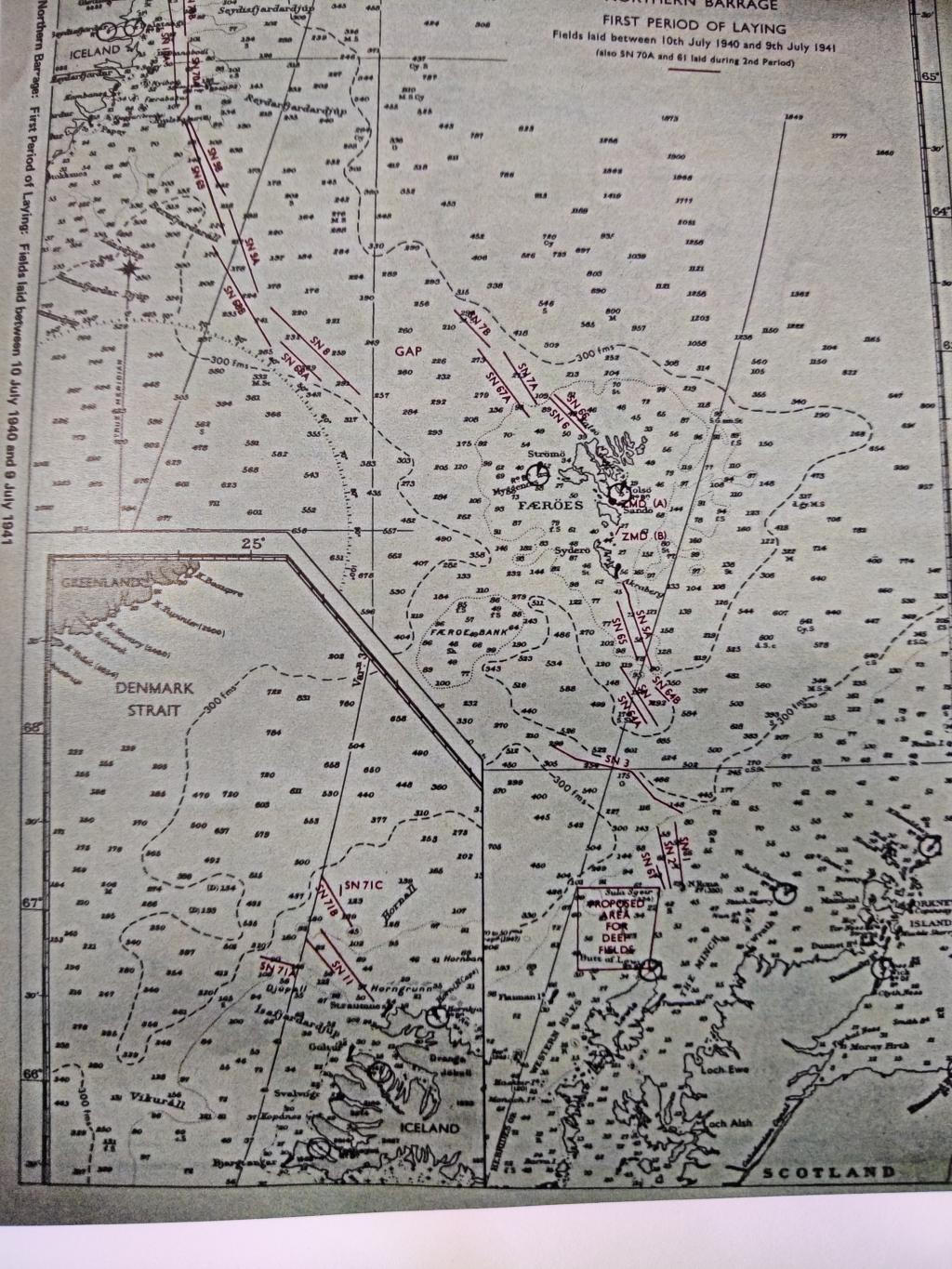
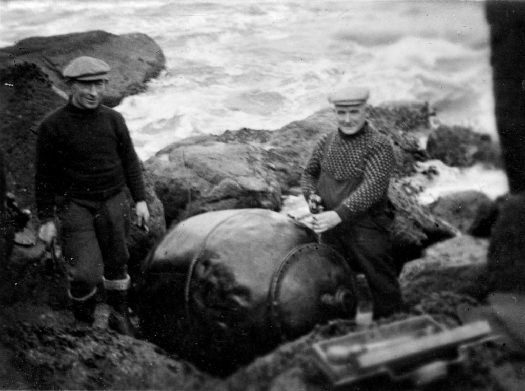
During the early stages of WWII, the British launched the "Northern Barrage," laying about 92,000 mines from the Hebrides to Iceland. Between July 1940 and November 1942, 11,883 mines were deployed in the Faroese seas, with 983 located in strong currents, causing many to drift and become problematic. These contact mines posed significant risks to ships and the Faroese populace, with the first recorded ship loss being the "Cheerful" on October 17, 1940.
Many vessels, both local and foreign, were lost to the mines, leading to the installation of warning signs and communication to harbour masters. On land, an estimated 200 to 300 homes were damaged by mines that washed ashore. The British Army responded by stationing 43 marksmen, who successfully destroyed 850 mines. Unfortunately, there were tragic accidents, with two boys in Vestmanna and three men in Dalur losing their lives. Twelve Faroese trained in mine removal for safety.
By 1943, it was recognized that managing these mines was costly, with minimal success, as they had only sunk one German submarine throughout the operation.
i
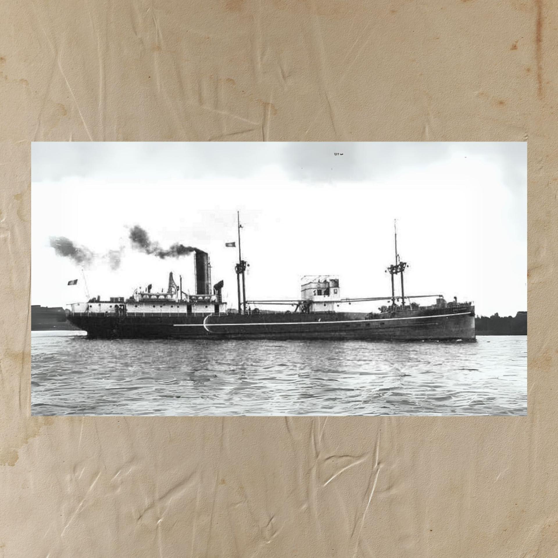
SS Sauternes
i
SS Sauternes (The Christmas Ship)
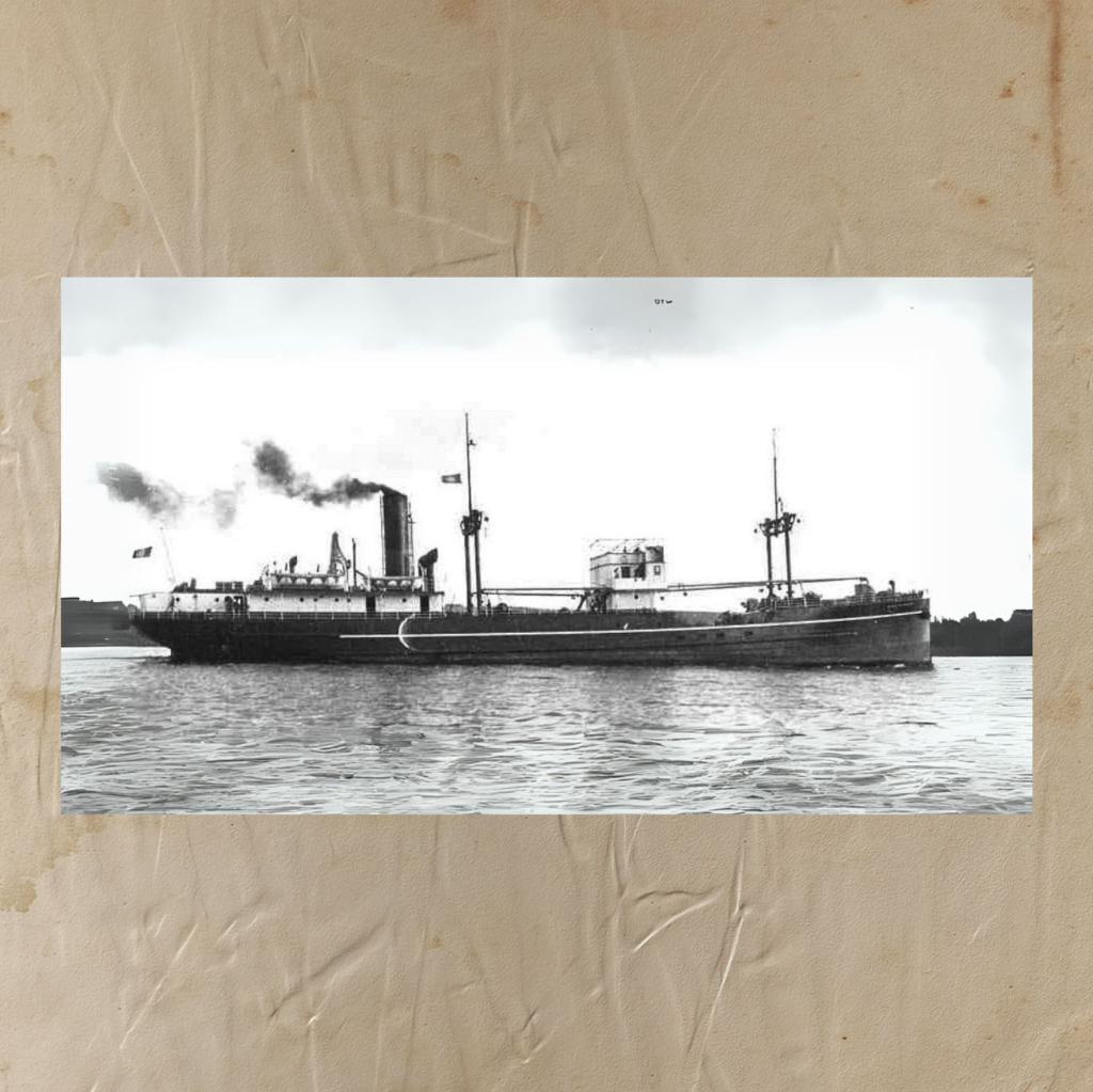
The SS Sauternes was a French cargo ship built in 1922. It measured 65 meters in length and 9 meters in width and had a capacity of 1,000 tons. After being captured in 1940, the British military used it during World War II.
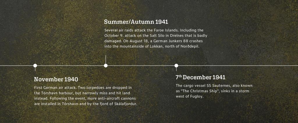
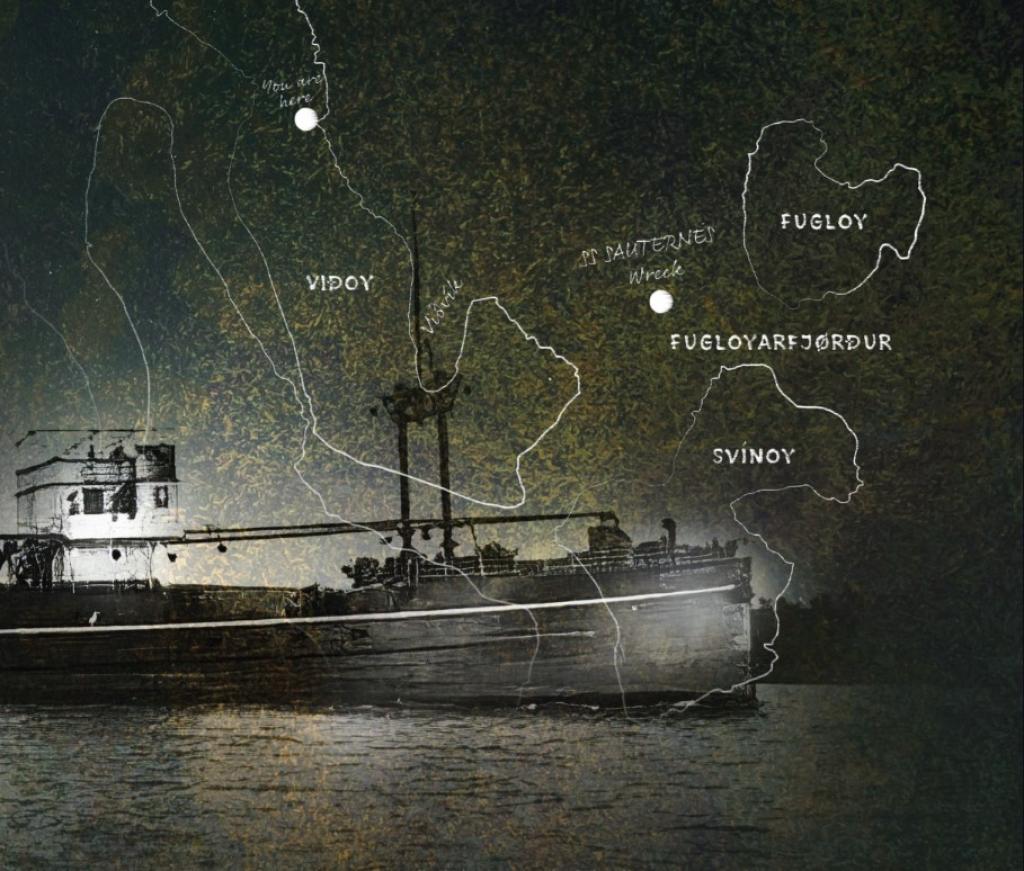
On December 2, 1941, the SS Sauternes departed Leithand for the Faroe Islands, carrying military supplies, food, a large shipment of whisky and rum, and a metal box containing 260,000 coins valued at 22,500 kroner. Accompanied by the armoured trawler HMT Kerrera, the vessel faced bad weather and lost its course.
After a misunderstanding regarding anchoring at Fugloyarfjørður instead of Fuglafjørður, a storm struck on December 6. The HMT Kerrera sustained minor damage but managed to escape, while the SS Sauternes sank, leading to the loss of all 25 crew members. Six bodies were later recovered and buried in Klaksvík. Debris, including rum, floated around the Northern Isles, and the wreck was discovered at a depth of 94 meters in 2000, but the metal chest and its coins remain unrecovered.

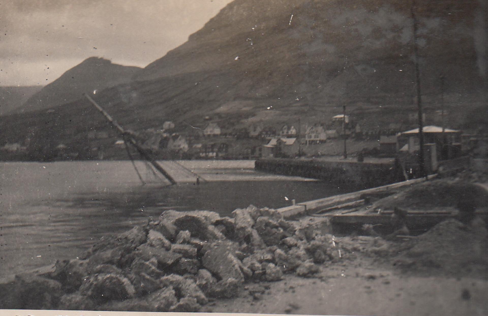
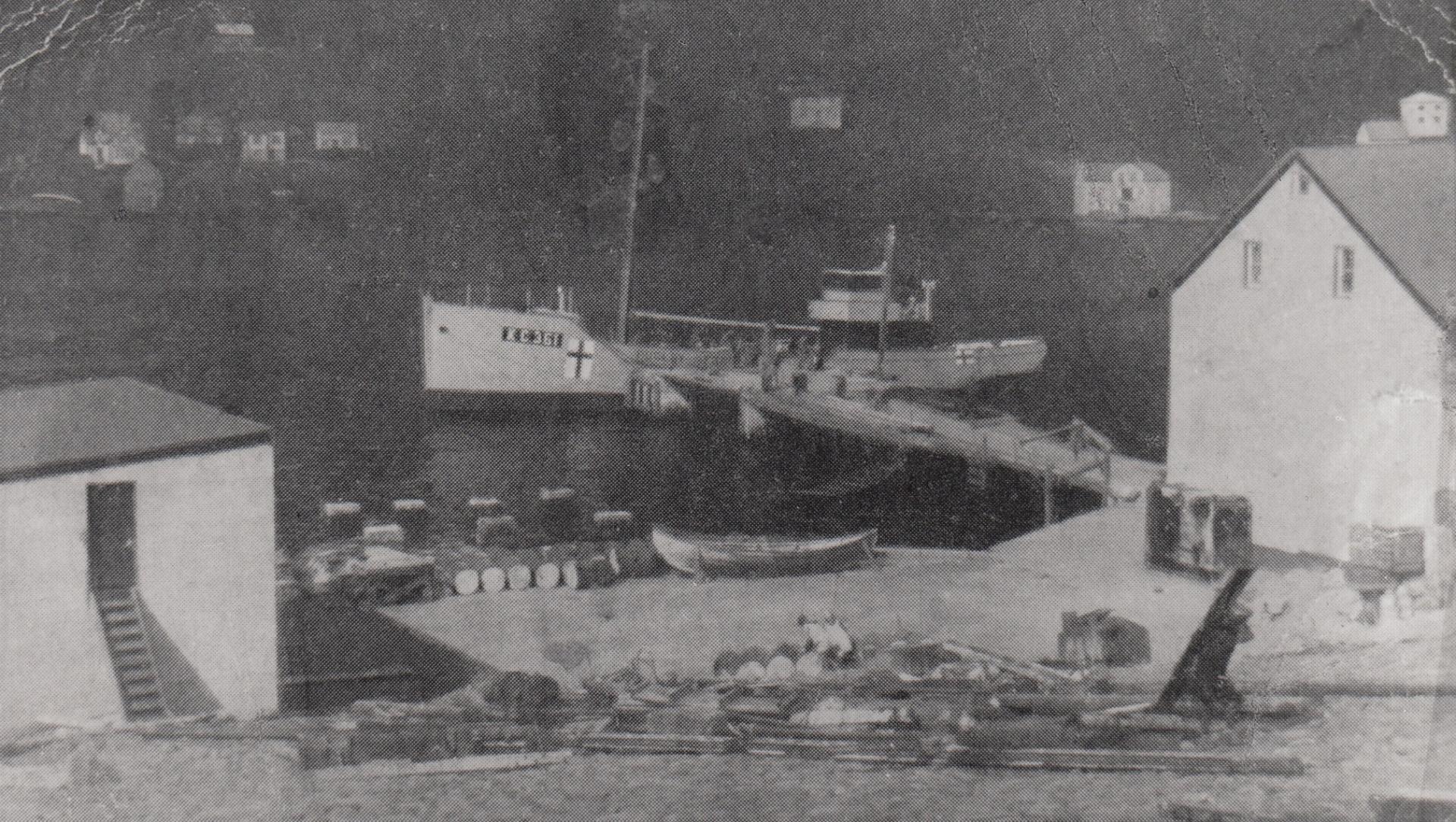
The day Fugloy sank
i

Fugloy before the insedens
i
Bomb Attack in Klaksvík
During the summer and autumn of 1941, the German bombing of the Faroe Islands intensified significantly. Most of the attacks were aimed at ships, but several villages also suffered damage. Due to their short distance from Norway, German bombers could swiftly reach the Faroe Islands, and radar stations were not operational until the summer of 1942.
In Klaksvík, several attacks took place during the autumn of 1941. On October 10th, a German bomber targeted the harbour, sinking a ship named Fugloy. This aircraft also fired machine guns at the village before returning to drop two additional bombs, damaging an English trawler in the harbour.
The following day, another plane flew low over the bay of Borðoyarvík and dropped bombs near a Norwegian line boat called Silva. Fortunately, one of the bombs did not explode and was later disarmed by soldiers.
On October 26th, numerous planes were spotted around the Faroe Islands.
A person from Klaksvík reports: A man was appointed to stand watch by the siren, and if he saw any aeroplanes or if neighbouring villages reported and warned about bombing aircraft, he was to sound the siren. From Trøllanes at 12:32, a call was made to the sheriff in Klaksvík, who informed that a German plane was heading south through the fjord of Kalsoyarfjørður. Three minutes later, the plane flew high above. The aircraft dropped four bombs, likely targeting the harbour or the ships anchored in the bay; however, they all exploded in the centre of Klaksvík, a kilometre off. The damage to houses was significant, and 15 homes were damaged, but it is by God's miracle that no person was injured.
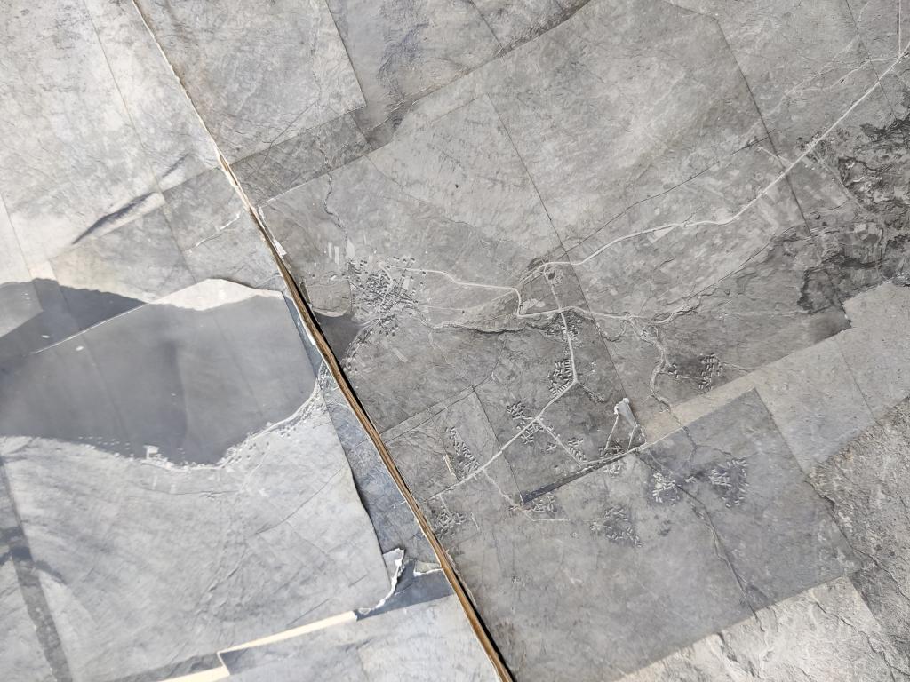
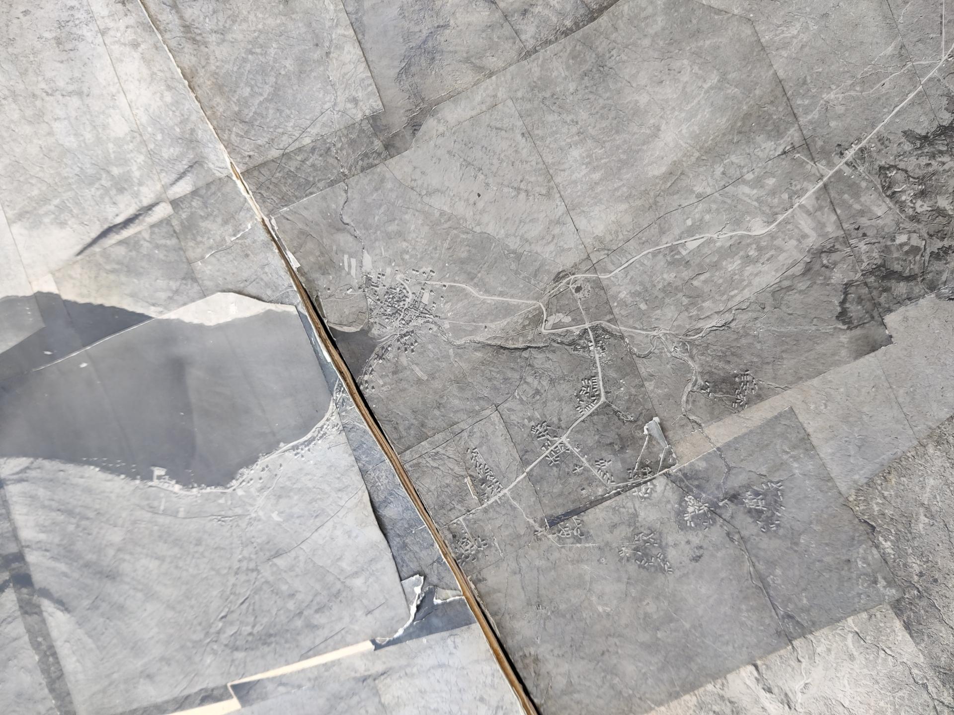
Old map of the area Uppi á Mýrum
i
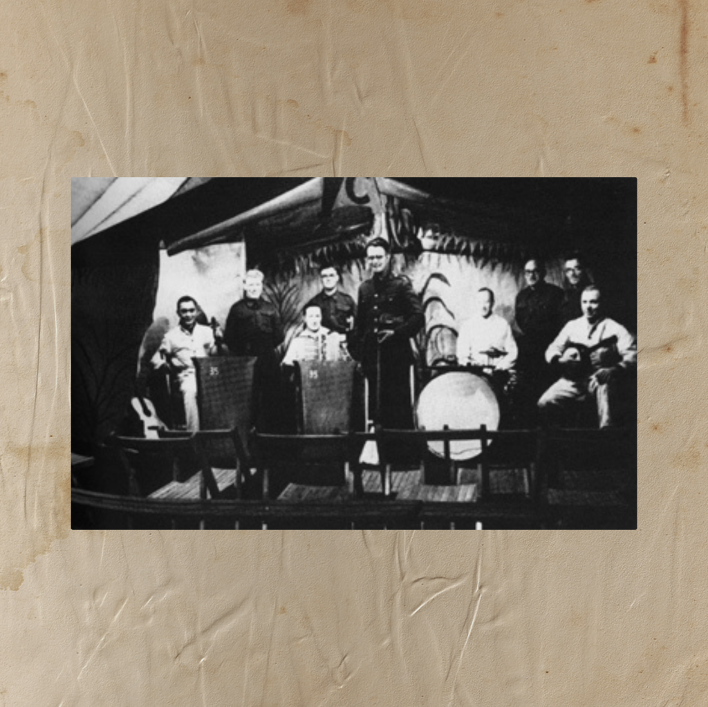
Bands travelled to the area to entertain soldiers
i
Barracks at Uppi á Mýrum
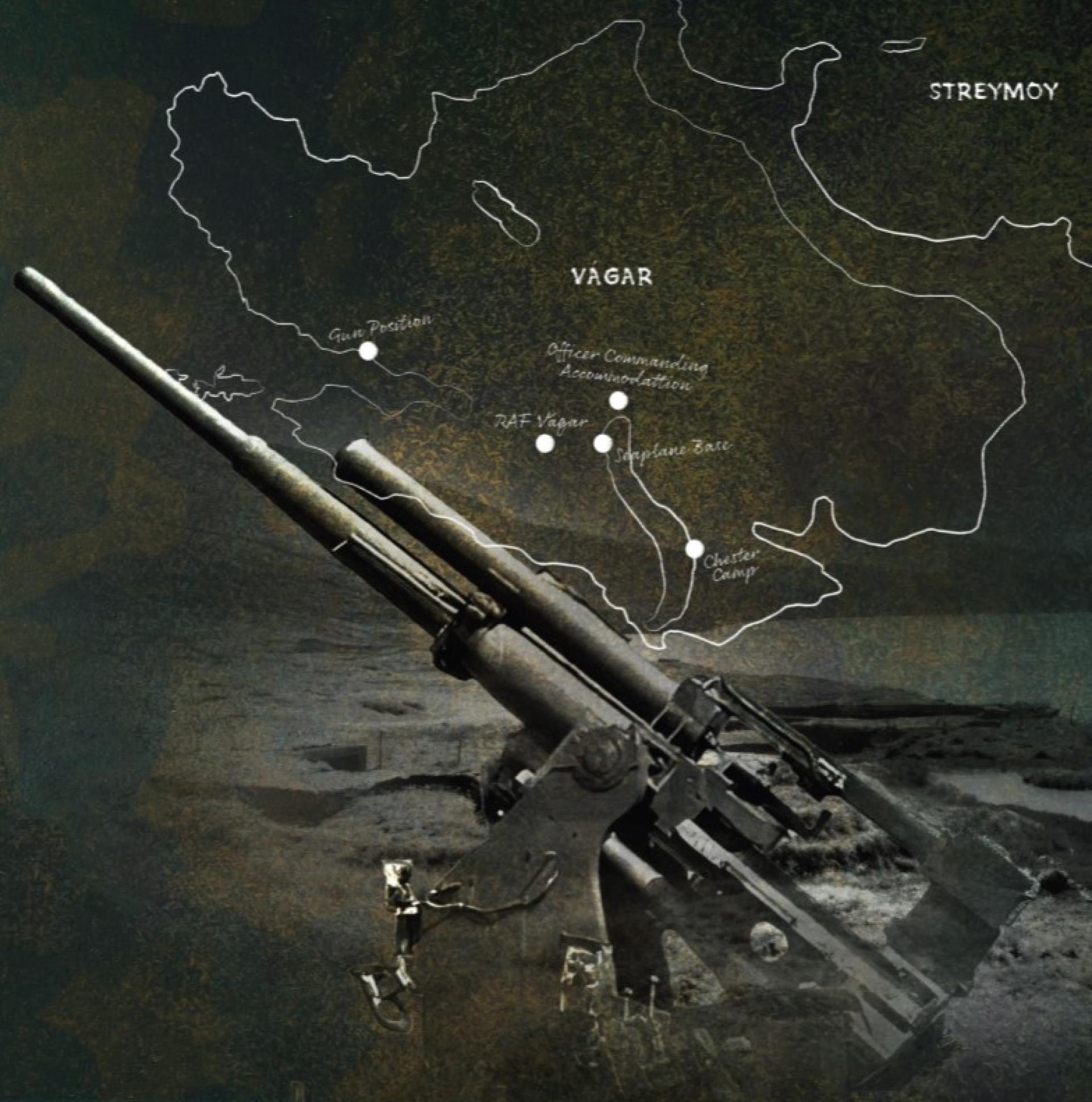
Barracks were established in key locations where army divisions were stationed, including Vágar, Tórshavn, and Skálafjørður, as well as at smaller stations throughout the country. The main camp was located at Uppi á Mýrum, above Sørvágur, where approximately 250 barracks were set up to accommodate those involved in building the airport. The Faroe Islands saw significant construction efforts during World War II, with the airport project being the most extensive. A large workforce was also required to improve road connections between villages, which included road expansions and bridge constructions. As a result, there was a substantial influx of army personnel to Vágar in April 1942. Around 3,000 men arrived to assist with the construction, and an additional 400 locals provided help whenever needed.
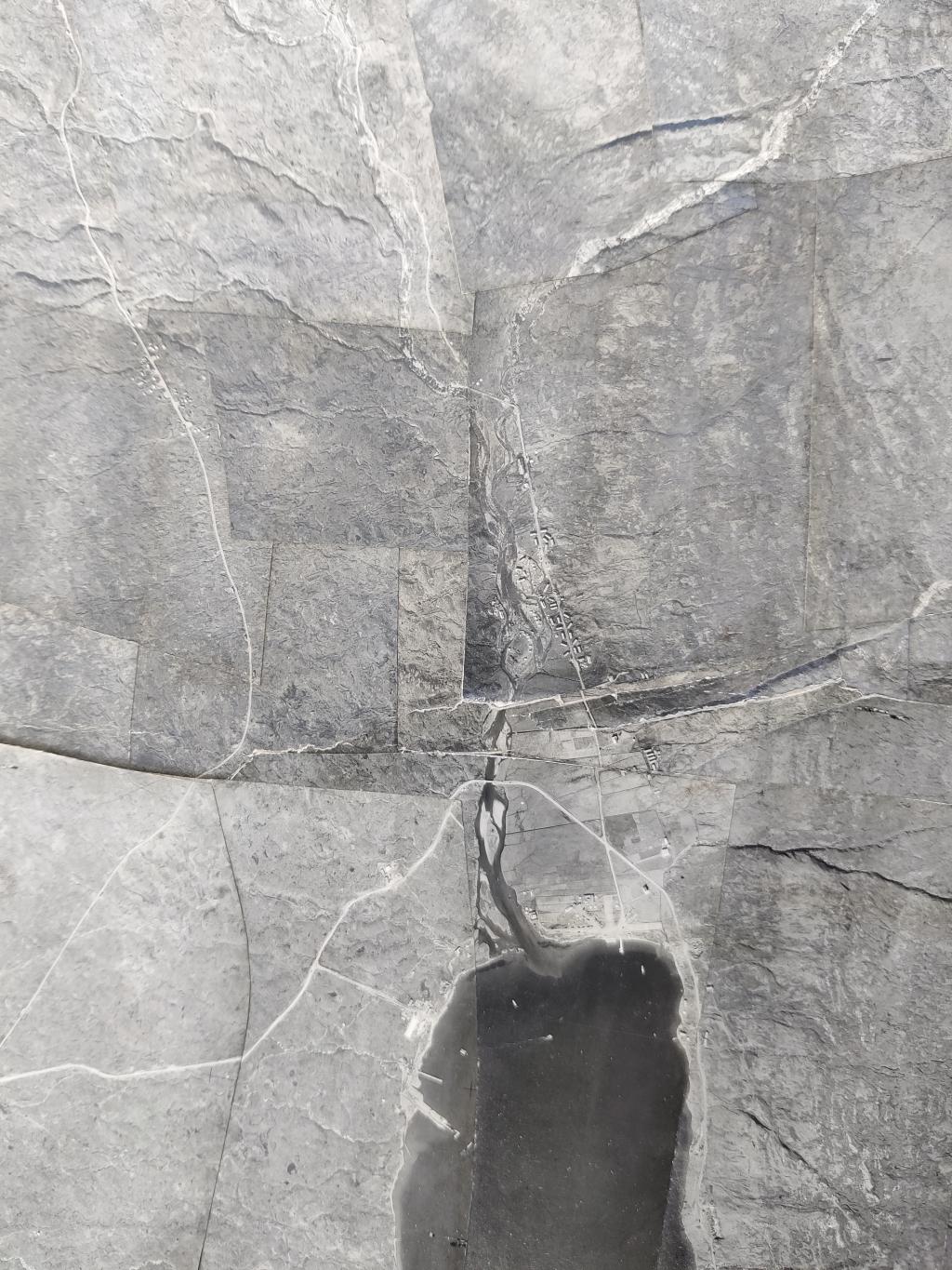
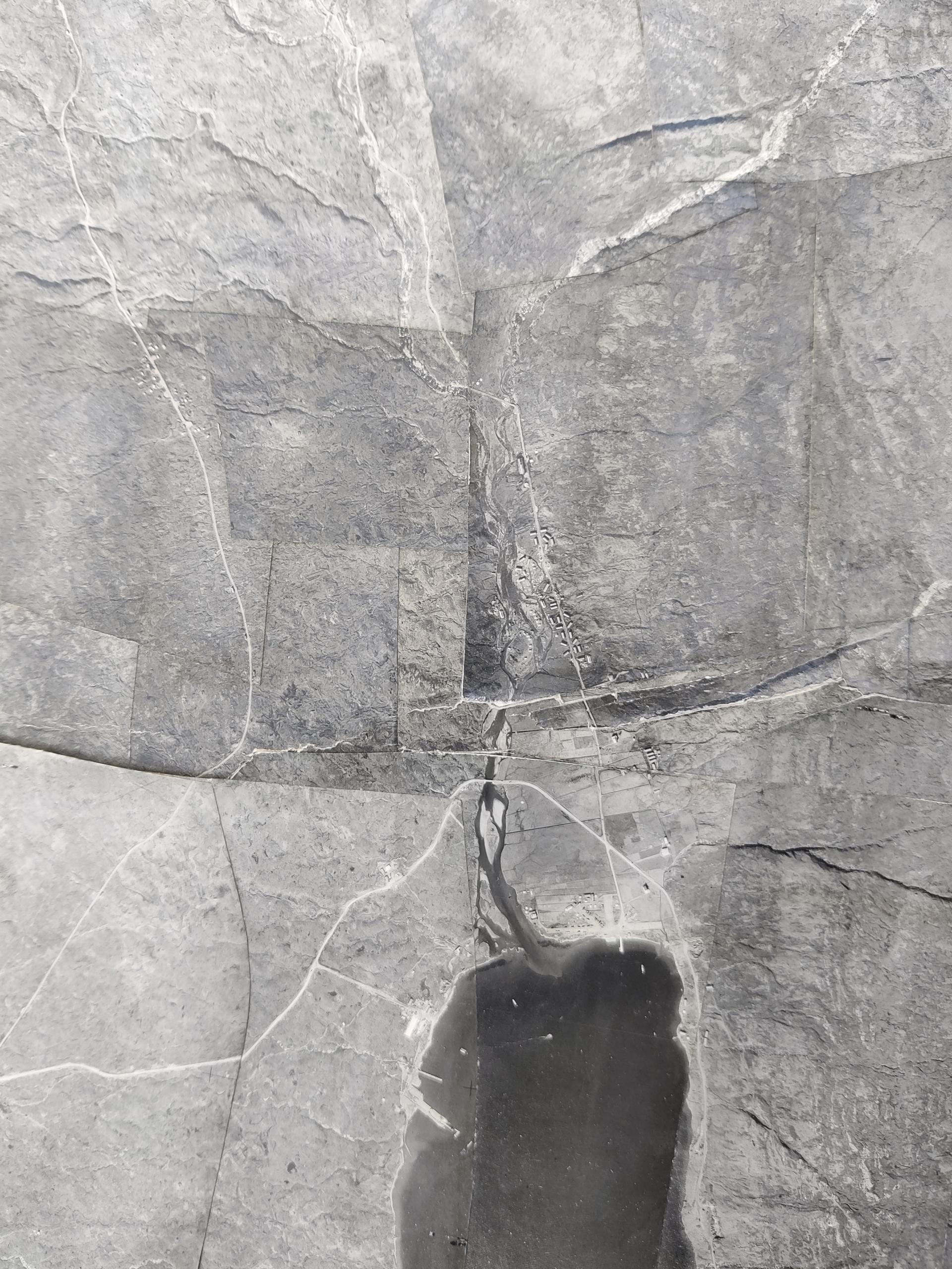
Old map of the area at Vatnsoyrar
i
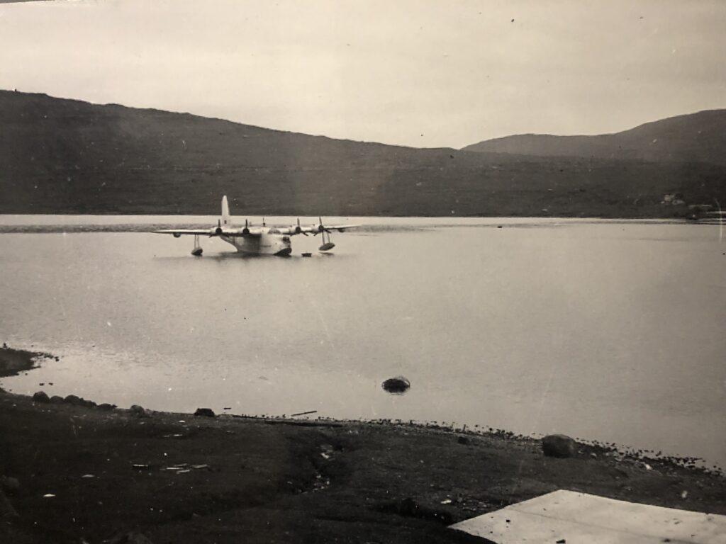
Sunderland Royal Air Force waterplane
i
Royal Air Force in Vatsnoyrar
The increase in German bombing attacks in 1941 led to the establishment of the first airport in the Faroe Islands on the island of Vágar. A Royal Air Force base was set up in the village of Vatnsoyrar, which required relocating local residents.
Initially comprised of tents, the camp expanded in the summer of 1942 with the construction of several barracks along the Sjatlá River. By spring 1943, there were 150 barracks, including sleeping areas, kitchens, mess halls, cinemas, and an ammunition house for bombs.
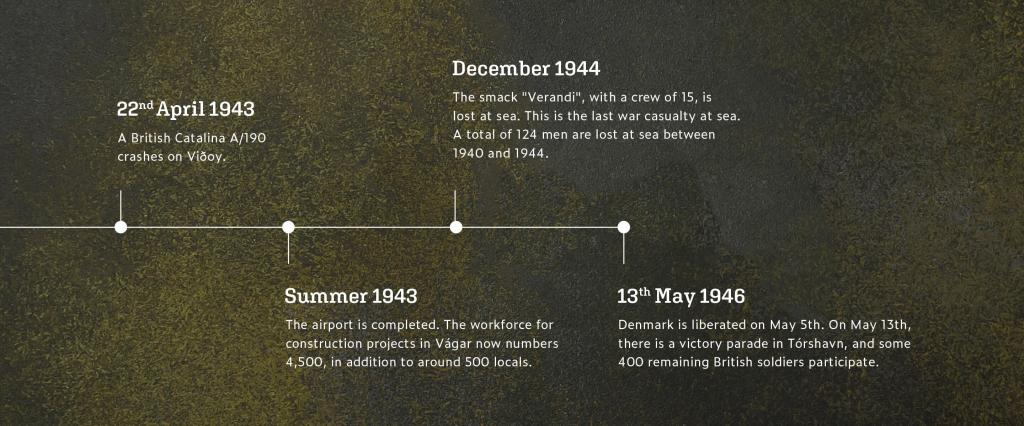
By the summer of 1943, the airport was ready for larger aircraft. On June 14th, a Lockheed Hudson F/279 was used for the first time in a rescue operation. Today, remnants of the base include cement foundations and a chimney.
Heavy snowfall during the winter of 1942-43 caused the Sjatlá River to overflow and destroy several barracks. On June 19th, 1943, the Royal Navy and Royal Air Force conducted a drill to assess the Faroe Islands' defence.
As construction progressed, the threat from German aircraft diminished, resulting in the airport being used only nine times before the Royal Air Force left. By summer 1944, around 160 personnel were stationed there, but by autumn, no one remained as the base was closed.
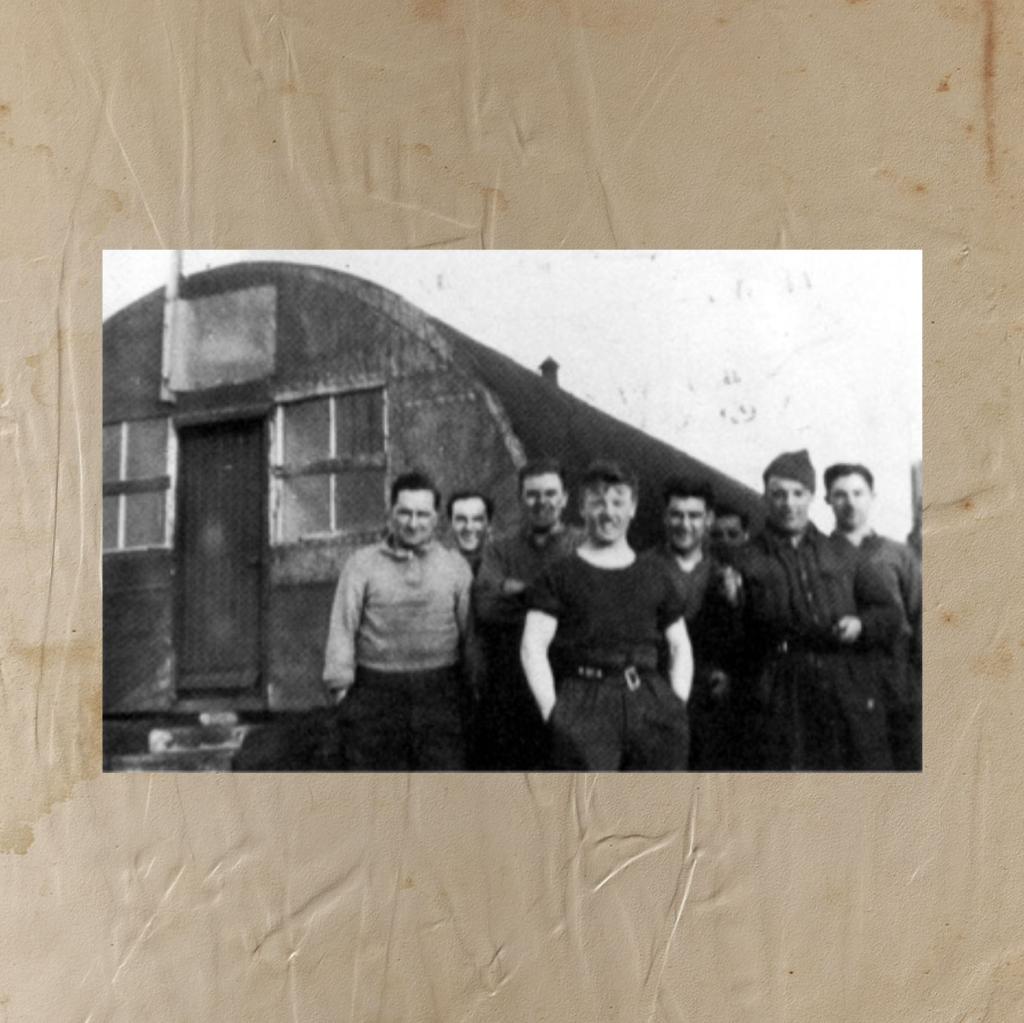
Freetime at Chester Camp
i

Four of these where on Chester Camp
i
Chester Camp
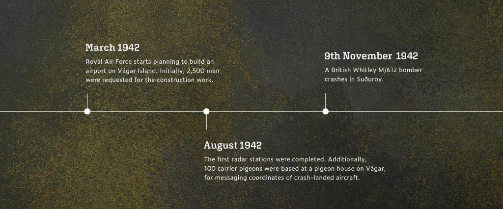
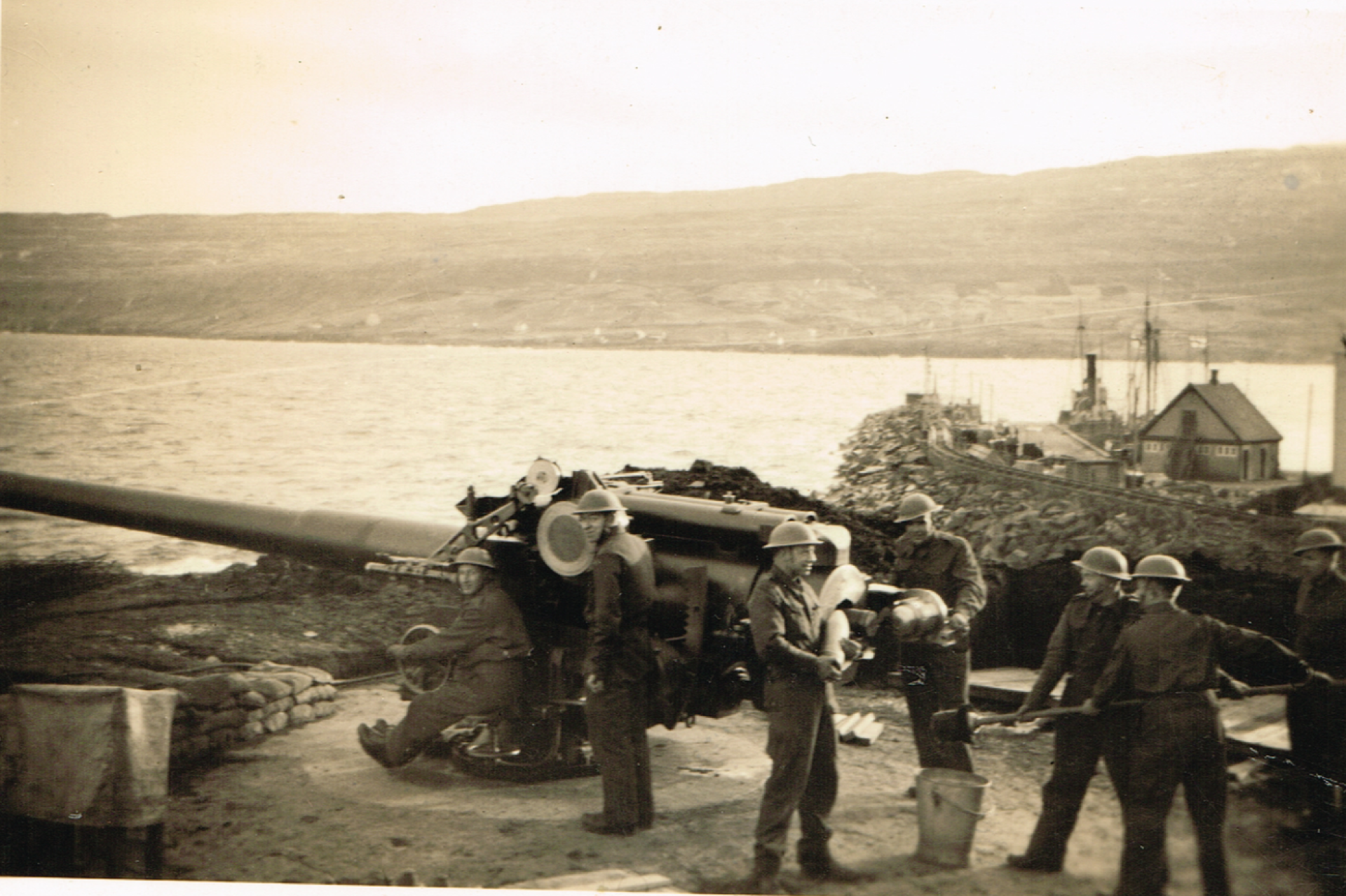
In March 1942, the Royal Air Force decided to build an airport, necessitating the construction of aerial defence stations. One cannon defence was established in Bøur, while another was built at Gróthústangi and named Chester Camp due to soldiers from the English town of Chester being stationed there. Construction began in July 1942 and was completed by November 1942.
Additionally, quicker and lighter cannons that required fewer personnel and were easier to operate were needed.
Occasionally, shots were fired at German aircraft from Chester Camp, although these rounds did not successfully hit their targets. As time passed in 1943, the threat to the Faroe Islands diminished, and by March 1944, the cannons were dismantled after 16 months since the first practice shots were fired.
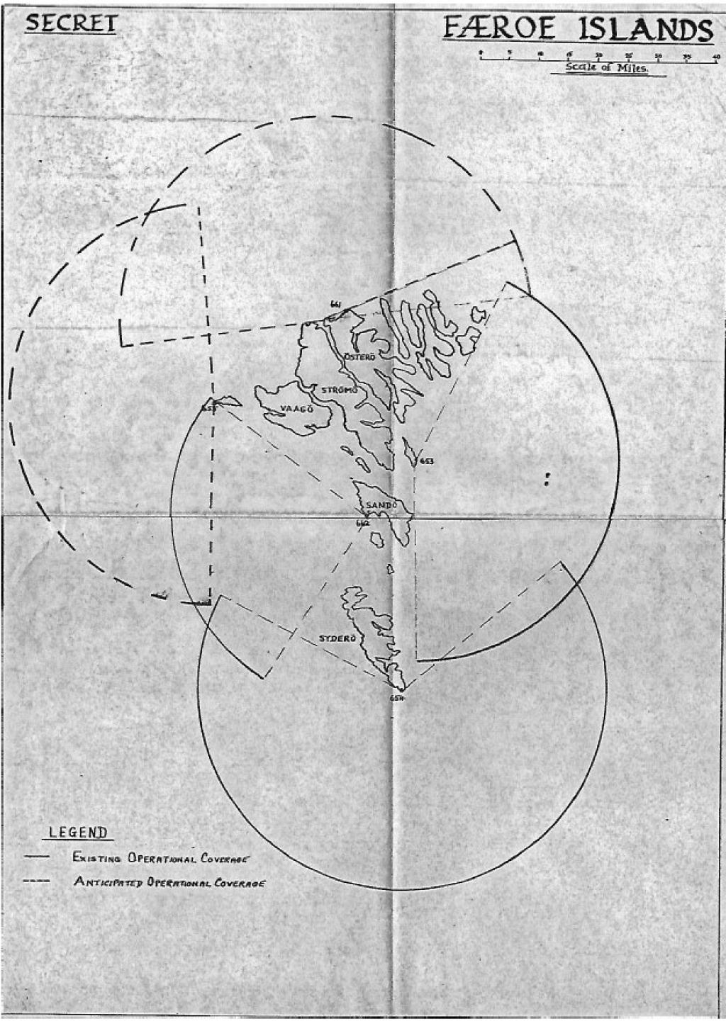
Old map of radar stations
i

Akraberg
i
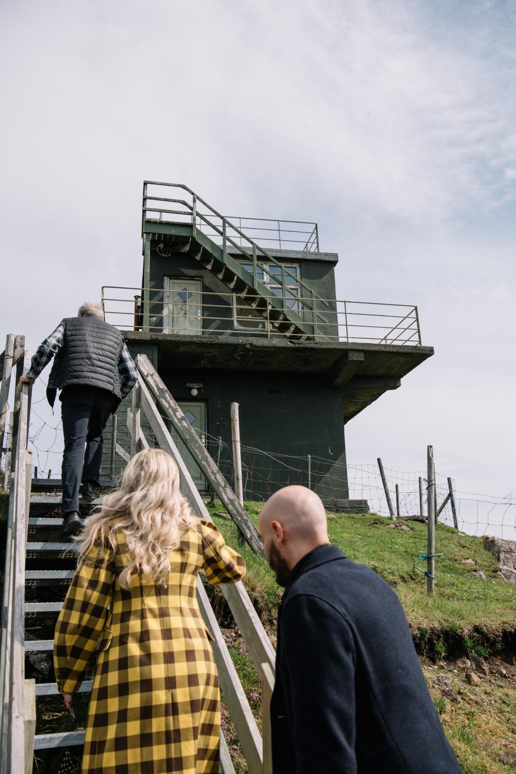
Radar Stations Around the Country
The British Army protected itself and the Faroe Islands by establishing radar stations. 1940, the first army inspection was conducted to identify the best locations for these stations. Five sites were chosen: Mykines, Eiðiskollur (north of Eysturoy), Borðan in Nólsoy, Søltuvík in Sandoy, and Akraberg in Suðuroy.
Most of the radar stations became operational in 1942. However, the station in Mykines was not activated until the summer of 1943, and it remains uncertain how long it stayed in service. Unfortunately, the first radar antenna installations did not perform well due to strong winds.
In 1943, several LWS radar stations were dismantled to conserve resources and maintain personnel for central operations. They were taken down due to inadequate performance and the need for radar support elsewhere. However, these stations were designed for quick reassembly if necessary.
A radar station was also planned for Froðba, where a base for soldiers was constructed along the road leading to "Nakkin." However, this station was never used due to a significant decrease in threats during the latter half of the war.
By November 1943, the radar station in Borðan, Nólsoy, was the last one still operational. Not much remains of these stations today, as the equipment was removed and transported back to England toward the war's end.

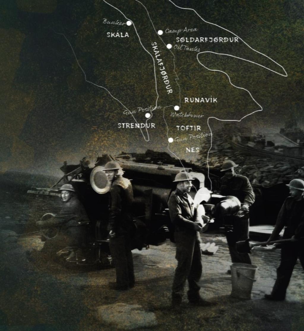
Military Stations in Nes
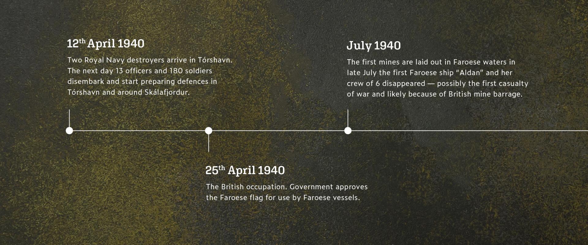
On 13 April 1940, the day after the British occupation of the Faroe Islands, military forces arrived in Strendur and Toftir to begin fortifying Skálafjørður. As the largest natural harbour in the Faroes, it was strategically important. British warships refuelled here before heading into battle in the North Atlantic.
By autumn 1940, the first cannons were installed at Nes, and over time, more military equipment was deployed to strengthen the fjord’s defences. A protective net was stretched across the entrance to prevent enemy submarines from entering, with a designated opening marked by buoys for safe passage.
Skálafjørður became a key target for German aircraft. British military records describe numerous air raids and counterattacks. On 21 February 1941, two German bombers flew over Tórshavn, where they destroyed the cargo ship Lincoln City. One aircraft continued towards Skálafjørður, dropping three bombs on passing ships—but missed. British forces fired back from defensive positions in Tórshavn and along the fjord, hitting the bomber. The damaged plane crash-landed in Gøtuvík, and its four-man crew was captured.
Today, remnants of this wartime history remain visible, including bunker ruins in Strendur, large oil tanks in Søldarfjørður, and a military bunker near the shipyard in Skála.