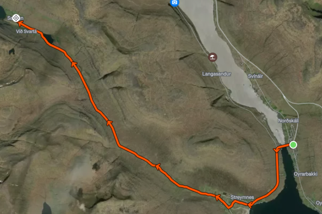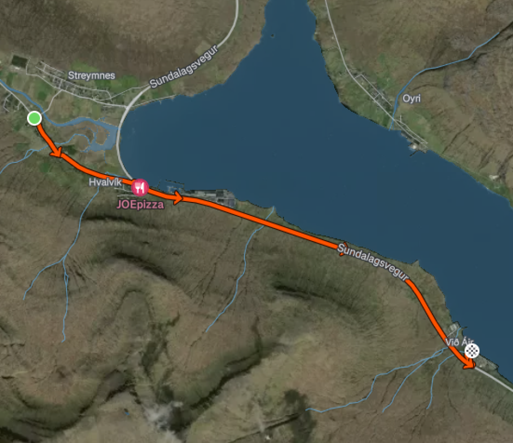
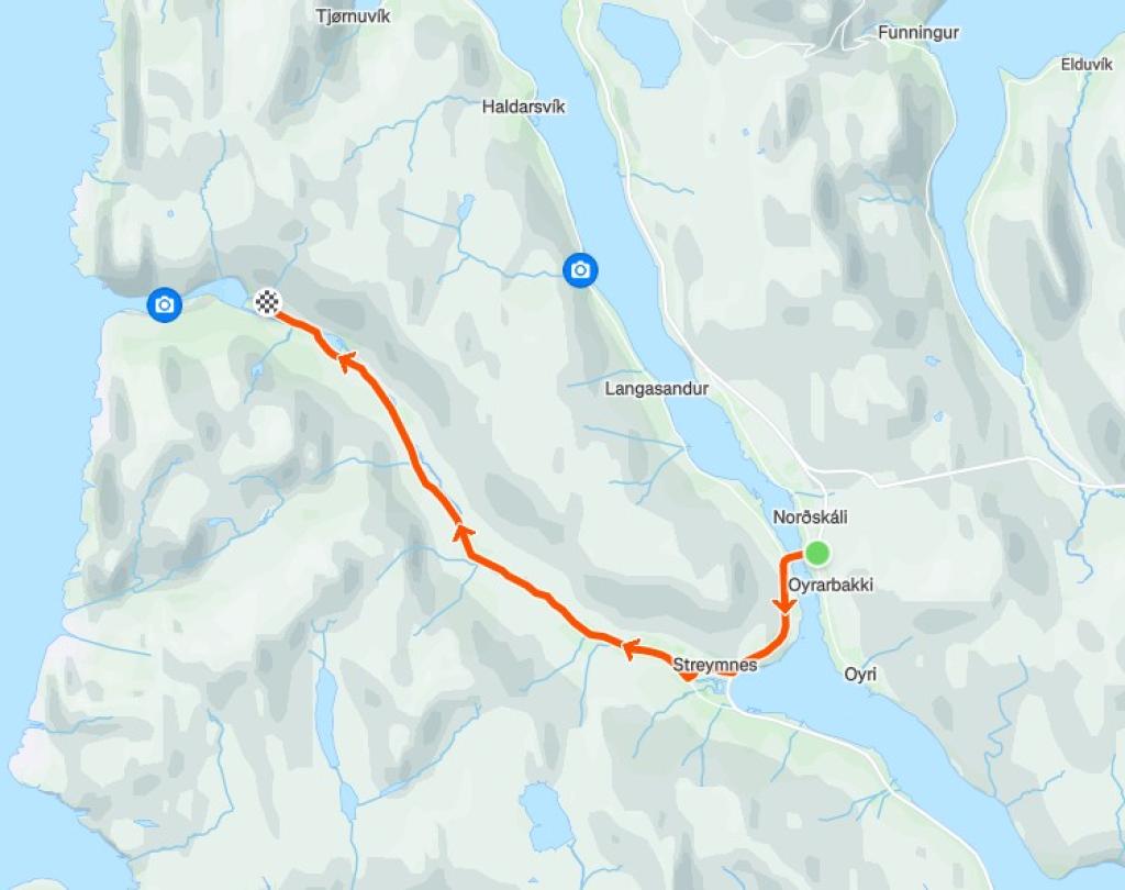
Oyrarbakki – Saksun
the scenic route takes you through a stunning 10K valley with breathtaking landscapes.
Description of the route
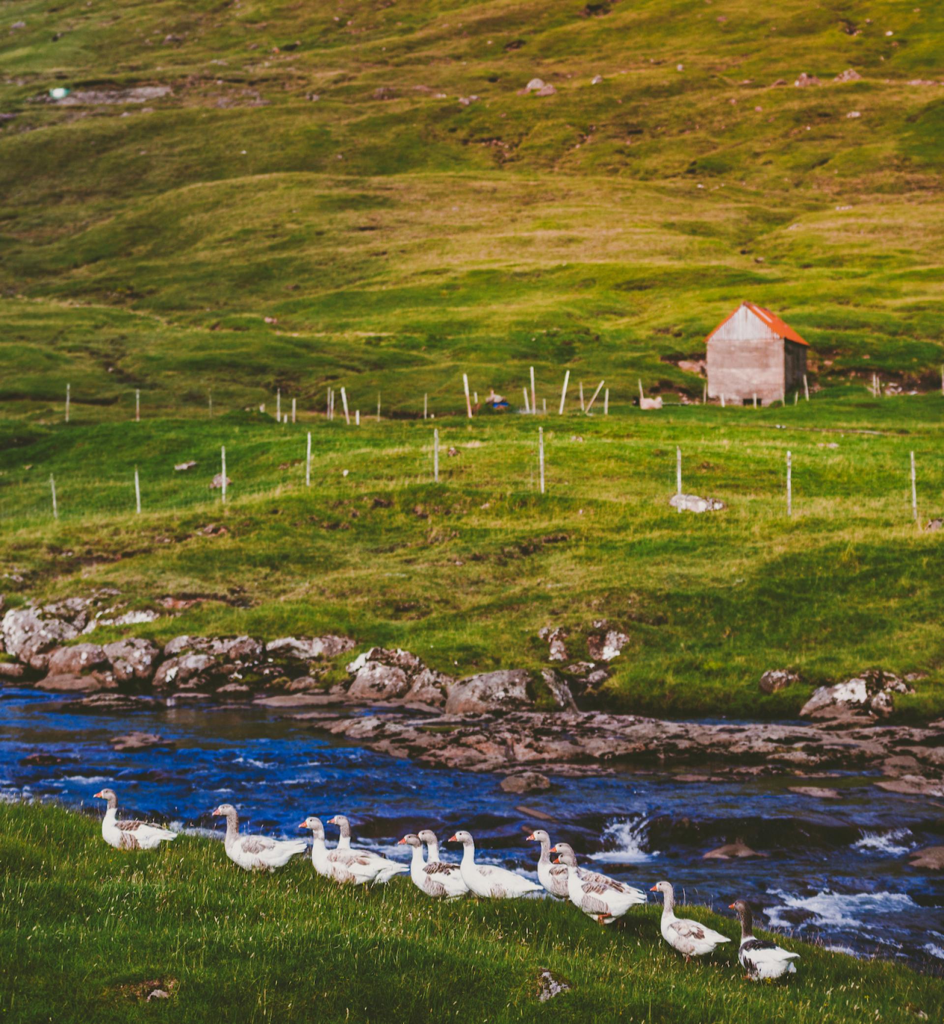
The ride starts at the Magn station in Oyrarbakki. From there, you cross the only bridge crossing the Atlantic Ocean and follow the main road through the villages of Streymnes and Hvalvík. The journey continues through the beautiful valley of Saksunardalur.

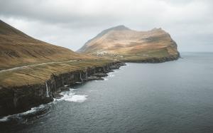
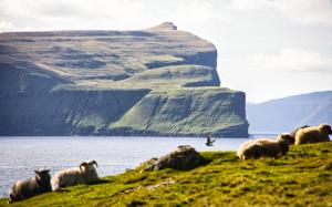
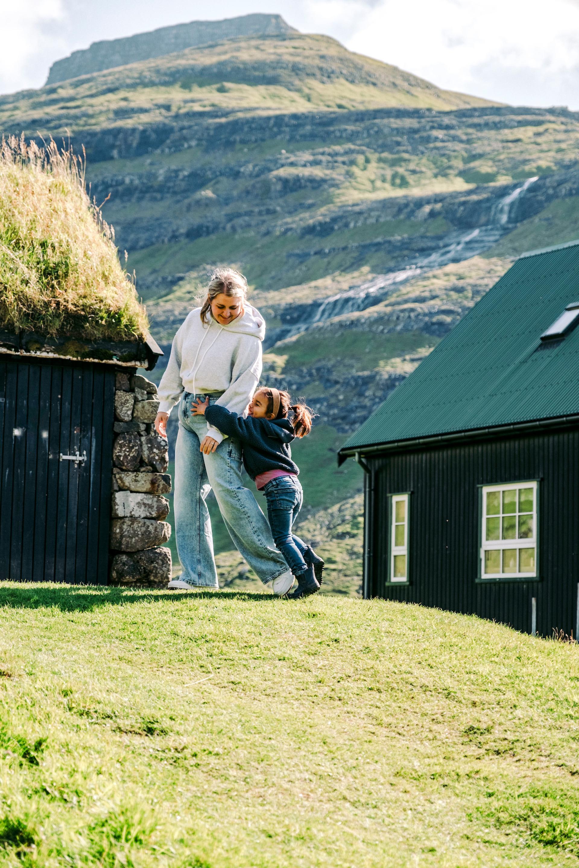
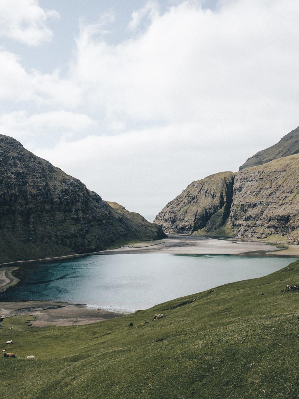
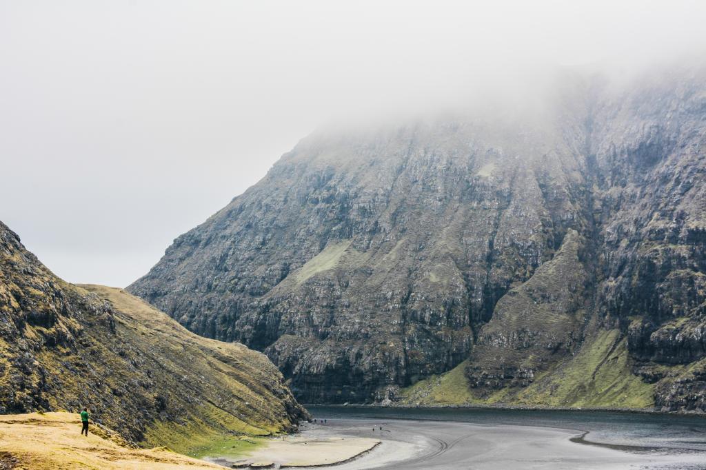
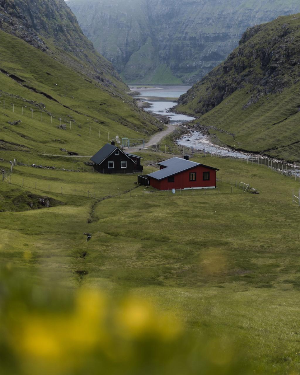
Saksun is an old village on the northern side of Streymoy, known for its unique landscape. The historic farm Dúvugarður is still active, though its old residential buildings have been preserved as a museum, offering a glimpse into Faroese farm life of past centuries. Nearby stands Koppenni, the highest mountain on Streymoy, and at high tide, small boats can enter the tidal lagoon of Pollurin. The road to Saksun passes through Saksunardalur, a lush valley with rich vegetation.
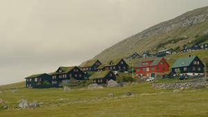
Saksun
Discover Saksun, a serene village set in a natural amphitheatre above a tidal lagoon with stunning mountain views and rich heritage.
Streymoy
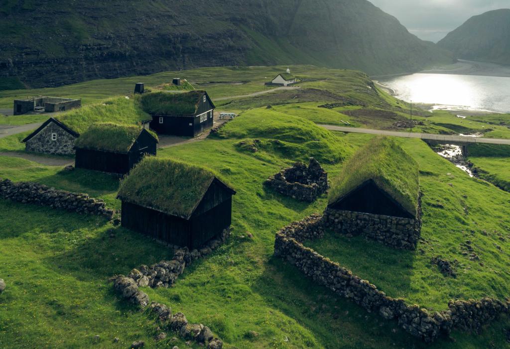
Dúvugarðar
Discover Dúvugarðar, a 300-year-old heritage farm in Saksun with historic turf-roof buildings and scenic trails.
Streymoy
Pollurin
Discover Pollurin, a stunning tidal lagoon in Saksun, Faroe Islands, where dramatic cliffs meet serene tides and sandy shores.
Streymoy
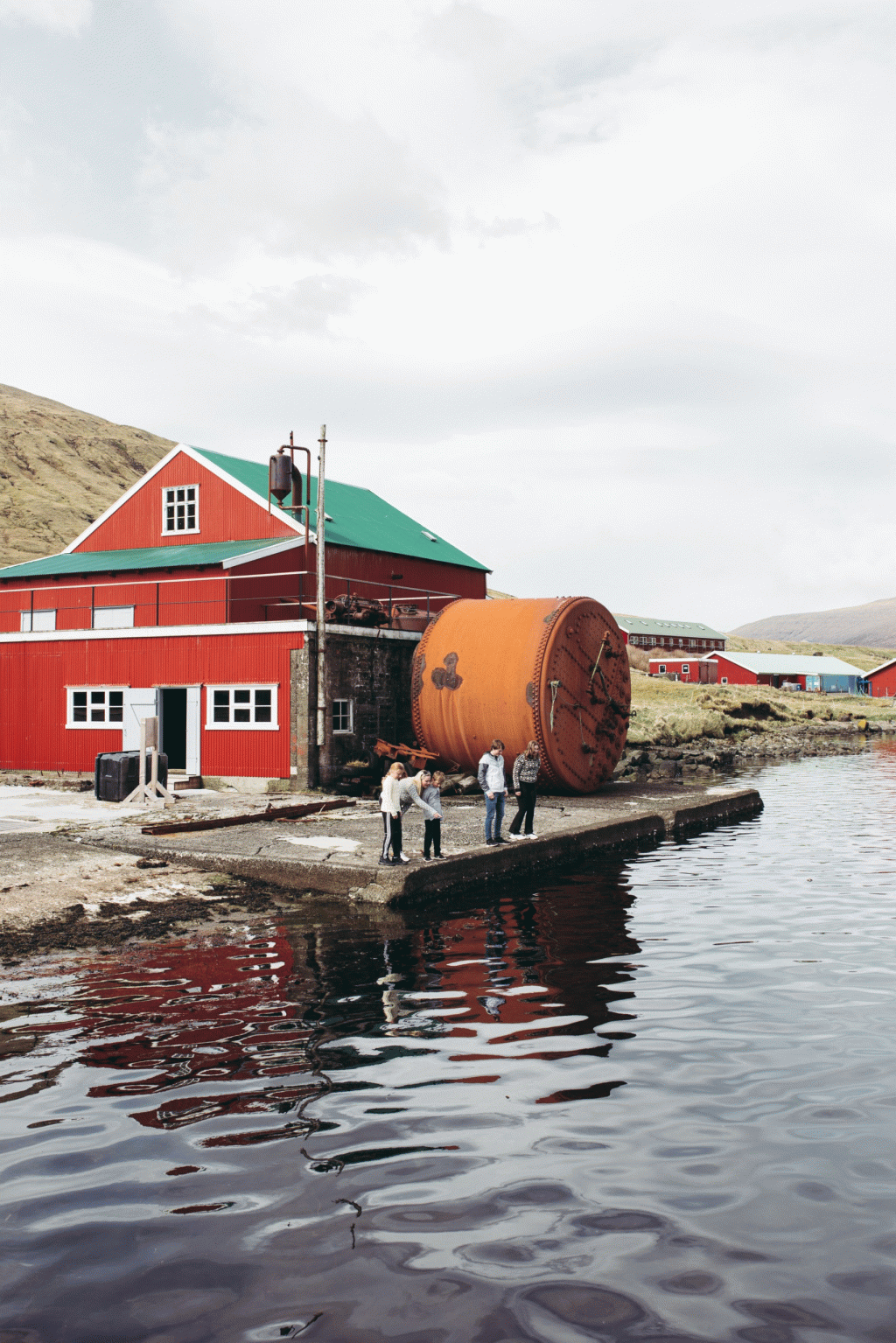
The Whaling station at Áir
The Whaling station at Áir is the last preserved northern whaling station, now a museum showcasing Faroese maritime history.
Streymoy
The striking landscape of Saksun attracts many visitors, featuring the 10 km-long Saksunardalur, the lake Saksunarvatn, known for its trout and salmon, and Dúvugarður, preserved in its original form. People lived here until 1978; today, the farmhouse is a fascinating museum. Saksun is breathtaking not only in summer, when many tourists visit but also throughout the year.

Alternative Routes & Inspiration
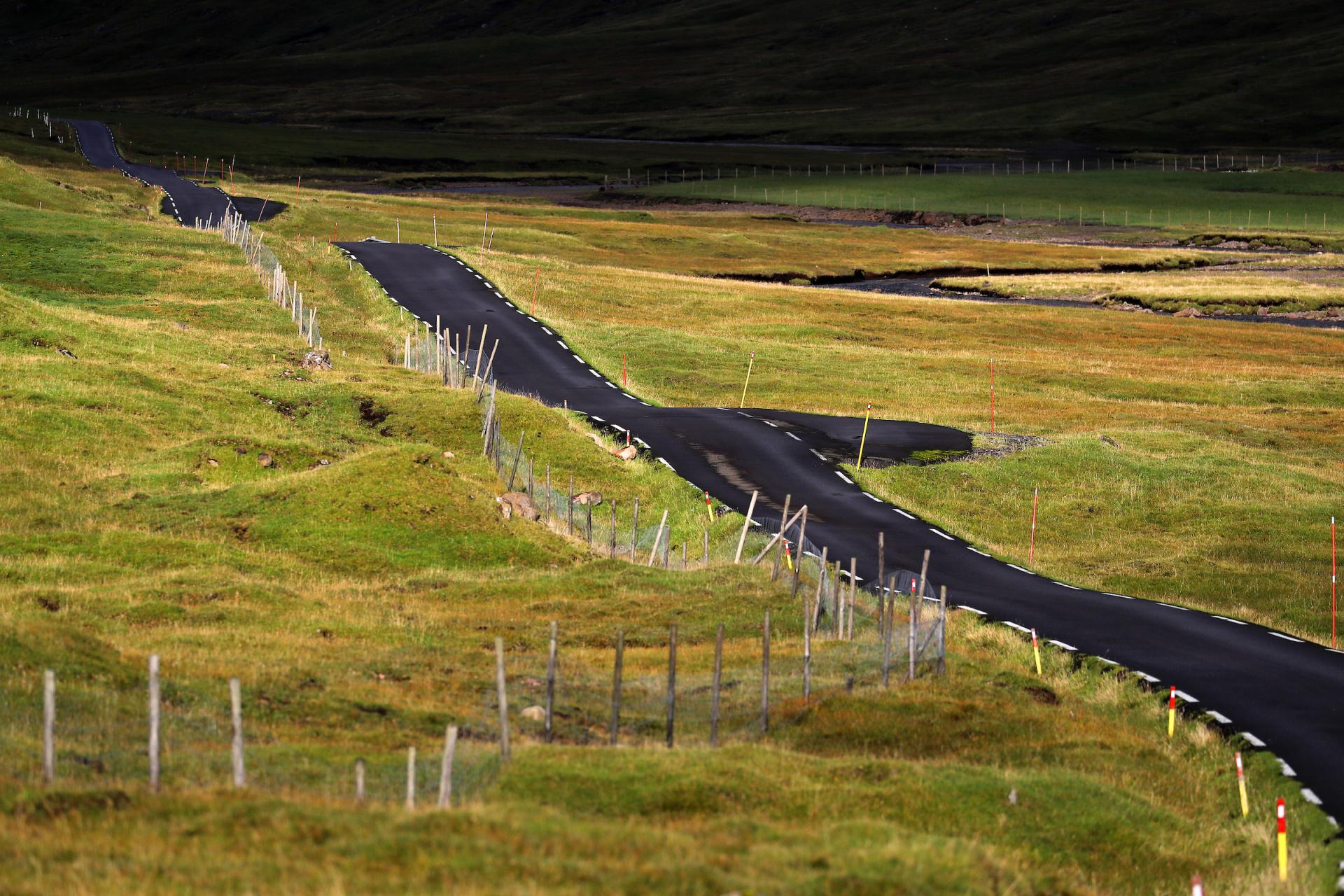
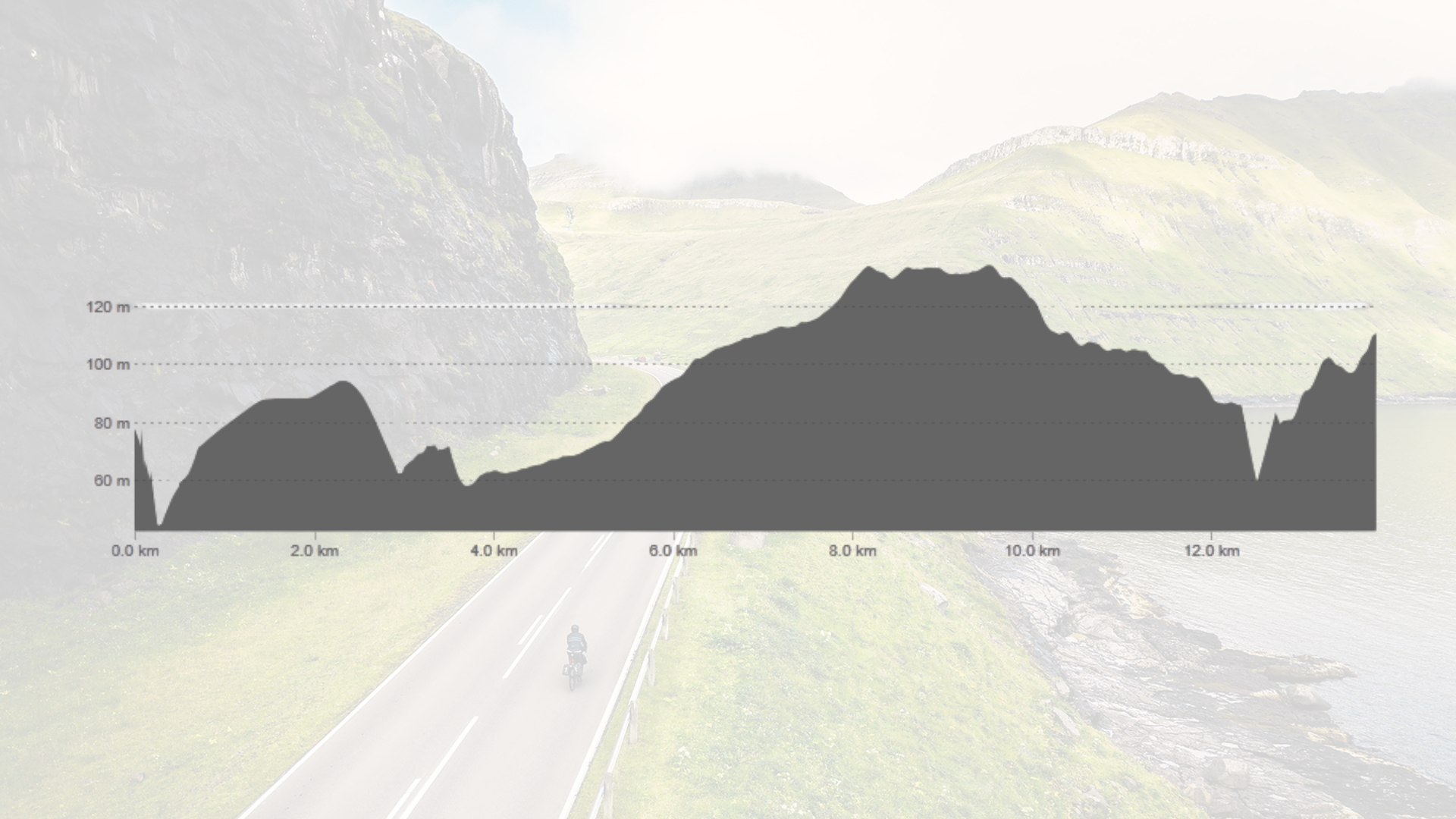
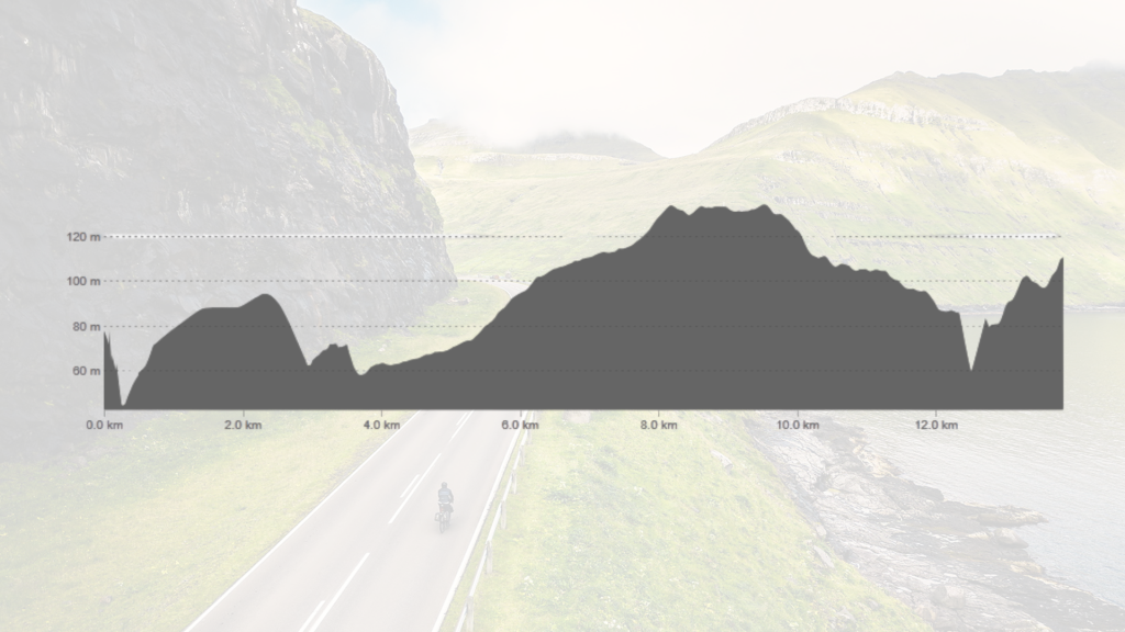
Elevation profile
The route features an initial climb to 100 meters, a brief descent, and rolling hills. The highest point at 120 meters occurs around the 8 km mark, followed by a gradual descent with minor elevation changes.
Child-friendly?
Suitable for children under 15 years.
Road conditions
Well-paved asphalt road throughout.
Special Note
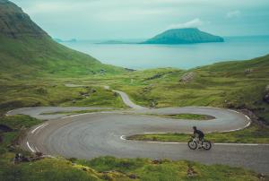
Bringing refreshments like water and a snack is a good idea for the journey. As traffic can be high at certain times of the day, it's best to aim for low-traffic time slots and parts of the year for a more peaceful experience. This route is also perfect for those wishing to bring their bike—take bus 400 from Farstøðin in Tórshavn or Klaksvík and enjoy a scenic ride back.