- BEFORE YOU ARRIVE IN THE FAROE ISLANDS
- Accessibility for disabled
- Advice for LGBT travelers
- Alcohol
- Customs
- Electricity
- Electric cars
- Health & safety
- Money
- Passport and Visa
- Phones & internet services
- Postal service
- Public holidays
- Storm statefy in the Faroe Islands
- Tax-free shopping
- Time Zone
- Useful numbers & service
- What to pack
- GUEST ARTICLES
- Uncovering a different side to the Faroe Islands
- Tórshavn marathon
- The food culture of the Faroe Islands
- The Faroe Islands... through the eyes of a New Yorker
- Fog with a chance of hihing in the Faroe Islands
- G! festival: cue the music for nature lovers
- Sheep farming in the Faroe Islands
- Discovering the Faroe Islands by bicycle
- Suðuroy: A hikers's haven


You haven’t got any favourites yet
This is where you can collect inspiration, articles, events and places that interest you.
Click the icon on pages and they’ll appear here.
Your favourites
Inspiration & Articles
Events & Tours
Places
Hiking
INSPIRATION & ARTICLES
EVENTS & HIKES
Places
Oyrareingir - Tórshavn


Link Copied!

-
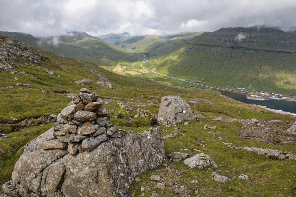 View up from the place Bergið in through the valley Kollfjarðardalur. Picture: Óli Gardshodn
 -
 From the village Kollafjørður up the village path Hórisgøta. The village gate is right by the river Hórisgøtuá, at the bus stop outside the tunnel. Picture: Óli Gardshodn
 -
 While walking up along the village path in Hórisgøtu, the view is very good down on the fjord Kollafjørður and in through the valley Kollfjarðardalur. Picture: Óli Gardshodn
 -
 View up from the place Bergið out through the fjord Kollafjørður. Picture: Óli Gardshodn
 -
 View from the place Mjóstíggjar over to the valley Mjørkadalur. Above it we see the mountain Fjallið between Botnar (686 m.). Far left, the mountain pass Norðradalsskarð, which we pass. Picture: Óli Gardshodn
 -
 From the village trail, up under the mountain Stiðjafjall, we look down over the mountain pass Norðradalsskarð (277 m.). To the right in the background Mannaskarð. Picture: Óli Gardshodn
 -
 300 m. up towards the mountain Stiðjafjall, we have a good view of the southern part of the village Norðradalur and the gorge Dalagjógv, with the island Koltur in the background.
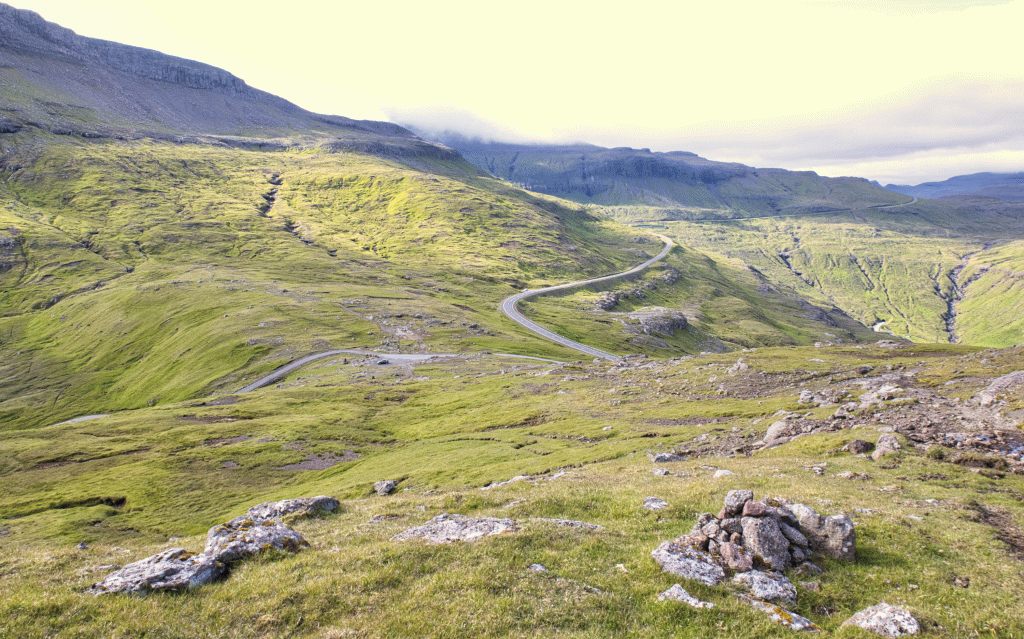
A long trip with gorgeous views, where a large portion of the route is along Oyggjarvegur.
You will walk up from the bus stop outside the northern mouth of the Kaldbaks tunnel. Then walk through the gate just above and right up towards the steep slope. This is one of the steepest paths in the Faroe Islands; however, because the path curves as it goes upward, it is not too difficult to walk.
The path is not visible in areas, and there is a long distance between the cairns; therefore, it can be challenging to walk the right way if you do not have a GPS. There can be a lot of noise from traffic; however, it becomes quiet and peaceful once at 230-meters above the first plain, right above Lágarstíggj.
You will walk across Skeiðsá and further up Oyggjarvegur. Continue walking southward along the road up on Sornfell and then down to the large cairn by Mjóstíggj. It is beautiful to walk with a view over Núgvan, Mjørkadal and out along Kallbaksfjørd. You can also see over Mannafelsdal, where the battle against the south and north men took place around 1307. Sadly, by Mjóstíggj, a landslide has taken the path with it, making it a little challenging to get across. From there, the route runs down to the station in Mjørkadal, where you come onto Oyggjavegur itself.
From Mjørkadal, it is 2km to Neytaskarð, where the route runs up a pass across Norðradalsvegur, then continues up the sharp mountain crest to a flat surface at 400-meters height above the unique Dysjarnar.
From there and at about 8km to Torshavn is a decent path with excellent and diverse views. During decent weather, as one nears Torshavn, you start to see more and more people, people riding horses and bicycles, making their way along the many paths outside of Torshavn. The route ends at the parking space above the quarry in Oyggjarvegur.


Oyrareingir - Hórisgøta - Tórshavn
Several buses routes pass by Leynar:
Route 100/300 Tórshavn – Vestmanna.
Route 300 Tórshavn – Flogvøllurin – Sørvágur.
Route 400 Klaksvík – Tórshavn.
Remember to tell the bus driver to stop north of Kaldbaks tunnel.
There is plenty of parking by the bus stop north of Kaldbaks tunnel.
You can park by the green markings. From there, you will walk through the gate and straight up by the river, where you will pass your first cairn at about 160-meters height.

Tórshavn - Hórisgøta - Oyrareingir

Oyrareingir - Tórshavn
Tórshavn - Oyrareingir
Facts

Duration

distance

Peak

Elevation
 No. Too long (14,7 km.), and Hórisgøta is steep and long.
 Difficult
- Challenging due to the length being more than 10 km.
A landslide has taken the path in steep Mjóstígg. It is strictly recommended not to walk across Mjóstíggj during snow or slippery weather.
Difficult
- Challenging due to the length being more than 10 km.
A landslide has taken the path in steep Mjóstígg. It is strictly recommended not to walk across Mjóstíggj during snow or slippery weather.
 Grassy and suitable terrain apart from Mjóstíggj, where the landslide has taken the path.
Some particularly areas have quite wet terrain.
North of Stiðjafjall, loose gravel on the path.
Grassy and suitable terrain apart from Mjóstíggj, where the landslide has taken the path.
Some particularly areas have quite wet terrain.
North of Stiðjafjall, loose gravel on the path.
